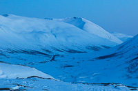
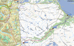
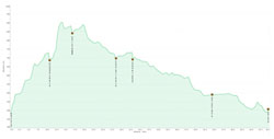
In the week before Easter, we went on a 6 day ski trip. The biggest challenge in organizing a trip like this is arranging transport from the end point back to where you started. This was the main reason we chose to start from Abisko in Sweden: you can take a train from there to Katterat, a station in Norway that cannot be reached by road. From there you can ski back to Abisko, a distance of 70 km, with several huts along the way. We decided to stay in every single hut we came across, even if they were close together – this would give us some slack in case the weather turned bad and we had to stay somewhere an extra night. Below you can see our route, and the height profile of our trip.
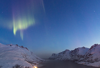
On the day before our trip, we drove from Tromsø to Abisko Turiststation where we spent the night. This is a mountain station owned by the Swedish Trekking Association, and basically a combination of a youth hostel and hotel. The atmosphere was very nice, people were there either for ski trips or for watching the aurora. That night the aurora was active, but we decided to ignore it and go to bed, as we had to get up early…
Day 1: Katterat station to Hunddalshytta – 10.5 km (5 hrs)
We got up at 06:30, as we had a train to catch at 07:45. We just about made it to the breakfast room to grab the lunch packets we ordered, no time to sit down and eat breakfast. We hurried to the train station, only to find out our train was 15 minutes delayed. This delay just kept increasing… until it was long enough for us to decide to have breakfast after all. To make a long story short: the train was eventually cancelled, and we had to wait for the next train at 14:05. That’s a 6.5 hour delay!!! It was very boring to wait around nearly all day, when you were ready to go so early in the morning… but finally, there it was: OUR TRAIN!!

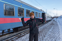
After a scenic train ride, we were the only ones to get off at Katterat station. We watched the train leave with mixed feelings – now we were on our own. It was 15:30 by the time we started our trip to Hunddalshytta, and the sun had already left the valley that we were following. We followed a few old tracks from skiers, snow scooters, dogs and even someone on foot. It was a beautiful day, especially when the moon came out as well.
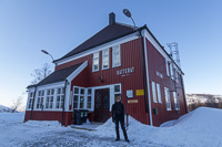
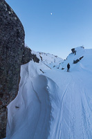
Our progress was slow though – we lost the route a couple of times, and the snow was icy and hard. The route was also a constant uphill.
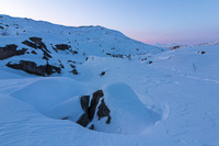
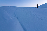
At some point we could smell a wood fire and we knew the hut could not be far away. And there it was, Hunddalshytta in the moonlight…
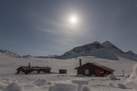
There are actually several cabins here: one for a warden (which was empty while we were there), one big one, and a tiny one. The big one was very full, there was only one bed available. So we knocked on the door of the small one, where we found 2 Dutch men with snowshoes. They just about had place for us, and were soon feeding us Baileys – mm, what a welcome 🙂 After a quick dinner, we went to bed early.
Day 2: Hunddalshytta to Oallavagge – 6 km (3.5 hrs)
The Dutch men left early in the morning, as they were catching a train all the way back to Stockholm from Katterat. We had a lazy morning, and watched the people in the other hut build an igloo which they were planning to sleep in that night. They were Dutch as well 😀
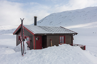
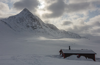
We left just before noon, we weren’t in a hurry as we didn’t have very far to go that day. We did have a steep climb however, very tiring when you have to herringbone your way up. We were happy when we made it to the top of the pass!
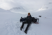
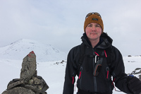
There was a nice downhill section afterwards, but it was one of those whiteout days where you don’t see any contrast in the snow. This makes it hard to estimate how steep a slope is, and as a result you don’t dare to speed up too much. There were also some old ski tracks that had turned to concrete ridges, hidden underneath a layer of fresh snow, as an extra hurdle… 😉 We were relieved to reach Oallavagge and find it empty – it’s a tiny emergency shelter, with only two beds. Not many people choose to spend the night in it, but even one extra guest would have been a squeeze!
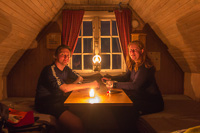
We spent a very cosy evening in the tiny hut. When we arrived, it was -4 inside, but the wood stove quickly raised the temperature to about 30 degrees! We had some soup, then made dinner. It was nice to have the place to ourselves and get some rest. The wind was very strong, during the night I woke up once fearing that we’d be stuck there for an extra day!
Day 3: Oallavagge to Cunojavrihytte – 12 km (4.5 hrs)
The wind had calmed down a bit by the time we got up. It was still windy though, but luckily in the right direction for us 🙂
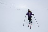
It was a grey day, though the sun tried to peek through the clouds every now and then, but made good progress with the wind in our backs. We didn’t meet anyone all day…
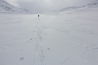
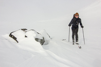
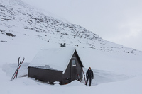
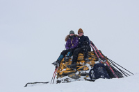
One big disadvantage of strong wind is that you hardly feel like sitting down somewhere to have lunch. We tried to shelter behind various rocks and once behind at a surprise cabin that was not on the map. The cabin was mounted on huge skis and had probably been dragged into position for temporary use by people working for the power company. (lots of the lakes in this area are used for hydroelectric power). When we got closer to our destination, we came across this small private cabin and a rickety suspension bridge over the river …

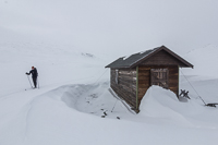
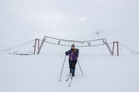
We thought it might be busy at Cunojavrihytte, as it was now Saturday and ski touring is very popular in the weeks around Easter. To our surprise, we found the place to be deserted! Here too, there was one big hut and a small one. We chose the small one as it would warm up quicker. Not long after we arrived, 4 skiers turned up at the large hut. They were the first people we had seen since we left Hunddalshytta two days earlier.
Day 4: Cunojavrihytte to Unna Allakas – 4.5 km (2 hrs)
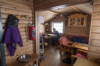
We had a very lazy morning at Cunojavrihytta, as we only had 5 km to ski to the next hut. Here are some photos of the hut we stayed in at Cunojavri, to give you an impression what they are like…
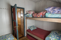
As you can see there’s plenty of duvets, so you only have to bring a sleeping bag liner. Both Cunojavrihytta and Hunddalshytta have solar panels and there are some low-voltage reading lights, but otherwise you need to bring candles with you. We cooked on the wood stove in this cabin, as for some reason the gas cooker was placed outside the living room, next to the front door, where it was freezing cold!
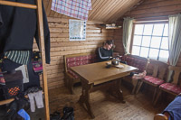
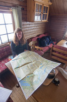
It was still windy, and the snow was blown into nice patterns around the hut. Unfortunately also inside the hut, as there was some problem with the outside door not closing very well and lots of snow got into the hallway!
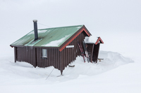
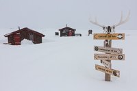
Reluctantly, we left the warm cabin and braved the cold wind outside. It was rather flat and grey so we only stopped to take one photo at the border marker. We made it to Sweden in just a couple of hours! 🙂
Unna Allakas was our first experience with the Swedish mountain huts. We weren’t sure what to expect, we had heard they were not as cosy as Norwegian huts. They’re just quite different: Unna Allakas is a big building with 18 beds (divided over 3 rooms) and one huge living room. It’s more communal in a way. The one thing I didn’t understand is that there were more beds than seats in the hut! But there were also some huge advantages: there was a warden who ran a small shop – it’s so nice to buy a few items you would never take with you (beer, Pringles…) and of course being able to buy dinner instead of dragging it with you in your backpack for several days. They also have a recycling system, which means you can leave all your waste behind. We had the hut to ourselves when we arrived, but while the warden came over for a chat, two Swedish men arrived from the other direction (Abisko). It was nice to have some company and share route experiences with them. With only 4 people, we had plenty of space in the cabin.
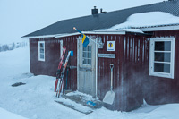
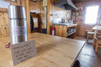
Both the Swedish cabins we stayed in had a well organized system for getting water from the lake or river, and some solution for waste water collection. But while Norwegian cabins usually give you ready-chopped firewood, here you had to first saw a huge logs into smaller bits, and then chop them up with an axe – quite hard work!
Day 5: Unna Allakas to Abiskojaure – 21 km (7.5 hrs)
We got up early as we had a long day ahead of us: it was 21 km to the next cabin! I had been dreading this day for a long time, as so far the furthest I had skied in one day was about 13 km and I am really slow. According to the Swedish men it would be even more windy today than yesterday, but luckily AGAIN it was in the right direction for us 😉

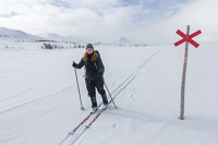
Quite a lot of fresh snow had fallen during the night, and the skitracks of the Swedish guys were gone. In Sweden, the marking is quite different though: they use wooden poles with crosses, and there are sooooo many of them that it would be impossible to lose your way. I actually quite liked it, even though I can see it’s a bit of an “attack” on an unspoiled landscape. In many places you can see a snake of red crosses stretching out miles in front of you, but it means you can just ski without having to check your map/gps all the time, or discuss your route choice. After a while, the snow showers cleared up and it actually got SUNNY!! We had our first lazy break in the sunshine (an important part of easter skiing), what a difference with the previous days! The route was downhill all the way and I started to relax and enjoy the day…
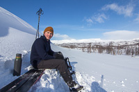
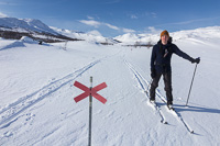
At some point (about halfway) we met a group of snow scooters coming from Abisko, which meant we could ski in their tracks. That made the rest of our trip a lot easier. They are smelly, noisy machines, but sometimes they are quite welcome 😉 As we made our way down the valley and into the birch forest, we finally saw signs of life: some reindeer, a couple of birds… finally some groups of cabins – we were coming back to civilisation it seemed 😉
I was so happy when Abiskojaure came into sight: we made it!! I was very proud, but also really exhausted and my feet were sore. I stumbled into the cabin, following the cheerful warden who was showing us where to sleep. The cabin was huge and very full, mostly with a big group of German teenagers. It was a bit too much to suddenly be in such a cramped hut (bunk beds were 3 high here!) after the solitude of the last couple of days. But it was fun talking to other people who were just starting a long trip and the Germans were very keen on chopping wood and getting water so we hardly had to do anything 😀 Another luxury of this hut: it had a SAUNA. No showers of course, but some ingenious system of mixing hot water coming from the sauna with cold water from the lake, so you could wash.
Day 6: Abiskojaure to Abisko Turist station – 15.5 km (5 hrs)
We hadn’t planned to get up early, but the Germans had breakfast at 6 am and it was hard to sleep after that. We had breakfast as soon as they had left, and by 09:30 we were ready to go 🙂
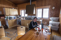
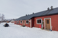
Of course we first took a few photos around the hut. There were 3 wardens at this hut, who put up Easter decorations everywhere and they were very chatty. The place is more like a youth hostel than a mountain cabin!
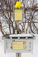
The route back to Abisko was easy but quite boring (crossing the long lake in grey conditions was not very exciting). Later it got sunny and we followed a gently undulating roller-coaster path through the forest.
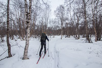
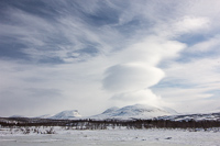
We got a bit lost in the end, as Abisko Turist station was not on our map and we had just guessed where it was on the GPS. As a result, we ended up at Abisko East (we had no idea there were 2 stations here :D) and we had to follow a scooter trail next to the road for half an hour to get back to the Turiststation. We picked up the key to our room, and rushed to a much needed luxury: a hot shower!! Clean clothes!! And finally a 3 course meal in the restaurant 🙂
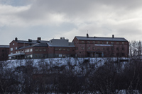
It was a fantastic trip, it pushed a lot of boundaries for me, and now I am keen to do some more trips like this 🙂


