Browsed by
Tag: hut-to-hut trips

Pallas to Hetta: 4 days of skiing in Finland

Pallas to Hetta: 4 days of skiing in Finland

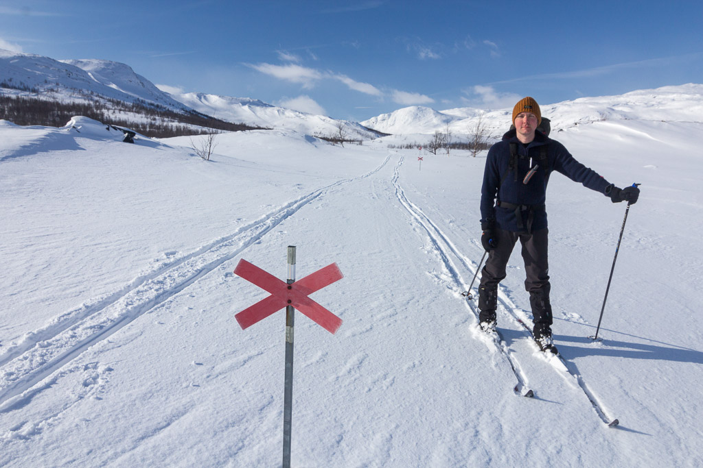
It’s become one of our traditions to go on a longer ski trip around Easter. This year we had planned to return to the area near Abisko, where we went last year, but the weather forecasts looked terrible: rain and strong winds for days on end 🙁 One day before departure, we decided to change our plans and head to Finland instead, where the weather looked very promising 🙂 We chose the Pallas-Yllästunturi National Park , a 5 hour / 400 km drive from Tromsø. We drove there after work on Wednesday, and spent the night in a cabin in Muonio.

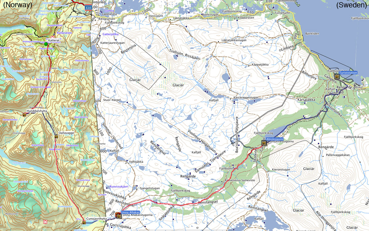
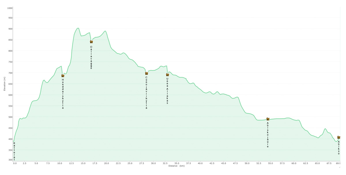
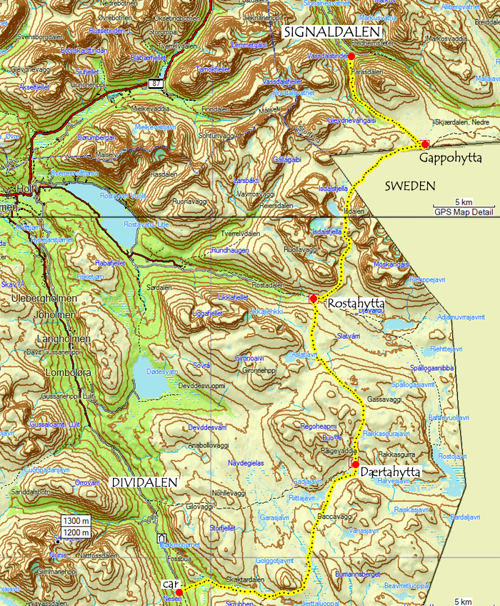
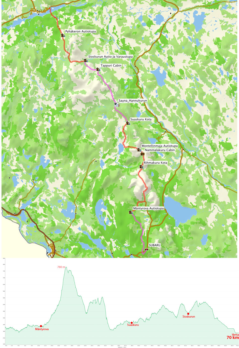
Here’s a map and height profile of our trip – click to enlarge…

Our trip from Pallas to Hetta, 70 km and 4 days of skiing

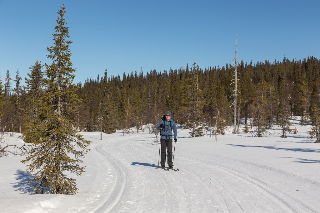
Day 1: Car park to Mäntyrova – 11 km (3.5 hrs)

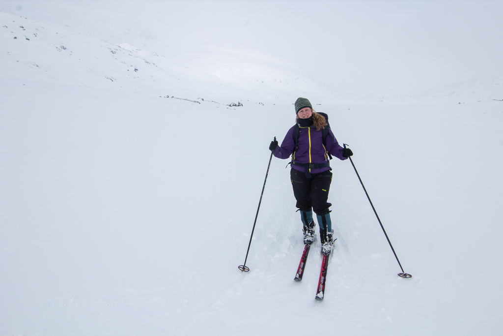
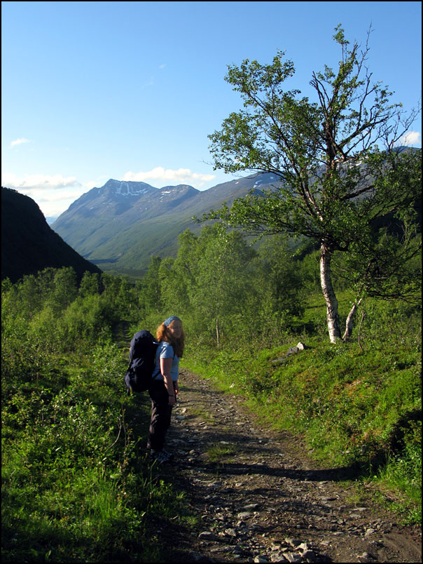
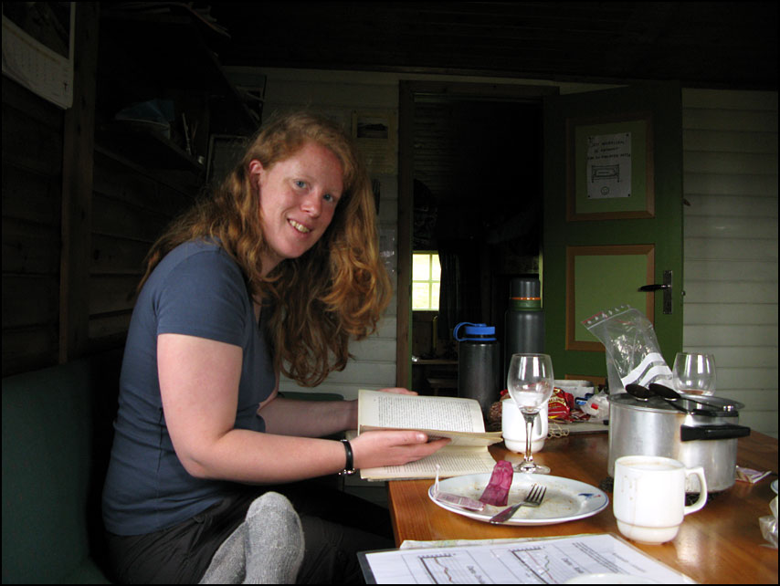
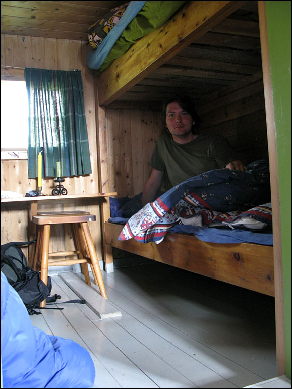
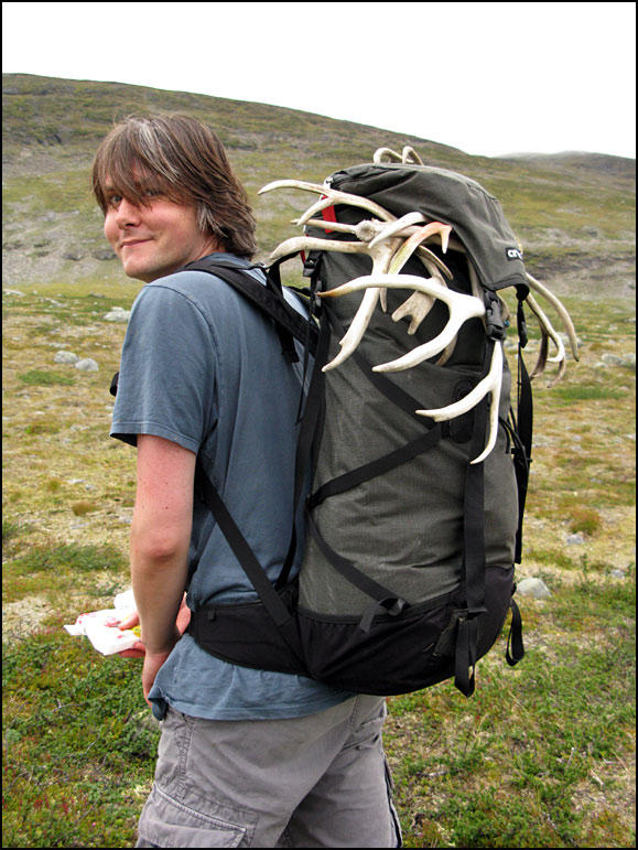
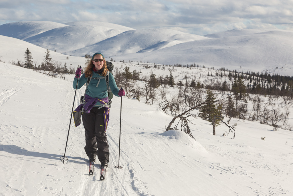
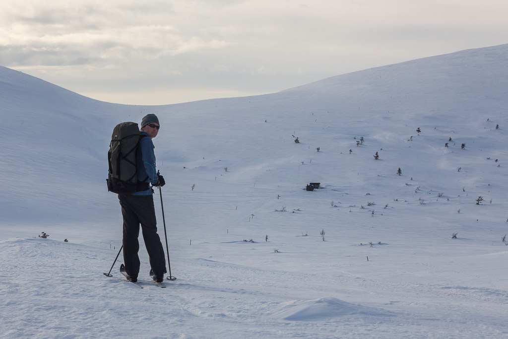
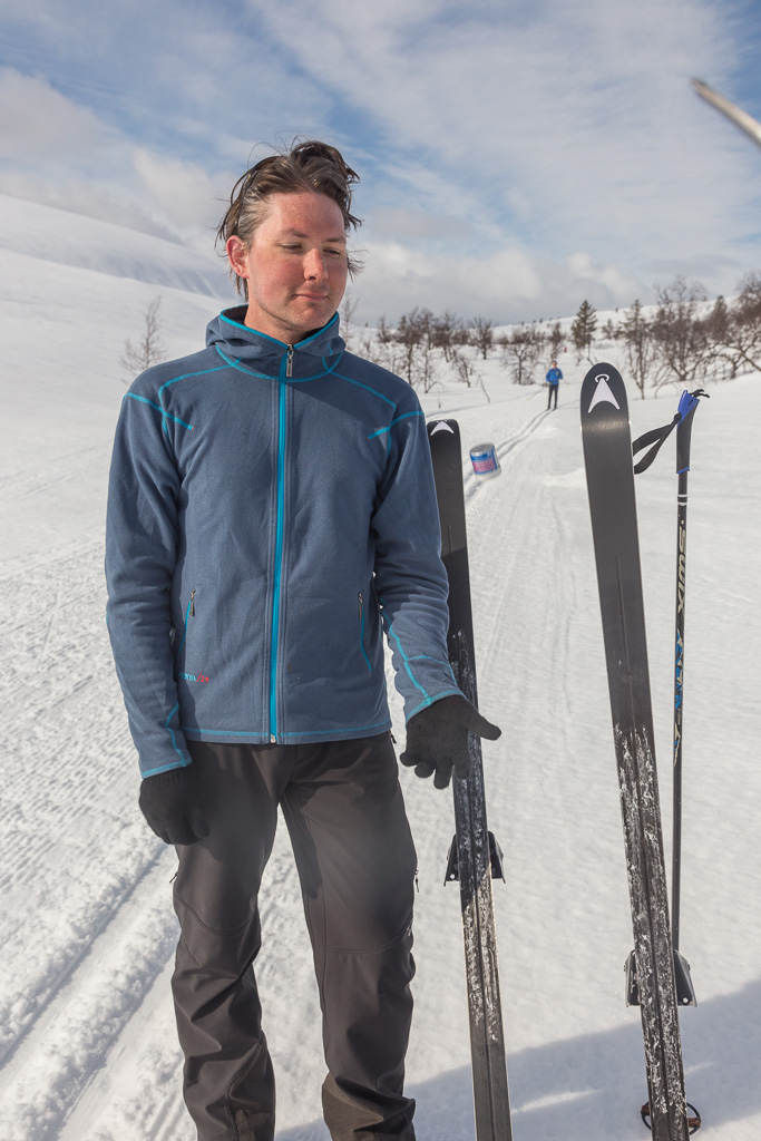
We visited the information centre at Pallas before finding a car park and starting our ski trip in the late afternoon. It was cloudy and warm – it even started to rain after a while. Never mind, we knew this was the last day with this type of weather – plenty of sunshine was forecasted for the following days! The warm weather and old (melting and soft) snow did give us some headaches with waxing our ski’s. I was lucky on the first day, as I had a mysterious mix of old layers of wax that miraculously worked perfectly, but Paul struggled to find something that would work. Just before 19:00 we reached the Mäntyrova Wilderness Cabin, which to our surprise was still empty – this national park is very busy around Easter. Two minutes later, a Finnish girl arrived at the cabin. She was very friendly and we enjoyed sharing stories all evening. She had come from the opposite direction and was a great source of information on cabins and trails that we were planning to visit. Nobody else joined, and we went to bed early that night.

Day 2: Mäntyrova to Suaskuru – 26 km (12 hrs)

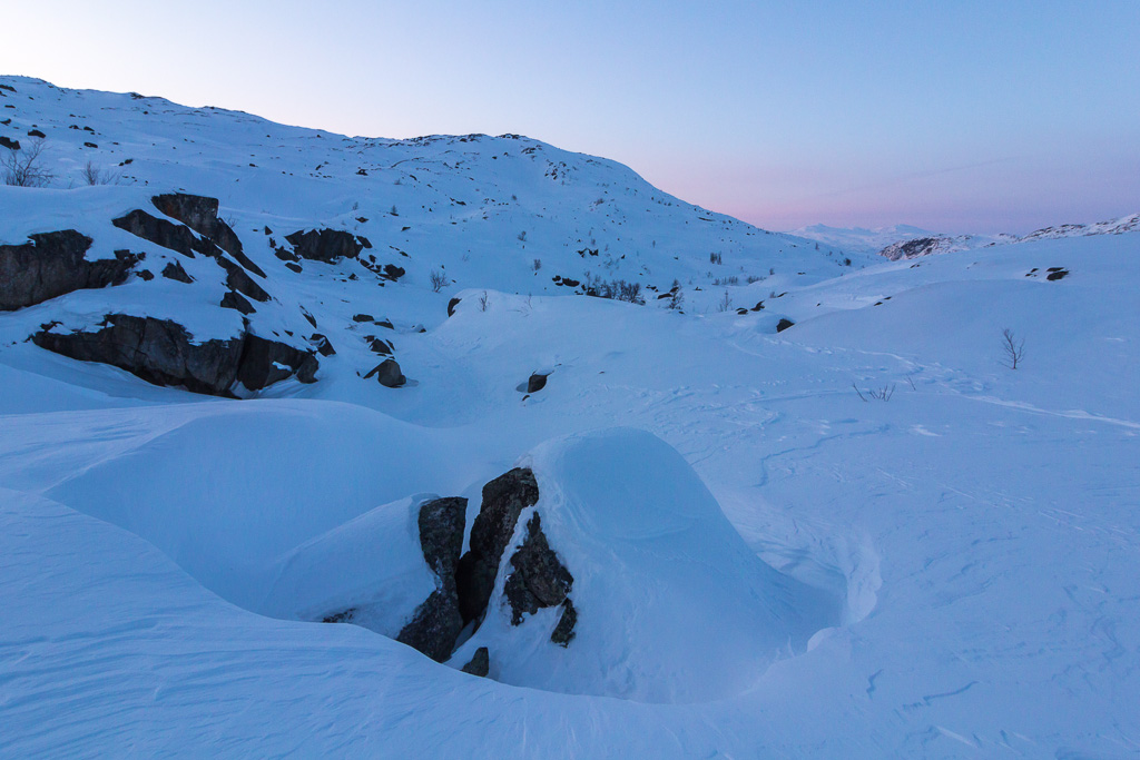
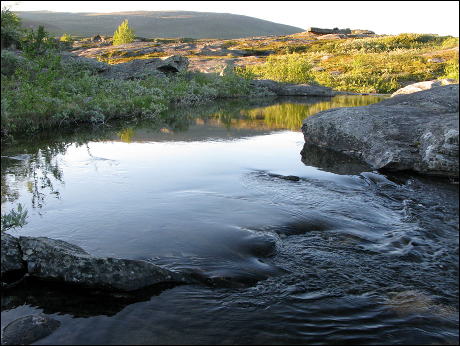
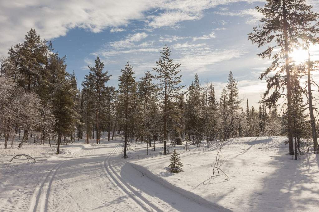
The next morning we found out that the weather forecast was correct: sunshine! The rain had turned to snow during the night, and it was really beautiful around the cabin…

Mäntyrova Wilderness Cabin in the early morning sunshine The trails looked inviting that morning!

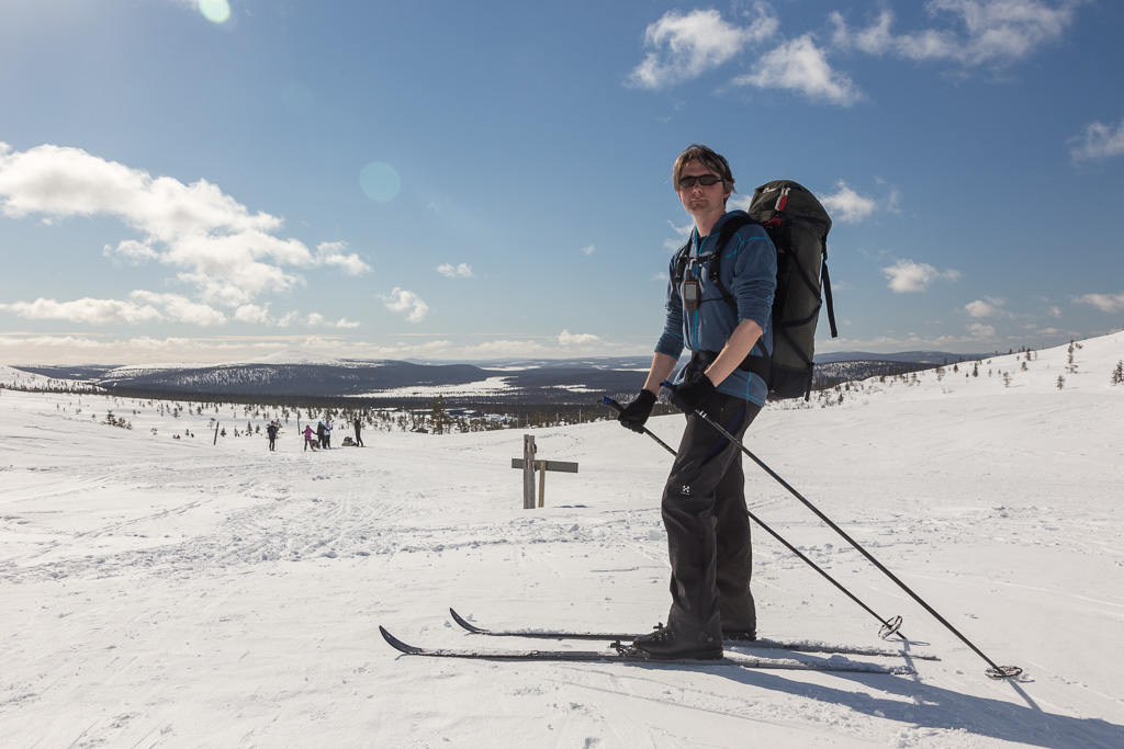
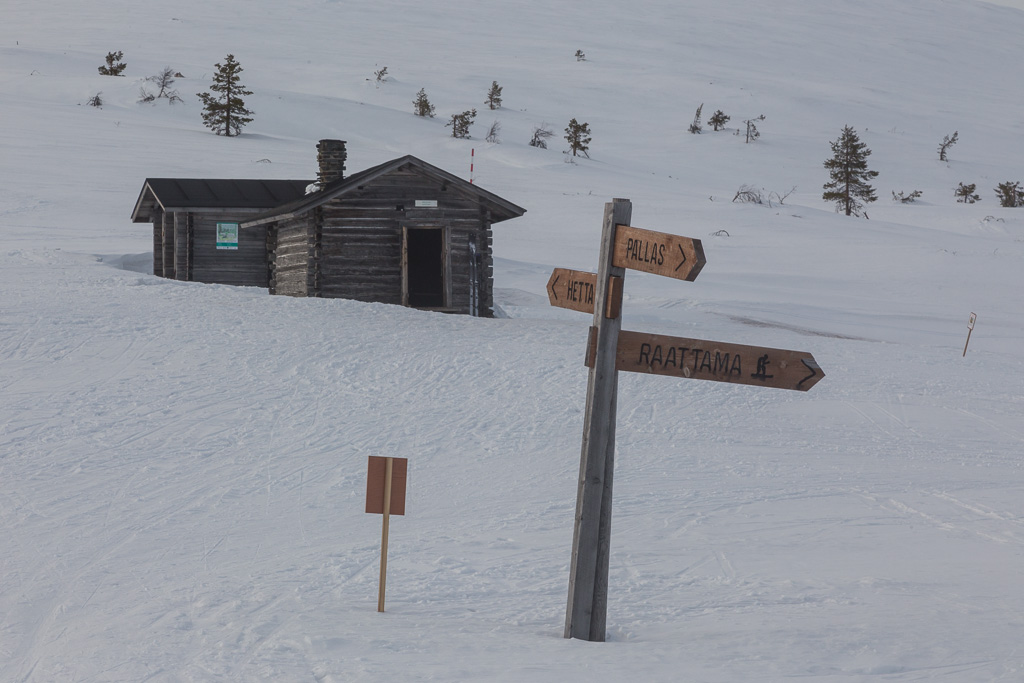
The Finnish girl told us that the summer trail over the Pallastunturi mountain near the hotel had been prepared as a ski trail, and that it would be a beautiful route on a sunny day. So we skied to Pallas Hotel (4 km from the cabin) and started our way up the mountain from there.

A short break at the hotel Starting our way up from Pallas Hotel

Actually the track up the mountain hadn’t been prepared, but there were tracks from other skiers, and with our ski’s with metal edges we don’t really need a maintained track anyway.

On top of the mountain (or hill rather, it was about 800 m high) there is no vegetation and the poles that mark the trail become crusted in snow This photo shows very well what the landscape was like: the hills are bare on top, with forest lower down - great views!

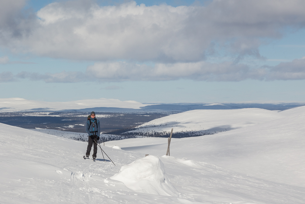
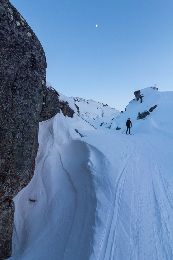
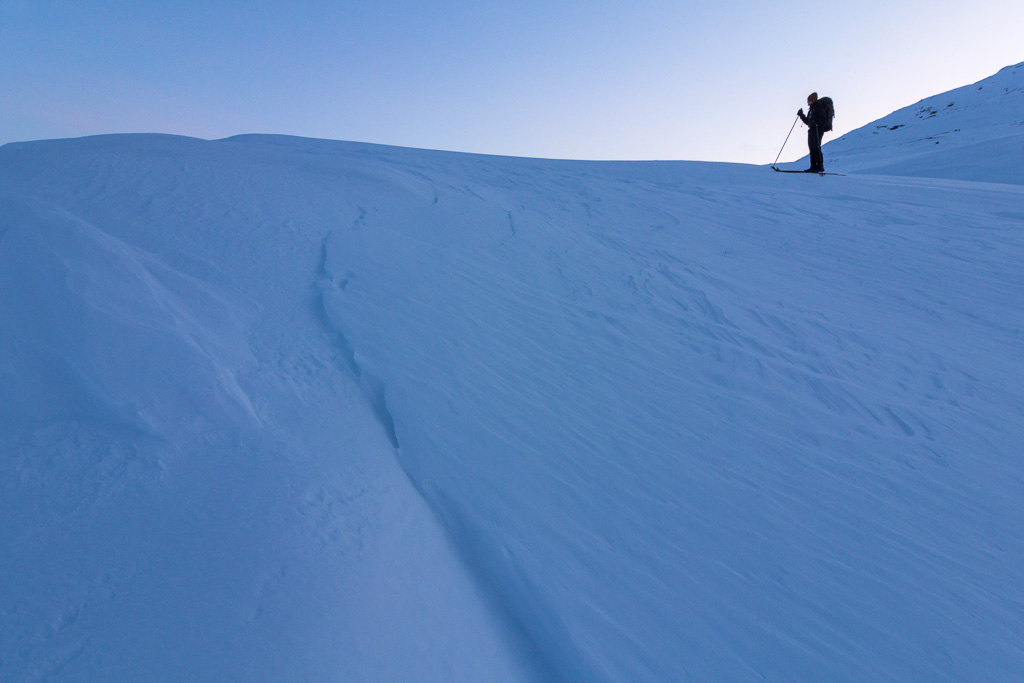
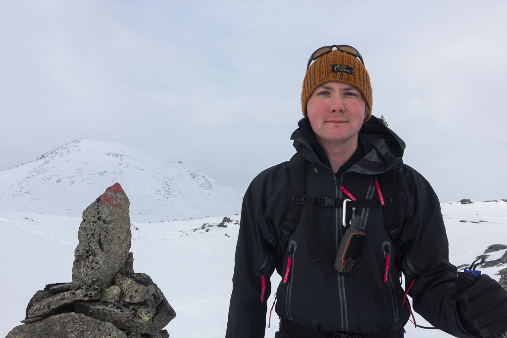
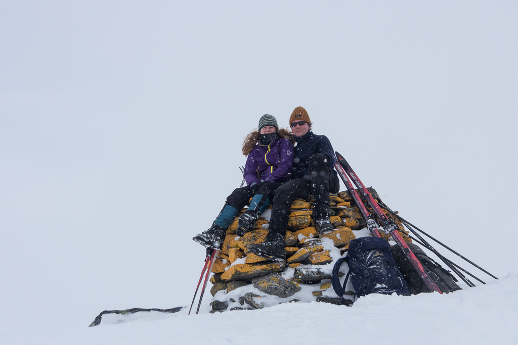
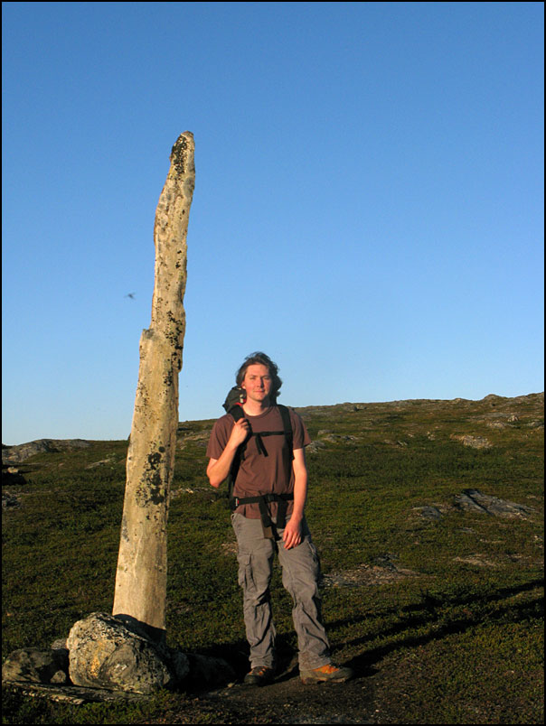
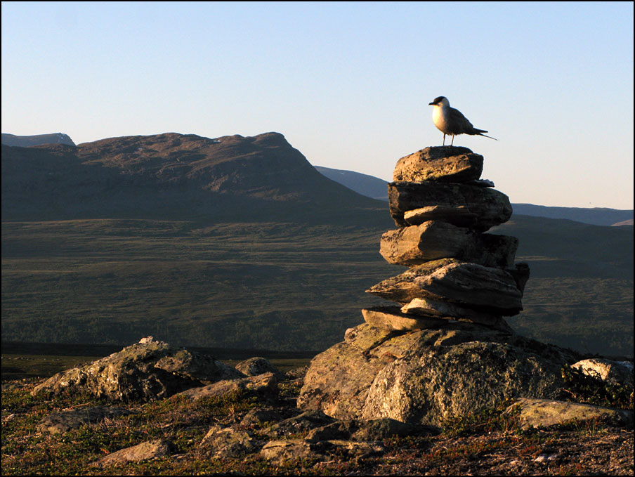
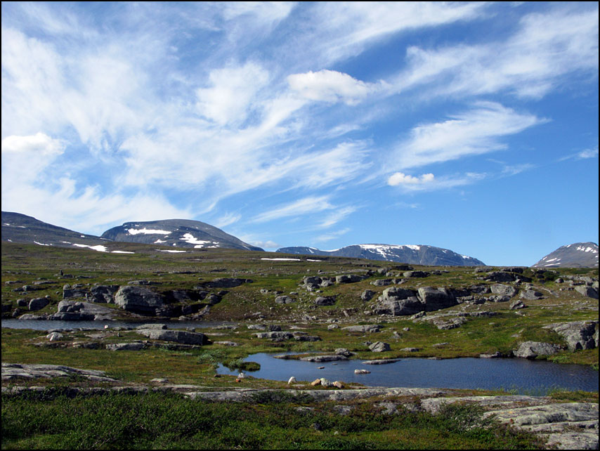
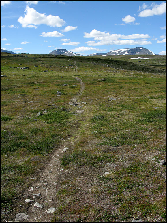
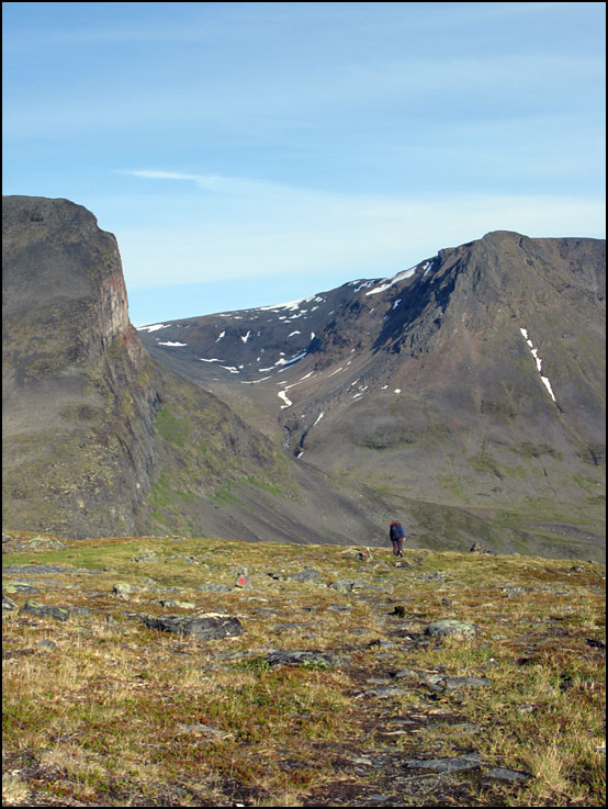
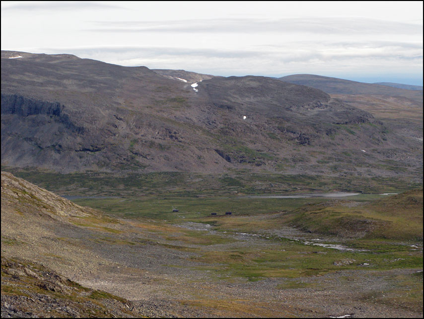
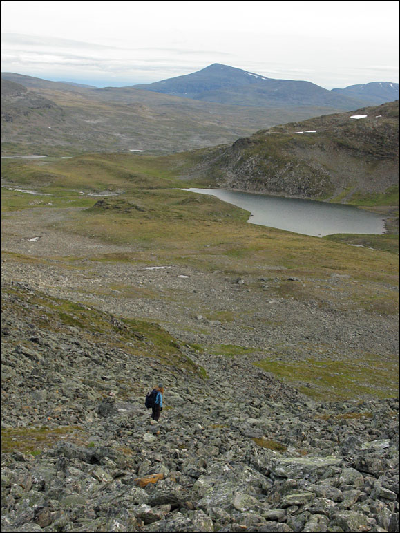
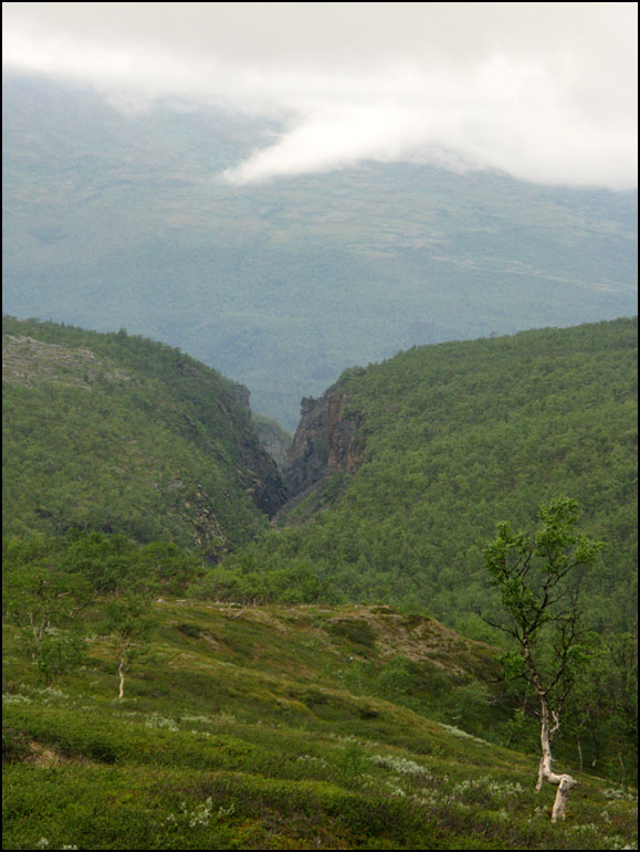
The views were great…

It's impossible to get lost, the trails are marked very well! Some lone trees when you get lower down the slopes

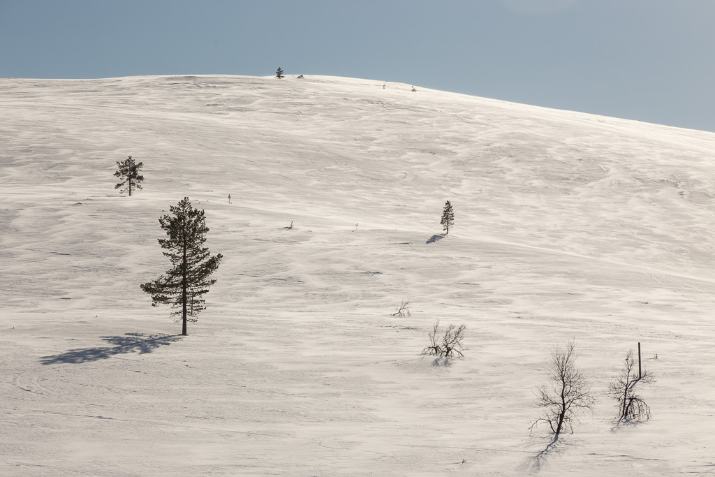
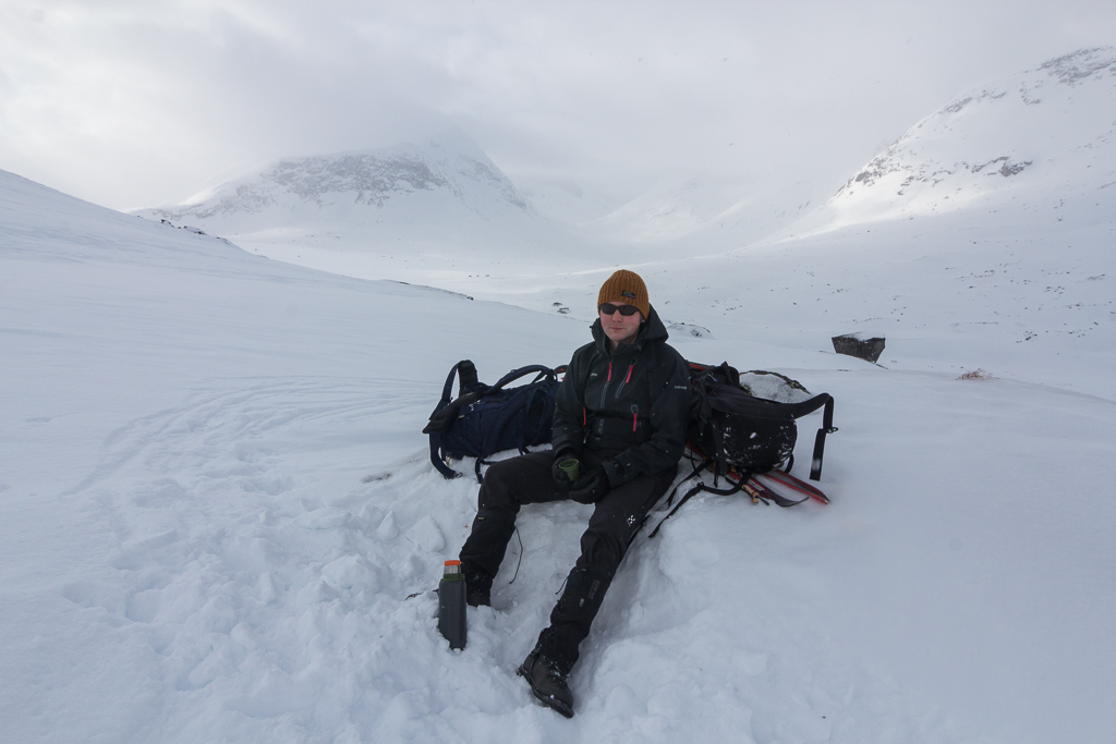
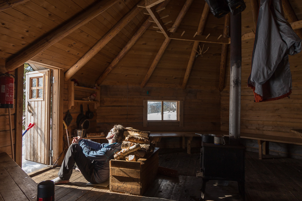
Going up was no problem, going down was a lot harder – at least for me. The snow was icy in some parts, while in other parts there was a crust through which you could fall into much softer/wetter snow – quite a challenge, and not always that much fun. We were glad to reach the Rihmakuru “kota” – a large wooden tent with a stove in the middle. We took a long break here to eat lunch, and enjoy the sunshine.

Out of the wind, and in the sun - perfect! Rihmakuru kota

We considered staying here for the night, but it was only 3 km to the next cabin, which we had heard was brand new and beautifully located. So after a while, we dragged ourselves out of the kota and back on our ski’s…

Looking back at the mountains we crossed What a beautiful day!

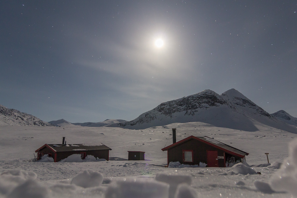
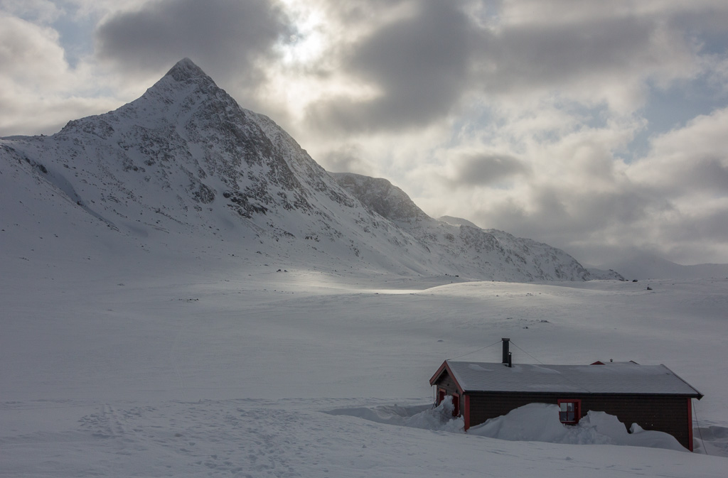
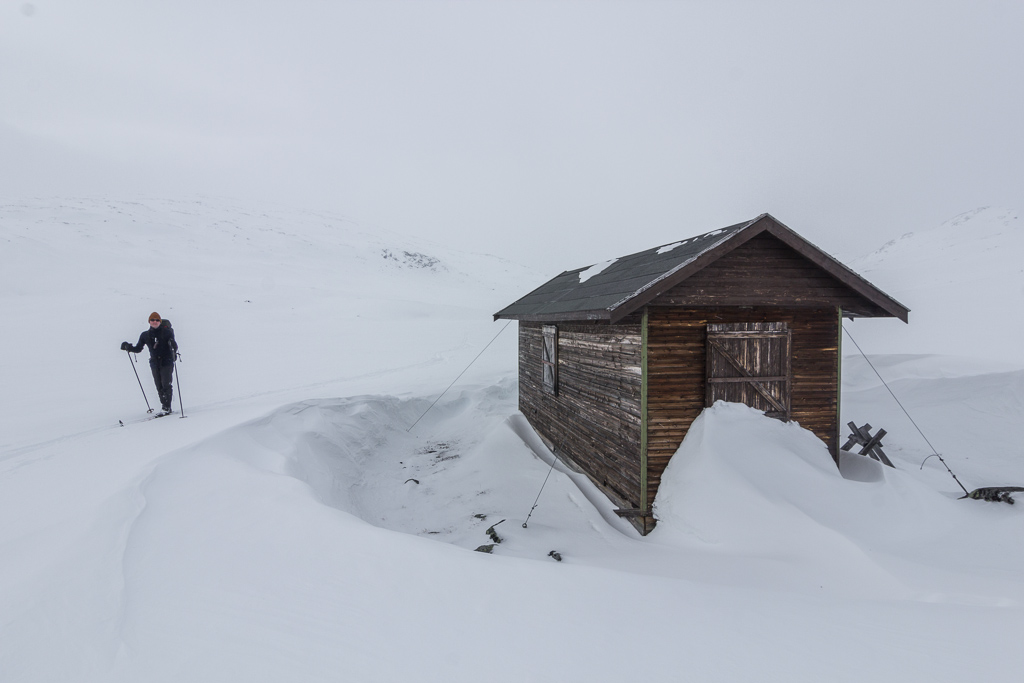
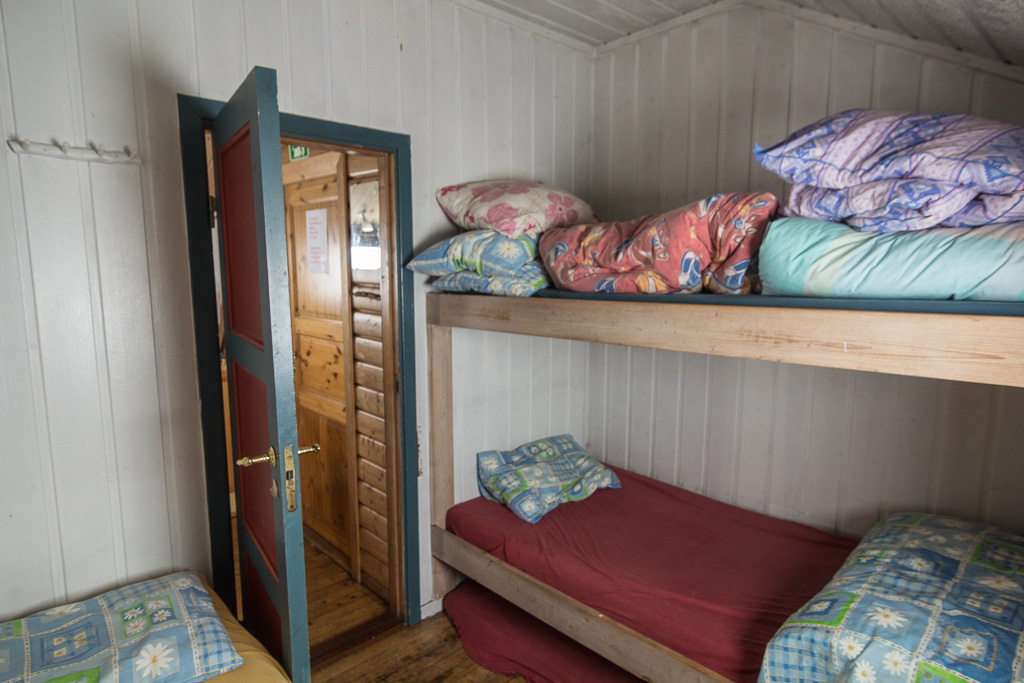
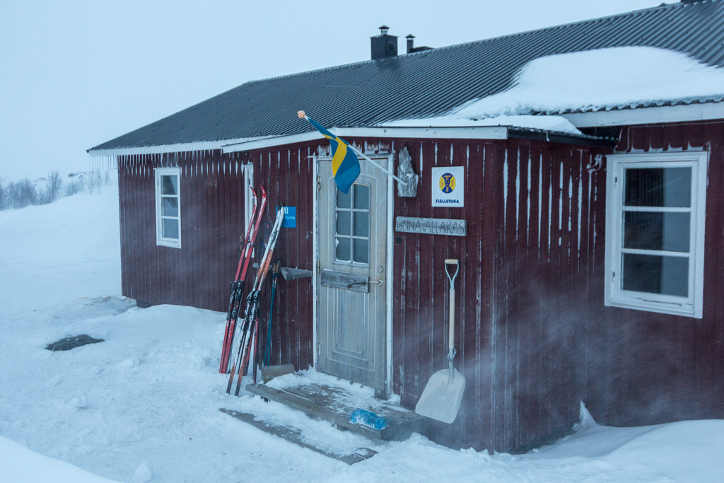
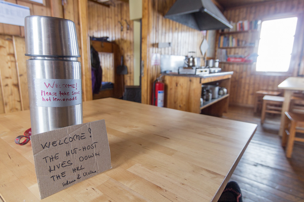
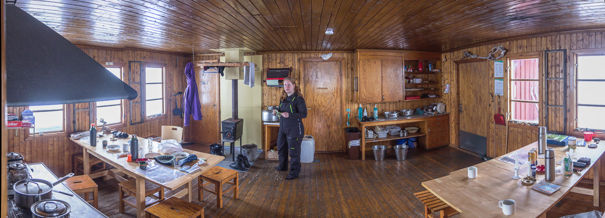
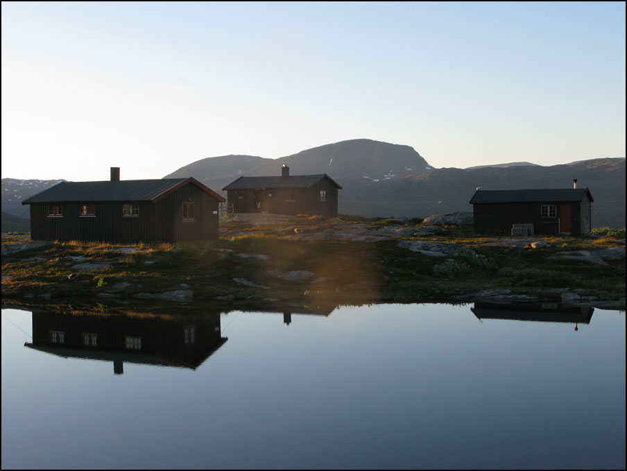
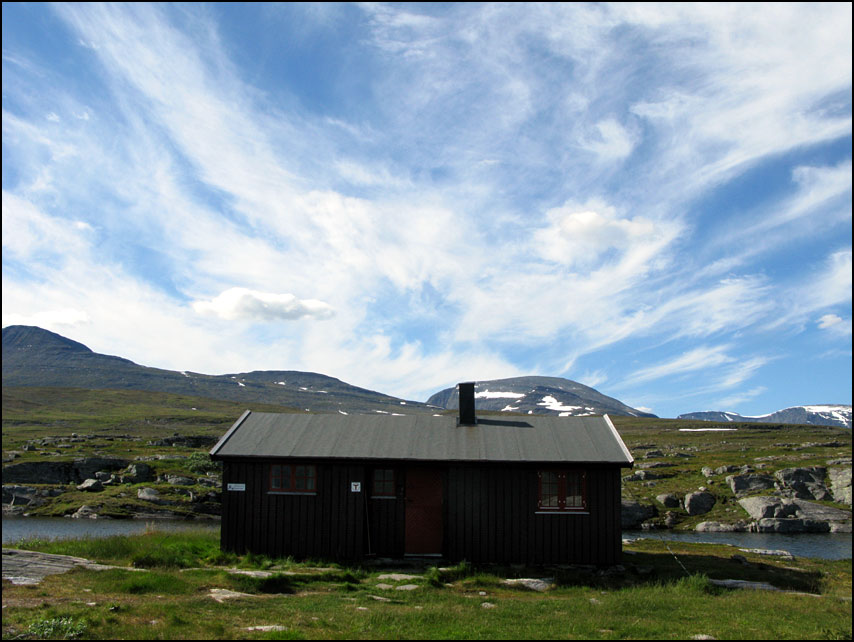
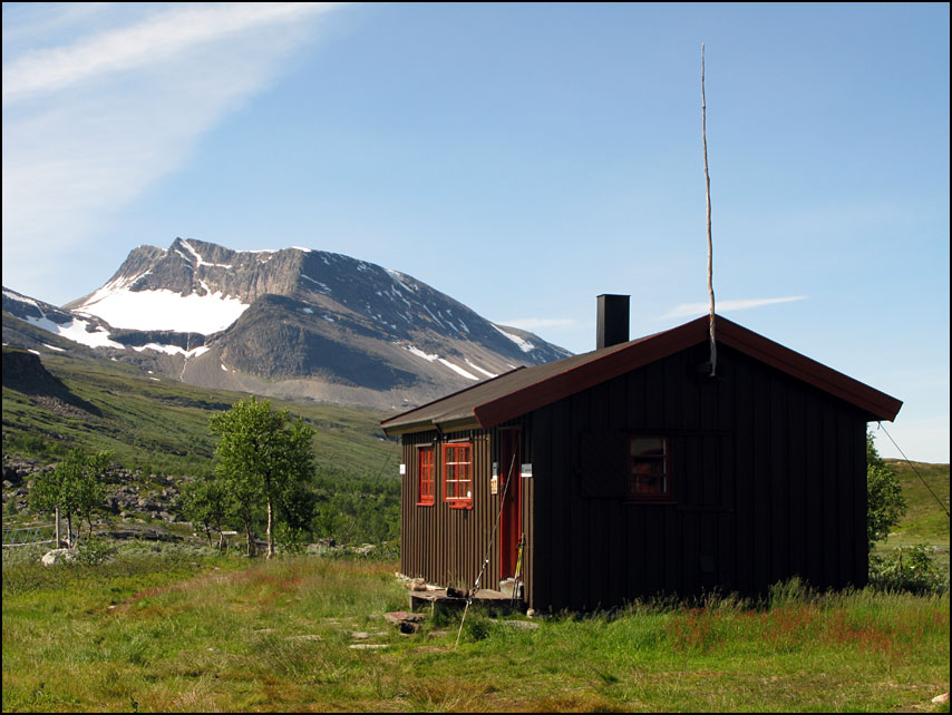
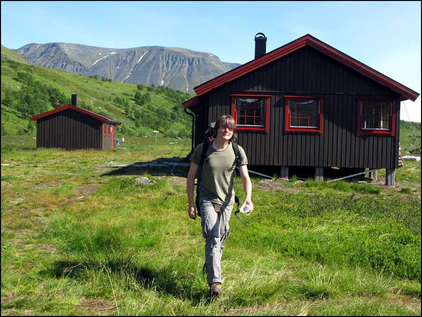
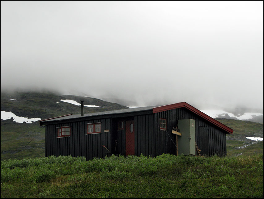
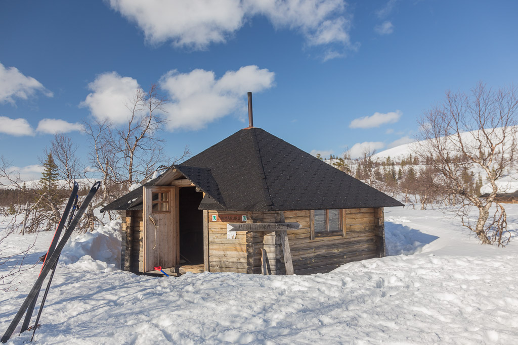
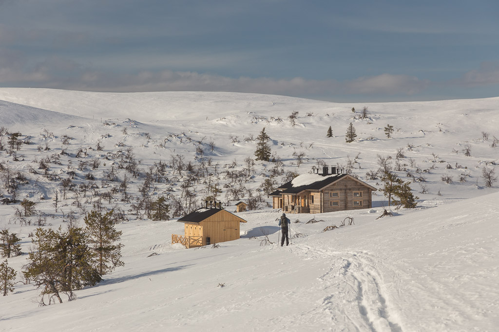
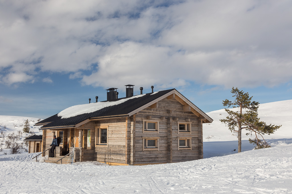
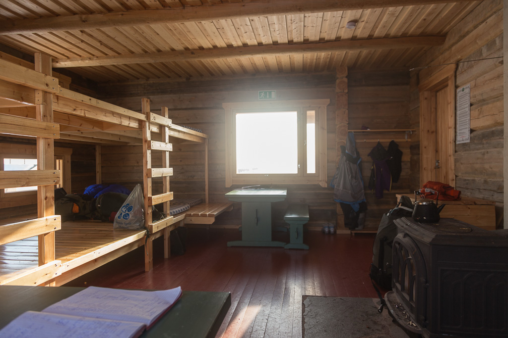
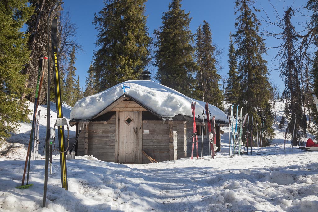
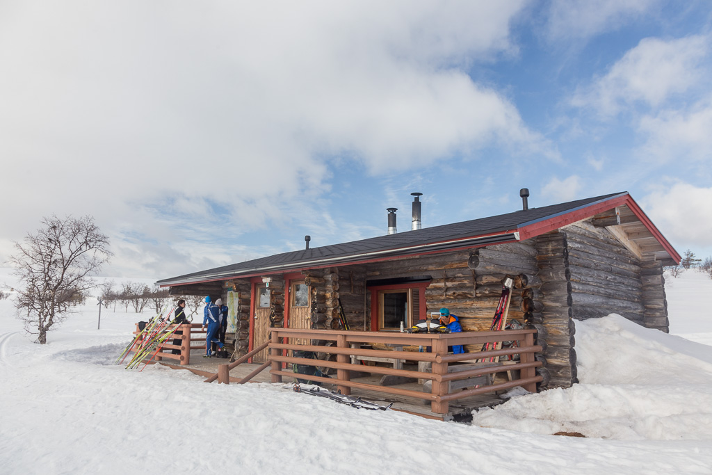
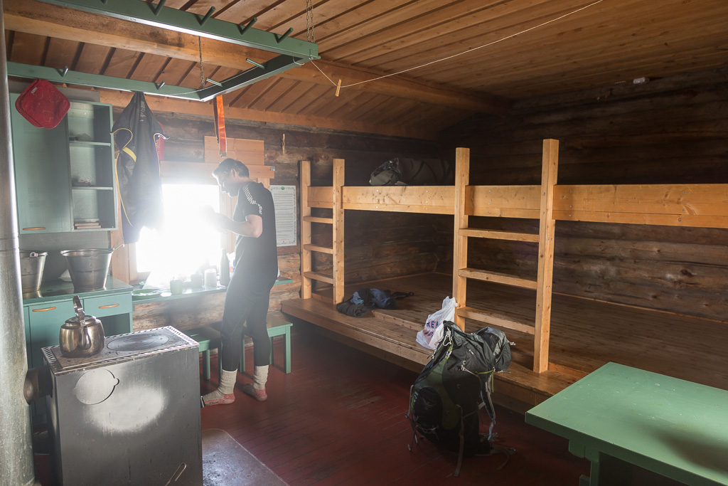
We didn’t regret it, as the weather was gorgeous and the views were fantastic. We took lots of photos, but it still didn’t take long to reach Nammalakuru Wilderness Hut. This hut only opened in late October 2013, it’s brand new! It has a locked half where you can reserve a bed (for 10 euros), with place for 12 people. The other half is open and has room for 20 people. All open cabins are totally free by the way – quite amazing!

Reaching Nammalakuru Wilderness Hut A beautiful, brand new building, with great views! Inside Nammalakuru Wilderness Hut

We got there at 18:00, and the only other people there were a Finnish couple who appeared to have just had a fight (?) – which made the atmosphere a bit strange. We were well rested after our long lunch break, the sun was still shining and it didn’t take long to decide that we could continue a bit further. The next cabin was only 1 km away, though this one was much older and much smaller…

Looking down towards Montellin Maja Open Wilderness Hut Tiny Montellin Maja Open Wilderness Hut

It didn’t have a gas stove, only an open fire place, and only room for about 4-5 people. While we sat in the cabin contemplating our plans, a group of 4 guys came in, intending to spend the night there. In the Finnish cabins it’s the last person who arrived who had the right to a bed – based on the philosophy that others will have had a break and can continue to the next cabin. We didn’t fancy the idea of sharing this tiny cabin with 4 large guys, and we should have really decided to ski back to Nammalakuru at this point… but we were a bit ambitious and decided we could ski another 7 km to another kota.

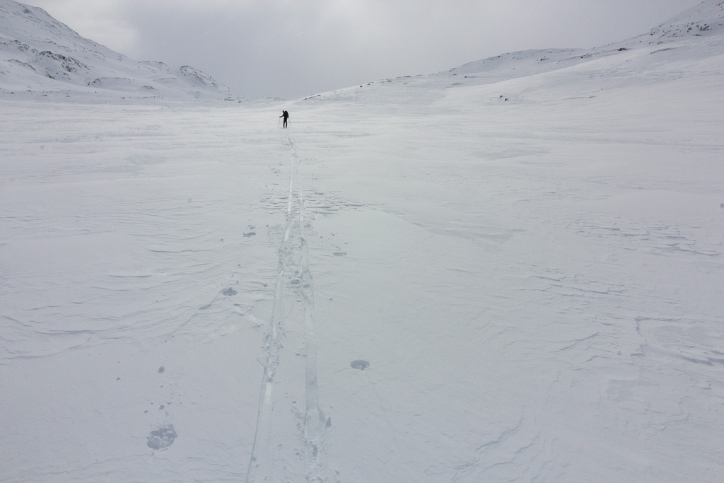
Half of this route was an annoying downhill on a narrow scooter track through the forest – but luckily the snow here was firm enough to walk on, so I took my ski’s off and just walked down 😛 At the bottom we joined one of the maintained tracks, which made our progress a lot faster. We were getting tired and hungry though. We were relieved to reach Suaskuru kota, but a bit discouraged when we found out that a group of 8 Scouts (age group 13-15 years old I think) were staying there, and that this kota had an open fire inside. The scouts asked if it was ok for them to stay, and of course we weren’t going to send a whole group of kids away 😉 but we were not really up for skiing another 5 km to the next cabin, so it was going to be a tight squeeze.

The open fire meant we couldn’t prepare dinner very easily (so instead we had the next day’s lunch and snacks…) and it also meant it was really smokey inside. Oh well, we were tired enough to sleep like a log – we had skied 26 km that day, on challenging trails!

Inside Suaskuru kota

Day 3: Suaskuru to Sioskuru – 17.5 km (9.5 hrs)

The next morning was sunny again 🙂 The only problem was that we (and all our stuff) smelt like a campfire :S. We had originally planned to do a loop in the national park, and return to our car by ski’s. Since we had pushed so far north yesterday, we started thinking of just continuing all the way to Hetta (or Enontokiö, not sure why it goes by two names). This would mean no boring backtracking on the same trails, and having new terrain in front of us, but it also meant we’d have to find some way to get ourselves back to the car in the end – worst case it would mean a 100 km taxi trip.

Suaskuru kota Direction signs at Suaskuru kota

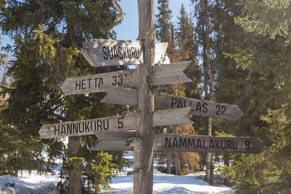
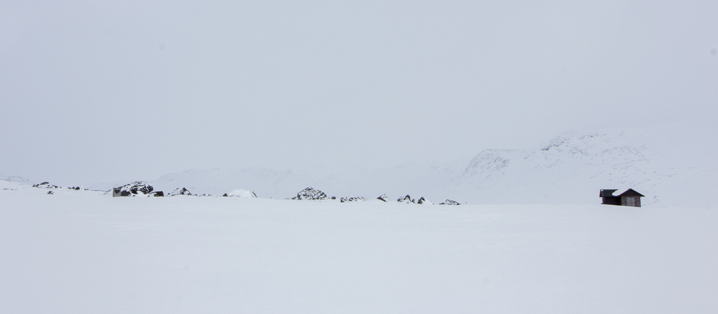
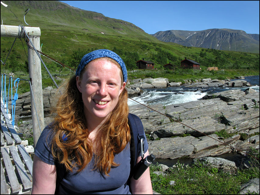
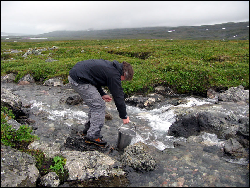
We started our day by skiing the 5 km to Hannukuru Wilderness Hut. Here there were lots of facilities: a large reservable wilderness hut, a large open one, a kota, AND… a sauna! 🙂 It was the middle of the day and the place was deserted. It had also started to cloud over, and there was even some light rain – what a perfect time to have a sauna, to get rid of the campfire smell and to get clean!

On our way to Hannukuru, when it was still very sunny On my way to get water from the lake

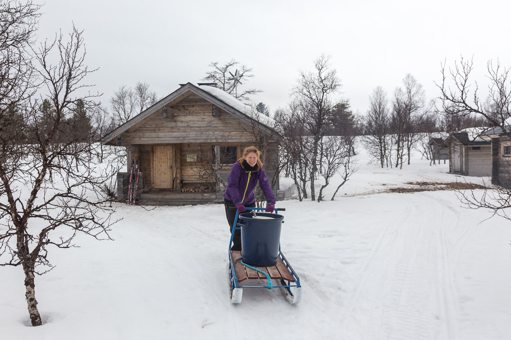
We really enjoyed the sauna, and didn’t see anyone while we were there. Just when we were getting ready to leave, two groups of skiers arrived, all keen to use the sauna. Lucky for us, as we had enjoyed having the sauna to ourselves, and lucky for them, as they arrived to a sauna that was already warmed up 🙂

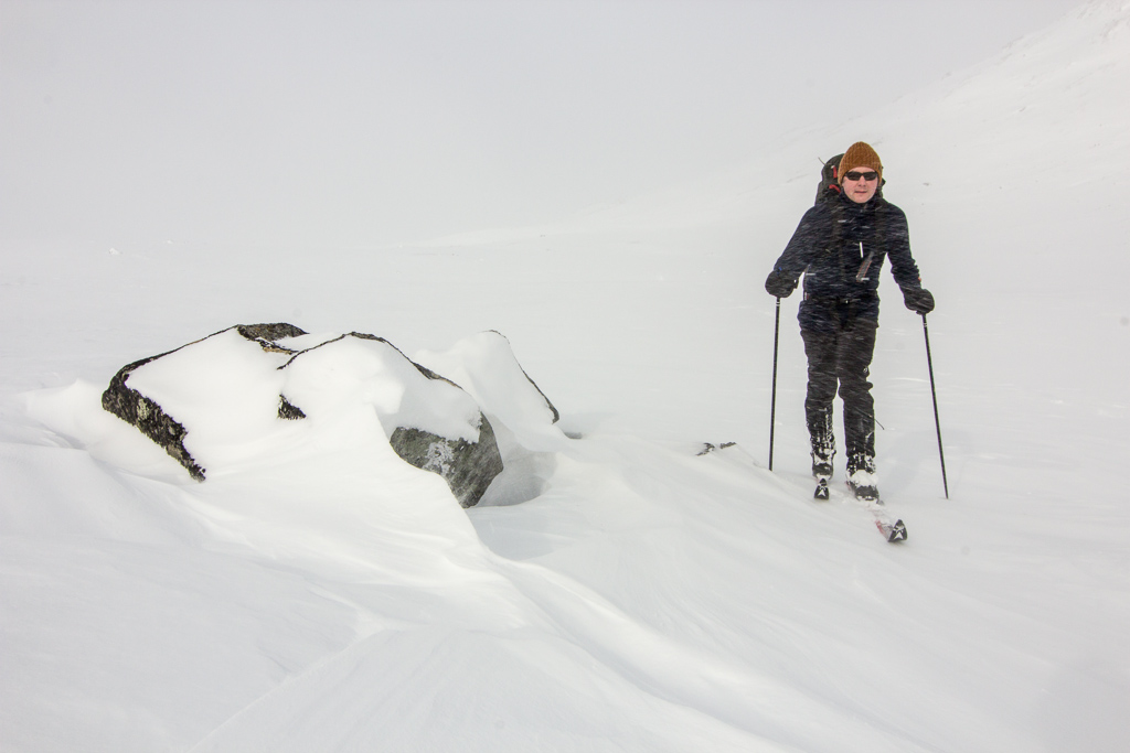
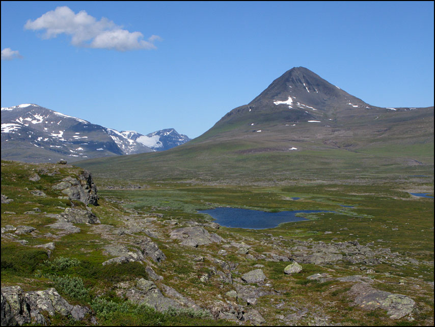
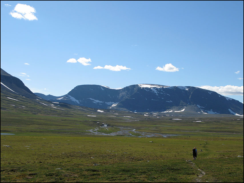
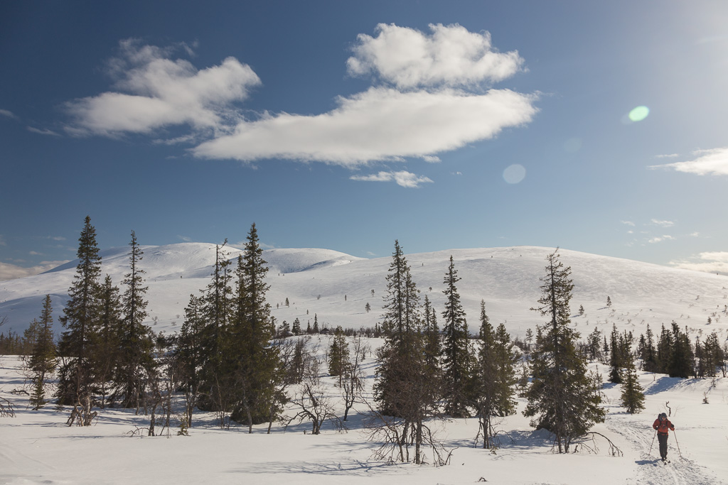
The Finnish girl in the first cabin had told us that the landscape just north of Hannukuru was really beautiful – and indeed it was! We left in light rain, but after an hour it cleared up and we had sunshine again…

Skiing through a narrow valley The view after coming out of the valley: fantastic!

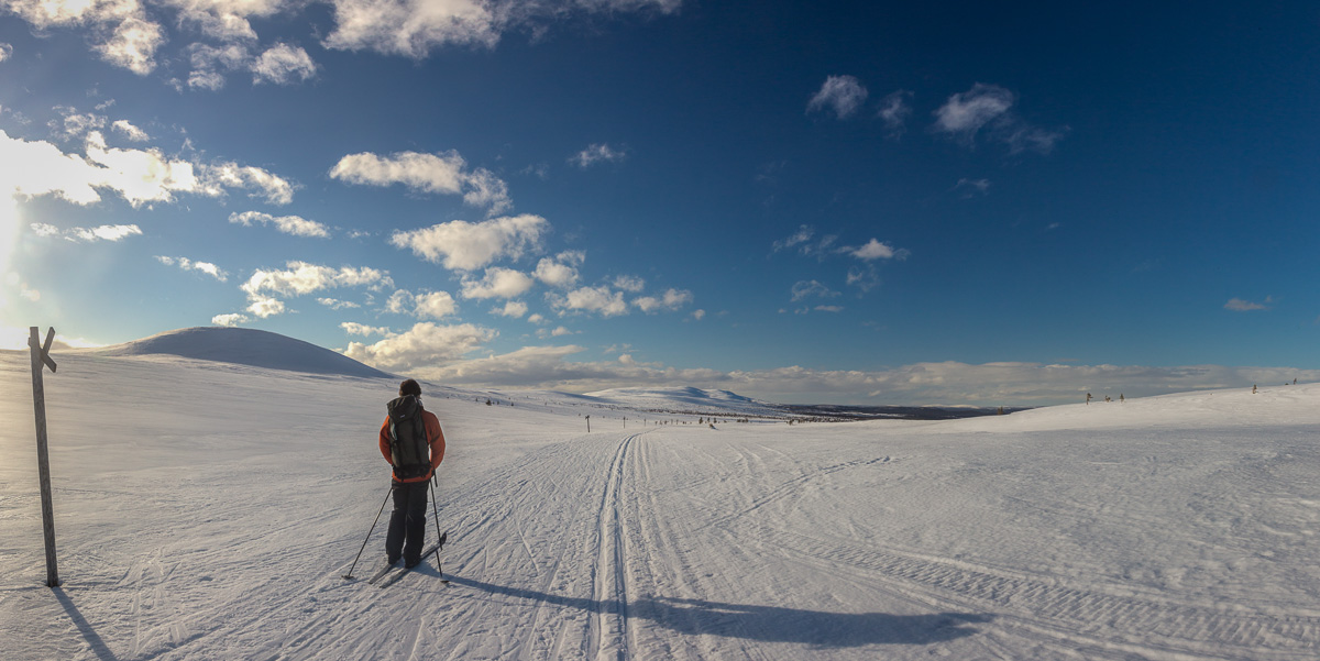
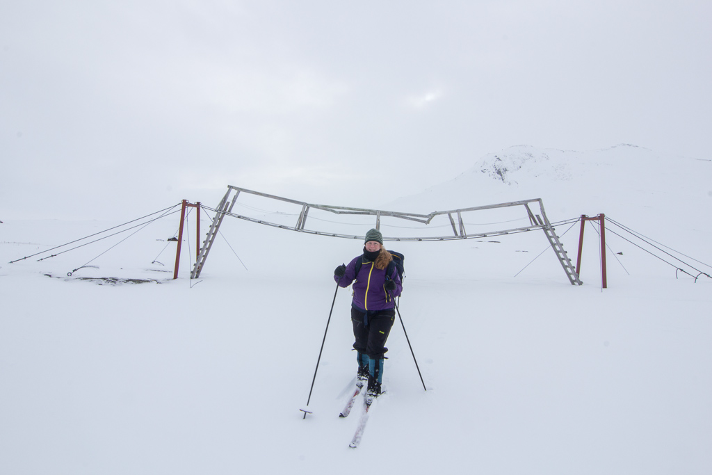
Just after that panorama was taken though, we were hit by very strong headwinds. Force 7 means resistance while walking, so we reckon it was at least force 8 😛 It was tough, slow-going but also quite spectacular. I wish I could have taken photos, but I was afraid that the contents of my bag would blow away as soon as I opened it! We had a short break at the cozy Tappuri Open Wilderness Hut. There was an old man there, who seemed very friendly but unfortunately didn’t speak a word of English. If we wanted to reach Hetta the next day, it would be better to continue to the next cabin (3.5 km away). We hesitated because of the strong winds, we’d have to climb up to the open terrain again before reaching this cabin. But luckily the wind wasn’t so strong anymore, and we reached Sioskuru Open Wilderness Hut within an hour.

Sioskuru Open Wilderness Hut at sunset

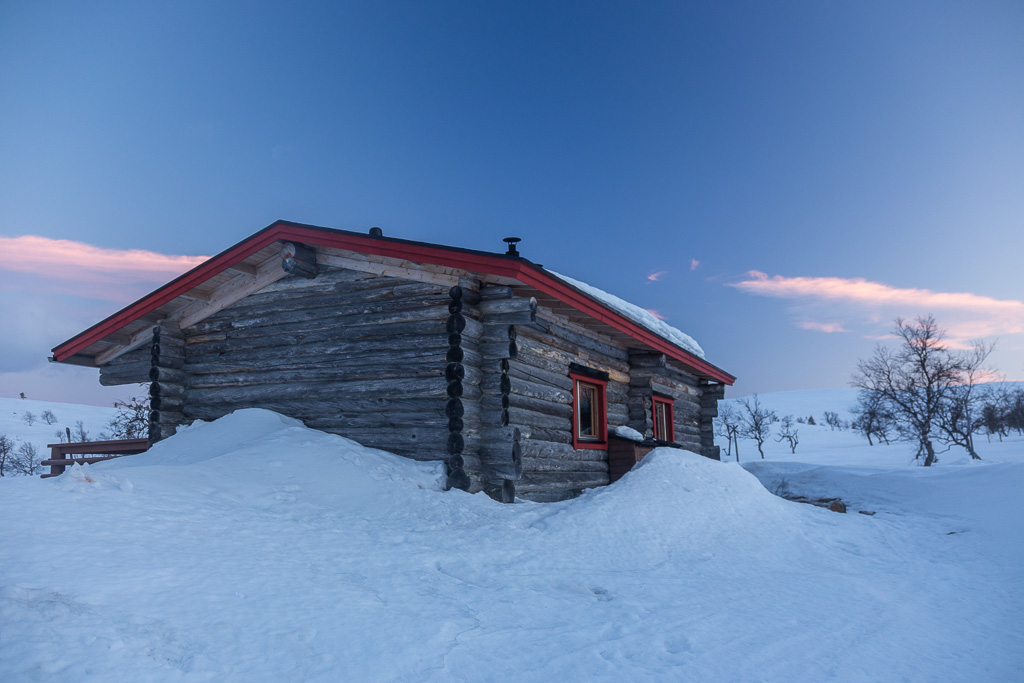
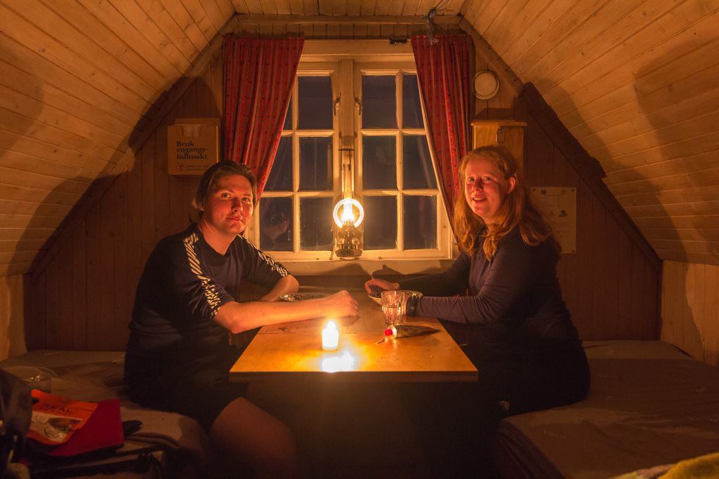
This cabin had a reservable and an open part, and we shared the open part with one Finnish lady. We enjoyed a good dinner and went to bed early.

Day 4: Sioskuru to Hetta/Enontekiö – 15 km (4 hrs)

The next day started really sunny again, and we had breakfast outside! It was lovely to sit out of the wind in front of the cabin, and after a while the first people on a daytrip from Hetta passed the cabin.

Lots of activity around Sioskuru Open Wilderness Hut Inside Sioskuru Open Wilderness Hut

By the time we left it had gotten a bit more cloudy, but it was still a nice day. The route went uphill at first, but later it was downhill all the way to Hetta. We stopped halfway, at the Pyhäkero cabin, which had a cafe! 😀 Unfortunately our 5 euros only bought us one slice of cake, but it was still nice.

Another attempt at waxing the ski's - but by the end we only had blue wax left, which is meant for temperatures below zero, and it was about +6! The start of a longggg downhill

After the short lunch break we skied all the way to Hetta. There were large flat bits in between the downhill sections, and with the very soft snow it was hard to get some speed. In the end we had to resort to the skate-skiing technique, which our ski’s are not really made for – but it worked a lot better 🙂 We reached Hetta by around 15:00. It was Easter Sunday, and everything was closed. We knew the national park visitor centre should be open, but we didn’t know where it was, and my phone was nearly out of battery. Luckily we managed to find out that the visitor centre is 1.5 km east of the town centre, and it was indeed open 🙂 the helpful girl behind the desk told us there were no more busses that day, but she had a list of taxi drivers we could call. In the end we paid 135 euros for the hour-long drive back to the car – but I think that still worked out cheaper than staying in a hotel, and getting a bus + taxi the next day.

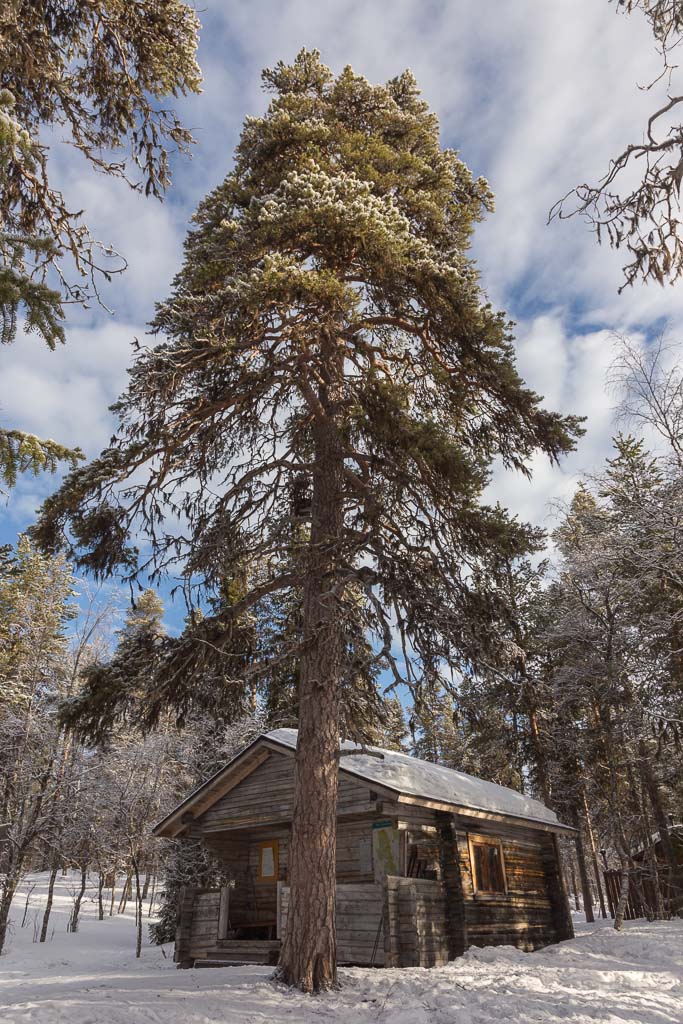
We really enjoyed this trip, the Finnish hut system is perhaps our best discovery this year 🙂 I would love to come back in autumn, but apparently that’s also a very busy time. Perhaps January would be a better time for our next visit, they have tykky here too – see here for some fantastic photos taken during the polar night.

Katterat to Abisko: 6 days of skiing

Katterat to Abisko: 6 days of skiing

In the week before Easter, we went on a 6 day ski trip. The biggest challenge in organizing a trip like this is arranging transport from the end point back to where you started. This was the main reason we chose to start from Abisko in Sweden: you can take a train from there to Katterat, a station in Norway that cannot be reached by road. From there you can ski back to Abisko, a distance of 70 km, with several huts along the way. We decided to stay in every single hut we came across, even if they were close together – this would give us some slack in case the weather turned bad and we had to stay somewhere an extra night. Below you can see our route, and the height profile of our trip.

A map showing our trip. We started from Katterat (top left) and made it to Abisko (on the right) 6 days later - a distance of about 70 km. Each day has alternate colours and the huts are indicated. Height profile of our trip. The big drops near some huts are the result of the gps adjusting itself the next day.

On the day before our trip, we drove from Tromsø to Abisko Turiststation where we spent the night. This is a mountain station owned by the Swedish Trekking Association, and basically a combination of a youth hostel and hotel. The atmosphere was very nice, people were there either for ski trips or for watching the aurora. That night the aurora was active, but we decided to ignore it and go to bed, as we had to get up early…

Day 1: Katterat station to Hunddalshytta – 10.5 km (5 hrs)

We got up at 06:30, as we had a train to catch at 07:45. We just about made it to the breakfast room to grab the lunch packets we ordered, no time to sit down and eat breakfast. We hurried to the train station, only to find out our train was 15 minutes delayed. This delay just kept increasing… until it was long enough for us to decide to have breakfast after all. To make a long story short: the train was eventually cancelled, and we had to wait for the next train at 14:05. That’s a 6.5 hour delay!!! It was very boring to wait around nearly all day, when you were ready to go so early in the morning… but finally, there it was: OUR TRAIN!!

We spent a frustrating day waiting for a train that was 6.5 hours delayed... Yay - the train!

After a scenic train ride, we were the only ones to get off at Katterat station. We watched the train leave with mixed feelings – now we were on our own. It was 15:30 by the time we started our trip to Hunddalshytta, and the sun had already left the valley that we were following. We followed a few old tracks from skiers, snow scooters, dogs and even someone on foot. It was a beautiful day, especially when the moon came out as well.

We got off at Katterat station, which cannot be reached by road. Let's go! :) At some point we went through an impressive canyon

Our progress was slow though – we lost the route a couple of times, and the snow was icy and hard. The route was also a constant uphill.

Soon the world turned pastel shades of blue and pink Beautiful colours and lots of windblown snow

At some point we could smell a wood fire and we knew the hut could not be far away. And there it was, Hunddalshytta in the moonlight…

Hunddalshyttene on a moonlit night...

There are actually several cabins here: one for a warden (which was empty while we were there), one big one, and a tiny one. The big one was very full, there was only one bed available. So we knocked on the door of the small one, where we found 2 Dutch men with snowshoes. They just about had place for us, and were soon feeding us Baileys – mm, what a welcome 🙂 After a quick dinner, we went to bed early.

Day 2: Hunddalshytta to Oallavagge – 6 km (3.5 hrs)

The Dutch men left early in the morning, as they were catching a train all the way back to Stockholm from Katterat. We had a lazy morning, and watched the people in the other hut build an igloo which they were planning to sleep in that night. They were Dutch as well 😀

The cabin we slept in Not very sunny, but still a beautiful view of the largest cabin, with Ristacohkka (almost 1700 m high!) in the background

We left just before noon, we weren’t in a hurry as we didn’t have very far to go that day. We did have a steep climb however, very tiring when you have to herringbone your way up. We were happy when we made it to the top of the pass!

A much needed break after herring-boning up a steep and icy slope. The three dots in the background are the cabins at Hunddalshyttene... Paul at the top of the pass

There was a nice downhill section afterwards, but it was one of those whiteout days where you don’t see any contrast in the snow. This makes it hard to estimate how steep a slope is, and as a result you don’t dare to speed up too much. There were also some old ski tracks that had turned to concrete ridges, hidden underneath a layer of fresh snow, as an extra hurdle… 😉 We were relieved to reach Oallavagge and find it empty – it’s a tiny emergency shelter, with only two beds. Not many people choose to spend the night in it, but even one extra guest would have been a squeeze!

A cosy evening in tiny Oallavagge

We spent a very cosy evening in the tiny hut. When we arrived, it was -4 inside, but the wood stove quickly raised the temperature to about 30 degrees! We had some soup, then made dinner. It was nice to have the place to ourselves and get some rest. The wind was very strong, during the night I woke up once fearing that we’d be stuck there for an extra day!

Day 3: Oallavagge to Cunojavrihytte – 12 km (4.5 hrs)

The wind had calmed down a bit by the time we got up. It was still windy though, but luckily in the right direction for us 🙂

Tiny & cosy Oallavagge On our way in a white and lonely world - we didn't meet anyone that day!

It was a grey day, though the sun tried to peek through the clouds every now and then, but made good progress with the wind in our backs. We didn’t meet anyone all day…

Wait for me! (my usual view...) A windy day, but luckily we were blown in the right direction :)

One big disadvantage of strong wind is that you hardly feel like sitting down somewhere to have lunch. We tried to shelter behind various rocks and once behind at a surprise cabin that was not on the map. The cabin was mounted on huge skis and had probably been dragged into position for temporary use  by people working for the power company. (lots of the lakes in this area are used for hydroelectric power). When we got closer to our destination, we came across this small private cabin and a rickety suspension bridge over the river …

A lonely cabin in the distance We went to have a look at the cabin, it was a private cabin, perhaps used by Sami in the reindeer season? Quite funny to ski underneath the bridge...

We thought it might be busy at Cunojavrihytte, as it was now Saturday and ski touring is very popular in the weeks around Easter. To our surprise, we found the place to be deserted! Here too, there was one big hut and a small one. We chose the small one as it would warm up quicker. Not long after we arrived, 4 skiers turned up at the large hut. They were the first people we had seen since we left Hunddalshytta two days earlier.

Day 4: Cunojavrihytte to Unna Allakas – 4.5 km (2 hrs)

We had a very lazy morning at Cunojavrihytta, as we only had 5 km to ski to the next hut. Here are some photos of the hut we stayed in at Cunojavri, to give you an impression what they are like…

The logo of Narvik Turlag Our bedroom

As you can see there’s plenty of duvets, so you only have to bring a sleeping bag liner. Both Cunojavrihytta and Hunddalshytta have  solar panels and there are some low-voltage reading lights, but otherwise you need to bring candles with you. We cooked on the wood stove in this cabin, as for some reason the gas cooker was placed outside the living room, next to the front door, where it was freezing cold!

Paul reading the guestbook - always a great source of amusement :) Studying the map and our progress View from the kitchen to the living room

It was still windy, and the snow was blown into nice patterns around the hut. Unfortunately also inside the hut, as there was some problem with the outside door not closing very well and lots of snow got into the hallway!

Cunojavrre hytte - this is the one we slept in Spooky sign! The cabin on the left has wood and other supplies, the one to the right is for a warden (not in use while we were there). The small hut to the right is the toilet, and to the left of the warden hut is a hut with water pump for use in summer

Reluctantly, we left the warm cabin and braved the cold wind outside. It was rather flat and grey so we only stopped to take one photo at the border marker. We made it to Sweden in just a couple of hours! 🙂

We made it to Sweden - this is the border marker :)

Unna Allakas was our first experience with the Swedish mountain huts. We weren’t sure what to expect, we had heard they were not as cosy as Norwegian huts. They’re just quite different: Unna Allakas is a big building with 18 beds (divided over 3 rooms) and one huge living room. It’s more communal in a way. The one thing I didn’t understand is that there were more beds than seats in the hut! But there were also some huge advantages: there was a warden who ran a small shop – it’s so nice to buy a few items you would never take with you (beer, Pringles…) and of course being able to buy dinner instead of dragging it with you in your backpack for several days. They also have a recycling system, which means you can leave all your waste behind. We had the hut to ourselves when we arrived, but while the warden came over for a chat, two Swedish men arrived from the other direction (Abisko). It was nice to have some company and share route experiences with them. With only 4 people, we had plenty of space in the cabin.

Unna Allakas, the first Swedish hut on our trip We were welcomed by a thermos of hot lemonade - how nice!

Both the Swedish cabins we stayed in had a well organized system for getting water from the lake or river, and some solution for waste water collection. But while Norwegian cabins usually give you ready-chopped firewood, here you had to first saw a huge logs into smaller bits, and then chop them up with an axe – quite hard work!

Day 5: Unna Allakas to Abiskojaure – 21 km (7.5 hrs)

We got up early as we had a long day ahead of us: it was 21 km to the next cabin! I had been dreading this day for a long time, as so far the furthest I had skied in one day was about 13 km and I am really slow. According to the Swedish men it would be even more windy today than yesterday, but luckily AGAIN it was in the right direction for us 😉

Panorama of the living room at Unna Allakas - we occupied the table on the left, and the two Swedish men took the table on the right :)

Quite a lot of fresh snow had fallen during the night, and the skitracks of the Swedish guys were gone. In Sweden, the marking is quite different though: they use wooden poles with crosses, and there are sooooo many of them that it would be impossible to lose your way. I actually quite liked it, even though I can see it’s a bit of an “attack” on an unspoiled landscape. In many places you can see a snake of red crosses stretching out miles in front of you, but it means you can just ski without having to check your map/gps all the time, or discuss your route choice. After a while, the snow showers cleared up and it actually got SUNNY!! We had our first lazy break in the sunshine (an important part of easter skiing), what a difference with the previous days! The route was downhill all the way and I started to relax and enjoy the day…

In Sweden, the winter routes are marked with crosses like this Hey what's this - sunshine?! Our first break in the sun, really nice You won't get lost in Sweden ;) Here we had to make our own tracks, later we met snowscooters which made the skiing a lot easier!

At some point (about halfway) we met a group of snow scooters coming from Abisko, which meant we could ski in their tracks. That made the rest of our trip a lot easier. They are smelly, noisy machines, but sometimes they are quite welcome 😉 As we made our way down the valley and into the birch forest, we finally saw signs of life: some reindeer, a couple of birds… finally some groups of cabins – we were coming back to civilisation it seemed 😉

I was so happy when Abiskojaure came into sight: we made it!! I was very proud, but also really exhausted and my feet were sore. I stumbled into the cabin, following the cheerful warden who was showing us where to sleep. The cabin was huge and very full, mostly with a big group of German teenagers. It was a bit too much to suddenly be in such a cramped hut (bunk beds were 3 high here!) after the solitude of the last couple of days. But it was fun talking to other people who were just starting a long trip and the Germans were very keen on chopping wood and getting water so we hardly had to do anything 😀 Another luxury of this hut: it had a SAUNA. No showers of course, but some ingenious system of mixing hot water coming from the sauna with cold water from the lake, so you could wash.

Day 6: Abiskojaure to Abisko Turist station – 15.5 km (5 hrs)

We hadn’t planned to get up early, but the Germans had breakfast at 6 am and it was hard to sleep after that. We had breakfast as soon as they had left, and by 09:30 we were ready to go 🙂

Breakfast at Abiskojaure - note the Easter decorations in the background :) to the right recycling bins, you can actually leave your rubbish behind in the Swedish cabins! Abiskojaure

Of course we first took a few photos around the hut. There were 3 wardens at this hut, who put up Easter decorations everywhere and they were very chatty. The place is more like a youth hostel than a mountain cabin!

The logo of the Swedish trekking Association Even the so called Weather Station was decorated for Easter

The route back to Abisko was easy but quite boring (crossing the long lake in grey conditions was not very exciting). Later it got sunny and we followed a gently undulating roller-coaster path through the forest.

The rollercoaster path through the forest near Abisko Impressive lenticular clouds

We got a bit lost in the end, as Abisko Turist station was not on our map and we had just guessed where it was on the GPS. As a result, we ended up at Abisko East (we had no idea there were 2 stations here :D) and we had to follow a scooter trail next to the road for half an hour to get back to the Turiststation. We picked up the key to our room, and rushed to a much needed luxury: a hot shower!! Clean clothes!! And finally a 3 course meal in the restaurant 🙂

Abisko Turiststation - good to be back ;) It looks like a factory here, but it's actually quite nice (and warm, and dry, and it has showers, and toilets that flush...)

It was a fantastic trip, it pushed a lot of boundaries for me, and now I am keen to do some more trips like this 🙂

Signaldalen to Dividalen

Signaldalen to Dividalen

For a while, we’ve wanted to explore the skiing/hiking tracks in Indre Troms, the area near the border with Sweden. There are several huts there, linked by marked paths – ideal as we didn’t fancy hiking with a tent and cooking gear. My parents were visiting us the week before we planned to do a hiking trip, and they offered to drive us to wherever we wanted to start, so we could leave our car where we wanted to finish. This was a great offer as public transport is sparse in this area. We decided to start in Signaldalen and hike to Dividalen. The total length of the walk was 72 km! Below is a map of our route, and the height profile, with the huts that we slept in indicated.

Map showing our hike starting in Signaldalen and ending in Dividalen. Total length: 72 km Height profile for the total hike, with the huts where we slept indicated

Day 1: Rognli (Signaldalen) to Gappohytta (11 km, 4 hrs)

It took us a day to park our car in Dividalen and drive to Signaldalen with my parents (and I managed to add some more time by realising I left my waterproof jacket in the car – we had to drive back for 20 minutes to get it… oops 🙁 )

Finally, at 18:00 we were ready to go. After lots of rain, that day it had finally cleared up and it was sunny!

Ready to go! Following the dirt track up the valley

We followed a track up the valley, first through the forest and later through a more rocky landscape.

Little stream! Paul making his way through the rocky landscape
A very pointy cairn! And notice the mosquito to the left of it... (no that's not a bird!) The long-tailed skua (Fjelljo in Norwegian and Kleinste Jager in Dutch), very common in this area. They aren't very shy, you can come quite close!

After a while, we found the disadvantage of the beautiful still weather – mosquitoes! And lots of them… Fortunately our repellent seemed to work – as in we didn’t get bitten – but it’s hard to enjoy the scenery with a cloud of mosquitoes around your head!

At about 22:00, we reached Gappohytta, which looked idyllic in the evening sun, reflected in the lake. There were 2 huts, one of them empty, so we had the luxury of a whole hut to ourselves. The huts from DNT (the Norwegian Trekking Association) in this part of the country are all unmanned and you need to buy a key to open them. They have no electricity or running water, but are always near a water source. They have gas for cooking (and everything else you need, like plates and pans and cutlery), wood for the stove, beds with bedding (but you need to bring a liner or a sleeping bag), and usually a separate building with a toilet of the hole-in-a-plank variety.

Gappohytta reflected in the lake! We stayed in the one closest to the lake. The one behind it is identical and had other people staying in it. The building on the right is the wood storage and toilet building
Paul reflected in the lake :) A long exposure of the waterfall where we got drinking water from

We enjoyed a good dinner that we brought from Tromsø, and then it was time for bed.

Day 2: Gappohytta to Rostahytta (20 km, 9 hrs)

The following morning it was still sunny, but with some pretty clouds and a nice breeze to blow away the mosquitoes.

The hut in the morning - beautiful sky! Another view from the hut in the morning
A pyramid shaped mountain :) Rostahytta was our next destination Here we were actually leaving Norway and entering Sweden for a while

We walked through Sweden for a couple of hours. We crossed a lot of small rivers, before stopping for a break at a waterfall.

The path we followed Crossing a small river Walking through such big landscapes makes you feel small!
Paul had a close look at the waterfall Checking Crossing a very wide (but shallow) river

We crossed the border back into Norway, and soon reached our halfway point, which means: lunch!

The border! Finally, lunch! I was quite tired at this point

We walked through Isdalen, a pass between two valleys, strewn with huge boulders and surrounded by steep mountains.

Huge boulders everywhere Crossing Isdalen There were still some patches of snow
The red T was showing the way Resting my backpack for a moment

At the end of Isdalen, there is a steep descend down towards Rostadalen. The view is quite spectacular! But walking down over small rocks was rather tedious.

Enjoying the view Just before the steep ascent
The river that we later had to cross Impressive mountain!

At the bottom we had our first serious river crossing – one that required taking our boots off and wading through. I had brought flip flops for this purpose – so I wouldn’t fall over or hurt my feet – so I thought I’d be fine. What I didn’t realise is how COLD these rivers are…. It was really painful, within seconds my feet were numb with cold and I cried when I got to the other side. It took a while before my feet stopped hurting! Not quite the nicest experience… but at least now I’d know what to expect next time.

At some point we heard a funny noise nearby, something between the noise of a duck and a pig, and we looked up to see what made that noise. Not very far from us, a herd of I think around 100 reindeers was walking past. What a sight!

Not a very sharp photo, but some of the reindeer we saw Trying to spray the mosquitos away

The final stretch was tough as the mosquitoes came back in full force, this time biting me all over my face. Such a relief to finally see the hut! It was quite busy and we only just about found 2 free beds. A quick dinner, and off to sleep.

Day 3: Rostahytta to Dærtahytta (17 km, 9 hrs)

We woke up to another sunny day. We washed ourselves in a pool at the side of the river before having breakfast at the hut. The hut is very nice and modern, it’s been built in 2007!

Eating breakfast in the very new hut This was one of the older huts, there were 3 huts here Setting off

To start out hike, we crossed the river using a suspension bridge – cool!

Paul on the bridge Me getting off the bridge

After that, we climbed up rather steeply – not easy when it’s warm! We then walked along a plateau for a while.

Climbing up There were pretty flowers everywhere!

At some point the landscape became very rocky and it’s tiring to walk from rock to rock like that. We climbed up to 1045 m. At that point it started to cloudy over and with the wind that made it feel quite cold. Soon however, the hut came into view!

The rocky bit, just below the highest point First view of the hut, way down below! Climbing down a very steep and rocky bit

It wasn’t long until we reached the hut. Again, there were two buildings and we chose the one that was empty. This was the oldest of the two, and very cosy – with the added luxury of an indoors “toilet”!

We arrived very tired, sunburnt, and all muscles aching from three days of hiking (nearly 50 km). The next day was going to be a very long one (24-28 km depending on the route). It was quickly decided that a day of rest would be the best idea for tomorrow.

Day 4: Rest day in Dærtahytta

We slept for a long time and enjoyed a lazy day in the hut. Outside the clouds were low and it was raining continuously, so we chose a good day to rest! We read the guestbook, which always has some amusing entries 😀 People also leave all sorts of books and magazines, so we had plenty to read. At some point in the afternoon, we got company from a German guy who had walked from Rostahytta that day. Later on, we were joined by a Norwegian couple from Stavanger – they got lost during the previous day and had spent the whole night walking!

Reading an old book in the hut Our bedroom The hut surrounded by low clouds Getting drinking water from the river

Day 5: Dærtahytta to the car (25 km, 9 hrs)

The next day the clouds were still low and it was drizzling. We had 2 options: our original plan was to walk to Dividalshytta and spend another night there, before walking back to the car the next day, or we could walk straight back to the car. The drizzle stopped soon after we set off, and it stayed dry for the rest of the day, but there was no wind and we were bothered by mosquitos the whole time. They bit me everywhere, even through 2 layers of clothes. We got so fed up of the mosquitoes, that we decided to walk to the car and go home that evening. I later counted 30 bites just one one arm, and they were getting into our noses, mouths and ears… they literally drove us out of Dividalen!

The path was quite good at first, so we made good progress. Later we had to go through a swampy area which was tough as we sank in over our boots and got wet feet. In this valley, we found a lot of antlers though! They were lying around everywhere, and we even found a matching pair. We took the best ones home, we’re planning to do something creative with them. Either a lamp, inspired by one we saw in a log cabin, or a coat hanger perhaps.

I found a big set of antlers! We found a lot of antlers, they looked quite funny on top of our backpacks

We had one major river to cross. It was too deep to walk through and very wide. Paul tried hopping from rock to rock, while I took my boots off and walked across on flip flops. We both ended with wet boots though! Paul stepped on a rock which flipped over, and I tripped and fell forwards while my boots (hanging around my neck) dipped into the water. Oh well 😉 The last part of the hike went through the forest, along a beautiful gorge created by the river we had just crossed. The river was now narrow and wild…

River going into a gorge Narrow gorge

We got back to the carpark at about 19:00 and were quite relieved to see our Caddy appearing when we came out of the forest 😀 We were wet, dirty and smelly – just longing for a warm bath at home and a good bed to sleep in 🙂 Some people who were just starting their hike asked if we had been on a long tour – wonder if we just looked that tired, or if they could smell us 😛

It was a beautiful hike through very nice landscape, but if we do it again, it won’t be in summer when there are so many mosquitoes and so much of the ground is swampy! Autumn is probably a better season. People had warned us about the mosquitoes but I thought they were exaggerating. They told me to buy a mosquito-net-hat, but I thought they look uncomfortable and silly. Next time, I’ll leave my pride at home 😉

We’re only home for one day, we’re leaving for the Lofoten tomorrow! We’ve rented a small house near the beach there for a week. I’m really looking forward to it! We’ll take the boat and are keeping our fingers crossed for some sunshine 🙂