Browsed by
Author: Hanneke

I started my first blog when I left the Netherlands (my home country) for an internship in Alaska in 2004, to keep my friends and family updated on my adventures over there. Little did I know it would be more than 13 years before I'd move back to the Netherlands! I spent a year in Toulouse (France) before starting a PhD in meteorology at the University of East Anglia in Norwich (UK) in 2005. That's when I started this current blog, first in Dutch but I soon switched to English. I really enjoyed life in the UK, and was actually planning to stay there after my PhD, but "life is what happens when you're busy making other plans" and I ended up moving to Tromsø in Northern Norway in 2009. Tromsø is a photographer's dream, surrounded by spectacular mountains, with the light ever changing from the midnight sun in summer to the dark days compensated by aurora-filled nights in winter. I learnt Norwegian and got a job as a weather forecaster - I got thrown in at the deep end, doing radio interviews and speaking with fishermen with way-too-strong dialects straight from the beginning, before I was anywhere near fluent in Norwegian :D I survived though, and slowly started to do some research on the side. I got more and more involved in research projects and in August 2015 I moved 2000 km south, to Oslo where I started working 100% as a researcher. A year after moving to Oslo, I met Michiel at a music festival in Brussels :) and we started to travel very frequently between Oslo and Rotterdam, where he lives. You can't do that forever though, and I soon realized I found the perfect "excuse" to finally move back home, something I had been considering many times before. So since July 2017, I'm living in Rotterdam! I'm actually taking some time off before finding a new job, and I'm looking forward to lots of adventures in the near future - so stay tuned!
Middagsfjellet

Middagsfjellet

Last week the weather was stunning, so when Hannah asked me whether I was up for a trip, the answer was yes :). I did have to be at work by 15:15 though, so we needed to start early. We picked one of the mountains from Turboka: Middagsfjellet (678 m high) on Kvaløya, near Grøtfjord.

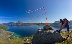
The first part was steep, but we quickly made it to the ridge – with very festive markings and a fantastic view towards Nordtinden, Skulsfjord and Bellvika.

Festive marking on the ridge, with a great view towards Nordtinden, Skulsfjord and Bellvika

We had about 5 hours to make it to the top and back, which was definitely doable but it did mean I couldn’t stop as often as I normally do. Which in turn meant that I didn’t take that many photos 😉 But luckily Hannah is a lot faster than me, so I could leave the photo-taking to her: the results are here.

We were slightly disappointed when we got to the top, as it’s a plateau where the ridge actually blocks a lot of the views – we couldn’t see Grøtfjord for example, nor the valley between us and Orvasstinden. But hey, the view towards the open ocean was still impressive 🙂

View from the top

On the way up we avoided the snow, but on the way down we actually followed the last remains of snow – it’s much better for your knees than loose rocks. The snow didn’t always hold us though, and I even managed to scrape my leg open by falling through the icey snow – who knew that was possible?!

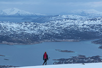
View towards Store Blåmann and Orvasstinden, and above Hannah you can see the top of Middagsfjellet

On the way down we went down a steep valley instead of following the ridge all the way. This was an attempt to save time, but it was a bit of an overgrown jungle which slowed us down. Still, we made it back to the car with about 10 minutes to spare 😀 It was a great hike, in fantastic weather – which left me quite severely sunburnt though (in spite of applying sunscreen several times). I can never decide if hikes before work are a good idea – on the one hand I am very happy I went for a nice trip while the weather was good, on the other hand it makes for a very tired person on duty 😉

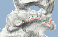
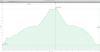
Here’s a map and a height profile of our trip…
Map of our hike to Middagsfjellet Height profile of our hike to Middagsfjellet

Sandøya

Sandøya

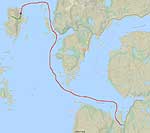
More than a month without any blog posts, what happened?! Did life turn boring, with nothing to write about? Nope, we have the opposite problem: we’ve been on so many trips lately that there was not enough time in between to edit any photos, let alone write a blog entry 😀 I’m really behind now, but I’ll try to catch up as much as I can. First of all: a weekend trip to Sandøya (an island near Tromsø) two weeks ago. You can get there by ferry 3 times a week, but we went with our own boat from Ringvassøya. It took about an hour, you can see our route on the map below…

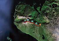
Map of our route to Sandøya, the place we camped indicated with a blue star, and in green our route to the top of the island

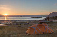
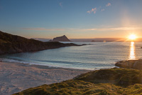
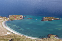
We left late, as Saturday was a rainy day and we had some things to do at home. We arrived at the beach shortly after midnight, and by then it had cleared up almost completely. The beach looked straight towards the midnight sun – beautiful 🙂

Setting up camp in the midnight sun The sun set briefly behind the layer of clouds, then came back again :)

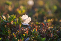
It’s been unusually warm in Northern Norway since Mid May, and we are weeks ahead of schedule – everything is green already, and even the cloudsberries are flowering! They were beautiful, backlit by the midnight sun. With views like this, who wants to sleep??

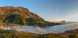
Summer is several weeks ahead of schedule here, the cloudberries are already flowering! Panorama of the beach we camped on, you can see our orange tent and red boat on the far left

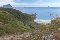
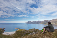
But finally at two in the morning we went to bed. It was so beautiful to fall asleep to the sound of crashing waves and singing birds, and we slept soundly until 11! We enjoyed a lazy breakfast on the beach 🙂 and afterwards we decided to climb to the top of the island, at 427 m. The views down to “our” beach were amazing…

A lazy morning and breakfast on the beach Starting our hike to the top of the island, looking down on our camp

We followed a ridge that also gave us views to the east side of Sandøya (where there’s a small village, but only 2 permanent inhabitants I believe!) and towards Rebbenensøya, with some very pretty clouds…

View towards Rebbenesøya - lovely clouds! Paul on the way up, in the background you can see one of the houses on Sandøya

We then went straight up to the top of the island, on a very steep slope. It wouldn’t have been doable on a rocky slope, but it was covered in small bushes which give more grip. We first reached the (radio?) mast on top of the island, and from there you can look straight down to the beach we camped on – it made me dizzy! From the mast to the actual top is a huge almost-flat plateau which is great fun to walk on 🙂 and the views are incredible, here towards Sørfugløya (Southern Bird Island).

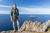
View from the top straight down to our camp - it made me dizzy! Paul poses in front of Sørfugløya (Southern Bird Island) - I took a similar photo of him in front of Nordfugløya (Northern Bird Island) just a few weeks ago :D

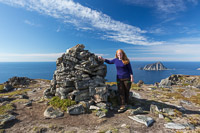
We didn’t meet a single person all day, the only signs of life we saw were some boats passing by. In the cairn on top we found the usual “guestbook” where people write about their experiences – and here we found out that 5 people had been to the top earlier that day 😀 Such a small island, but we never saw them.

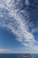
Posing with the cairn on top. We didn't a see a soul all day, but according to the book 5 people had been to the top that day! Sørfugløya and some impressive clouds

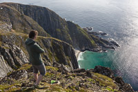
There are some really steep drops near the top, with views to more sandy beaches. I think you can guess where the name Sandøya comes from 😉 We could see all the way from Rebbenesøya to Ringvassøya, Kvaløya, Senja and even Andenes!

Paul looking down at another beach Panorama from the top, with views of Rebbenesøya, Ringvassøya, Kvaløya, Senja and even all the way to Andenes (though that is impossible to see in this photo)

We were getting hungry so we were keen to get back to our camp – there was a bbq waiting for us 😀

Amazing colours near one of the beaches On the way back to our camp

Coming down the steep slope was hard on our knees, but we made it back safely and we enjoyed a well-deserved bbq on the beach 🙂

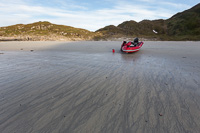
One last break to enjoy the views After a nice BBQ, we made our way back. The patterns on the beach at low tide were very pretty

It was getting late so we decided to make our way back home. We had originally planned to have a look around the small village, and I have also heard there is an impressive remains of a church on the south side – but this has to wait for another visit. I wouldn’t mind coming back, it’s such a beautiful place 🙂

Gråtinden on Ringvassøya (587m)

Gråtinden on Ringvassøya (587m)

The first of May is a bank holiday in Norway. We decided to climb a mountain around sunset, as the weather was supposed to improve in the evening. I used Turboka for the first time 🙂 and chose Gråtinden on Ringvassøya. We weren’t sure about the snow conditions this far out on the coast, so we took snow shoes as they can be used in any kind of conditions. We parked at the highest point of the road to Skarsfjord, and hiked straight up from there. The start is really steep! After that it flattens out a bit, before getting steeper near the top. The weather didn’t seem to improve – we even got a hail shower on our way to the top, and it was VERY windy. We were really happy when we found that it was possible to shelter from the wind behind the cairn on top 🙂

On the way up to Gråtinden On the top, sheltering behind the cairn, away from the strong wind

When we reached the top (after about 1.5 hrs), we had a bit of a “halleluja” moment – as this was our view….

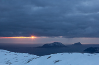
Fantastic sunbeams on the horizon! On the right the islands Sandøya and Sørfugløya

There is a large plateau around the top, with views towards Kvaløya, all the islands on the outer coast (Sandøya, Sørfugløya) and Rebbenesøya. Fantastic views!

Paul on his way to the edge of the plateau, with Kvaløya in the background So beautiful...

I’ll have to come back here in summer, and walk all the way to the westernmost tip of the plateau to have an even better view over the sea and all the islands. Would be great during the midnight sun season 🙂

Another panorama of the view

We were hoping the sun would eventually come below the cloud layer and give us a nice sunset. It looked like it was just going to disappear behind the next cloud layer however. But just when we gave up hope and decided to turn round, the sun briefly appeared – how nice! Luckily it was also finally clearing up, and the wind calmed down.

Just when we gave up hope and turned back, the sun appeared briefly between two cloud layers On the way down - good to see the snow is disappearing from the mountains!

It had gotten quite late (sunset is after 22:00 now), so we made our way back to the car. The snow conditions were variable, there were areas with very icy snow, lots of bare rock, crusty snow and some soft snow. I actually managed to fall over THREE times – I didn’t think that was a risk on snow shoes 😀

Map of our trip Height profile. We walked around the plateau on top for quite a while. The start (and end) is pretty steep!

It was a great little trip, and a mountain to remember for the summer season 🙂