Browsed by
Tag: road trip

Canada Highlights – part 1

Canada Highlights – part 1

I spent a month in Canada in the summer of 2015, but I never shared any photos – this blog post has been a draft for over a year, so I thought I should publish it as “part 1” whether or not I will ever get around to part 2 😉


WHISTLER


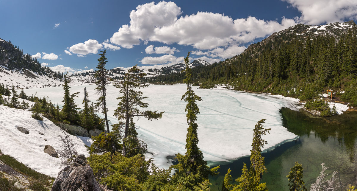
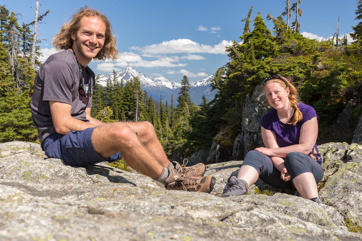
The reason I went to Canada was a conference in Whistler. Colin, a friend from my time in Norwich who now lives in Victoria, was also going to the conference. We met up a couple of days early and went on a beautiful hike to Rainbow Lake. It was warm and sunny, but the lake was still frozen. It was a really nice day and a great way to catch up after so many years!


Rainbow Lake near Whistler With Colin who I hadn't seen for many years

VANCOUVER


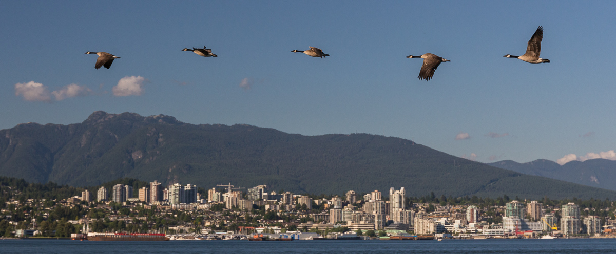
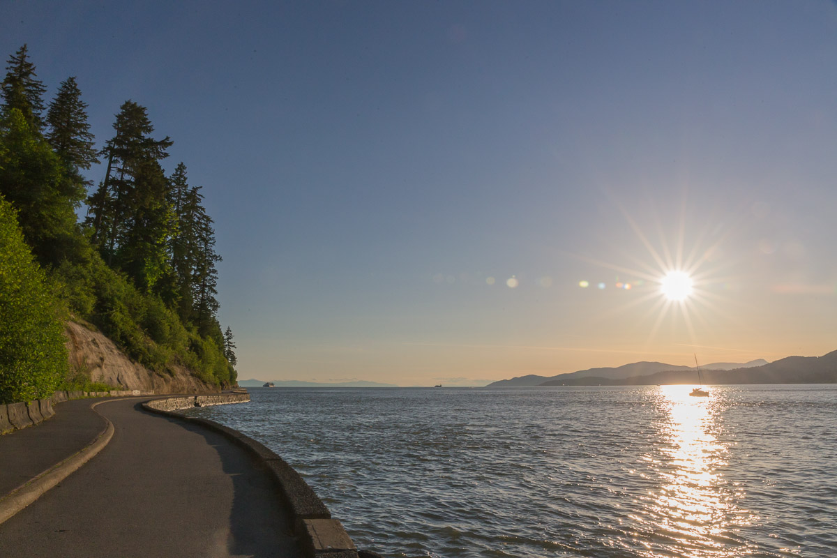
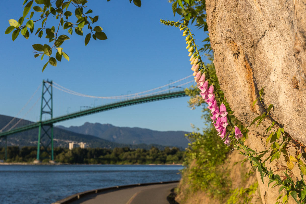
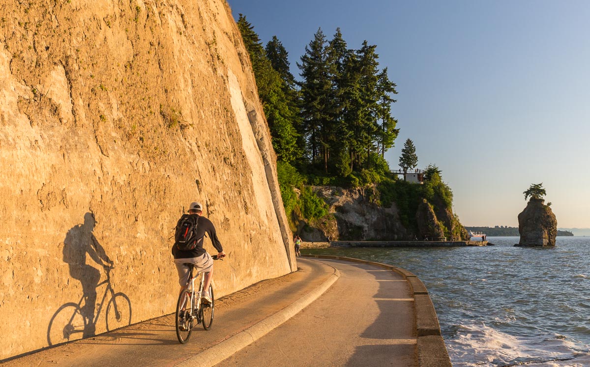
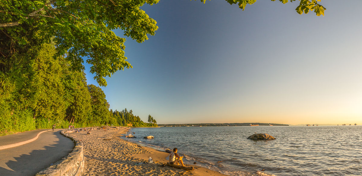
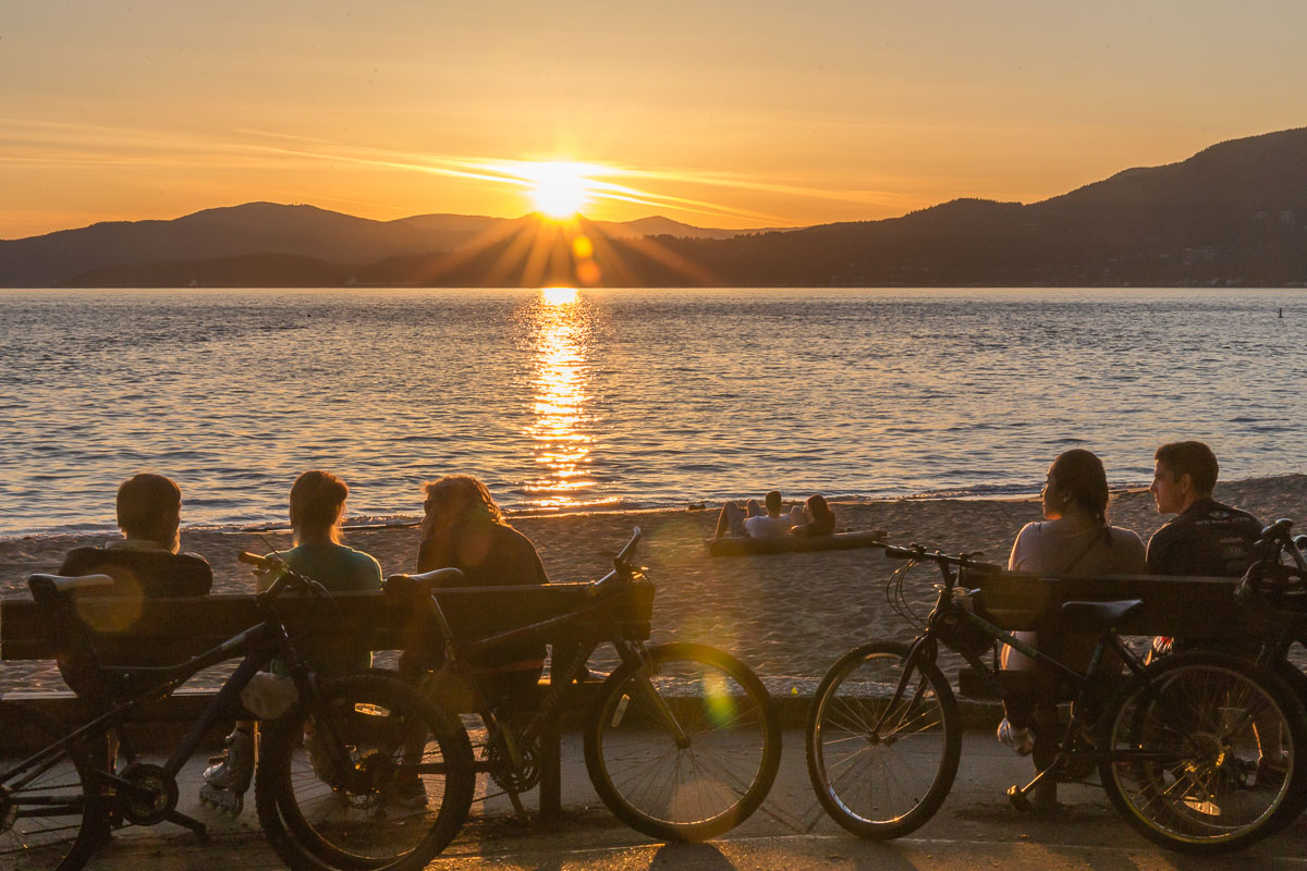
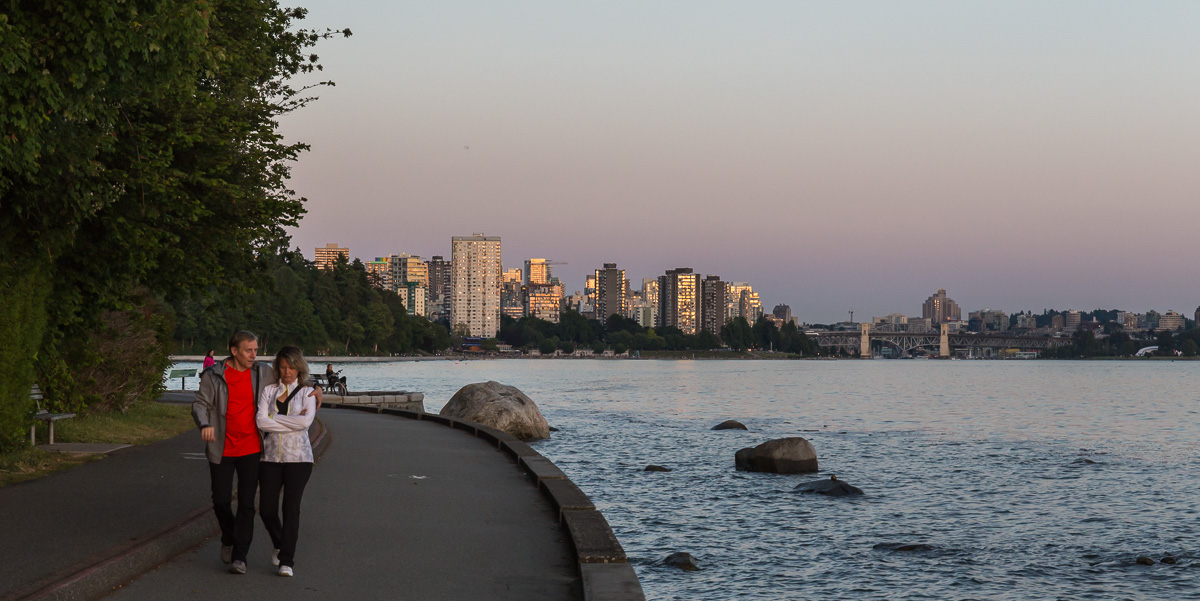
After the conference, I spent an evening walking around Stanley Park on the Seawall. I fell in love with Vancouver – what a fantastic city. It was great to see so many people walking, cycling, jogging, inline skating or just enjoying the beaches.

Downtown Vancouver seen from the Seawall Canada Geese
The beautiful Seawall, with one part for walkers and joggers and one for cyclists and skaters Foxglove and the Lions Gate Bridge
A cyclist near Siwash Rock Fantastic beaches
Lots of people enjoying the sunset The Seawall at sunset

SOPHIA


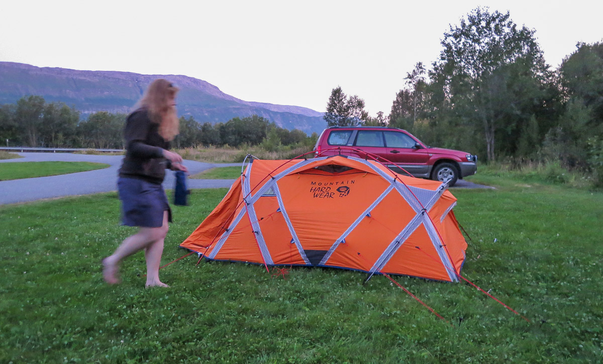
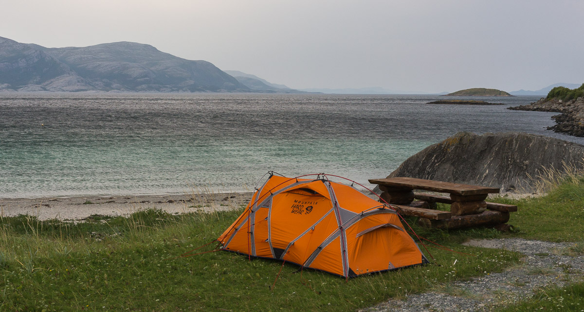
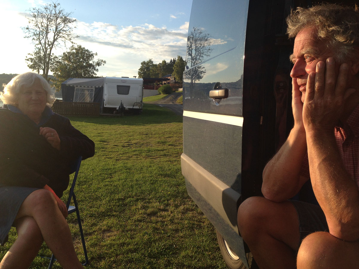
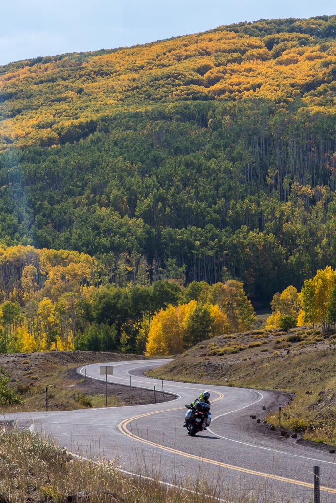
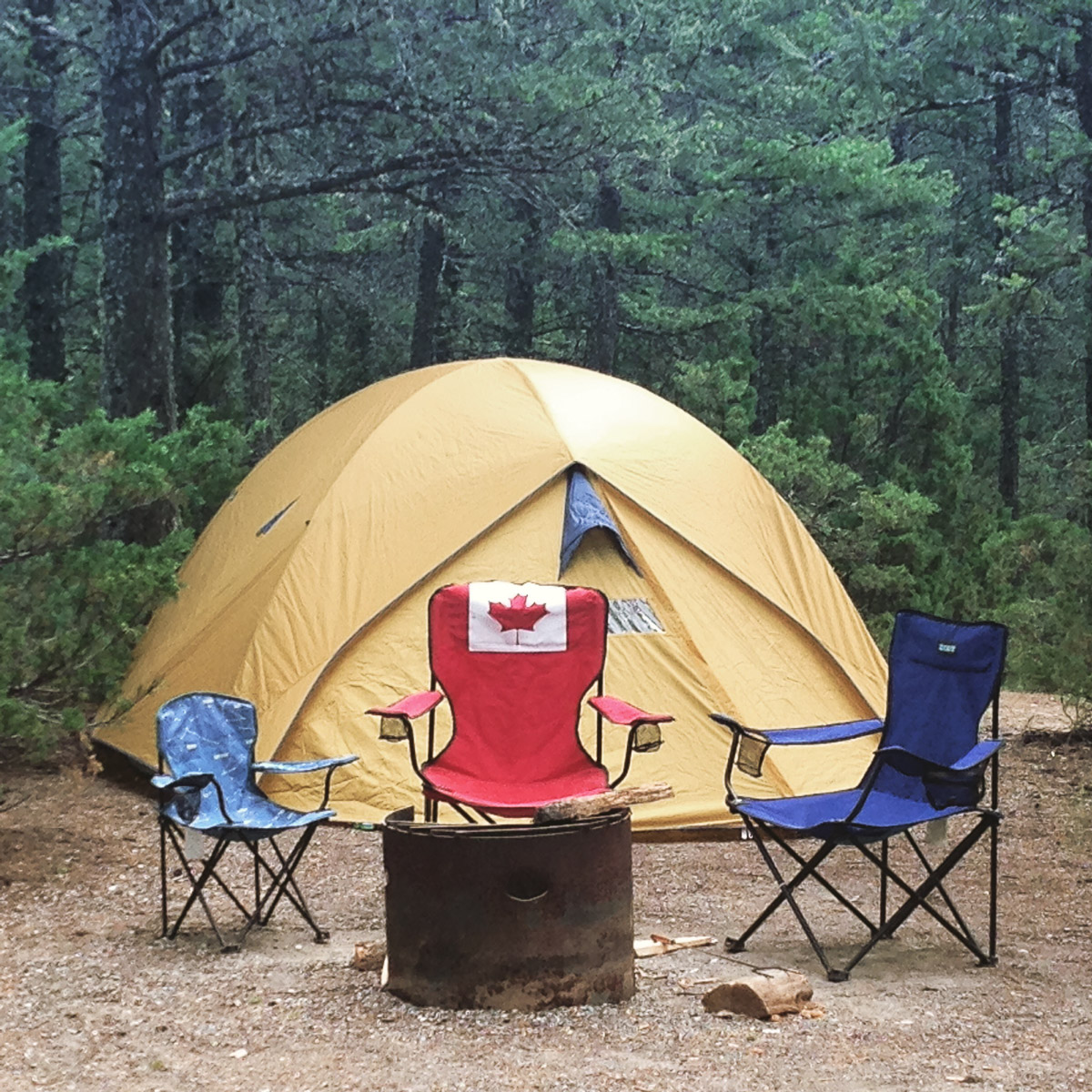
Sophia is the name of the Volkswagen campervan I rented for the remaining three weeks. She was OLD and had lots of problems (doors that couldn’t lock, parts broken, she needed the garage at some point too), she was a PAIN to drive (no power steering, gears that got stuck), but somehow everyone fell a little in love with her. I think it was the feeling of freedom and adventure, the waves and smiles from other VW drivers and the convenience of always having your “home” with you.

With Patrick - and Sophia :) Campfire in Yoho National Park Meeting fellow VW travellers - this couple had taken their van from Switzerland to New York and were travelling for a whole year

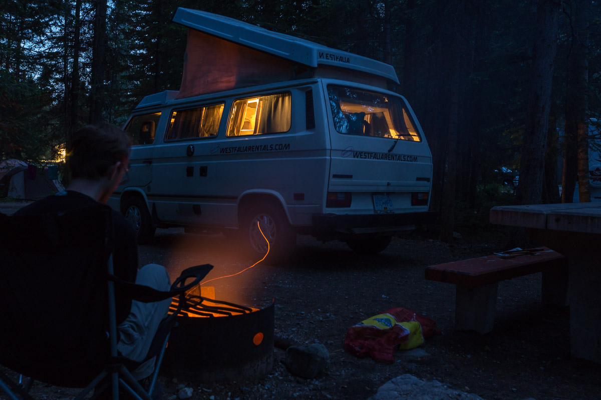
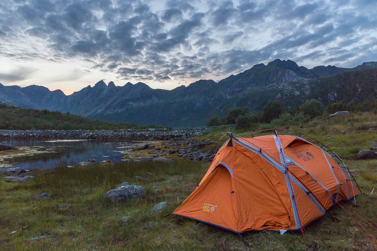
During the three weeks with Sophia, people came and went (friends from the US and from Norway) – this was the most complicated trip I ever organised, where I needed a google document to keep track of everybody’s arrival times and places. We were never more than 4 at any one time, but I often slept in my tent next to the car as the “double” beds in the van are not very spacious.

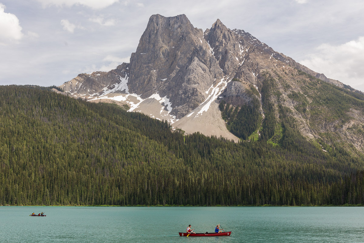
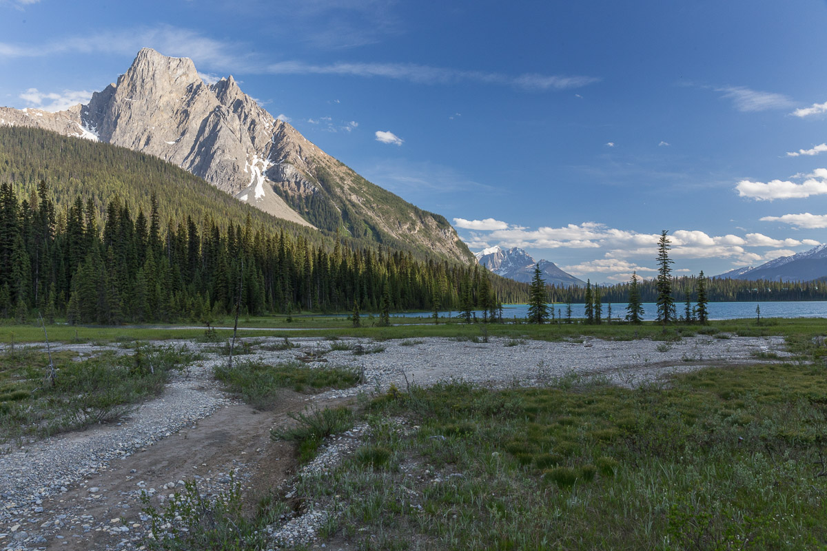
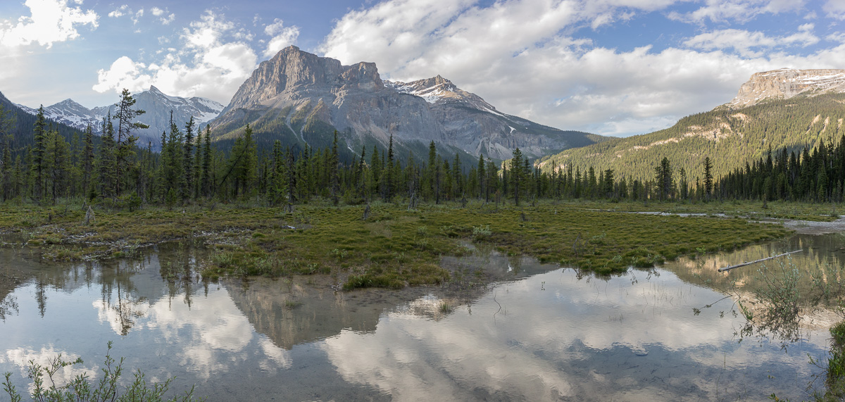
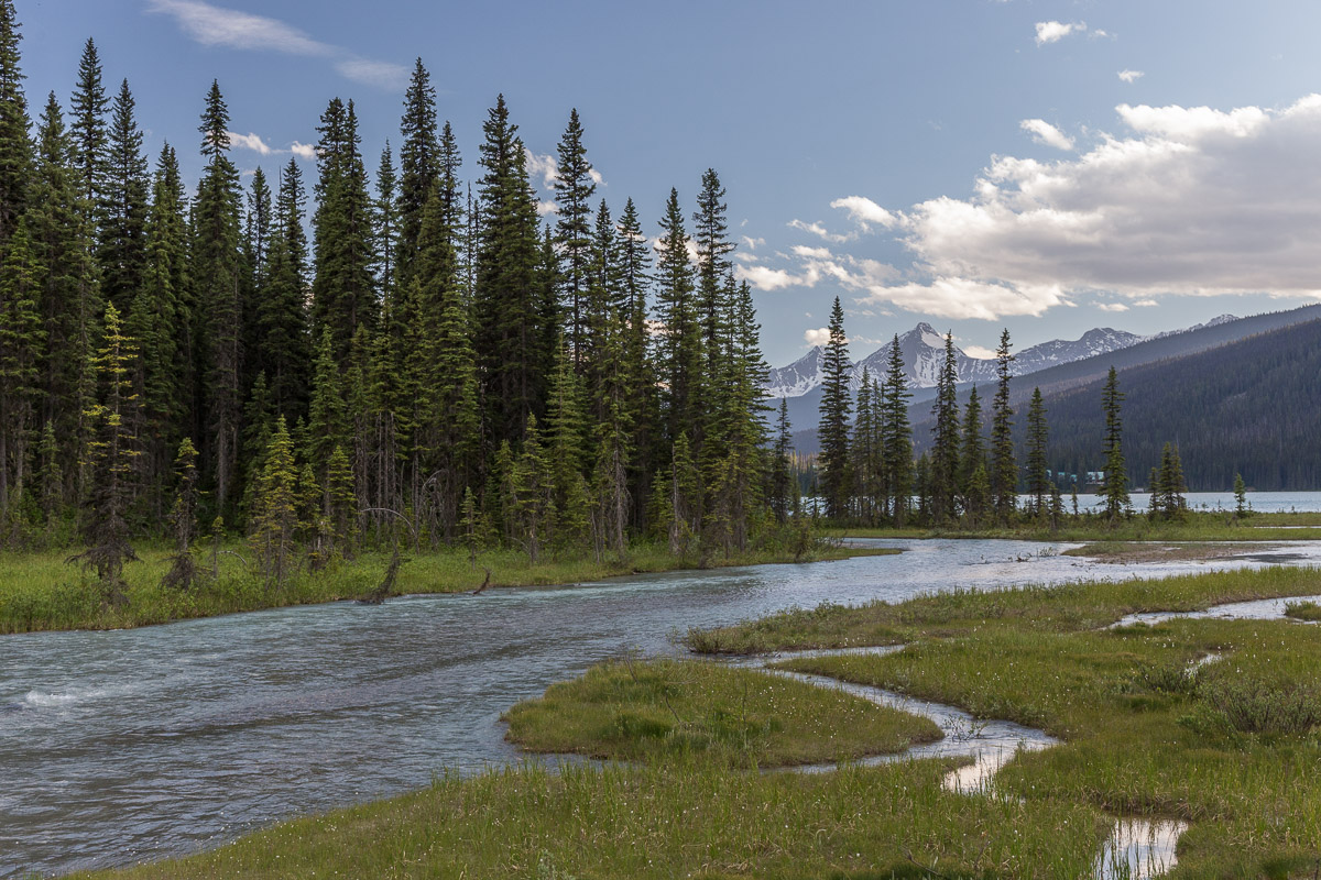
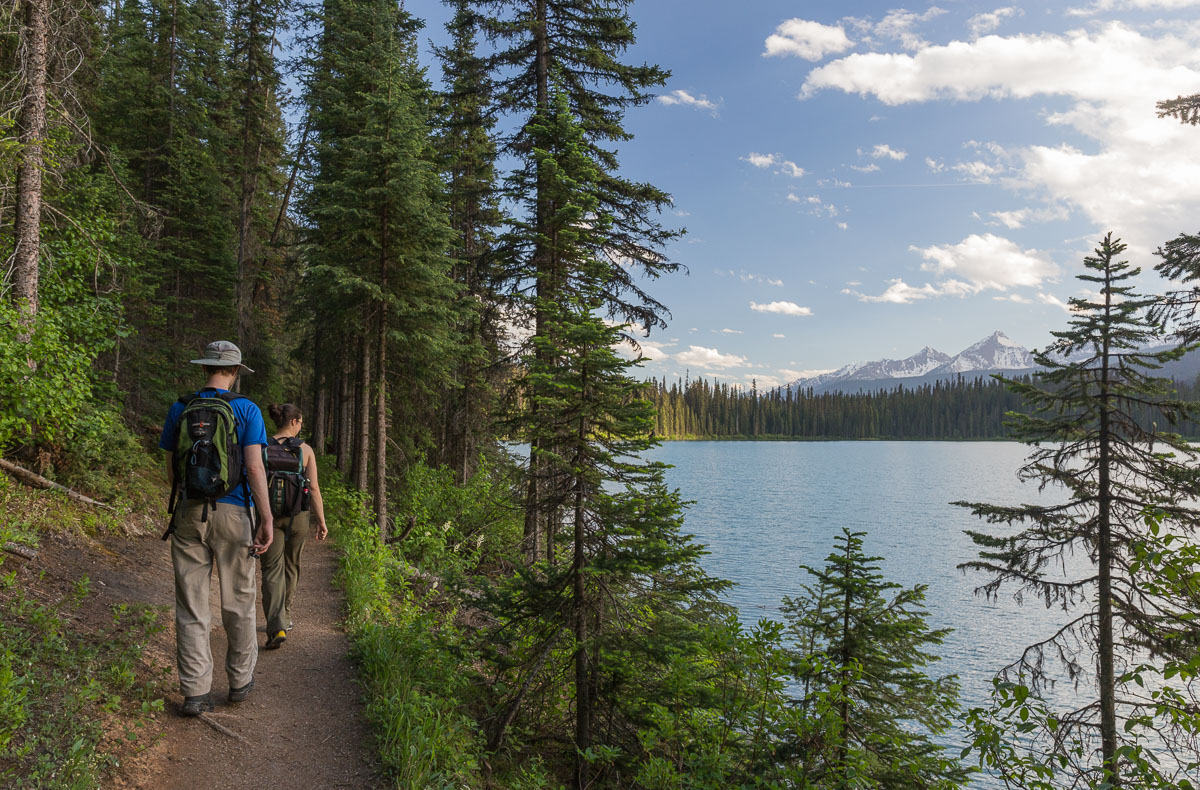
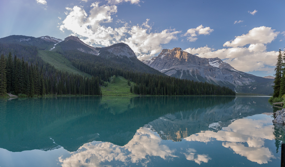
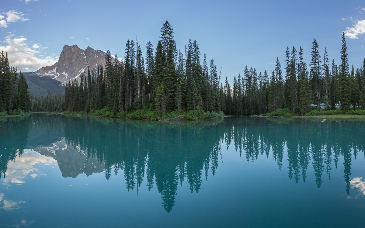
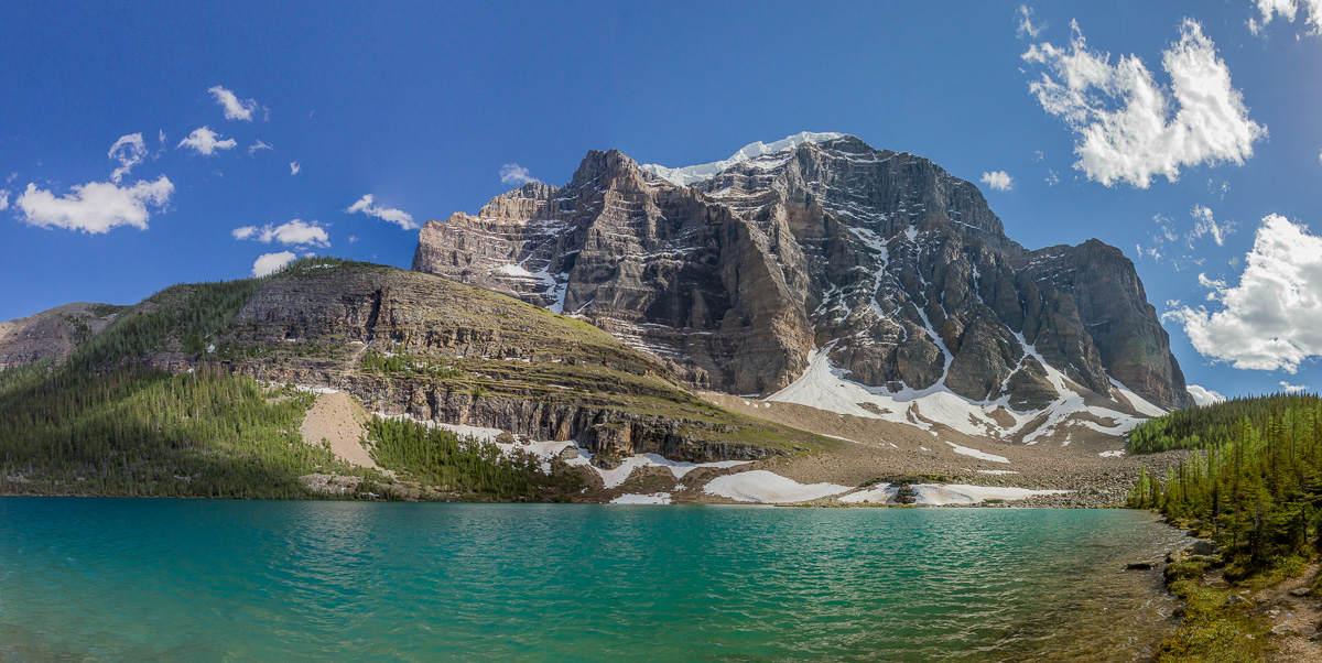
EMERALD BASIN HIKE WITH NICOLE AND PATRICK


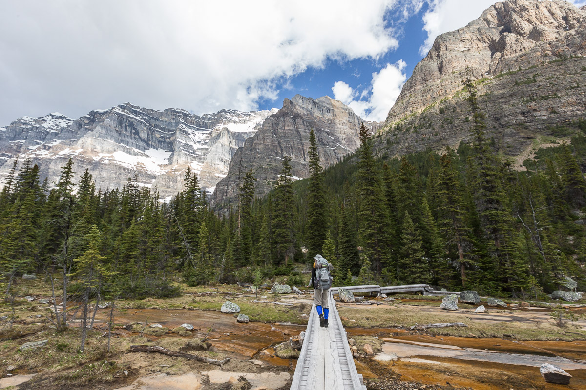
After driving for two days to get from Vancouver to the Rockies, we were really looking forward to go hiking. Our first hike started at beautiful Emerald Lake in Yoho National Park, and climbed up to Emerald Basin (a natural amphitheatre). We added the remaining part of the Emerald Lake Loop Trail to the end of the hike, which made it about 11.5 km in total. A beautiful hike!

Canoers on Emerald Lake, Yoho National Park Starting our hike along Emerald Lake
The destination of our hike: Emerald Basin, above Emerald Lake Patrick & Nicole at Emerald Basin
Cooling down in the stream On our way back
A Yellow Lady's Slipper, an orchid Emerald Lake in the evening
It was such a nice evening we added the rest of the Emerald Lake Loop to our hike It was a quiet and calm evening
Nice reflections The river feeding into Emerald Lake
Walking the loop around the lake Such a nice evening!
Emerald Lake reflections

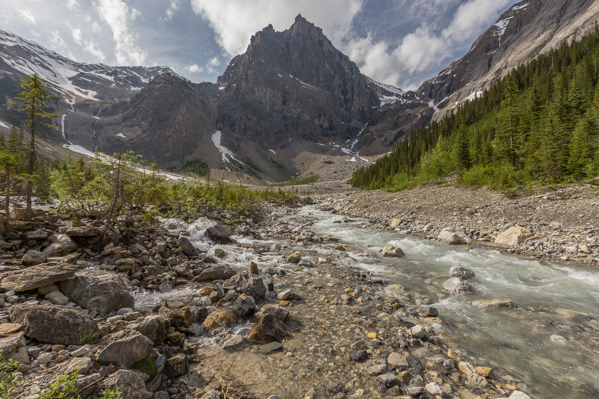
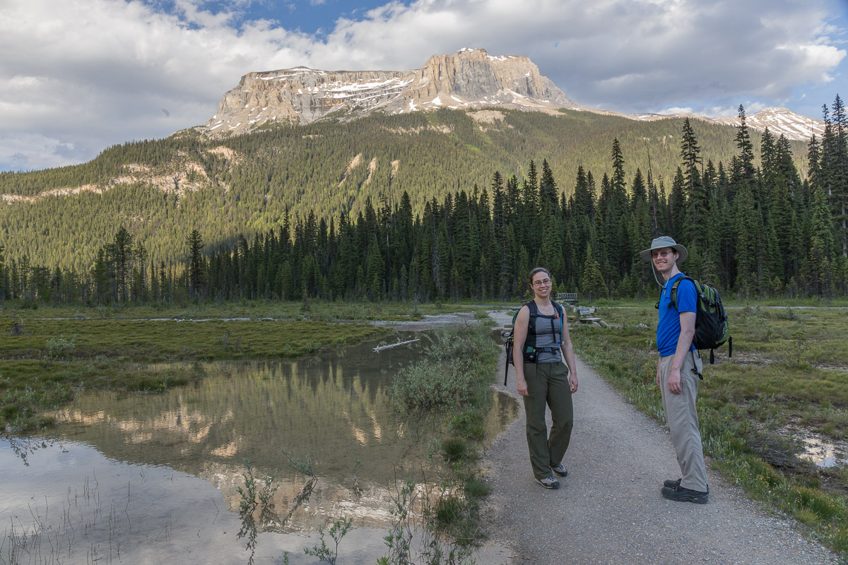
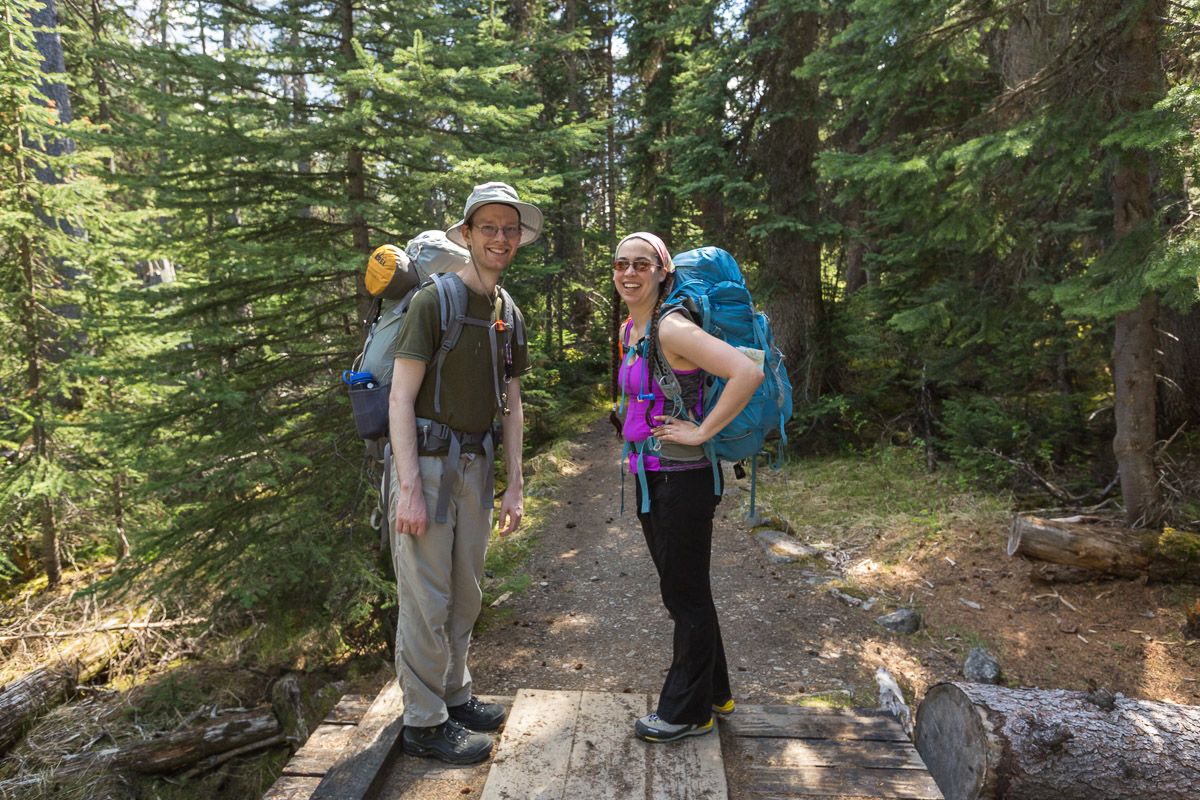
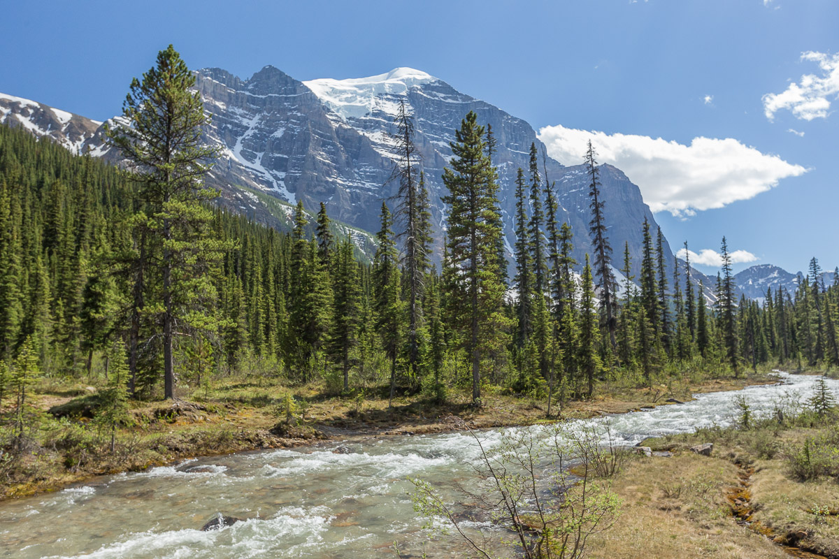
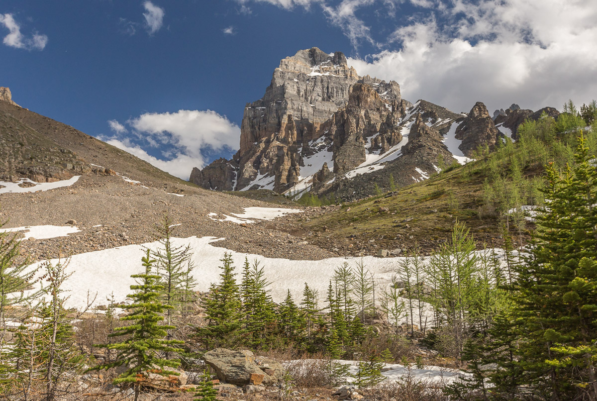
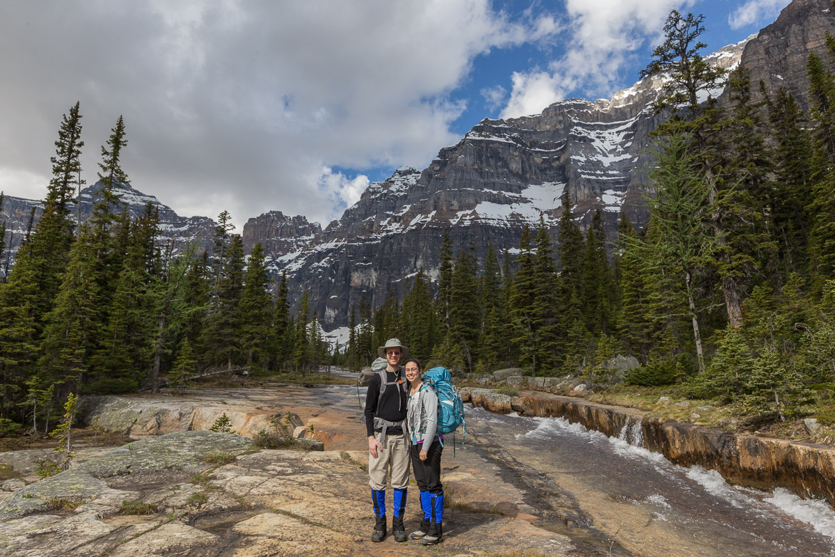
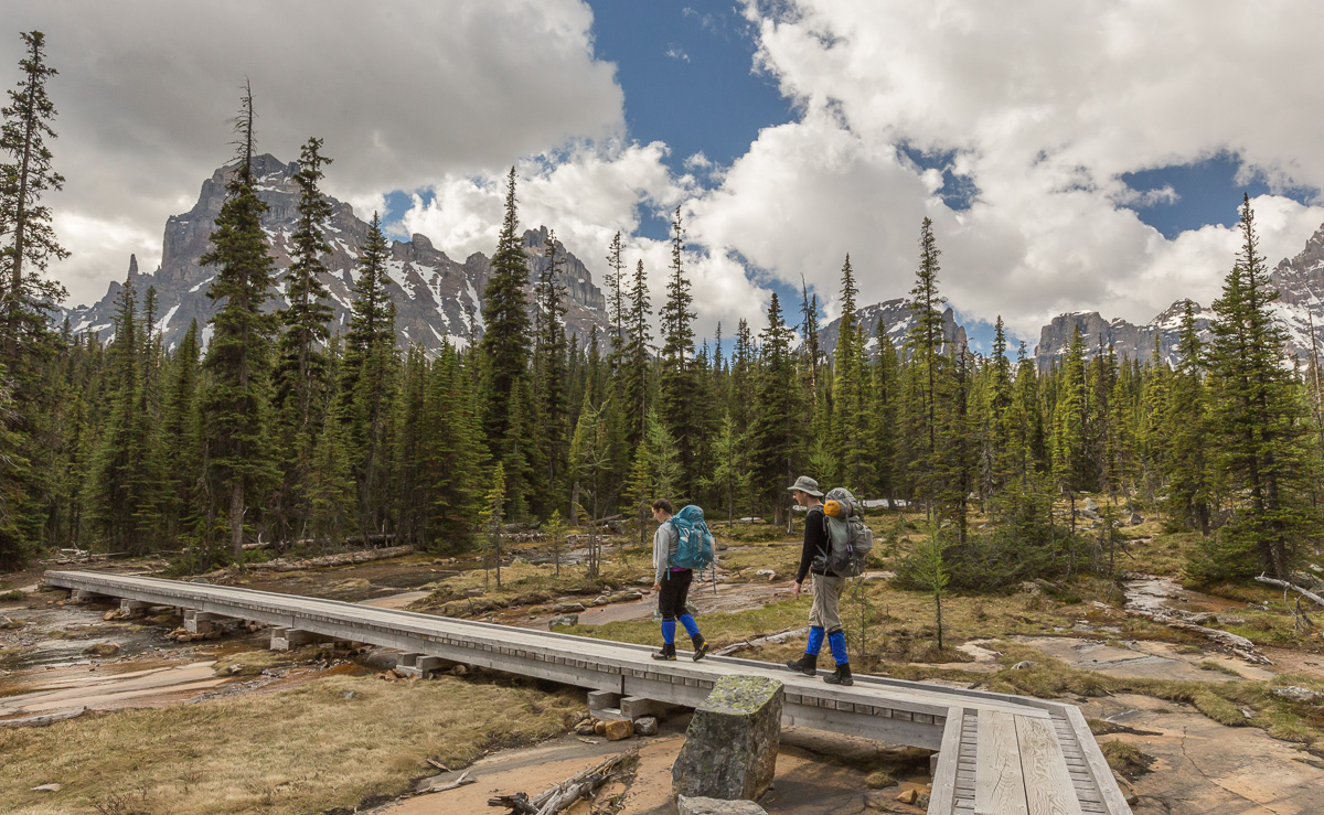
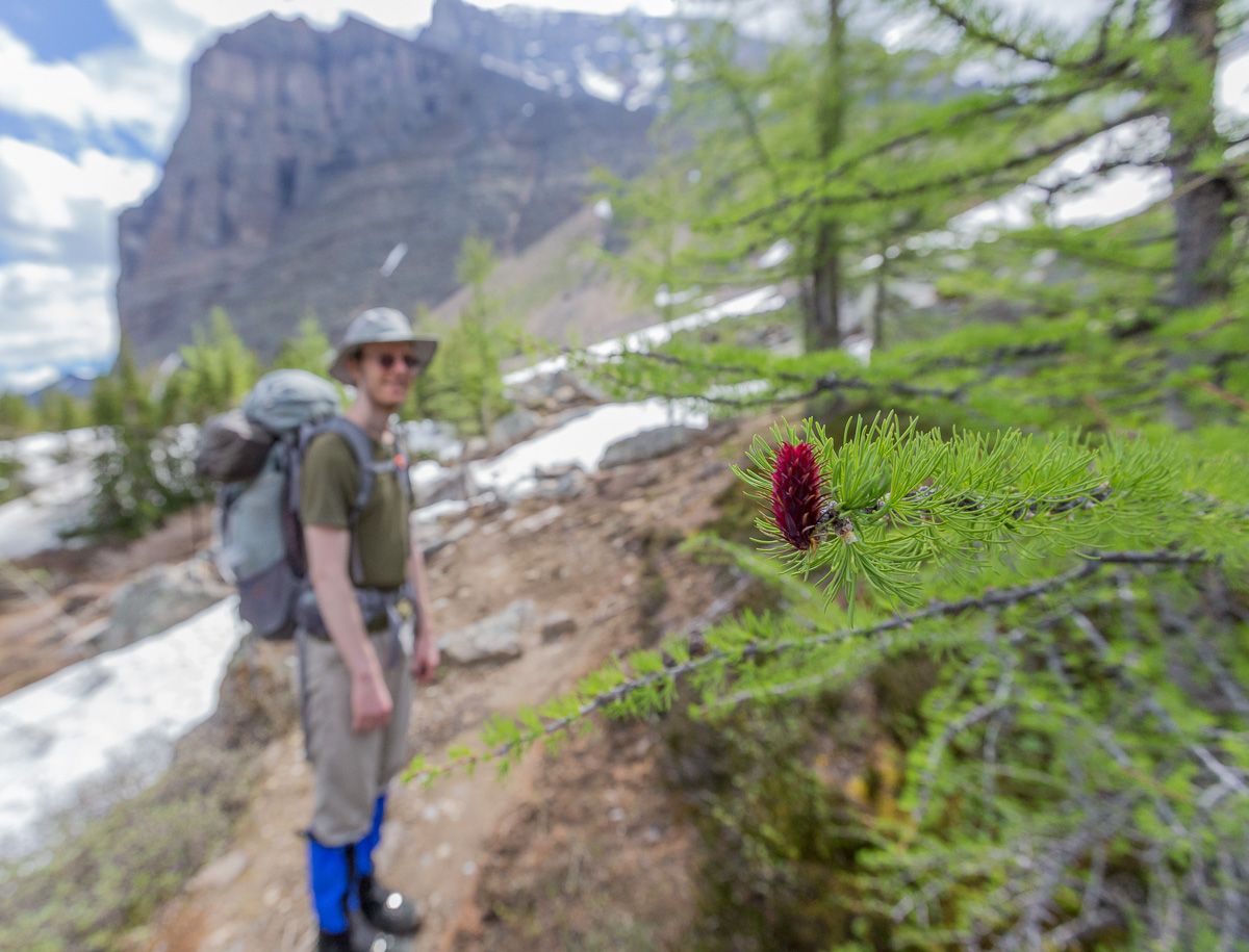
PARADISE VALLEY OVERNIGHT HIKE WITH NICOLE AND PATRICK


We really wanted to do some overnight hiking in the Rockies, but we were having problems finding good hikes as it was still early in the season and many of the higher trails were still snow-covered. We realised later that a lot of the people working in the visitor centres for the national parks are overly careful and tell you there’s still a lot of snow on the trails to discourage people from visiting too early – once they even told us it would be dangerous to walk on one of the park roads due to avalanche danger – in the end this road opened two days later and there was NO snow in sight.

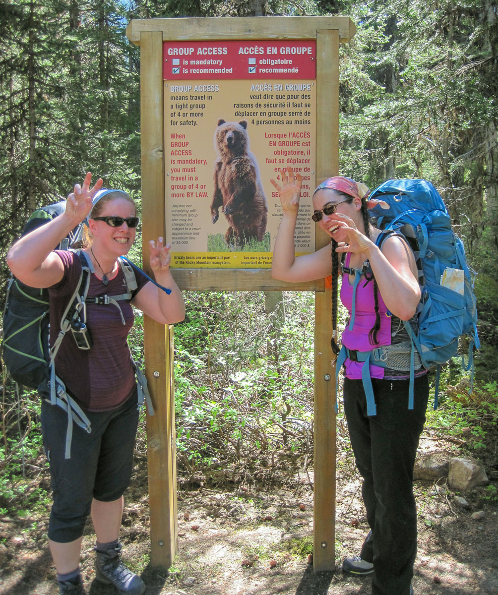
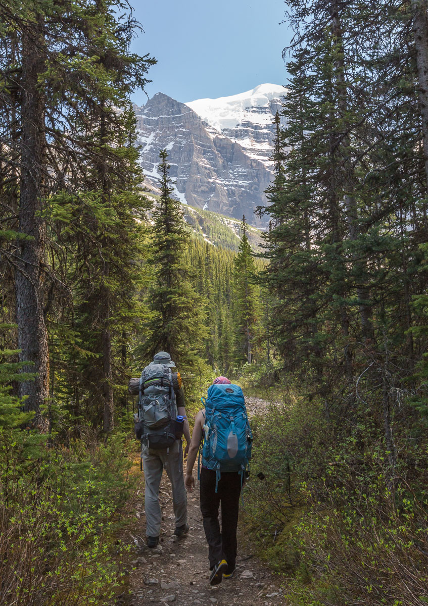
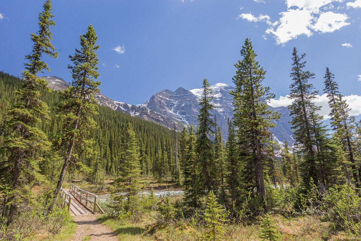
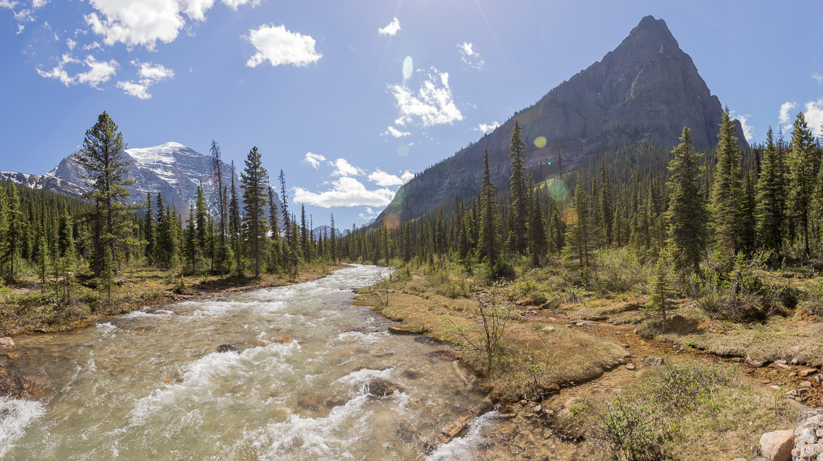
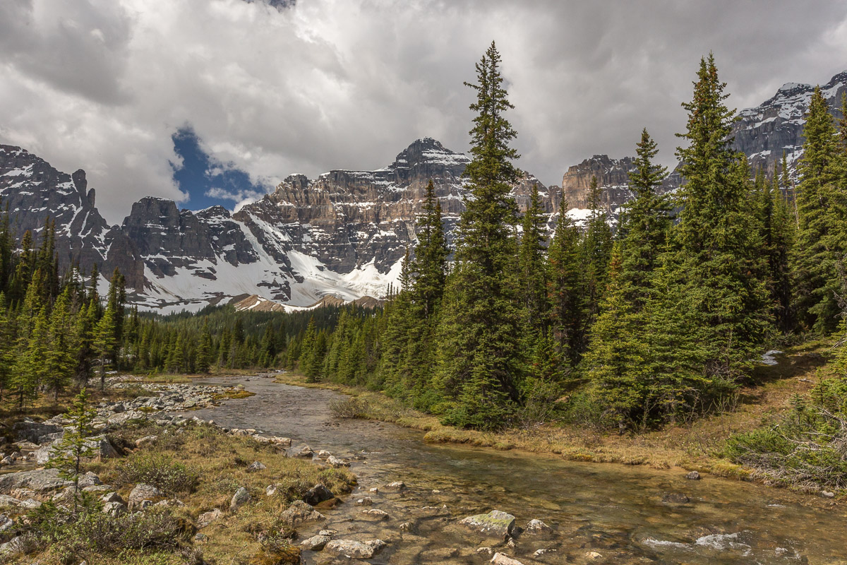
Anyway, we finally got lucky with a cheerful lady at the Banff National Park Visitor Centre – who did sell us backcountry permits to stay at Paradise Valley campground. It was a 10 km hike, passing beautiful Lake Annette, and with beautiful views of Mount Temple with its impressive glacier. Paradise Valley is often closed later in the season because of high bear activity, but we didn’t meet any bears.

During certain times of year you are obliged to travel in groups of 4 or more - now it was only 'advised' Starting our overnight hike
Catching glimpes of the impressive mountain and glacier Reaching the river
Mount Temple in all its glory! River panorama
On the bridge Following the river upstream

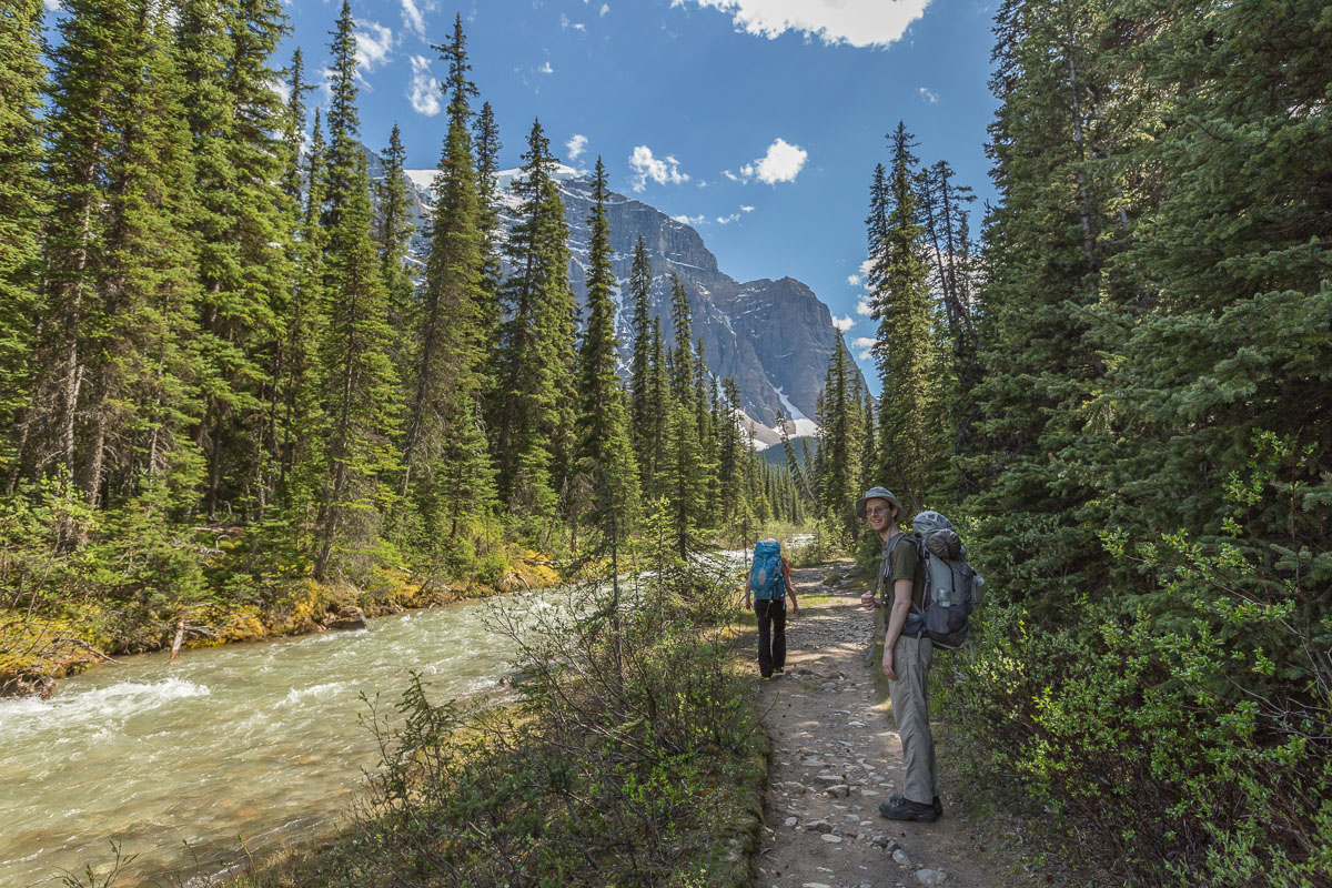
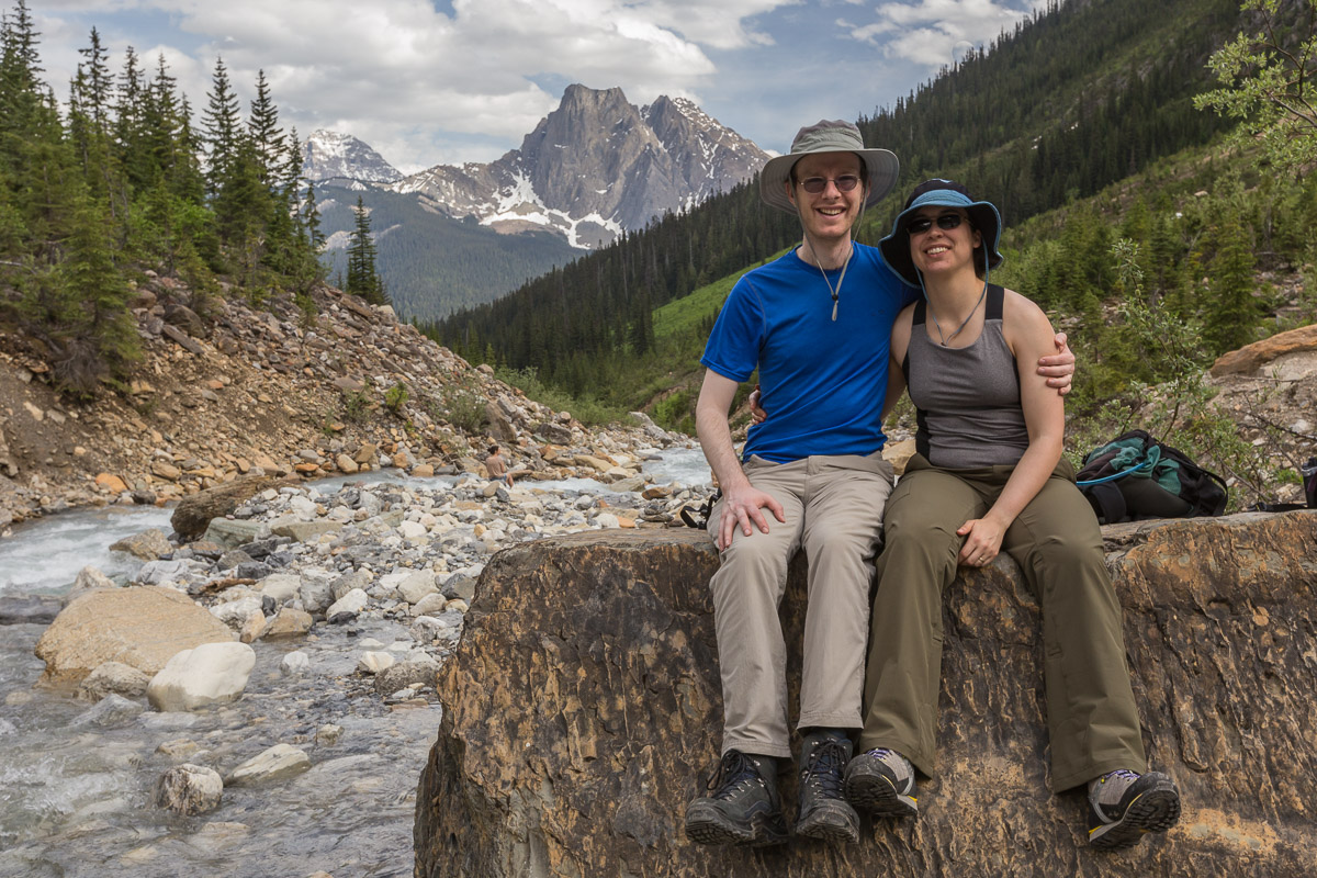
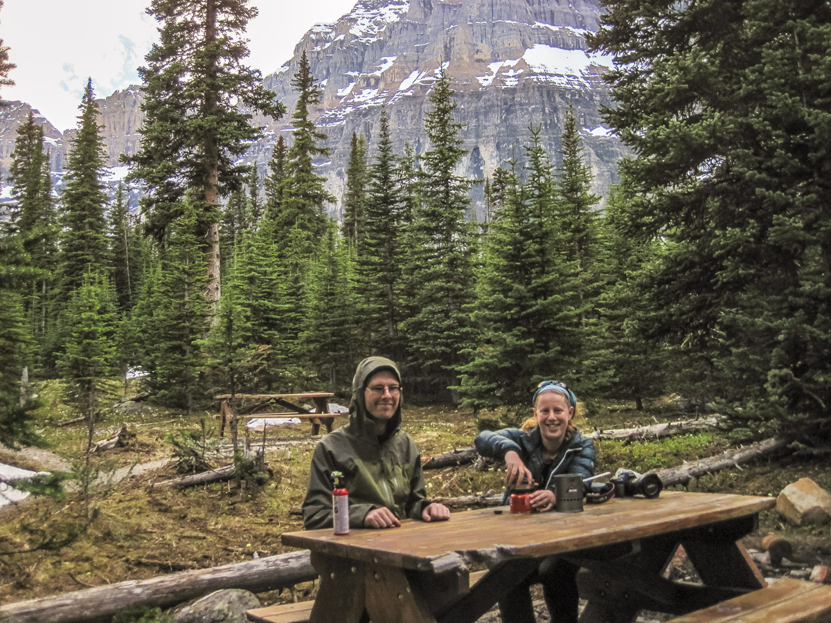
Time for a break at Lake Annette! Most hikers returned at Lake Annette, but there was a group of 4 young guys who were also camping at Paradise Valley Campground, who we kept passing on the way.

A break at Lake Annette Panorama of Lake Annette and Mount Temple
Looking towards Sentinel Pass, but from this angle it's hard to see the sentinels Getting ready for dinner at the campground - pestered by mosquitos

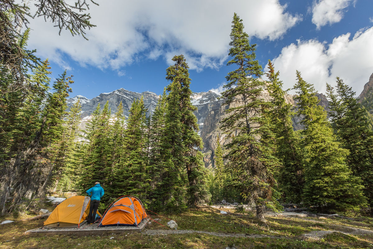
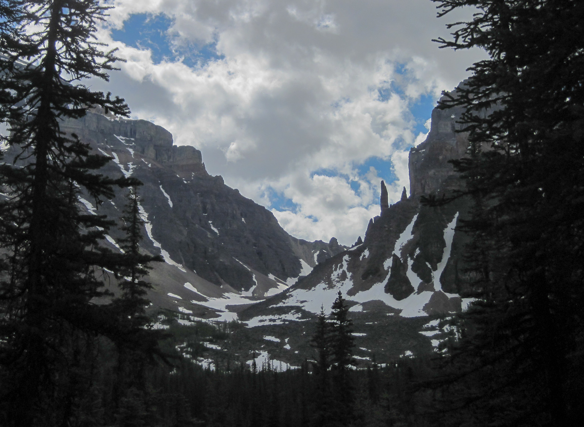
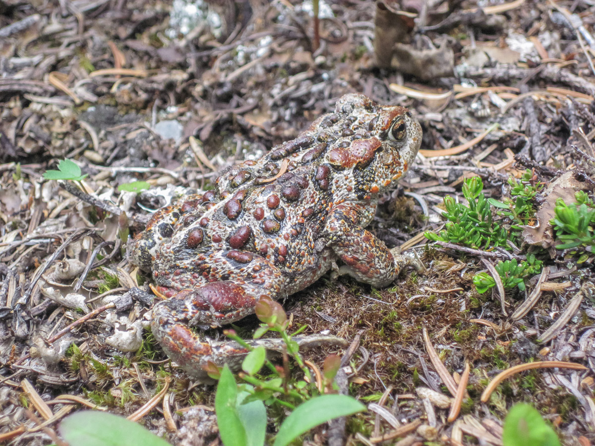
The hike had been beautiful, but as Patrick put it, the lady should have explained the hike as follows: “It’s a really beautiful hike, but it ends up in a huge swamp where you have to spend the night”. This was kind of true 😉 it also meant there were a LOT of mosquitos around which was quite annoying. This was my first night backcountry camping in bear country, and I had been very nervous about it. As long as you take precautions it’s fine though, and they have bear-proof lockers to store your food (and toiletry products) during the night. Of course, you do worry about every funny noise in the night (most funny noises came from all the rock slides coming from the mountains in the distance) but I slept surprisingly well!

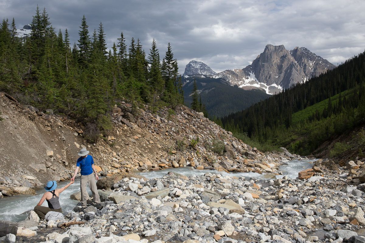
Before hiking back the way we came, we stopped at the Giant Steps waterfalls. A very pretty place, and we wondered why they couldn’t have put the campground there?!

Our tents in the morning On the boardwalk towards the Giant Steps
At the edge of the Giant Steps Patrick & Nicole at the Giant Steps
Impressive views... On our way back to the trail
From this side we could clearly see the sentinals - impressive! One last look back
Fascinating trees A very camouflaged toad - photo by Nicole, I would never get this close to a toad ;)

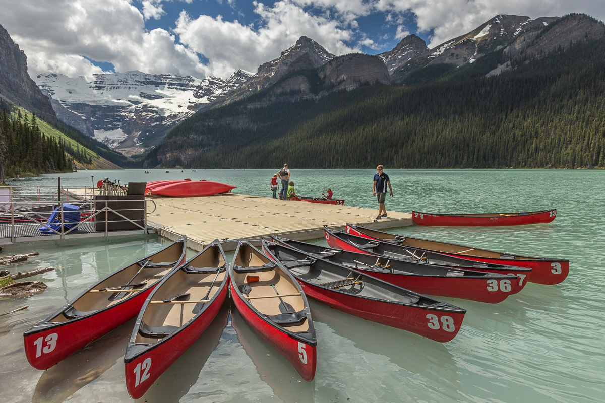
We had to drive to Calgary after the hike to pick up a friend, but we enjoyed a nice lunch at Lake Louise before the long drive…
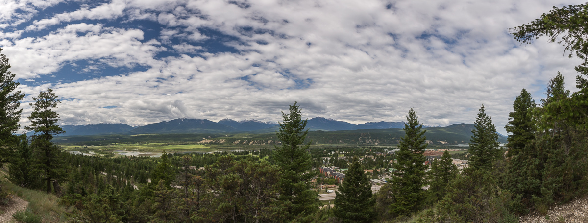
Lunch break at Lake Louise

BANFF


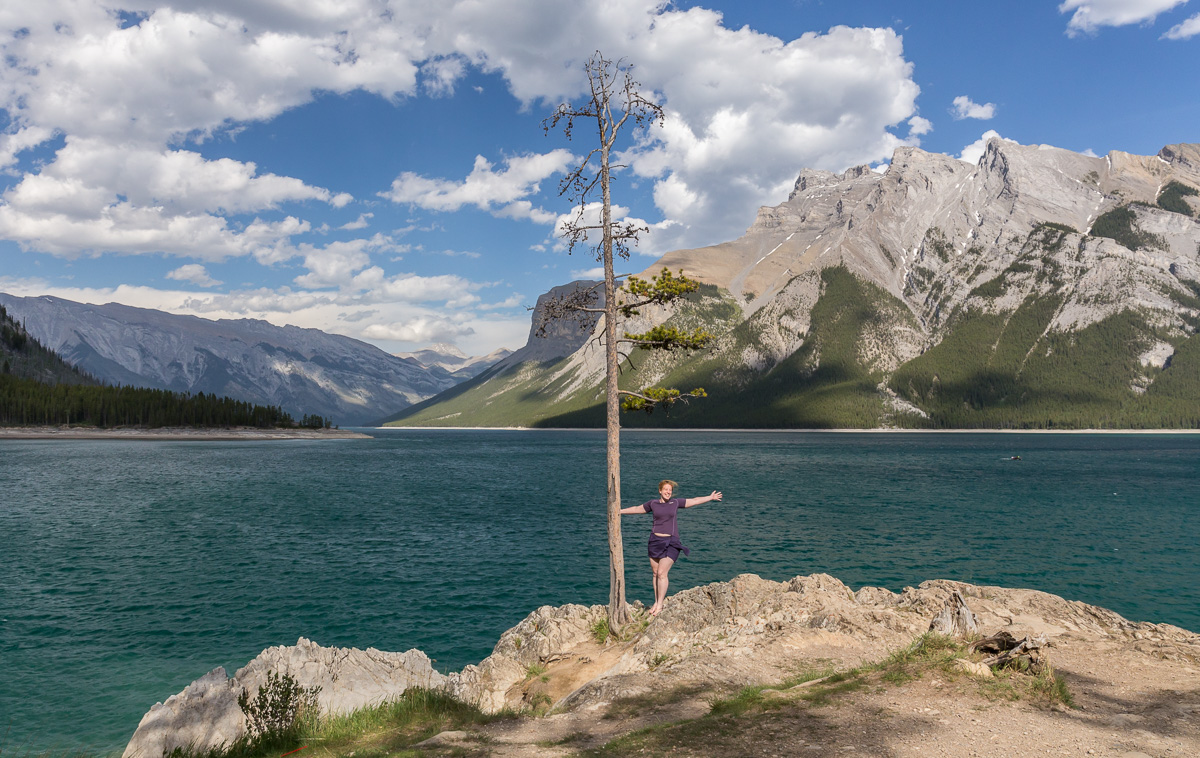
We spent a day in Banff before Nicole and Patrick were flying back to Seattle from Calgary. We explored Lake Minnewanka on a very windy afternoon…

At Lake Minnewanka Windy Lake Minnewanka

I also went for a short walk along the Bow River, and stopped to watch the hoodoos from a parking lot.

Panorama of Mount Rundle and the Bow River View of the hoodoos and the Bow River

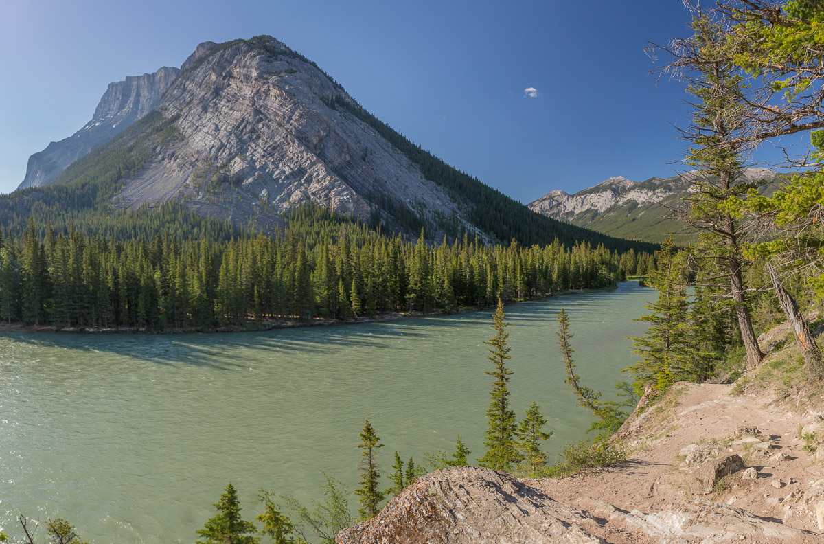
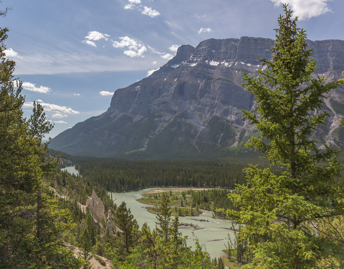
We passed through Banff several times later in the trip. It’s quite a nice place, good for stocking up on whatever you need (food, outdoor equipment), but the area is really touristy and I think we all preferred the quieter places which were just as pretty (Yoho National Park for example).

KOOTENAY NATIONAL PARK


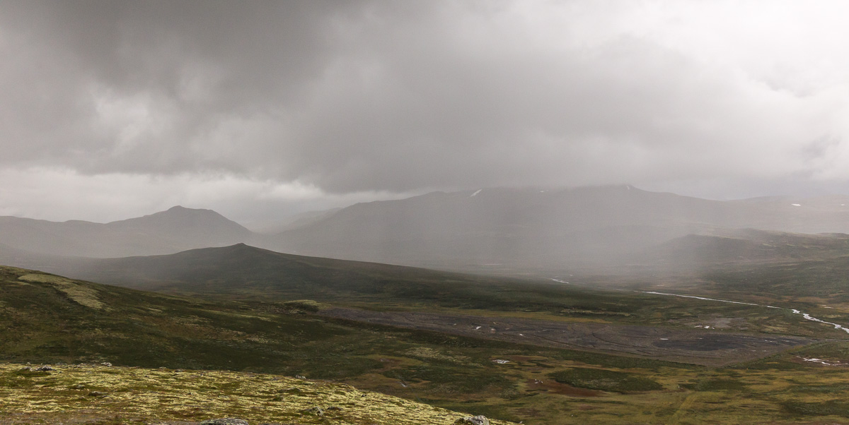
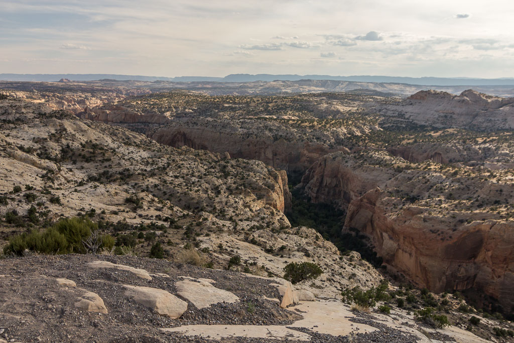
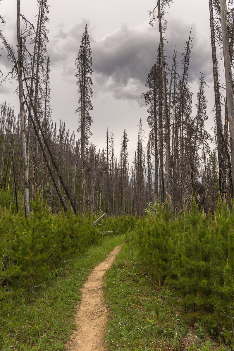
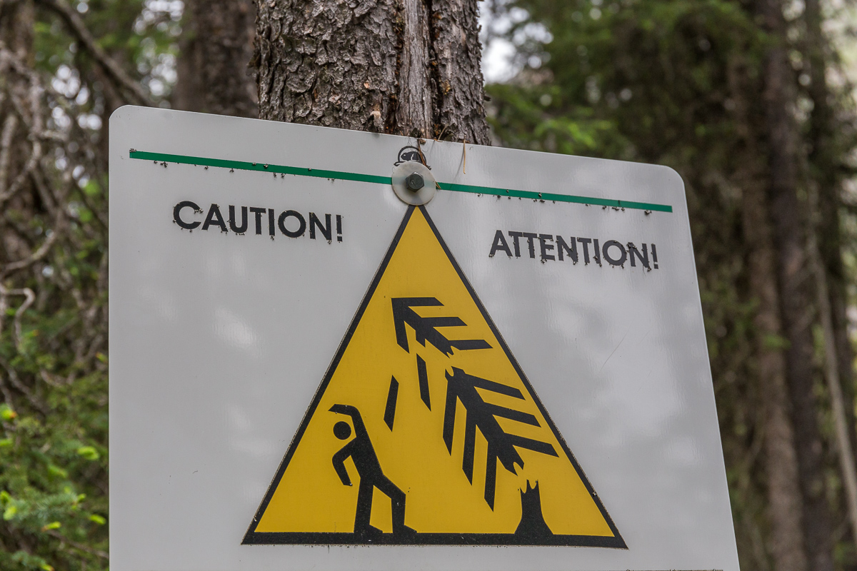
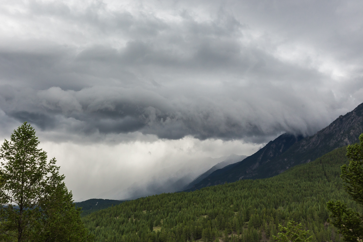
To escape hectic Banff, we went on a side trip to the much quieter Kootenay National Park. It was the first cloudy day in over a week, and the heatwave was also coming to an end. I went on a hike exploring Marble Canyon, and then continued through a large area of burnt forest. This was quite spooky, as the dead trees were swaying and creaking in the wind, and one even fell quite close to me!

Marble Canyon Butterflies at Marble Canyon
A flower in the burnt forest The spooky path between Marble Canyon and the Paint Pots
This sign wasn't so funny anymore after a tree fell very closeby! Bridge over the Vermillion River

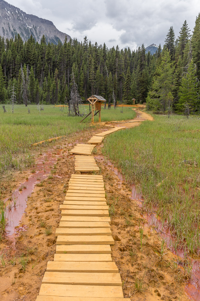
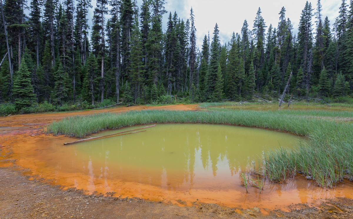
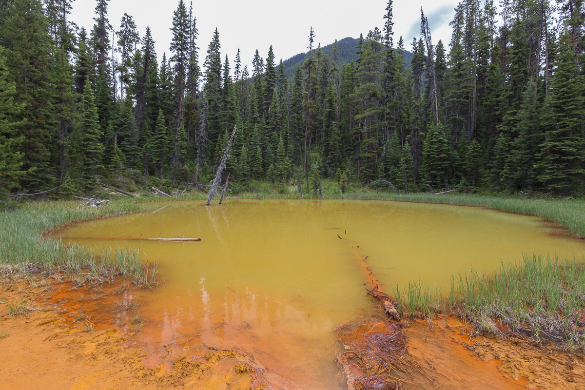
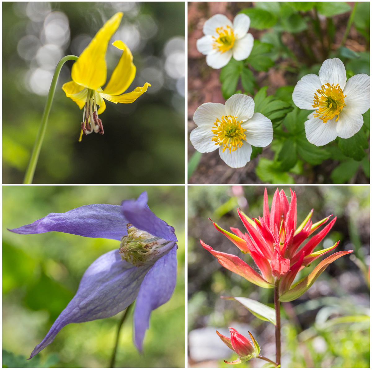
At the end of the trail through the forest I met the trail to the Ochre Beds and Paint Pots, a really impressive phenomenon! Aboriginal people gathered the ochre for ceremonies and for trading, and it was also mined for a while (to be used as a paint pigment). I really loved the vivid orange and the unusual colours!

The Ochre Beds Path through the Ochre Beds
One of the Paint Pots - impressive! Another Paint Pot

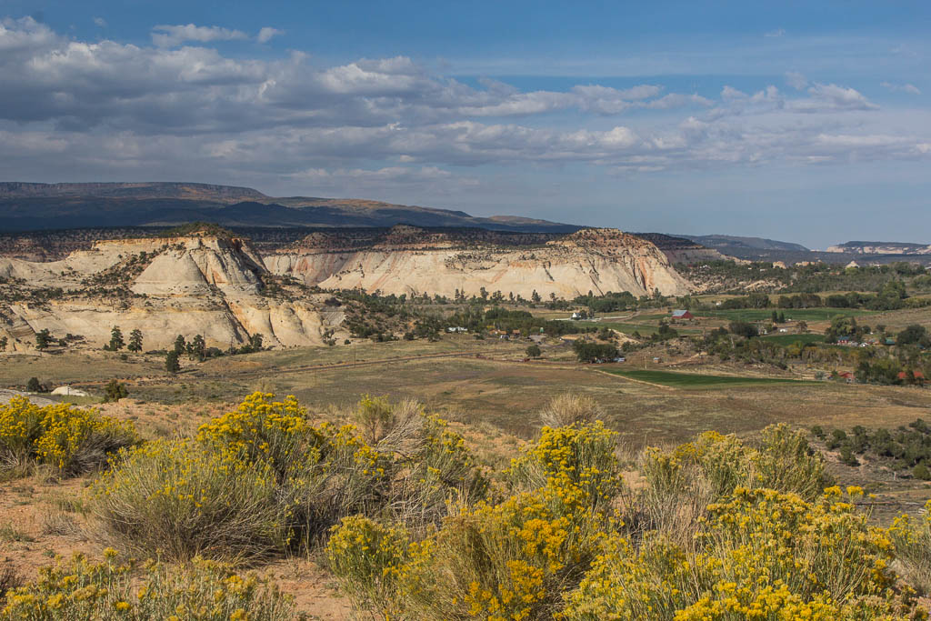
We spent a couple of days at the very quiet Redstreak Campground, high in the hills above the village of Radium Hot Springs, with a great view of the Columbia Valley. It was fun to watch the showers come in on a rainy day… We also tried the actual Hot Springs which was really nice!

Watching an impressive rain shower approach Spectacular sunset!
This made me giggle: three little bears went camping? Last panorama from Radium Hot Springs

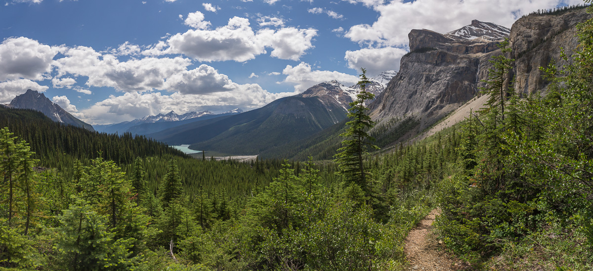
LITTLE YOHO VALLEY TO EMERALD LAKE HIKE


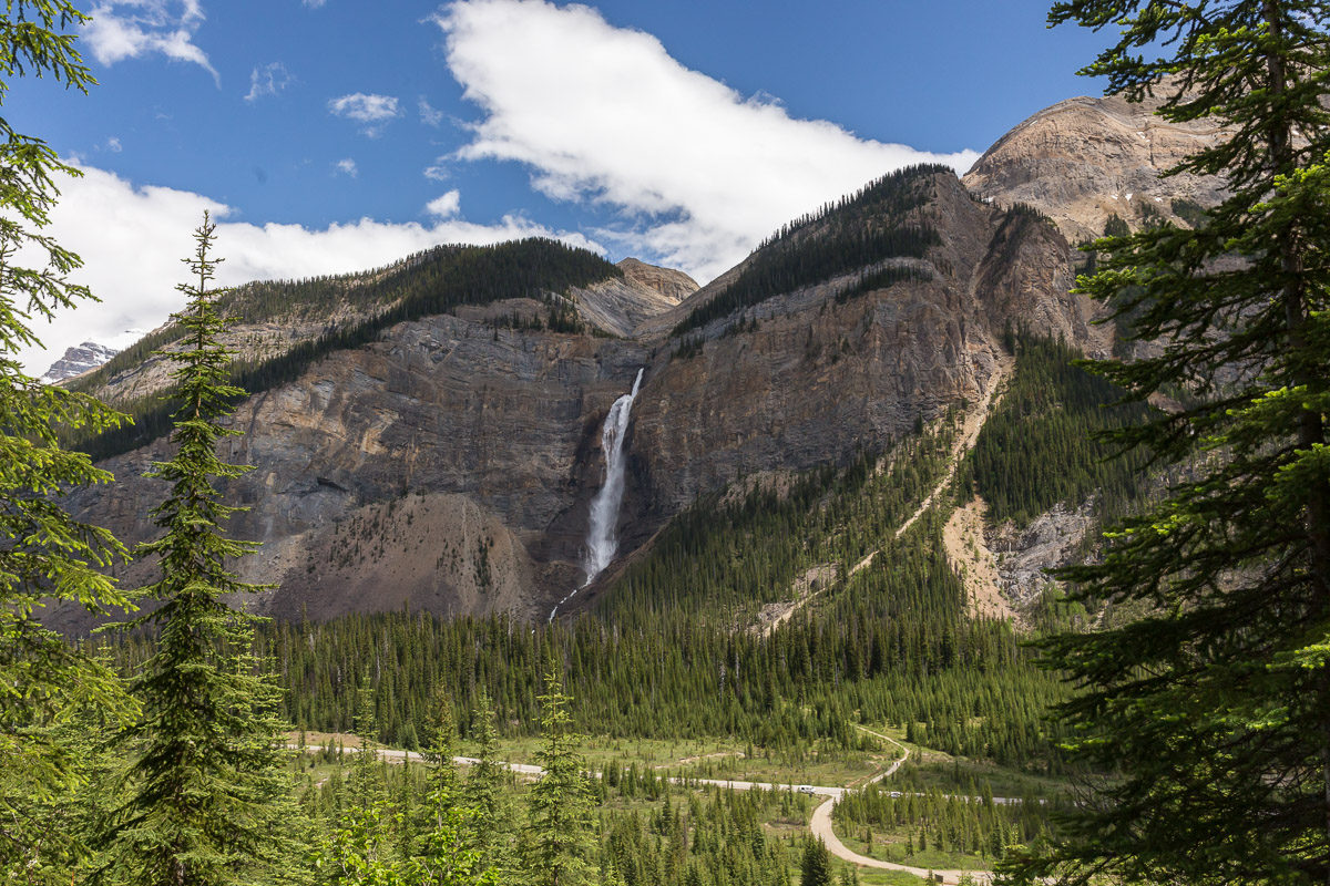
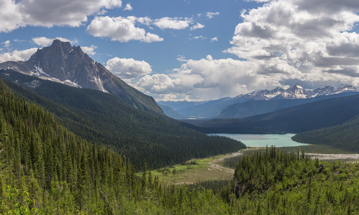
After visiting Kootenay National Park we went back to our favourite Yoho National Park again :). One day I hiked from Yoho Valley over the Yoho Pass all the way to Emerald Lake.

The hike started with nice views of Takkakaw Falls, then went through the forest until I reached Yoho Lake. So pretty!

Takkakaw Falls in Little Yoho Valley Amazingly green Yoho Lake

There is a campground near the lake, a very pretty place. This was the only time I met people on my hike until I reached Emerald Lake.

Panorama of Yoho Lake and Wapta Mountain Flowers found along the hike

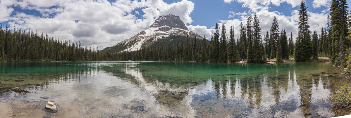
It was still early in the season, and around Yoho Pass there was some snow. Nothing problematic though, and the rest of the hike down to Emerald Lake was really pretty!

Hiking down from Yoho Pass, with Emerald Lake in the background Fantastic views of Emerald Lake

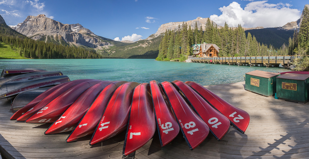
I was hoping the cafe at Emerald Lake Lodge would still be open, but I was just too late! Oh well, I had a nice break at the canoe dock, and a little chipmunk (eating dandelion seeds!) kept me company 🙂

Canoes at Emerald Lake A chipmunk eating dandelions seeds right next to me!

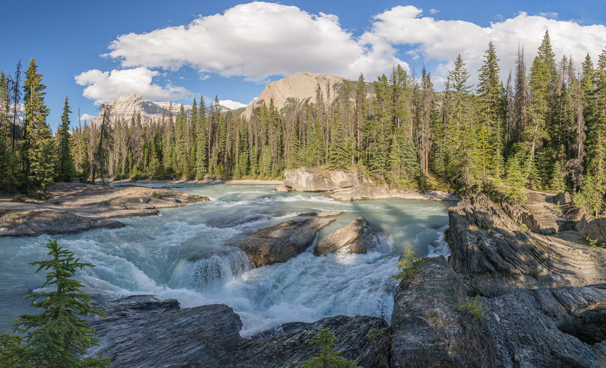
I was picked up from the parking lot at Emerald Lake, and on the way back to the campground we stopped at the Natural Bridge over the Kicking Horse River – impressive!

Natural Bridge over the Kicking Horse River

I had signed up for a Burgess Shale fossil hike the next day (you can only visit on a guided hike), which I was very excited about – unfortunately our VW camper Sophia broke down and we had to get to Banff to fix it. I hope I can visit this area another time, and go looking for the fossils!


Tromsø to Oslo – a 2000 km road trip

Tromsø to Oslo – a 2000 km road trip

At the end of August a moving truck picked up all my stuff and I returned the keys of the flat that I had lived in for six years. The end of an era, I was leaving Tromsø and moving to Oslo. It was a beautiful sunny day, and with mixed feelings I started the long drive south.


Day 1: Tromsø to Ballesvika (Senja) – 140 km


I took a week off to drive the 2000 km to Oslo, bringing my tent and hiking boots – ready for an adventure 🙂

Waiting for the ferry at Brensholmen Last views towards Sommarøy

I took the ferry from Brensholmen to Botnhamn. Before leaving Northern Norway, I finally wanted to go on a mountain hike on the fantastic island of Senja and after some research I chose Segla.

View from the ferry - what a beautiful day! Looking towards the top of Segla

The last part of the hike was steep and sweaty, but the views were so worth it. From the top you can dangle your feet over the 639 m high drop – slightly scary 😉

The majestic view from Segla, with Husøya visible on the right You can sit with your feet dangling over the 639 m deep drop - a little bit scary!

The Arctic Race of Norway took place at Senja the week before, and somebody had left a bike with flags on top of the mountain – a funny sight 😀

The Arctic Race of Norway took place her recently, and someone had put a bike on top of the mountain Another photo of the bike

Of course I had to take some selfies on the top 😉

Selfie on top :) Enjoying the views

What a fantastic hike! Segla means sail, and the photo below clearly shows why the mountain got that name.

Panorama looking back, the village of Fjordgård far below I was there!! :D

After the climb, I kept driving towards Gryllefjord where I planned to take the ferry to Andenes the next day. I stopped to take a photo of Hamn i Senja, where I have stayed several time and have very good memories. This time though, I planned to sleep in my tent. I found this beautiful beach at Ballesvika, that I had all to myself!

Panorama of Hamn i Senja, where I have stayed multiple times - love this place! My private beach at Ballesvika

It was a fantastic place – beautiful beach, picknick tables, a flat grassy spot for the tent, and perhaps best of all: there was even a toilet nearby.

Sunset What a great place to spend the night


Day 2: Ballesvika (Senja) to Hopen (Austvågøy, Lofoten) – 235 km


I woke up to another sunny day, and really enjoyed having breakfast and reading my book in the sunshine.

Morning bliss Last photo of the pretty beach at Ballesvika

It was only about 7 km to Gryllefjord where the ferry to Andenes (Andøya) left. A lovely crossing, and I even met a friend on the ferry who was on the way to Stavanger with his girlfriend. Norway is a small country 😉 Once in Andenes, I continued a short way to Bleik where I went for a walk on the fantastic sandy beach.

On the ferry between Senja and Andenes / Andøya The fantastic beach at Bleik

It was so beautiful, I couldn’t stop taking pictures. I was almost tempted to go for a swim, but I knew the water would be too cold for my liking.

So beautiful, I couldn't stop taking pictures Some people were even swimming - the water is very cold though

I would have loved to spend the whole day on the beach, but I still had a long way to go so I continued my drive, following the coastal route, stopping for photos all the time.

I love Bleik! Driving the coastal route at Andøya - very very pretty
Car advert for my beautiful Subaru :D Andøya has large areas with marshlands

Watching a flock of sheep crossing a river, and at Bjørnskinn it looks like you are going to drive straight into the church 🙂

Follow the leader - a flock of sheep cross the river At Bjørnskinn it looks like you're going to drive into the church

I continued my way to Melbu, where I took the ferry to Fiskebøl.

Pretty landscapes along the way Leaving Melbu on the ferry to the Lofoten

From there it’s not far until you are in the Lofoten. It was a calm and beautiful evening, and I stopped all the time to take photos of reflections in the fjords.

A sailing boat seen from the ferry Reflections
Lofoten idyll Looking towards Sildpollnes Church from a viewpoint along the road

I took photos of some very shallow mist as well, before I finally found a camping spot by the water.

A very shallow layer of mist My camping spot late at night


Day 3: Hopen (Austvågøy, Lofoten) – Bodø 240 km


The next day I woke up to a grey day with the clouds hanging low – typical Lofoten weather, but very boring for photography. I went to the Henningsvær, a small fishing village.

The next morning, where did the nice weather go?! Poem on a door in Henningsvær

I visited the art museum there, which had an exhibition about according to the owner “Norway’s most famous artist” – I thought that would be Munch, but she meant Bjarne Melgaard. Google him if you’re curious – to be honest I didn’t understand his work at all so I had to disappoint the eager museum lady 😉

Art museum in Henningsvær. The missing letters in Kaviar Factory spell ART Sea urchins for sale :)

I kept hoping the sun would come back, but Ramberg beach was pretty on a cloudy day as well. I found a nice rock to read my book on 🙂

The fantastic beach at Ramberg View from my book-reading-rock

After eating dinner in Reine, the sun finally came out again and I took some photos of this picturesque village – this is probably the most-photographed view in the Lofoten though so I wasn’t very original 😉 I continued to Å where I watched sunset at a beautiful little lake. It looked like a painting!

Picturesque Reine in the evening, when it finally cleared up Sunset at a lake near Å

I decided to drive to the ferry even if I was way too early – or so I thought, but I had misread the time table and a ferry for Bodø arrived 15 minutes after I joined the queue. Nice! Watching the Lofoten become small on the horizon during this spectacular sunset was quite magical. This was also the furthest I had travelled previously, so from now on I would be visiting new places – exciting!

Sunset panorama A spectacular goodbye to the Lofoten from the ferry to Bodø

I arrived in Bodø in the middle of the night, so I went to a hotel for a good night of sleep and a much needed shower 😉


Day 4: Bodø – Flostrand/Utskarpen – 265 km


I was excited to leave Bodø and see new places, so I picked up a brochure about the Helgeland coastal route from the tourist information and I was on my way. This route is over 400 km long and has 6 ferries. It was once again a beautiful day, and I really enjoyed driving through this beautiful landscape…

Starting the coastal tourist route south of Bodø A nice beach for a lunch break

After some very long tunnels, I finally got a good view of the glacier Svartisen – beautiful! I really would have liked to take the ferry to the glacier and hike up to the cabin Tåkeheimen. This cabin was voted “most inaccessible cabin in Norway”, but it looks SO beautiful. Unfortunately it was too late in the day for the ferry, and if I had to wait until the next day (and then hike for two days), I wouldn’t be able to continue my road trip until 3 days later so with a heavy heart I decided to drive on. I hope I can come back here one day!

Svartisen glacier - wish I could have visited! Warm evening on a ferry

My parents were driving from Tromsø to Oslo at the same time as me, though they had taken a different route (avoiding the Lofoten). Now we were back on the same route, and I decided to join them at the free campsite they had found next to the road. A very nice place!

Putting up my tent at the free campsite


Day 5: Flostrand/Utskarpen to Vennesund (Sømna) – 260 km


The next day was sunny and warm, but very windy. A lot more ferries and bridges were waiting… the bridge below is Helgeland bridge near Sandnessjøen.

View from one of the many ferries Helgeland bridge at Sandnessjøen

After Sandnessjøen there were some nice views of the row of mountain peaks called the Seven Sisters. I would have loved to climb one of them, but the wind was very strong (or perhaps I was just lazy 😉 ) so I kept on driving and decided to find an easier peak further along the route.

The Seven Sisters at Sandnessjøen

After taking the ferry to Horn, I climbed Mosfjell which has great views towards Brønnøysund – a nice evening hike!

View towards Brønnøysund Brønnøysund seen from a mountain top - pity it was so hazy that day!
The landscapes were changing from further north: more agriculture Great views

The sunset near Brønnøysund was spectacular!

Sunset south of Brønnøysund Sunset panorama

It was getting harder to find camping spots, as the landscape was changing a lot – now I was mostly driving through farmlands, and I could hardly put up my tent in a field of crops 😉 It was getting dark and I was worried I wouldn’t find a good spot – but just in time I discovered the perfect place near Vennesund. It was a beach with picknick tables and a proper toilet building with running water and good grassy spots for tents.

The only issue was the wind. It was SO windy that the food flew from my fork while I ate dinner, and putting up the tent was quite a challenge. Meanwhile it was still over 20 degrees, a very strange combination.


Day 6: Vennesund to Inderøy – 250 km


After a CRAZY windy night where I got scared that my tent would blow straight into the sea (I didn’t get much sleep…), I woke up to a windy morning. I drove back to Vennesund, ready for the very last ferry crossing (nr 10!) of this road trip.

My very windy campsite - and another private beach :) Art

Right after the ferry crossing I hit an area of rain. That was a first! The landscape was becoming gentler and I passed some large lakes. My parents told me they found a nice campsite between Steinkjer and Levangen. It was still quite early, but I decided to stop there as well.

The landscape was becoming gentler, with some large lakes My parents at the campground just north of Trondheim

It was a nice spot by the fjord and we enjoyed watching the sunset.

Sunset from the campground Nice spot :)

My mum took these photos of me eating some (disgusting) banana dessert that I had bought in Canada, and a photo of the typical camping life 😉

Eating a pretty disgusting banana dessert that I bought in Canada The camping life ;)


Day 7: Inderøy to Tretten – 435 km


We woke up to rain, so I decided to drive as far as I could towards Oslo. I was getting impatient to reach my new home 😉 I did stop for some hiking at Dovre though – a very beautiful open mountain landscape of mossy greens.

Hiking in Dovre - love all the mossy greens Dovre panorama

I hiked to a 1200 m top, which would be impressive near Tromsø, but here the road was already at 1000 m 😉

From the top, with lots of rain showers around Selfie on top

After my hike I discovered that I was near the Snøhetta Viewpoint, of which I had seen some spectacular photos on the cabinporn website – see here. Of course I had to stop! After a 1.5 km hike I reached the cabin. It was open and there was a fire burning – what a fantastic place!

Fantastic Snøhetta Viewpoint- the mountains were obscured by clouds but the views were still great Snøhetta Viewpoint detail - I loved this building

On clear days you can see the nearby mountain tops, and there was a volunteer who was pointing out the herd of muskox that roam the area through the binoculars (I only saw some brown dots which could have been anything 😛 ).

Snøhetta Viewpoint from the outside The shower that chased me on my way down - I didn't manage to outrun it

On the way back down I got soaked by a rain shower, and driving on towards Oslo the rain got so strong that driving got quite scary. I decided to stop at a motel at Tretten, a strange place but I was tired enough not to care about that 😉


Day 8: Tretten to Oslo – 215 km


The next day was beautiful again, with some fog banks hanging over the river. I couldn’t find a good place to stop for a photo though. I arrived in Oslo around lunch time, picked up the keys from my landlord and then drove to my new home. It had been a fantastic road trip, but now I was ready to settle in my new apartment and start my job 🙂

USA Adventure Part 8: Highway 12 – Scenic Byway

USA Adventure Part 8: Highway 12 – Scenic Byway

Highway 12 is called a Scenic Byway, and runs from Capitol Reef to Bryce Canyon National Park. We were planning to camp somewhere along the way after leaving Cathedral Valley. The road is claimed to be one of the most beautiful roads in the USA, and it’s clear to see why… the views are fantastic and the landscape changes a lot along the way.

Impressive views from Scenic Byway 12 Autumn leaves moving in the breeze

The autumn colours were fantastic, a lot of the birch trees were a bright yellow colour.

Paul and the fantastic autumn colours Such a diverse landscape!

We stopped at nearly every viewpoint along the way and took LOTS of pictures 🙂

This road is popular with motorbikes, I can see why! A small village along the way

The forest was so pretty…

Me in the autumn forest What a beautiful day!

Later on, the road goes over a narrow ridge, with steep drops to both sides. Unfortunately I didn’t get a good picture of that, but it was impressive. The landscape turned more desert-like again, and we saw a canyon from above.

Looking down into a canyon Panorama taken from one of the viewpoints near Escalante - if you look closely you can see the road winding through the landscape

Paul had been battling a cold for a couple of days now, and was tired after camping for the last 2 days. When I also started getting a cold, we decided we needed some more luxury that night, and we found a motel in Escalante. It turned out to be a very friendly town – full of outdoor shops, book shops and nice cafes – perfect!

The next day I wasn’t feeling well but Paul was lots better, so we decided he would hike to Calf Creek Falls, while I stayed in the shady picknick place next to the parking lot, reading a book.

Paul walked to a waterfall while I sat with my book in the parking lot. I was surrounded by birds and managed to take this photo with Pauls lens :) The path to the waterfall

Here are the photos Paul took of the waterfall… looks really nice, I think on a healthier day I would have liked to swim in the lake underneath 🙂

Calf Creek Falls Calf Creek Falls - beautiful! People were swimming in the lake underneath

Later that day we drove to the cabin we rented, between Bryce Canyon and Zion. Ready for more adventures 🙂