Browsed by
Year: 2013

Summer in Finland, part I: Cycling Oulu – Kajaani

Summer in Finland, part I: Cycling Oulu – Kajaani

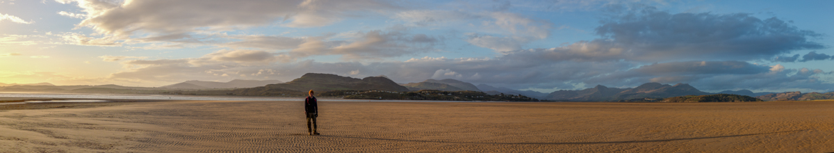
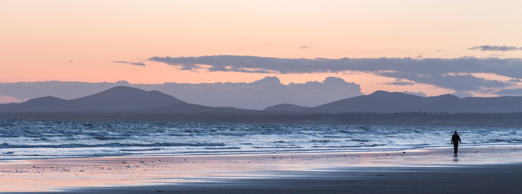
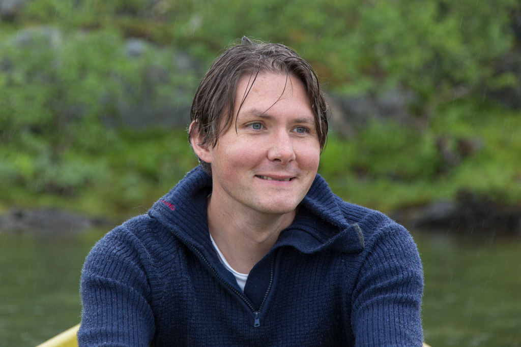
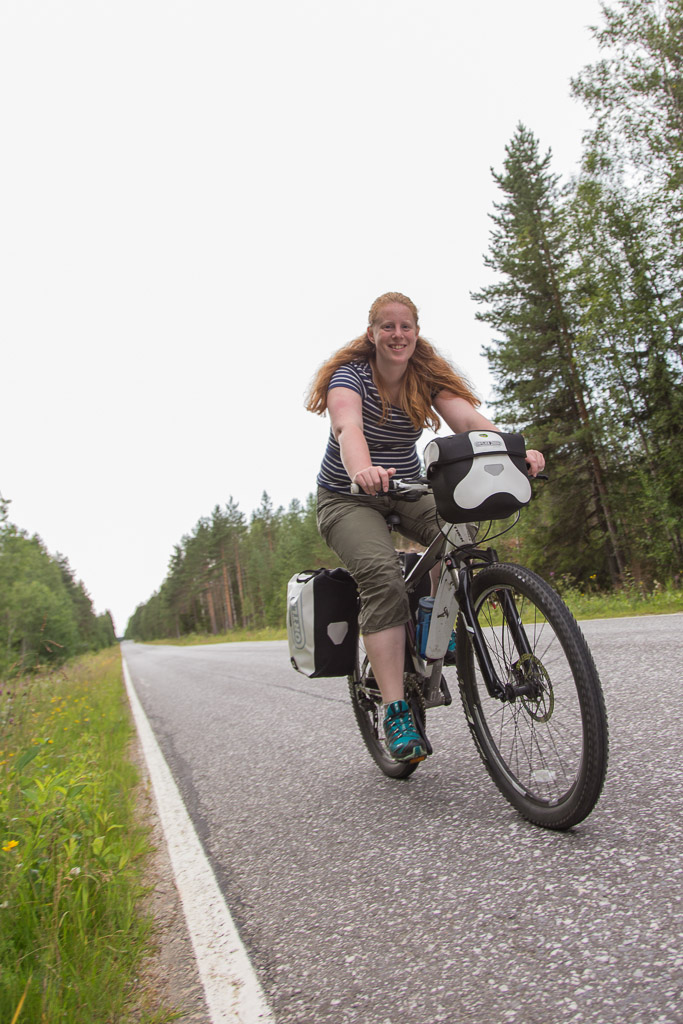
This summer we’ve spent our three weeks of summer holidays in Finland 🙂 We drove from Tromsø to Oulu, breaking the long trip in half by staying in a cabin overnight. We had stayed at the same place before, one our way back from Easter holidays in LuleÃ¥. The cabin was at Muodoslompolo, try to pronounce that 😀 In Oulu, we parked our car in a parking garage for a week, and on a sunny Sunday morning we started our cycle trip to Kajaani – we would cycle just over 250 km in 5 days…

A map of our route from Oulu to Kajaani, with our hotels indicated by a house. The GPS ran out of batteries on the third day, where it looks like we cycled over the lake ;) Proof: Finland is NOT flat!! :) We cycled uphill for most of our trip, though I have to admit it was hardly noticeable

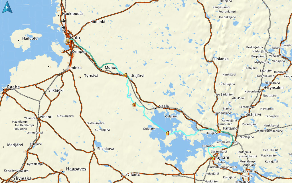
Day 1: Oulu – Utajärvi (61 km)

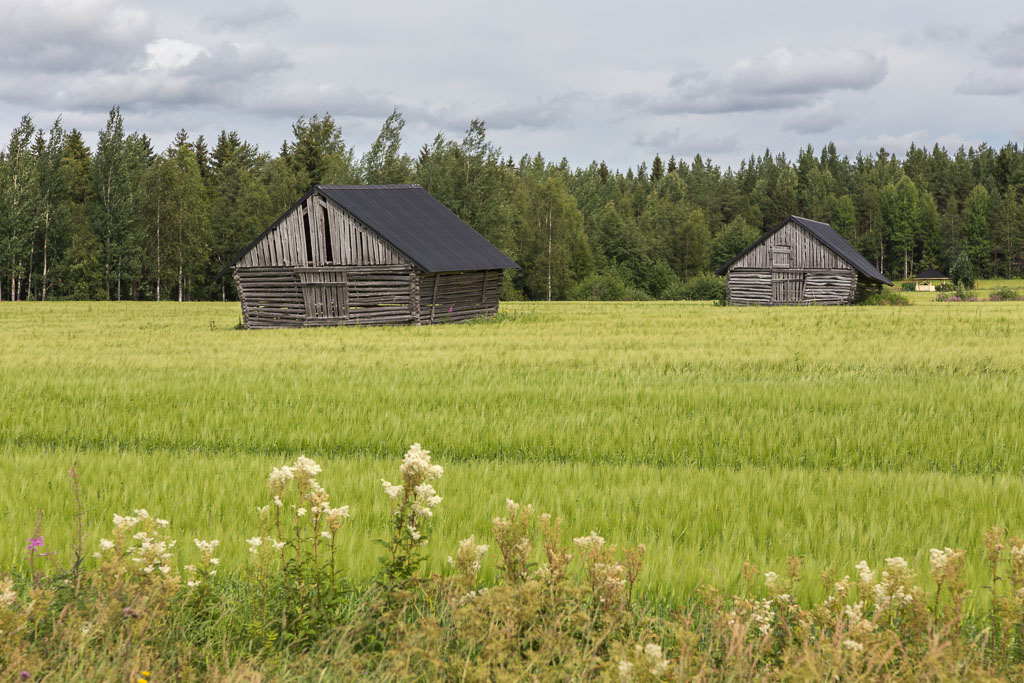
Oulu is a very cycle friendly city, so it was easy to get out of town. We followed the Oulujoki (Oulu river) all day, though we could only glimpse the river every now and then, hidden behind fields and forests. We mostly cycled through farmlands…

Some of the typical views along the way, I love these old sheds You could often see small-scale drying of grass - the old fashioned way without any plastic!

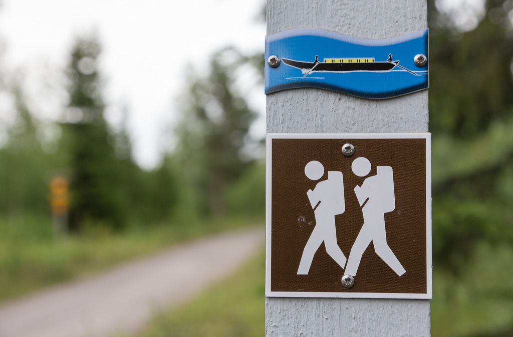
It was a pleasant day of cycling, on quiet roads. We soon found we were following a hiking trail called the Tar Route, a nearly 100 km long route from Rokua National Park to Oulu. Tar production used to be very important in this region, and the barrels of tar were transported along the river to Oulu, which is represented in the logo of the hiking trail.

Cycling along quiet roads The Tar Route hiking trail, which we followed almost all the way

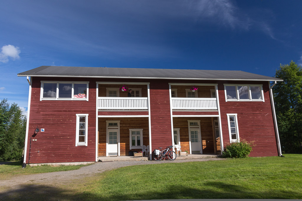
We arrived at our accommodation at 18:00, and dinner would be served at 19:00 – perfect! We stayed at a manor house called Merilän Kartano, a really nice place on the river. Besides a couple staying in a cabin, we were the only guests. Dinner was a buffet, we had to be careful not to eat more than our share and leave the other couple hungry 😉

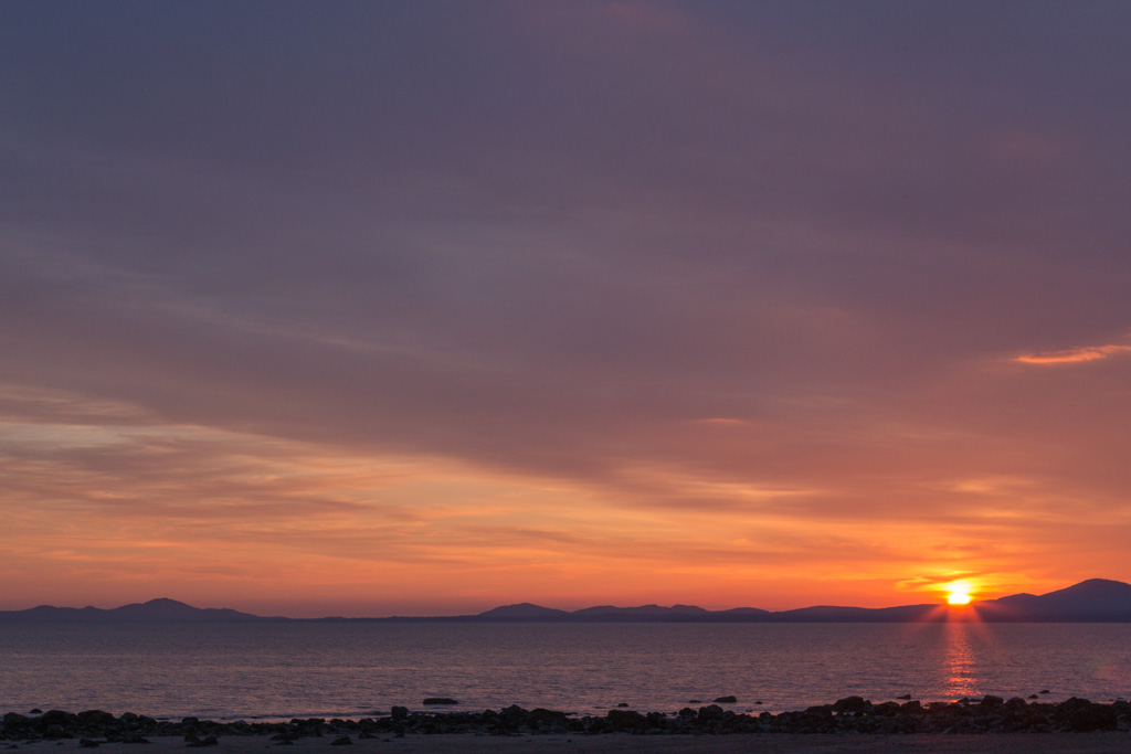
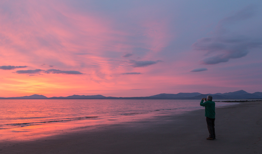
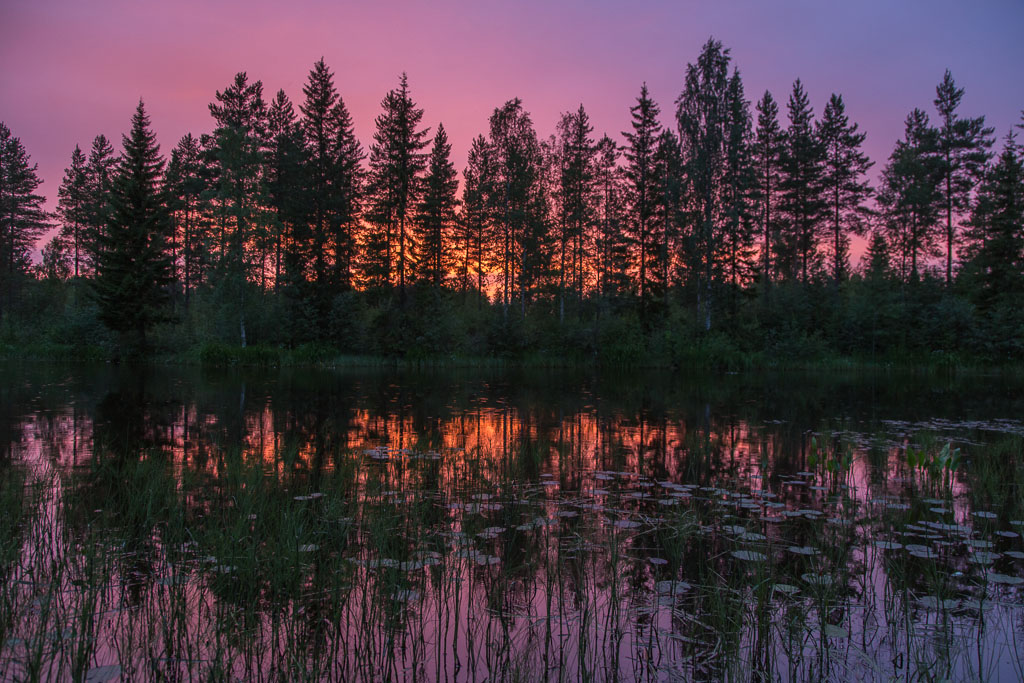
In the evening we watched the most amazing sunset from behind our room… the sky turned this deep pink/purple, even though it was raining at the time. We also saw a hedgehog 🙂

We found this sad looking owl on a walk near the hotel We watched the most amazing sunset that evening...

Day 2: Utajärvi – Rokua (34 km)

The next day started perfectly sunny, and after breakfast we cycled to nearby Utajärvi to buy some supplies in the supermarket.

Our hotel in the morning sunshine The wooden church in Utajärvi

We didn’t have very far to cycle that day, so we took it easy with lots of breaks along the way 🙂

The landscape changed to pine forest, moss and heather The moss was nice & soft :)

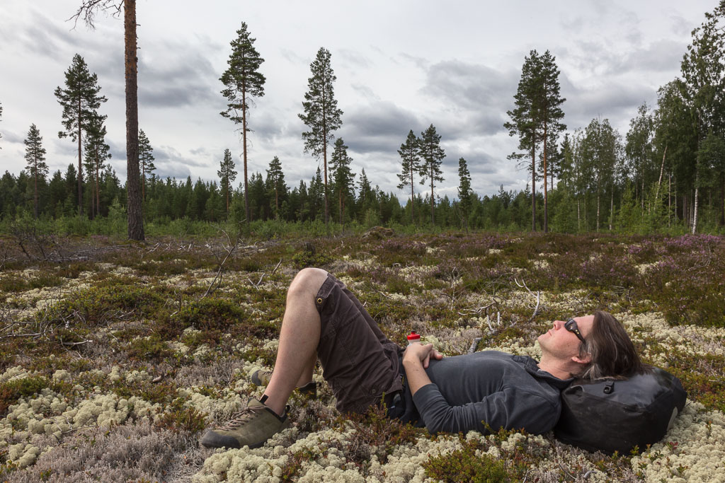
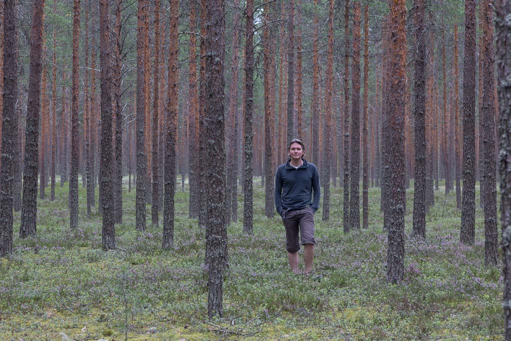
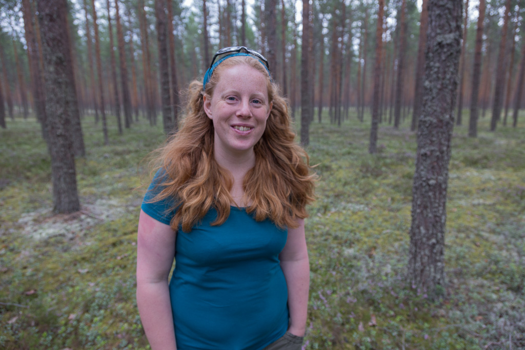
We were now cycling through the forest, with a thick moss covering on the ground – very pretty.

Paul in the ethereal forest My turn to pose in the forest

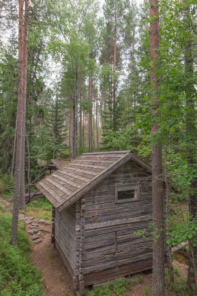
Unfortunately it got more and more cloudy throughout the day. We had a final stop at Ahmas Kalevala Heritage Village. The Kalevala is the Finnish national epic, published in 1835. I didn’t even know what a national epic was, but Wikipedia has the answer: “an epic poem or a literary work of epic scope which seeks or is believed to capture and express the essence or spirit of a particular nation”. The village of Ahmas was famous for  bards, folk singers and poem singers, and part of the source material for the Kalevala came from them. There was an open air museum with beautiful buildings and interesting stories… there was nobody there and apparently it’s free to wonder around and even go inside some of the buildings. An interesting stop!

The forest road An old cabin in a sort of open air museum

It started to rain while we were at the heritage village, so we decided to cycle the last 9 km to our hotel as fast as we could.

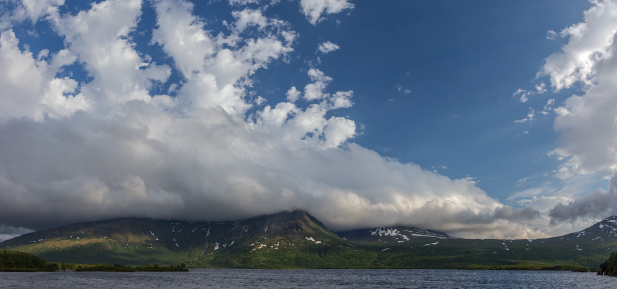
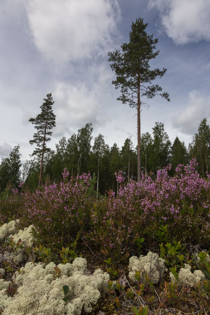
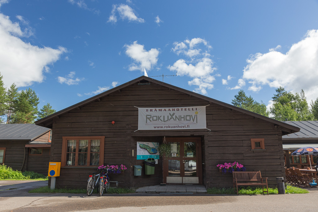
Our hotel (Rokuanhovi) was located inside Rokua National Park. We went for  a long walk before dinner, but we didn’t take many photos as it was raining. It was beautiful though – it’s a landscape shaped by the last ice age. The soil is mainly sand, shaped into crescent dunes, but now covered in a thick forest and an incredibly thick layer of reindeer lichen.

Day 3: Rokua – Manamansalo (58 km)

The next day we did see some sunshine, but there were lots of rain showers around. Somehow I decided to be very Dutch that morning and I took some extra rolls of bread from the breakfast buffet to have for lunch. Lucky – as we didn’t come across a singe cafe/shop the whole day!!

Our hotel in Rokua No lack of wood in Finland :)

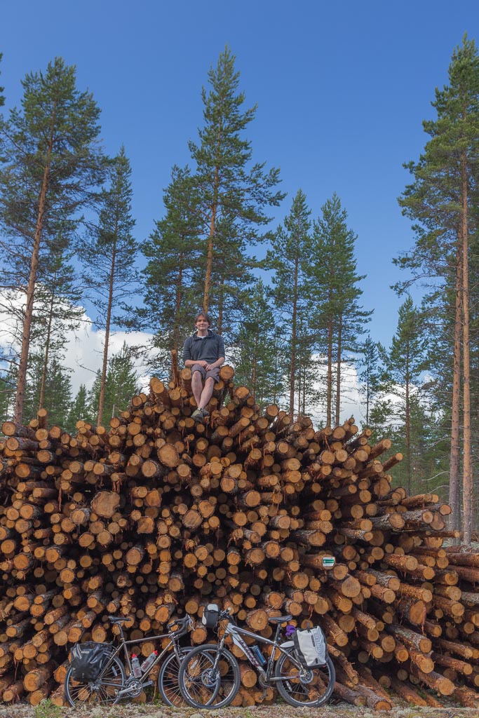
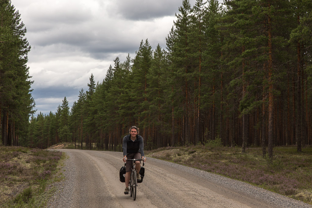
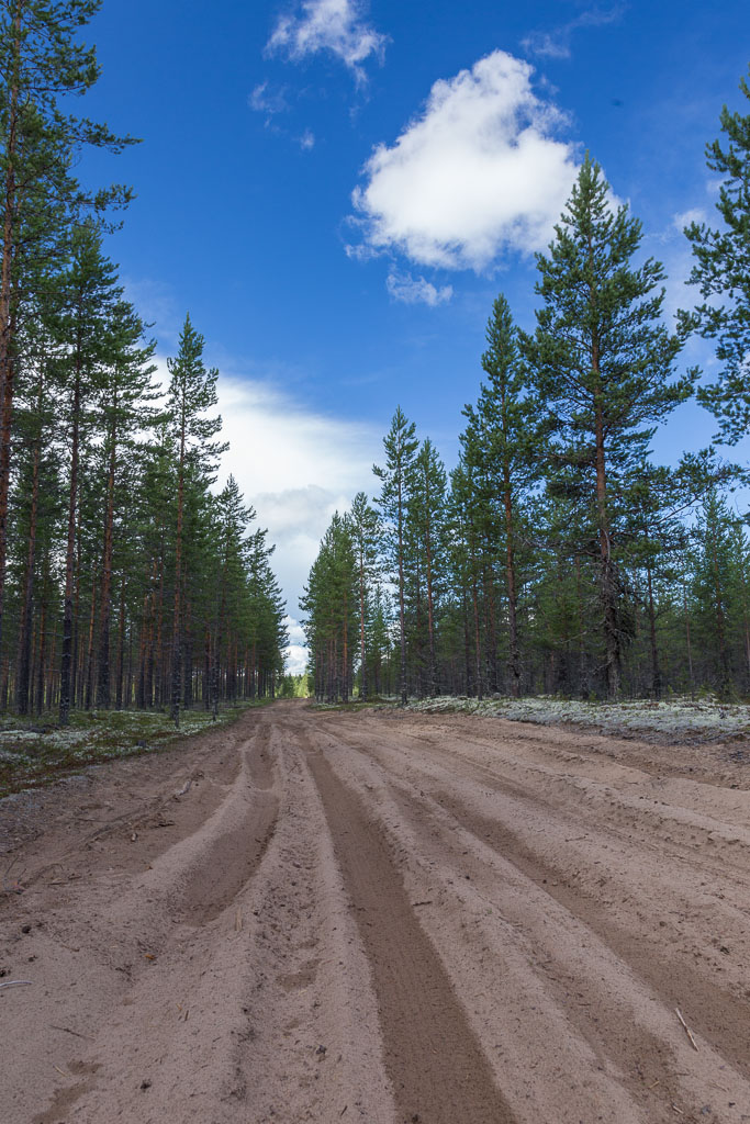
We cycled through the forest, following a route that Google maps suggested (I used my iPhone and a Finnish sim card that gave me unlimited data for nearly nothing (0.66 euro per day), with excellent 3G reception in even the most remote places – brilliant!!). It was a nice route, but what Google didn’t tell us, was that the dirt road we followed would turn into a nearly-impossible sandy road…

Nice place to sit - pity most places on the lake are private! Rain showers were approaching here... Through the magical mossy forest near Rokua, on a dirt road. The only person we saw was a guy in a van, collecting moss!

The only other person we met was a guy in a van, collecting moss… I know reindeer lichen is used for Christmas decorations in the Netherlands, and it’s quite expensive – so this might be a great business?! 🙂

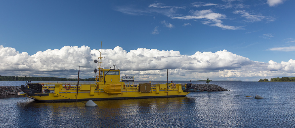
We were very relieved when we got to the end of the crazy sandy road, and back on a tarmac road… We cycled to the ferry to Manamansalo, an island within Lake Oulu.

It's a bit hard to see in this photo, but the dirt road was really bad in some places, with deep sand The ferry to Manamansalo

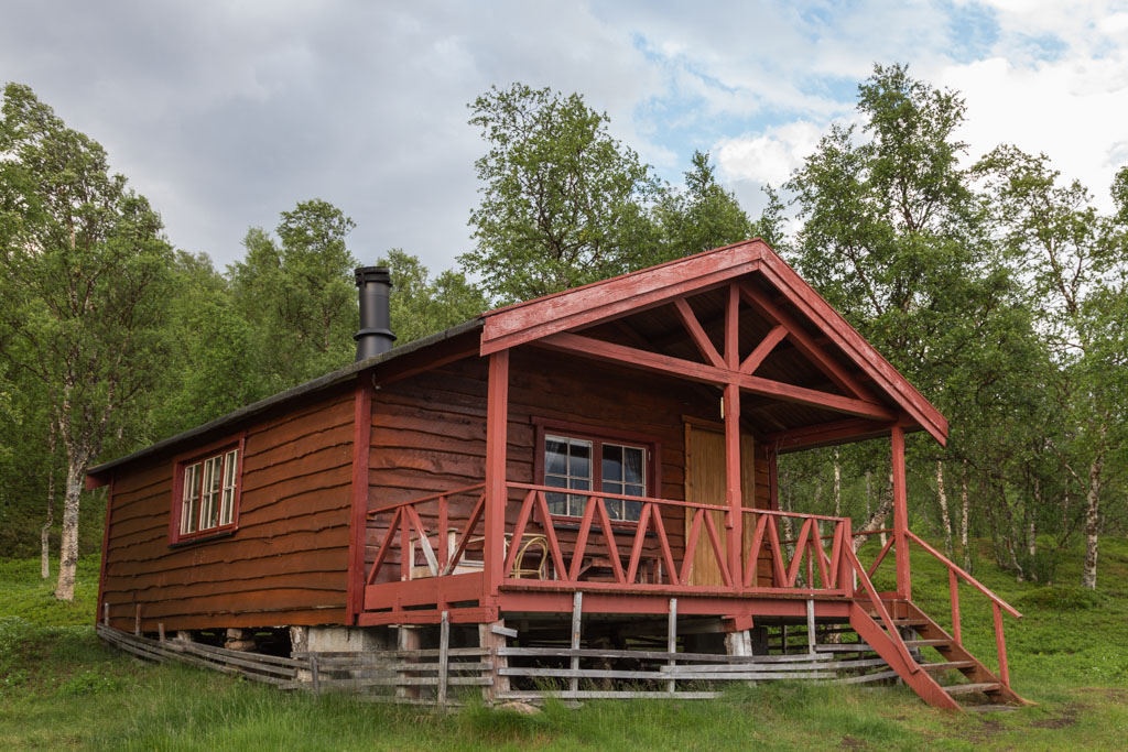
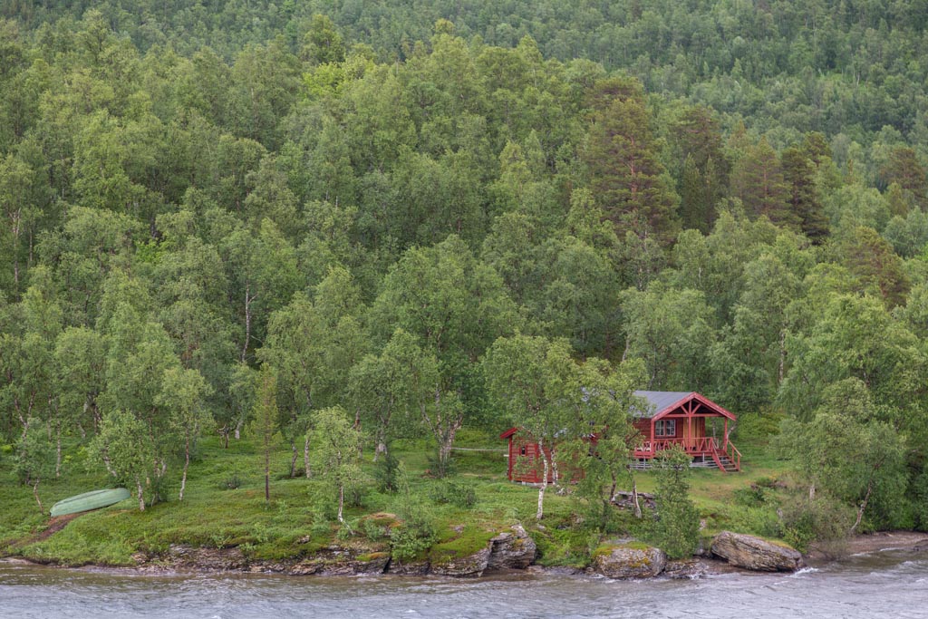
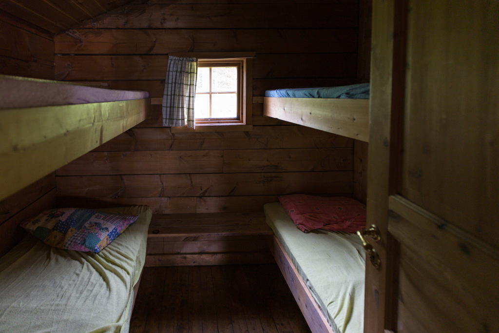
A thunderstorm was following us from the ferry to our camping site, but luckily we only got some light rain. Our accommodation for the night was at Manamansalo campsite, where we rented a cabin. The cabin was very nice, though in a way not such a good deal compared to hotel rooms – the price was the same, but linen was not included and neither was breakfast. There was a small shop on the campsite where we bought a luxury meal: a tin of meat balls in brown sauce and instant mashed potatoes 😀 It actually tasted very good after a long day of cycling 🙂

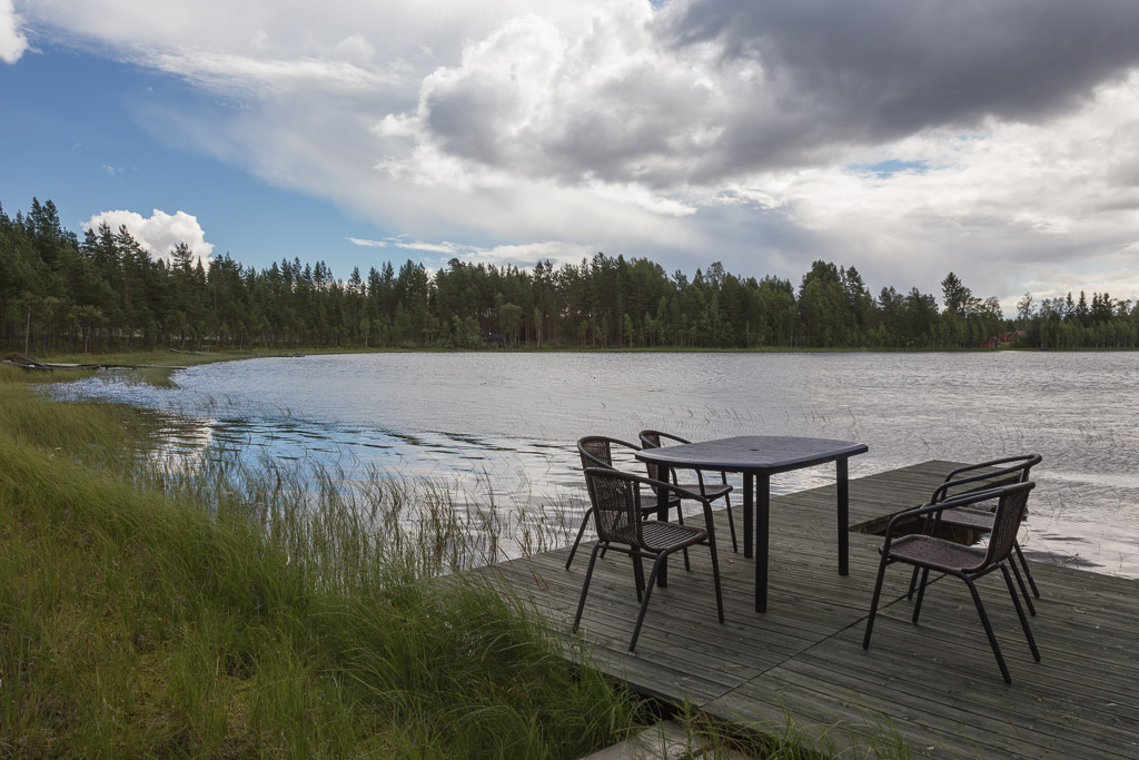
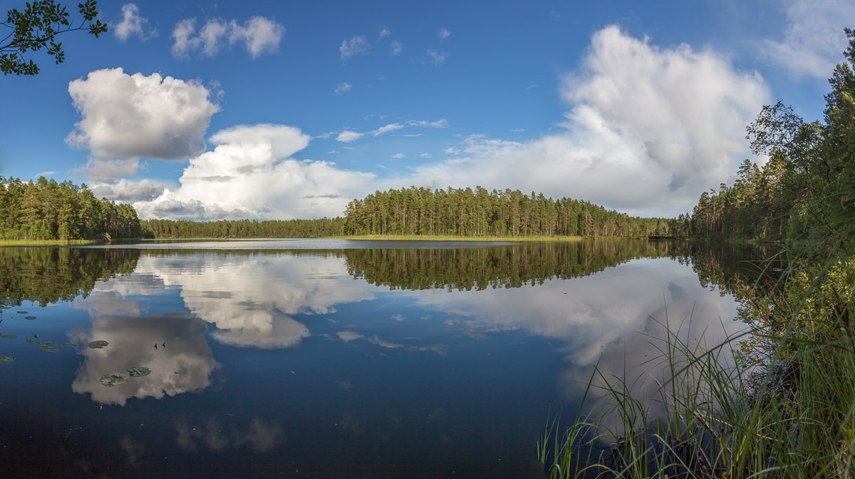
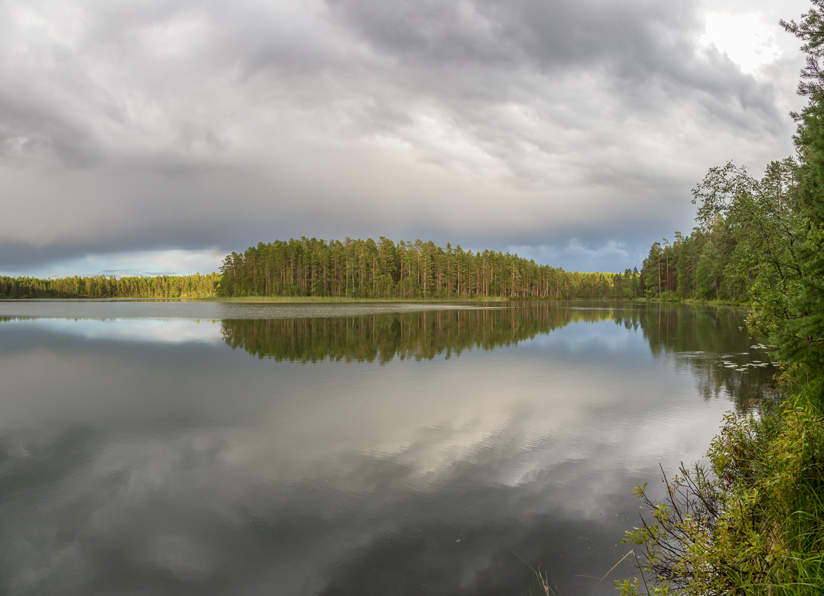
Our cabin was next to a small lake, with great reflections…

Threatening thunderstorm behind us - but we managed to avoid most of it View from our cabin by the lake - fantastic!

We went for a walk after dinner, but after only 15 minutes we ran back to the cabin to avoid another rain shower 😀

The shore of Oulajärvi, or Lake Oulu The view of the lake never got boring, even when the skies turned grey

Day 4: Manamansalo – Paltamo (48 km)

The next day wasn’t the best: it rained all day, and it was quite cold and windy too. And when we stopped at a cafe for a break and some food, I discovered I had a flat tire. Well, at least it was better to find that out while at a cafe with a covered outside area, than along the road in the middle of nowhere.

A rainy day...

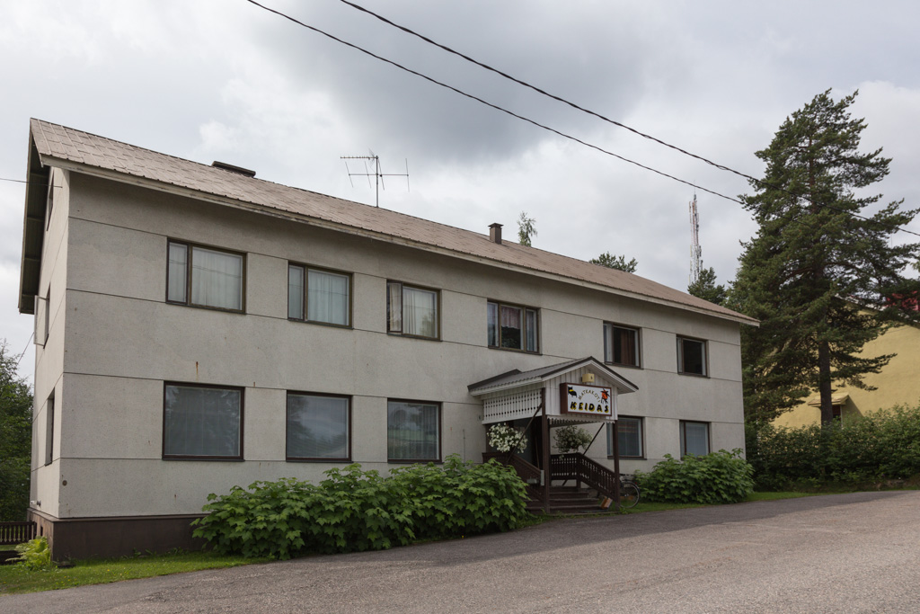
We didn’t stop all day, except for another tea-and-cake stop at a cafe. Our destination for the day was Paltamo, and it was the only night that we hadn’t been able to book accommodation for. We knew there was a hotel, and we had tried to call them several times, but after asking the lady if she spoke English or Swedish, she would just hang up! Luckily the hotel did exist and her husband even spoke some English. It was quite a special place, frozen into the 70s. It was cheap though, and warm, and dry, so I wasn’t complaining 😉

We walked around Paltamo in the evening – a very sleepy town with basically nothing to see or do. We were hoping for a restaurant, but the only option was a burger at the petrol station. There was a big supermarket though, so we stocked up on snacks and lunch, and breakfast, as the hotel didn’t provide that.

Day 5: Paltamo – Kajaani (53 km)

The next day was warmer and dry – but still rather cloudy. We had to cycle along a relatively busy road for a while in the morning.

Our glamorous hotel in Paltamo

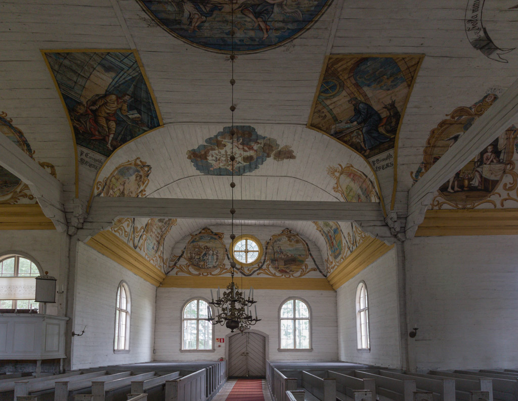
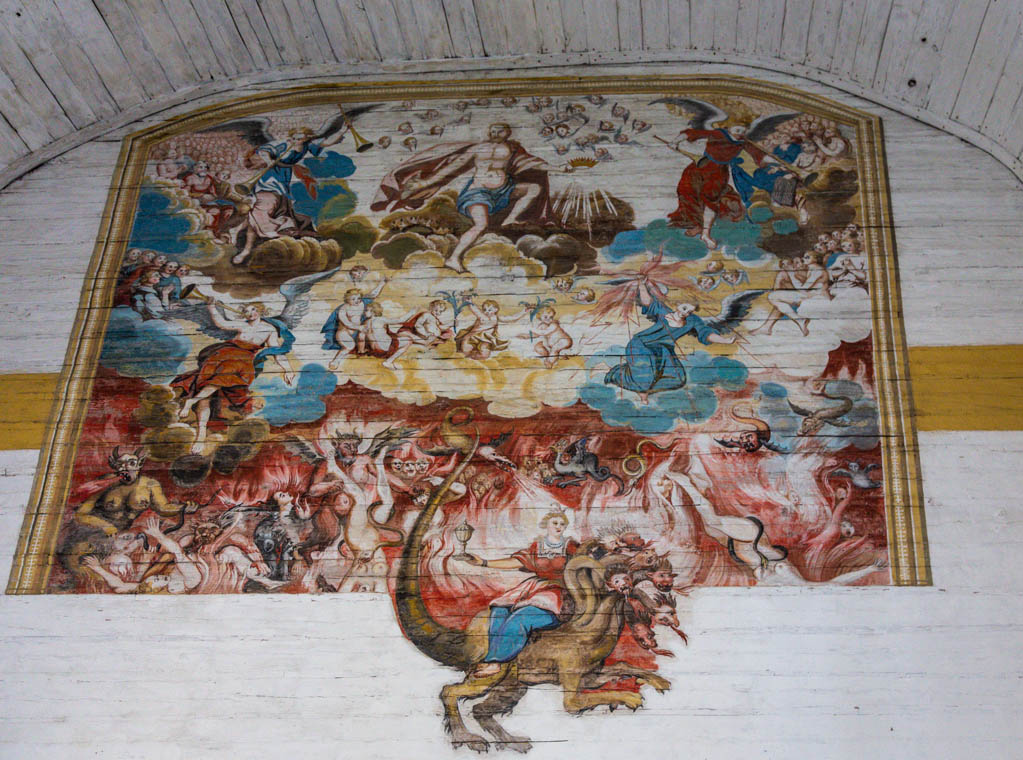
Later we took another forest dirt road (never trust Google maps :P) and we visited the Paltaniemi. This village is famous for its pictorial church. It was impressive indeed, an old wooden church full of paintings of various scenes from the Bible on the ceiling and walls. Above the door there is a large painting of heaven and hell, but a large part of hell is missing. Apparently, it was removed as it was so shocking that ladies were fainting… it makes you curious what it was showing 😉

The church in Paltaniemi This old church is famous for the paintings on the walls and ceilings, and also called a pictorial church. Impressive!

I liked the bird :) Of course there was a nice illustration of what hell is like... but a large part at the bottom is missing, as it made ladies faint - wonder what it showed!!

After a tea and doughnut, we cycled the last 9 km to Kajaani, the final destination of our cycle trip. It looked like a pleasant town, but we didn’t explore much as it rained heavily that evening and the next day. We relaxed in our hotel, and took the train back to Oulu the next day.

It had been a nice trip, though we were a bit unlucky with the weather. As long as you don’t take Google-shortcuts, the roads are great, though you sometimes have to cycle on quite busy road (where the speed limit is 100 km/h). Usually there are alternatives though, and near towns there are often very nice cycle paths. Paul would have preferred to cycle longer distances each day, but I am not sure I would find that so enjoyable – though with the large distances between places (shops! cafes!) you might be better off.

Two Weeks in Wales

Two Weeks in Wales

In May we spent two weeks in North Wales. Paul’s mum is from there, so it’s not a new area for us – it was my third visit there, but I never get bored of this area. Just before the long journey from London to Wales, I picked up my new camera – a Canon EOS 6D, I’ve finally taken the step to full-frame 🙂

One of our first trips was to Porthmadog by train. From there it’s a short distance to Borth-y-Gest, a very pretty village around a bay that falls completely dry at low tide. Time to test my camera 🙂

Low tide at Borth-y-Gest near Porthmadog Panorama of Borth-y-Gest, with lots of rain showers around...

Later that day we went for our usual walk on the beach at Llandanwg. Heavy showers had been passing all day, and the skies were very threatening while we were on the beach…

Threatening skies on the beach at Llandanwg Shortly after taking this photo we had to run for cover from a heavy rain shower

In the end we had to run for cover, and we found shelter underneath the entrance to the small church of St Tanwg. This very old church used to be in the fields, but is now surrounded by dunes. For some time it was even buried in sand, and only dug out once a year for mass. At the moment it’s in more regular use, but a lot of the gravestones are buried in the dunes. A fascinating place! And it was even more special when the rain shower passed, and a bright double rainbow spanned over the church – beautiful 🙂

We sheltered near the church, and were rewarded with a bright rainbow when the sun broke through Paul posing under the very bright double rainbow

We continued our walk on the beach, with beautiful clouds…

The beach and the last remains of the rainbow seen from the top of the dunes When it cleared up, we continued our walk along the beach

Around sunset the light was very yellow and we walked back over the tidal flats next to the river, together with a lot of sheep and their lambs 🙂

A typical Welsh scene: sheep, lambs, stone walls and yellow broom flowering on the hills The light was very yellow around sunset, and the sheep were reflected in the small tidal ponds

Another beach that we like to visit is the huge beach near Harlech. You can walk there from Llandanwg, but this time we drove to the parking lot at the golf course, as we wanted to reach the far end – about 5 km one way. Paul took his kite, and took aerial photos of the beach.

The wide beach at Harlech Paul took aerial photos with a camera on a kite.

A pretty cumulonimbus on the horizon, making a meteorologist very happy 😉

A nice cumulonimbus on the horizon :)

The beach at the far end is HUGE!

Paul at the very end of Harlech beach

We walked back at sunset, with the clouds colouring pink and flocks of birds flying around us – so beautiful.

Flocks of birds were flying around us A beautiful sunset!

We didn’t meet anyone else during our walk, except for this one guy when we were almost back.

A lonely cloud reflected in the wet sand The only other person we met that evening

Here are some photos that Paul took with his kite:

Lots and lots of sand It's funny to see the wave patterns from above Two small persons on a huge beach

The next day we decided to go for a long walk: the northern section of the Ardudwy Way. We did it in the opposite direction as described on the website, as it meant we could take a train to Llandecwyn in the morning, and walk back to Llandanwg. The weather wasn’t perfect, it was overcast with a few drops of rain, and quite cold – but we still enjoyed the hike. Near the start of the hike we found this really cute little lamb…

We came across this cute lamb, I wanted to take it home with me!! A cold, grey and wet day - but we still enjoyed our hike

The church of Llandecwyn has a spectacular view!

The small church of Llandecwyn - with a grand view :) Panorama of the view towards Porthmadog and the river estuary

We passed through a mossy forest, and came across this lonely farmhouse high in the hills.

Paul in the mossy forest A lonely farmhouse in the hills

After that we left all houses and roads behind, though we did follow a Bronze Age trackway (3000-4000 years old) through the hills. The highlight of the trip was Bryn Cader Faner, a Bronze Age burial site or cairn circle. Quite impressive!

A typical weathered tree :) The impressive cairn circle of Bryn Cader Faner, more than 3000 years old

Paul flew his kite for a while, but the cairn circle just looks like a pile of rocks from above 😉 We continued our way back to Llandanwg, it took us about 7 hours to walk the 20 km – a long day!

A kite photo showing Bryn Cader Faner from above - looks like a pile of rocks without any pattern! A little lamb was guarding this lonely farmhouse

I had sore muscles after our hike, but I couldn’t stay inside when this double rainbow appeared over the Moelfre in the evening… followed by an amazing sunset 🙂

In the evening we were treated to another double rainbow! A fantastic sunset followed...

The next day we took it easy and we went on a day trip to Aberystwyth (by car). We hadn’t been there before, but it’s a very pretty and pleasant town. Full of students, which is quite a change from other parts of North Wales where the population consists of lots of pensioners 😉

The castle ruins in Aberystwyth Panorama of the sea front at Aberystwyth - a very pretty town!

Our real destination for the day was the submerged forest at the beach near Borth. This “forest” (collection of tree trunks) is between 4500 and 6000 years old, and only visible at low tide. There doesn’t seem to be a clear reason why this forest became submerged, but there isn’t much information available. It’s not indicated on any maps, and only mentioned in one sentence at Ynyslas Nature Reserve (though the information centre there was closed by the time we arrived, perhaps they had more information inside). Anyway, well worth a visit!

Clouds and dunes at Ynyslas Nature Reserve The submerged forest at Borth. Forest might be a bit exaggerated, but the tree trunks were impressive nonetheless

The tree trunks were beautiful, and you could see all the tree rings on them. They still feel like wood, it’s hard to believe they are thousands of years old!

The tree trunks are only visible at low tide, and apparently sometimes even then they are covered in sand The trees are between 4500 and 6000 years old!

You could clearly see the tree rings on the trunks It makes you wonder what the landscape used to look like here A trunk filled with rocks and shells

Paul had his kite with him again, and he took some photos of the forest from above….

Paul took kite photos here too :) The tree trunks look like starfish from above He even managed to get an aerial panorama!

When our muscles had rested long enough, we decided to climb Rhinog Fawr, the highest of the two neighbouring Rhinog peaks. We parked at a farm next to where the so-called Roman Steps start. I have seen this name on a map for many years now, and it always intrigued me. Why were the Romans building steps in the mountains? It was almost disappointing to learn the truth: the path has nothing to do with the Romans, it was a medieval pack-horse trail. You can follow it all the way to the pass where we turned off to climb to the top of Rhinog Fawr. Impressive! We got a bit lost here, when you get closer to the top there are many paths to follow.

The Roman steps, which made me imagine a Roman army marching up the mountain... but it's actually a medieval pack-horse trail! Paul enjoying the cloudy view from Rhinog Fawr

The weather was cloudy and we got a few drops of rain while on top. Luckily someone had built a shelter so we could enjoy our lunch out of the wind!

Somebody had built a stone shelter on top, which was a nice place to eat lunch The obligatory cairn-balancing photo ;)

A cute little bridge on our way back to the car. The last part of the path goes through a mossy forest.

A cute little bridge on our way back, following the Roman steps The last part of the path goes through a mossy forest

As usual, the weather cleared up in the evening and we enjoyed another fantastic sunset from the beach…

As usual, it cleared up enough in the evening for a beautiful sunset We just couldn't stop taking photos! A not-entirely-sharp panorama of the sunset - it was spectacular!

The next day we decided to walk the southern section of Ardudwy Way. Paul’s parents decided to join for the first part of the hike, as the weather was very nice. We started from Barmouth, with great views from the broom-covered hills to the coast.

Looking down at Barmouth and the beach, from the broom covered hillside Paul and his dad on the way up

We passed lots of ruined farmhouses, and a couple of lived-in ones 🙂

One of the many ruined farmhouses we saw that day This one was only half in ruins ;) and was lived in

The sunshine disappeared which made it a lot chillier, but the views were still great

Wales is a windy place... Panorama overlooking the river estuary at Barmouth

Paul’s parents were curious to see Cerrig Arthur, a small stone circle that is quite well known around Barmouth. We almost didn’t find it though, as it’s just 3 rocks in the middle of a field… a bit of a anticlimax really, especially when we also found that we had a long climb ahead of us and our views were taken away by fog and light rain rolling in. By this time it was also too late for Paul’s parents to turn around as they had planned, so we decided to all walk to Tal Y Bont where we had left one car in the parking lot.

Pretty views This was Cerrig Arthur, so much fuss about 3 rocks... The clouds rolled in soon after we left Cerrig Arthur behind. Here we are relieved to have reached the highest point, but the path down was not the easiest

The last part of the hike is really pretty, it follows a river surrounded by a mossy forest. The forest was full of bluebells and other flowers, very pretty!

Group photo on the old bridge - the wide angle makes me look like a giant, but hey ;) Bluebells in the forest

We made it back to the car just before it got dark. It all worked out nicely, as we were able to order pizza’s in Tal Y Bont, drive back to Barmouth to pick up the other car, and pick up the pizza’s on our way home 🙂

The river - it would have been fun to have a tripod here Wild garlic

Our holiday in Wales was coming to an end, and one place I was still keen to visit was Ynys Llanddwyn. This is a tidal island (only becoming an island at the highest of tides) on the coast of Anglesey. I had seen lots of beautiful photos taken here, and I was very excited about visiting 🙂 We parked at Newborough Forest, and walked along the beach to Ynys Llanddwyn…

Llanddwyn Bay, with Ynys Llanddwyn to the right, and Newborough Forest on the left Sea Thrift growing in the most impossible places

It was a beautiful day: warm and sunny! The island was covered in lots and lots of flowers… and there were birds everywhere.

There were fields of bluebells - I thought they only grew in forests, but here they were right next to the sea More bluebells

The island was also full of birds. I believe this is a stonechat. It makes a funny sound! Our first view of the lighthouse, the two crosses, and the lighthouse cabins

I took a lot of photos and I really enjoyed our visit. There are two towers here, one is an old beacon called Twr Back, and the other a lighthouse called Twr Mawr. There are also some lighthouse cottages, a cross, a Celtic cross, the ruin of a church… plenty of things to see!

The old beacon Twr Bach Paul in front of Twr Bach

And there were horses!

A surprise: there were horses on the island! One of the horses was convinced Paul had an apple in his pocket...

Such a beautiful place…

Someone checked out the beach in a large zodiac The cross on top of the island, with Twr Bach on the left and the lighthouse Twr Mawr on the right So many flowers...

A few days later our holiday was coming to an end… On the last day, the weather was perfect and we went for one last walk to Harlech beach – I think you can understand it was hard to leave views like this… what a perfect little holiday 🙂

A last goodbye... on the zig-zag path above Harlech beach

Malangshytta

Malangshytta

What do you give someone who has everything? My answer to that was a weekend away 🙂 So the weekend after Paul’s birthday, I had reserved Malangshytta through inatur.no. This cabin belongs to the Hunting and Fishing Association, but can be rented by anyone. It’s a wonderful spacious cabin on a lake (Ytre Fiskelausvatnet), quite close to the road but very secluded – we didn’t see anyone for more than a day, even though there are some houses/cabins closeby.

Malangshytta Malangshytta hidden in the forest

Like most Norwegian cabins, there is no electricity, only a primitive outhouse and you have to get your water from the lake. There was no mobile signal here, let alone internet. Our only luxury was an FM radio 🙂 it was wonderful to be away from everything for a while. I’m quite an internet addict, but every once in a while I really enjoy to be cut off 😉

The comfy living room and kitchen One of the 2 bedrooms, you can sleep 8 people in this cabin

We arrived on Friday night, and Saturday was rainy. We didn’t mind, we spent our time drinking tea, eating brownies and other nice food and reading books and magazines. In the evening the weather cleared up, and we went for a short walk along the shore of the lake. Impressive clouds!

Impressive clouds hiding the mountain tops on the other side of the lake

It was surprisingly windy! This caused quite a lot of waves on the lake, and I had fun trying to capture them 🙂

Very windy! Waves crashing on the shore - this one got me and my camera quite wet!

This is the sheltered bay near the cabin. It was so windy even the ferns wouldn’t sit still for a photo…

The beach and sheltered bay near the cabin Pretty path to the cabin, but the ferns wouldn't sit still for the photo!

On Sunday it was very calm, and it was amazing to see the lake completely flat after all the waves the previous day. It was still raining, but when it stopped for a while, we decided to try the boat that comes with the cabin. We briefly tried to use it on Saturday, but the wind and the waves were too strong, and the boat was difficult to row as it didn’t have any rollocks (just loops of string). It was much easier now that the wind and waves were gone 🙂 We rowed over the completely calm lake, and even tried our fishing luck. There are supposed to be Arctic Char and Trout in the lake, but unfortunately the lake lived up to its name 😉 – Ytre Fiskelausvatnet means “Outer Fishless lake”. It started raining heavily when we were on the other side of the lake, and by the time we came back we were completely soaked.

Rowing over a mirror-lake Paul and lots and lots of rain drops ;) We disturbed this black-throated Loon, probably near its nest, as it gave an impressive show of trying to swim with broken wings, to distract us I suppose

Even though the weather was less than ideal, we kind of fell in love with Malangshytta 🙂 We really enjoyed the peace and quiet at this beautiful spot, and I’m pretty sure we’ll be back here!