Browsed by
Tag: Ti på Topp

Ti på Topp 2012: Kjølen

Ti på Topp 2012: Kjølen

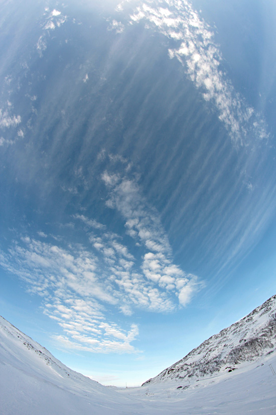
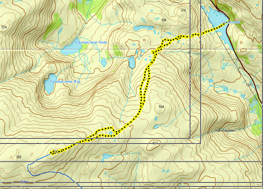
This year, Ti på Topp has started earlier than usual and includes 5 winter tops. I had a day off last Tuesday, and the weather was still really nice, so I decided to challenge myself and go up Kjølen (790 m). It’s one of the most prominent mountains near Tromsø (it also has the flight radar on top), but I had never been there. I’d read that there was very little snow in places and decided to go up on snowshoes as you’re more flexible that way. I started from Finnvikvatnet in glorious sunshine 🙂 I only took our new fisheye lens with me, as I wanted to get more familiar with it.

Finnvikvatnet, the frozen lake where I started my trip. Enough tracks to follow :) Pretty clouds!

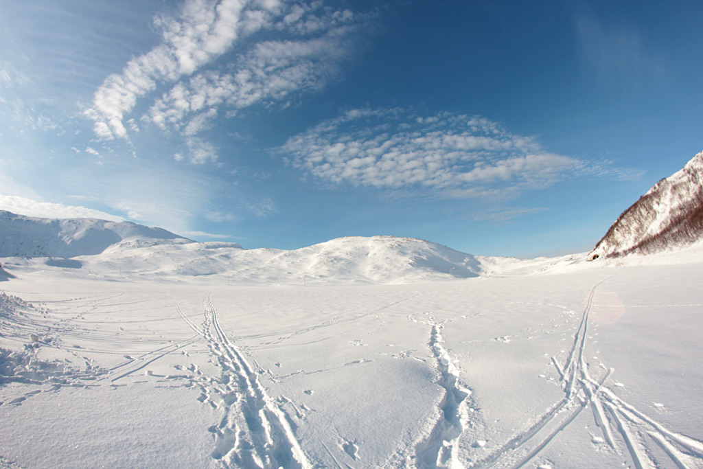
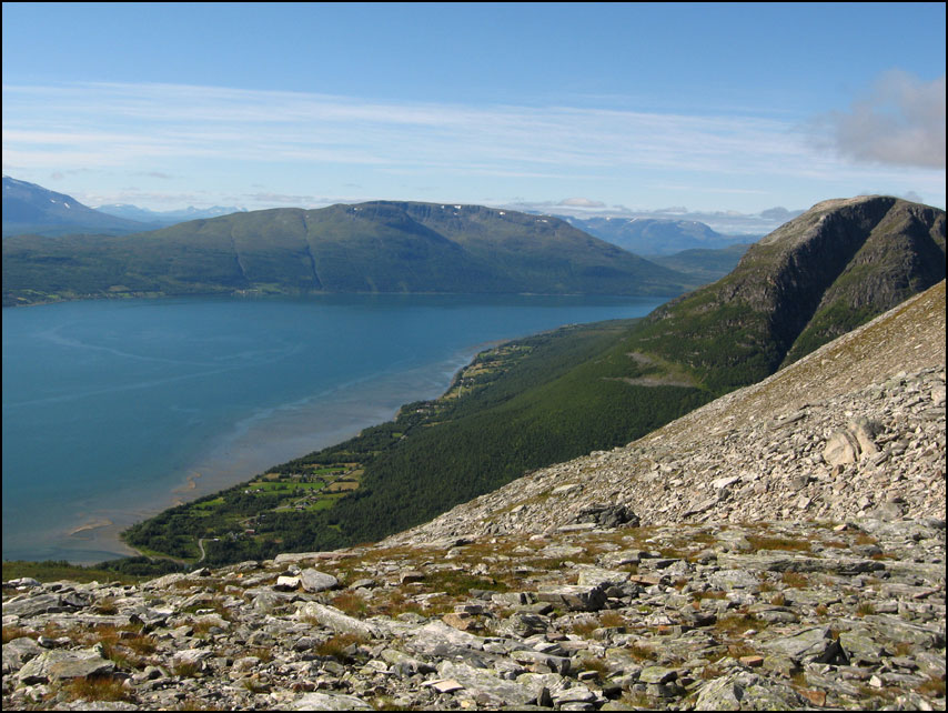
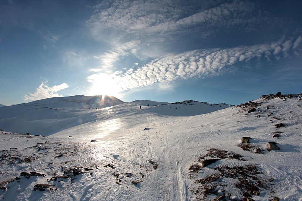
There were a couple of other people with the same idea, most of them on fjellski’s, but also a woman who just went on foot. The ascent is quite gradual and the views are really nice. I saw quite a lot of reindeer on the way, but with the fisheye lens it’s impossible to get a photo of them – you’ll never get close enough 😀

At some parts the snow had blown away and was quite icy. But unlike the 2 skiers in front of me, I didn't have to worry about scratching my skis on rocks ;) Self portrait on the way up. It was warm enough to go without hat, gloves or jacket. I even got slightly sunburnt :)

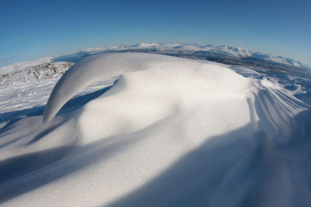
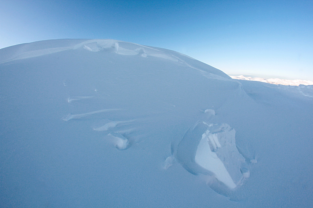
There was hardly any wind that day, but Kjølen is notoriously windblown. Especially near the top, I found all kinds of wind-sculpted snow ridges (sastrugi). They are so delicate and pretty 🙂

Sastrugi near the top

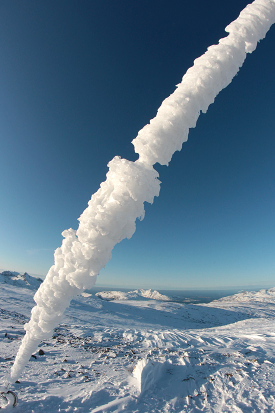
Another proof of how extreme the weather gets up there: all the poles had a huge slab of ice hanging from them. The second photo is taken on the top, there are 2 masts there and this is one of the lines securing them.

Impressive slabs of ice on the poles near the top And even more ice on the lines securing one of the masts

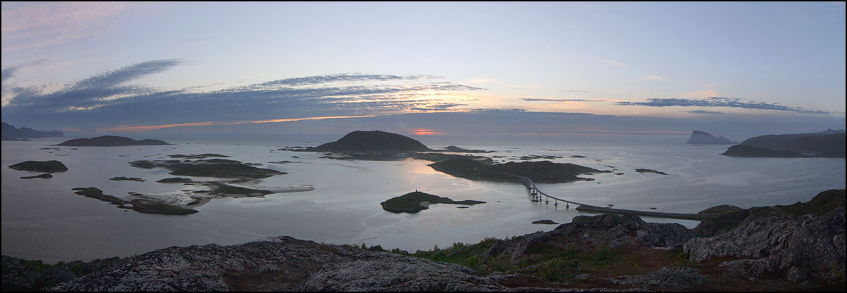
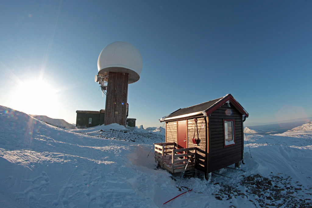
The dominating feature on the top is the flight radar. Nice to finally see it from up close! The other building is the “Varmebua” that DNT built here a couple of years ago. It’s not meant to spend the night, it’s just a small hut with a table and chairs and FLOOR HEATING. How luxury! On this sunny day, I didn’t feel like sitting inside though. I had lunch on a bench outside the radar, enjoying the view and soaking up the sunshine. I had the top all to myself, all the others were already on the way down.

The small DNT cabin in the foreground, the huge flight radar in the background The same buildings seen from the back, clearly this is where all the blowing snow ends up!

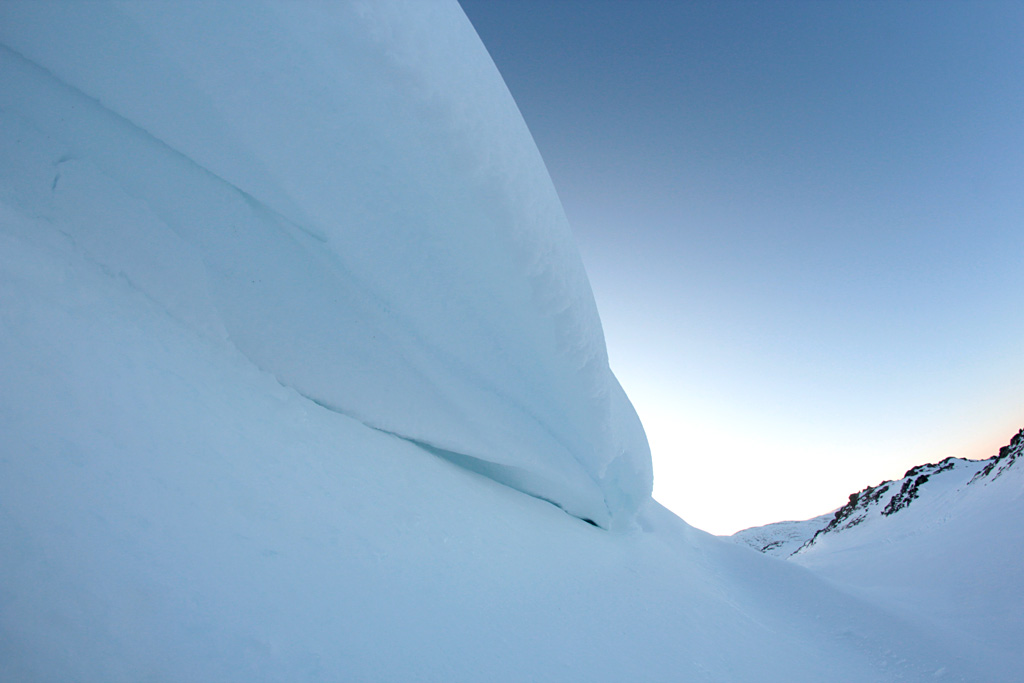
After an hour on the top, I started making my way down as well. I took some detours to look at interesting snow features…

A big block of snow broke off from the top and tumbled down An overhanging 'wave' of snow

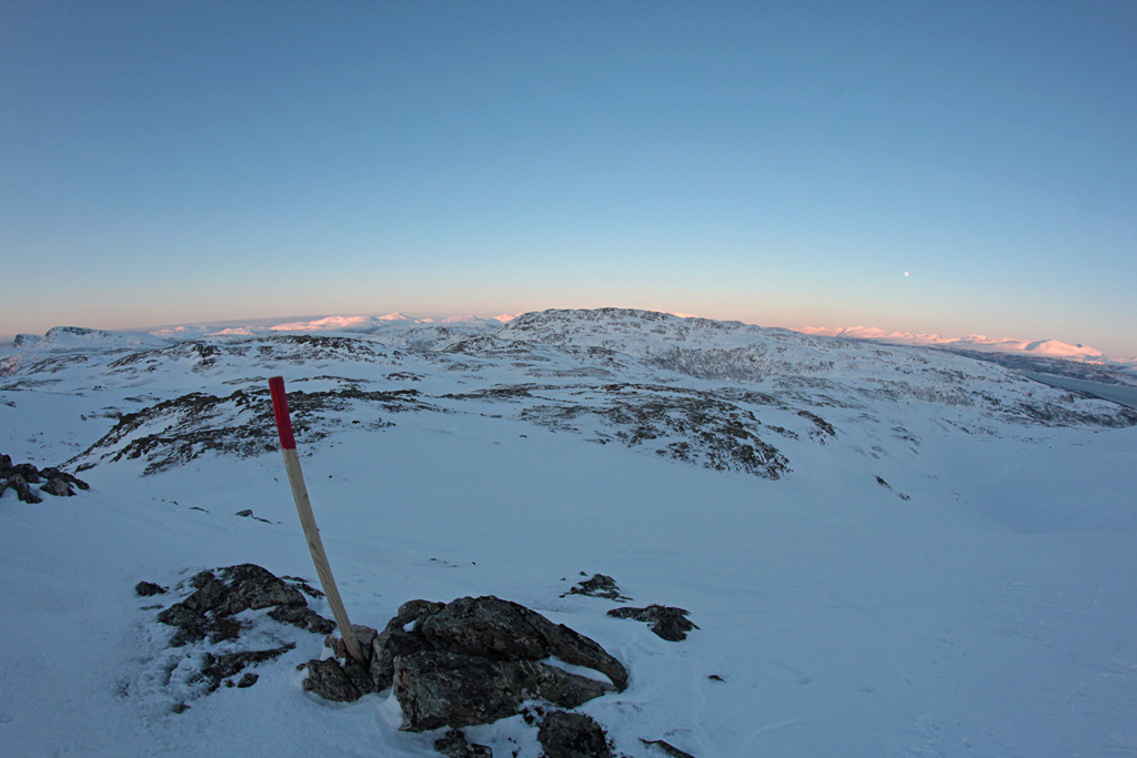
The shadow of the setting sun caught me up on the way down, but the view of the last sunlight on the surrounding mountains was beautiful!

The last sunlight on the mountains in the distance. The rising moon was beautiful, but with the fisheye lens it's hardly visible

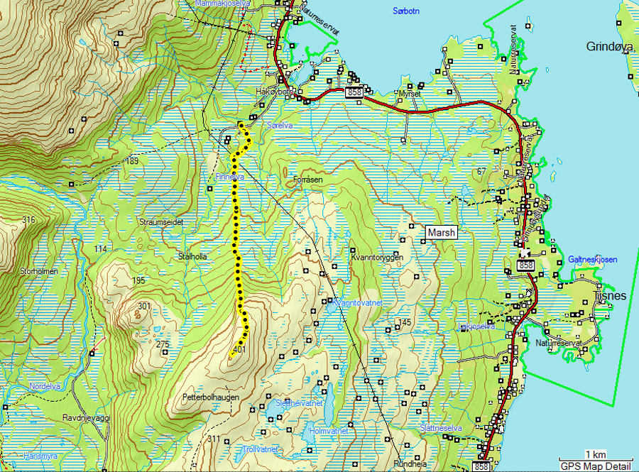
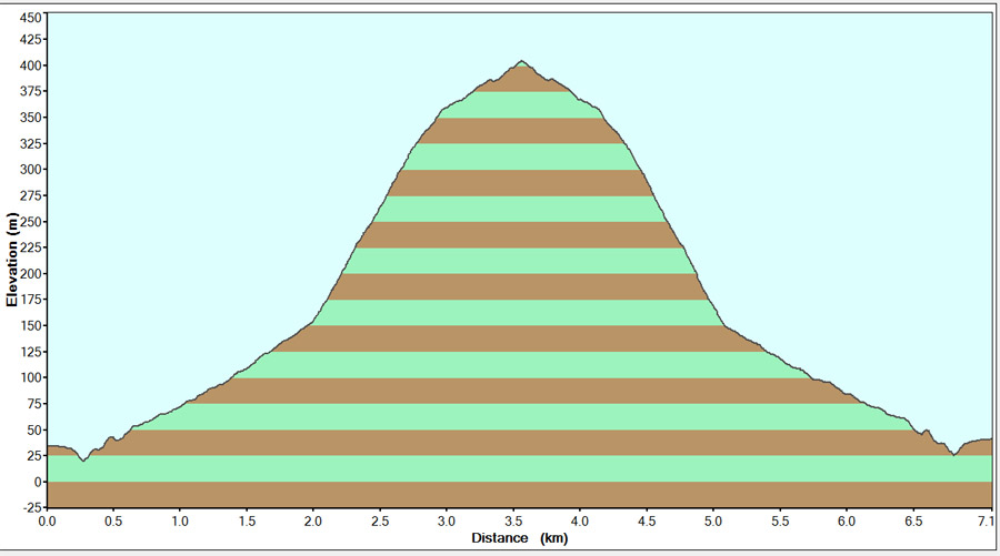
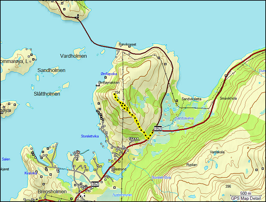
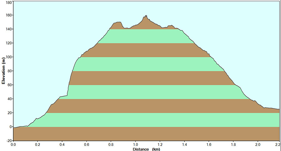
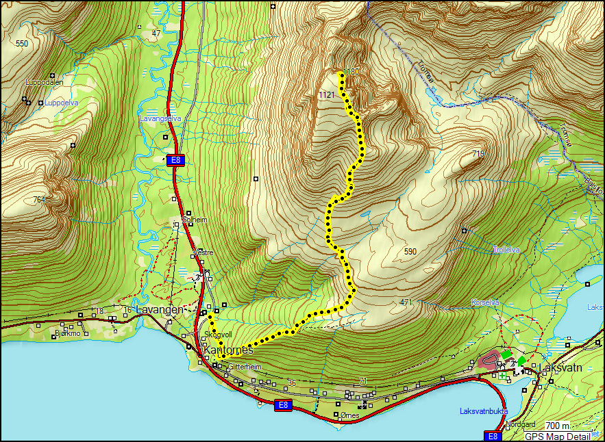
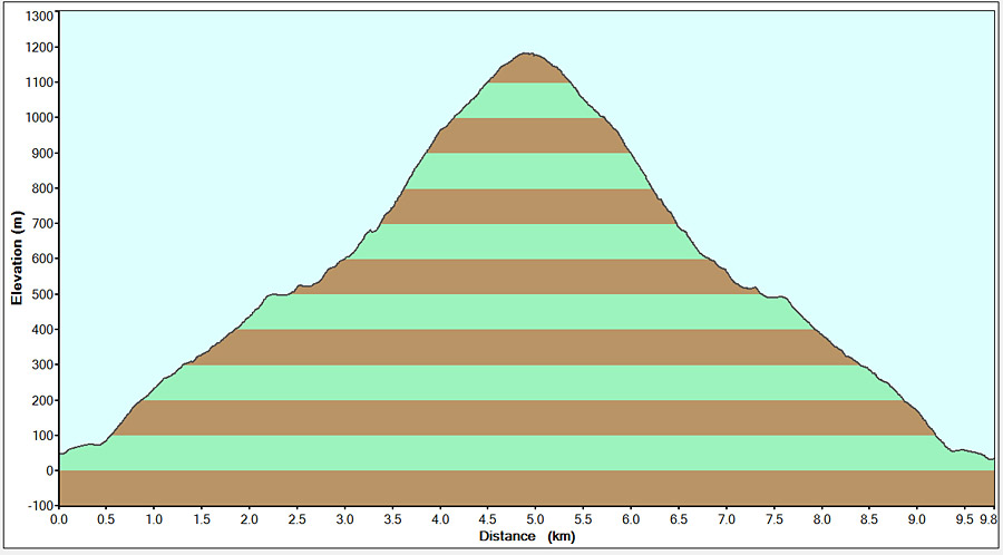
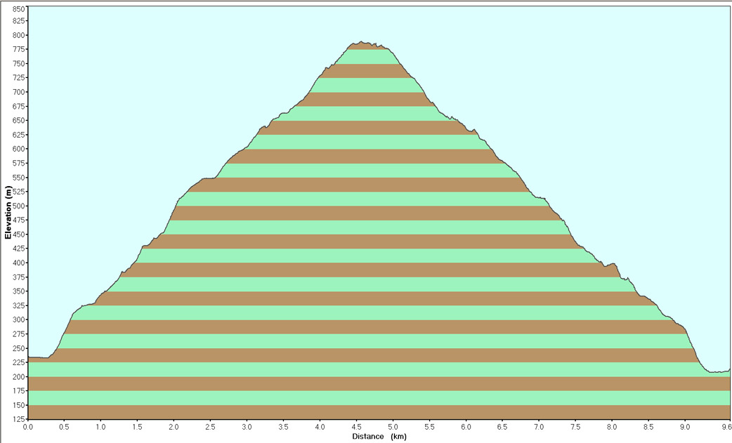
What a fun day! I really enjoyed myself. Below you can see my route and the height profile. It took me about 3 hours to reach the top (but this includes many photo and snack stops 🙂 ) and about 1.5 hour to come down.

My route up Kjølen The height profile

Two days later, the nice weather came to an end. This weekend it’s windy, snowy, at times even rainy. A great weekend for updating my blog 🙂

Ti på Topp 2010: Grønnlibruna & Ørnfløya

Ti på Topp 2010: Grønnlibruna & Ørnfløya

I went up Grønnlibruna one morning in July before a late shift at work. Grønnlibruna is 401 m high. I took the shorter route up from Håkøybotn. I have been to Grønnlibruna twice before (once on snowshoes and one failed attempt in autumn) but always from Straumsbukta. I much prefer the route from Håkøybotn, it’s a lot shorter and very direct (the other route goes up to a slightly lower top, then down to a valley and up to the actual top). The total length was 7.1 km and it took me 2 hours and 45 minutes (about 1.5 hours up, a short break on top, and down in one hour).

Map of the route to Grønnlibruna Height profile of Grønnlibruna

I didn’t have very good weather. The weather forecast (which I wrote myself :D) promised the weather would improve very quickly, and I was hoping for sun on the top. However it took a bit longer to clear up, and in the end the sun came out when I drove back to town! I didn’t take a lot of photos, but it was a very nice walk. The first part goes through fairytale forest with flowers everywhere. The top is more rocky and the view was nice, even with all the clouds.

The path through the forest View towards Tromsø

More recently, Paul and I went up Ørnfløya on a Friday evening. It was going to rain all weekend, so we decided to make the most of the last bit of good weather. Ørnfløya is near Sommarøy and it’s quite a drive from Tromsø (about an hour). It’s by far the easiest of all tops though, it’s only 160 m high and the total walk is 2.2 km. It took us 25 minutes to reach the top, and about the same to come down.

Map of our hike up to Ørnfløya Height profile of Ørnfløya - I changed the batteries of the gps on the way up which confused the gps a bit!

We were hoping to watch the sunset from the top, but although we reached the top just in time (at 22:00), the sun had already disappeared behind a layer of clouds. Still, the view was very nice! It’s great to see Sommarøy from above.

Panorama of the view towards Sommarøy, with Senja on the left and Håja on the right (in the mist) A boat passing below

We didn’t stay on the top very long as it was getting quite chilly. We drove to Sommarøy and enjoyed a cup of tea on a beach there. It was a quiet evening and we watched some seagulls fight with what we think was an otter. The tide was coming in very strongly and we watched a school of small fish fight with the current while being attacked by bigger fish. Life is unfair 😉

Us on top :) One of the bridges in Sommarøy

The clouds were really pretty! The midnight sun is gone since late July, but at 23:30 it was still pretty light. It’s changing very quickly though, this was only a week and a half ago, but now we do have real darkness!

The sky was beautiful! The midnight sun is gone, but at 23:30 it's still not really dark

Ti på Topp 2010: Blåtinden

Ti på Topp 2010: Blåtinden

Yesterday I climbed Blåtinden with Ine-Therese. This is one of the extra tops, which are more demanding. Blåtinden is 1180 m hight. The total hike was 9.8 km and it took us about 8 hours – 4 hours to get up, 3 hours coming down, and a nice long lunchbreak on top 🙂

Map of our hike up to Blatinden Height profile of Blatinden

The hike starts very steep, but we had some help with us! Ine-Therese brought her 2 dogs (Luna and Sepi). They are sled dogs, and we both had a harness around our waist connected to the dog. I was surprised what a difference this makes! The dogs have a lot of energy and almost literally drag you up the mountain 😀 The first part of the hike goes through the forest, until you reach a plateau. From there it’s a steep and rocky climb to the top. These are some views on the way up…

The view on the way up Ine-Therese with the Lyngen Alps in the background

After 4 exhausting hours, we made it to the top! The last bit is very flat, which was good – I had hardly any energy left by that time. The view from the top is really good 🙂

We made it! Taken from the top The road towards Ramfjorden. The mountain at the far right is Tromsdalstinden.

The cairn on this top is really impressive – it’s about 4 meters high and it has a room at the top that you can climb into. Of course we had to try that 🙂 It was about 9 degrees but there was hardly any wind, and we enjoyed a long lunch break in the sun.

The cairn on top was very impressive - 4 m high, and it had a room you could climb into! We took a long lunch break at the top

You can look very far in every direction. This panorama shows the Lyngen Alps. Luna and Sepi also enjoyed their break, it must be quite tiring for them too!

The view towards the Lyngen Alps (on the left a glacier as well) Sepi and Luna at the top

Around the top there were some very steep drops. The path goes quite close to them at times, we tried not to look down too much 😉 There were some low clouds drifting below the top, and at some point we decided to go down in case the clouds would increase and cover the top.

Steep drops on all sides! A few clouds passed below the top

The way down wasn’t easy, especially the bit with loose rocks – very hard on your knees. And the dogs can’t help you much coming down 😉 They are very well trained though, on the way down they walk behind you so that you don’t trip over them or get pulled down by them. It took us about 3 hours to come down. We were quite exhausted and very happy to see the car again 😀