Ti på Topp 2010: Blåtinden
Yesterday I climbed Blåtinden with Ine-Therese. This is one of the extra tops, which are more demanding. Blåtinden is 1180 m hight. The total hike was 9.8 km and it took us about 8 hours – 4 hours to get up, 3 hours coming down, and a nice long lunchbreak on top 🙂
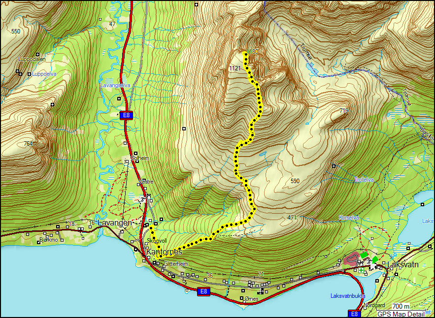
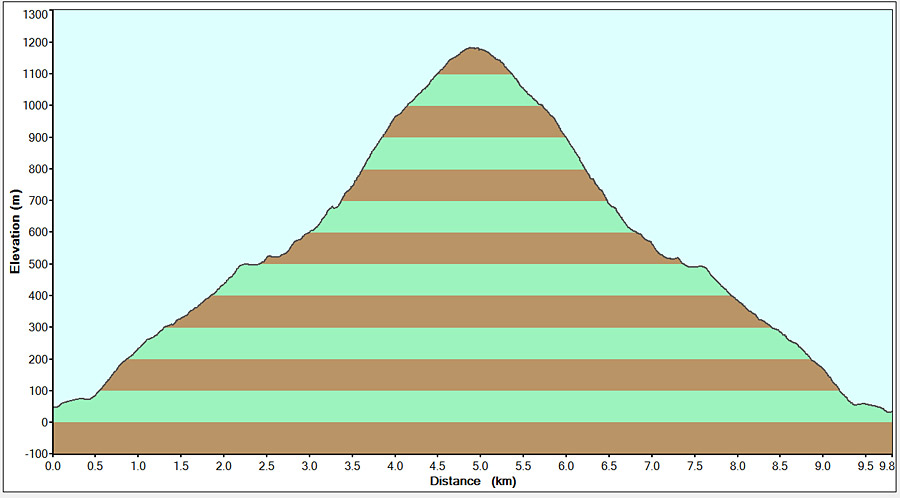
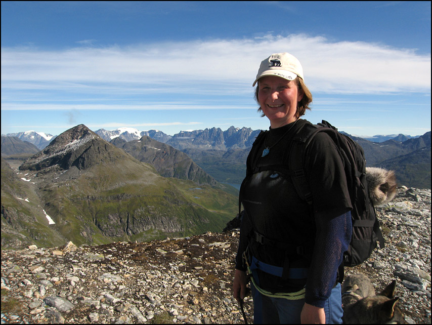
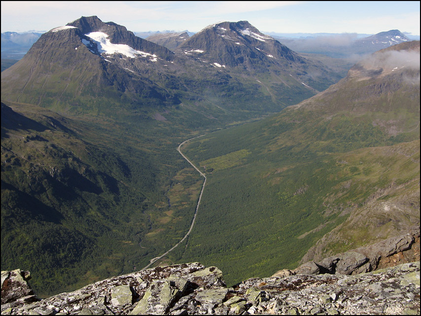
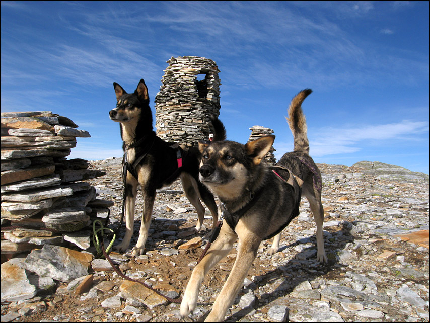
The hike starts very steep, but we had some help with us! Ine-Therese brought her 2 dogs (Luna and Sepi). They are sled dogs, and we both had a harness around our waist connected to the dog. I was surprised what a difference this makes! The dogs have a lot of energy and almost literally drag you up the mountain 😀 The first part of the hike goes through the forest, until you reach a plateau. From there it’s a steep and rocky climb to the top. These are some views on the way up…
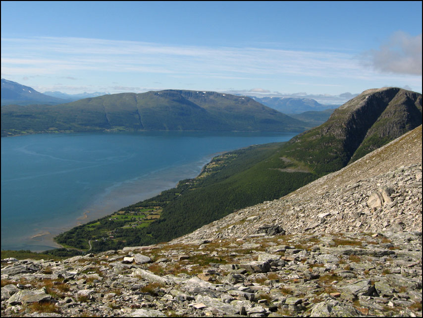
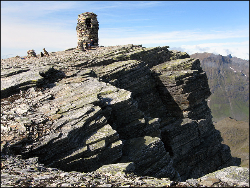
After 4 exhausting hours, we made it to the top! The last bit is very flat, which was good – I had hardly any energy left by that time. The view from the top is really good 🙂

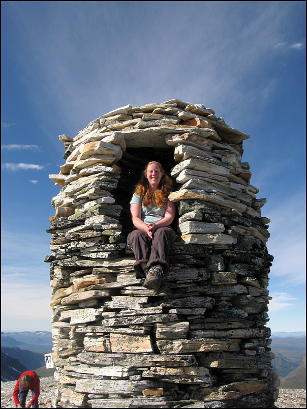
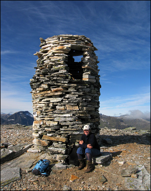
The cairn on this top is really impressive – it’s about 4 meters high and it has a room at the top that you can climb into. Of course we had to try that 🙂 It was about 9 degrees but there was hardly any wind, and we enjoyed a long lunch break in the sun.
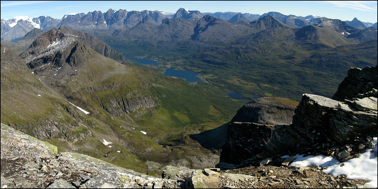
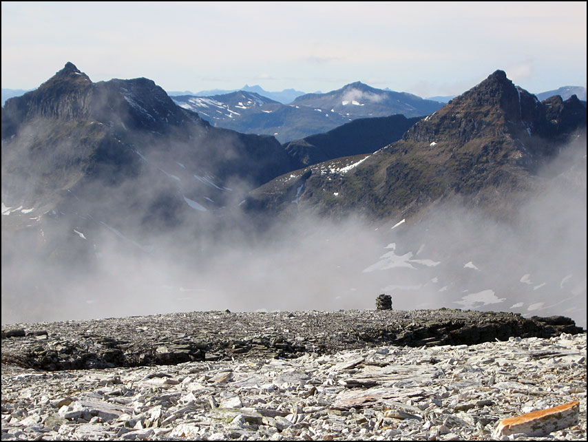
You can look very far in every direction. This panorama shows the Lyngen Alps. Luna and Sepi also enjoyed their break, it must be quite tiring for them too!
Around the top there were some very steep drops. The path goes quite close to them at times, we tried not to look down too much 😉 There were some low clouds drifting below the top, and at some point we decided to go down in case the clouds would increase and cover the top.
The way down wasn’t easy, especially the bit with loose rocks – very hard on your knees. And the dogs can’t help you much coming down 😉 They are very well trained though, on the way down they walk behind you so that you don’t trip over them or get pulled down by them. It took us about 3 hours to come down. We were quite exhausted and very happy to see the car again 😀
6 thoughts on “Ti på Topp 2010: Blåtinden”
Hi Hanneke,
Thank you for sharing you beautiful pictures from your travels. I check out your blog periodically and it always put a smile on my face. You are such a talented photographer. Congratulations on your academic achievements and career placement. I have such admiration for you. I hope the US is in your future travel plans, although who would want to leave Norway! Best wishes always.
Respectfully, Pam Berg
Hello Pam,
Thanks for your very nice comment! It’s so nice to know you still visit my blog 🙂
I do hope to visit the US in the future again! I will be going to a wedding in Seattle next summer, I’m hoping to stay a bit longer afterwards and travel around. Would love to be able to stop by in Minnesota 🙂 can’t believe that was 6 years ago, time goes so fast!
Hope all is well with you and your family!
All the best,
Hanneke
ESPLENDIDA AVENTURA ¡¡¡VIVA LA VIDA¡¡¡ SIGUE ASI,SUBIRAS ALTO.MIS FELICITACIONES
Espléndida AVENTURA ¡¡¡ VIVA LA VIDA ¡¡¡ SIGUE ASI , subiras ,(9 000 felicitaciones) ALTO.
QUE MARAVILLA,ALGUIEN QUE SE EXCUSA POR UN ERROR,ME GRATIFICA VER QUE ESTAMOS CIVILIZANDONOS.
” NO PROBLEM”
y…gracias por el buen humor,me voy a dormir,son la 3,25h….chiaooo
wow! that must have been a really adventurous trip!
I will get back to your blog, I like it a lot. Thanks
Comments are closed.