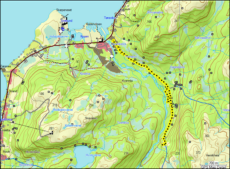
Ti på Topp 2010: Nedre Kovhaugen & Raudfjellet
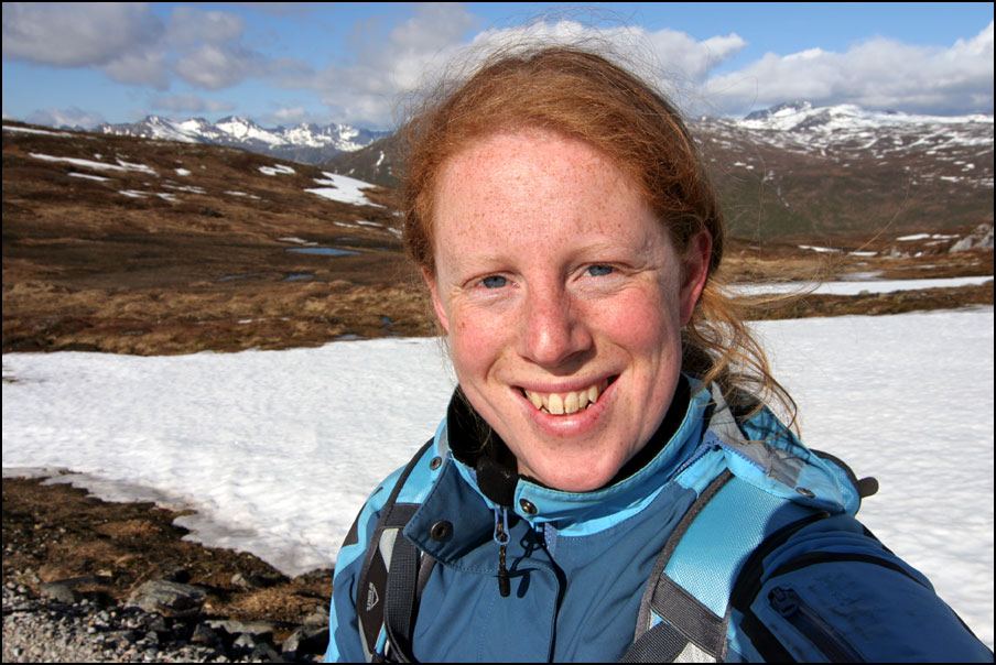
Last Sunday I had to work a late shift (starting at 15:00) but we decided to go for a short hike before. We chose Nedre Kovhaugen as it’s quite nearby and a very easy hike. It was in Ti på Topp last year as well, so we were familiar with the route. Actually it’s not even a real “top”, you follow a valley until you get to a little bump and that’s it :D. Below are the map and the profile. This time the profile is only for the way back as the gps height was wrong on the way there. Nedre Kovhaugen is 155 m high, the total trip length was just under 8 km and it took us 3 hours and 15 minutes – but that’s including a long lunch break and a few detours 😉
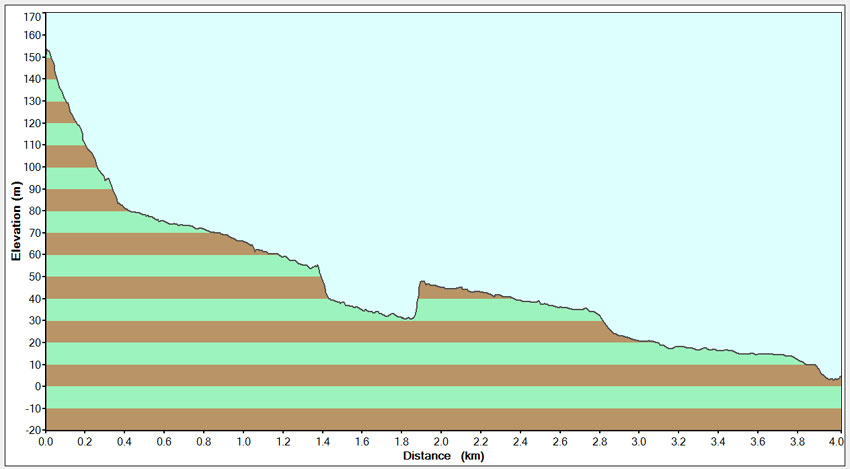
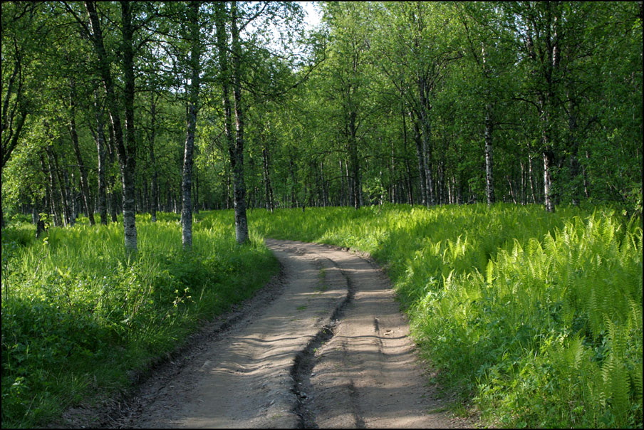
Paul at a little meandering stream, and the river down in the valley. We went down to the river, that’s the funny “bite” out of the profile!
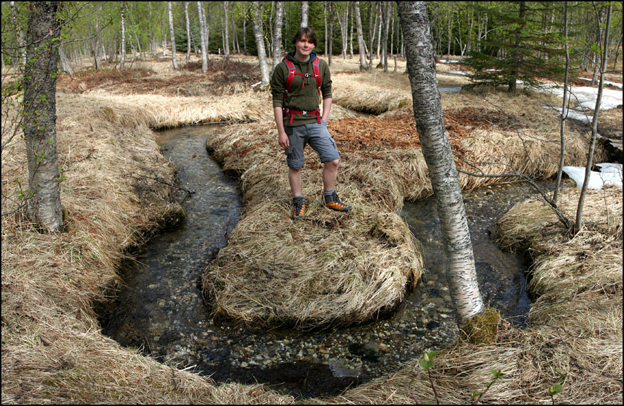
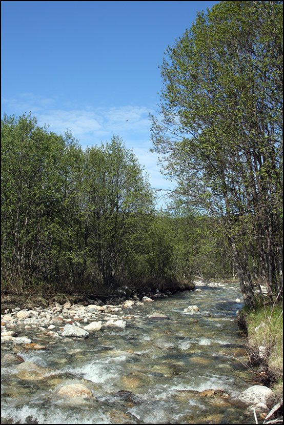
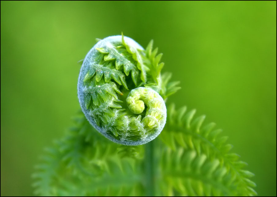
As we had limited time, I didn’t take many photos. Last year we did this hike at the end of June, when it was very green in the valley and it was full of ferns! Those photos never made it onto the blog as I was too busy finishing my PhD – so thought I could share some now! In the first photo you can see how the birch tree has a different colour at the bottom. Someone explained me that you can tell the snow height from this – as lichen only grow above the snow and that’s what makes the brown colour.


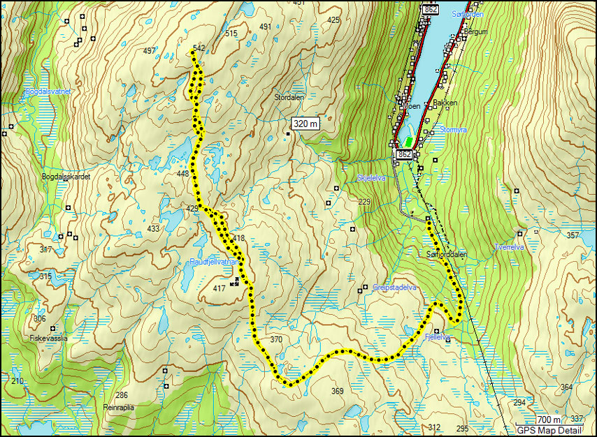
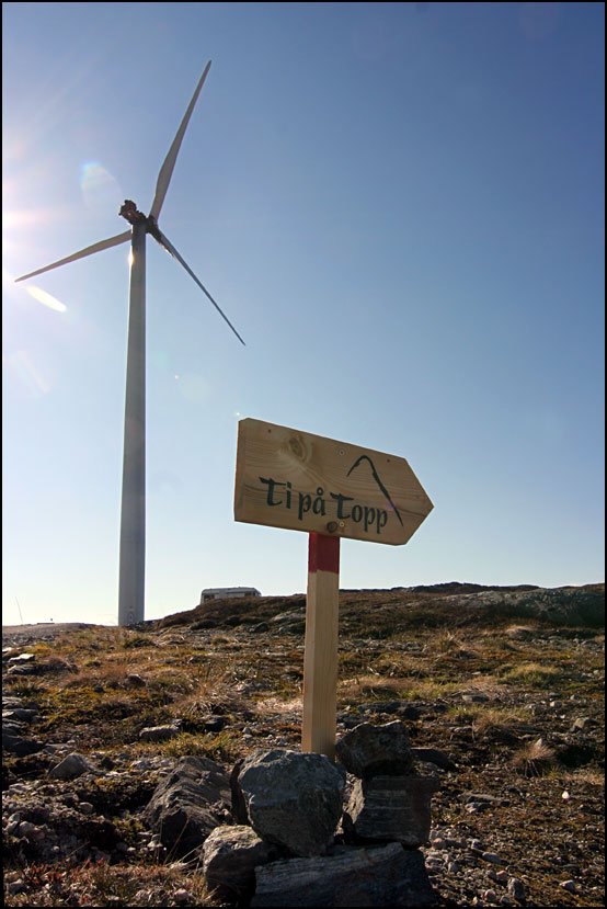
I had Monday off, and decided to climb one of the moderate tops, as I had all day. I chose Raudfjellet, a mountain on Kvaløya, about 40 km from Tromsø. It’s 542 m high. The route follows a gravel road all the way up to 400 m, where there is a wind turbine. It’s quite a long route, about 15 km, and it took me 5 hours and 20 minutes.

On the way up, it was quite cloudy and it would rain every now and then. On the way back it had cleared up and it was very sunny. The next two photos are taken from the same place, and show how different the landscape looks in different weather!
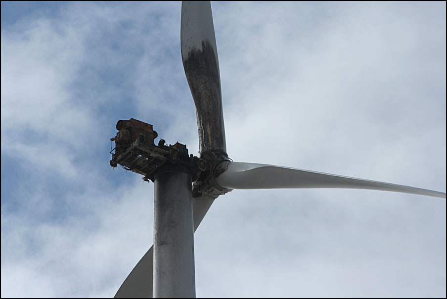
From the wind turbine, the route was signposted to the top of Raudfjellet. When I got close to the wind turbine, I realised something was not quite right… and suddenly remembered seeing photos in the newspaper of it being on fire! Click here for a photo and the news article. Quite sad really, it must have cost a lot to install it so high up (and have a road built all the way). I don’t know if they plan (or can afford!) to repair it.
After 3 hours, I finally reached the top. It has a great view over the sea and several islands, and it was a nice surprise to find a clear and sunny view that way! It was quite windy on the top though and I was FREEZING. I ate lunch in the lee of the cairn, but I couldn’t stay very long as I was getting very cold.


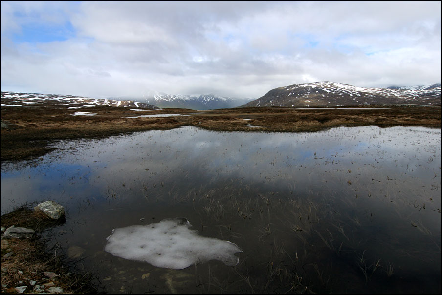
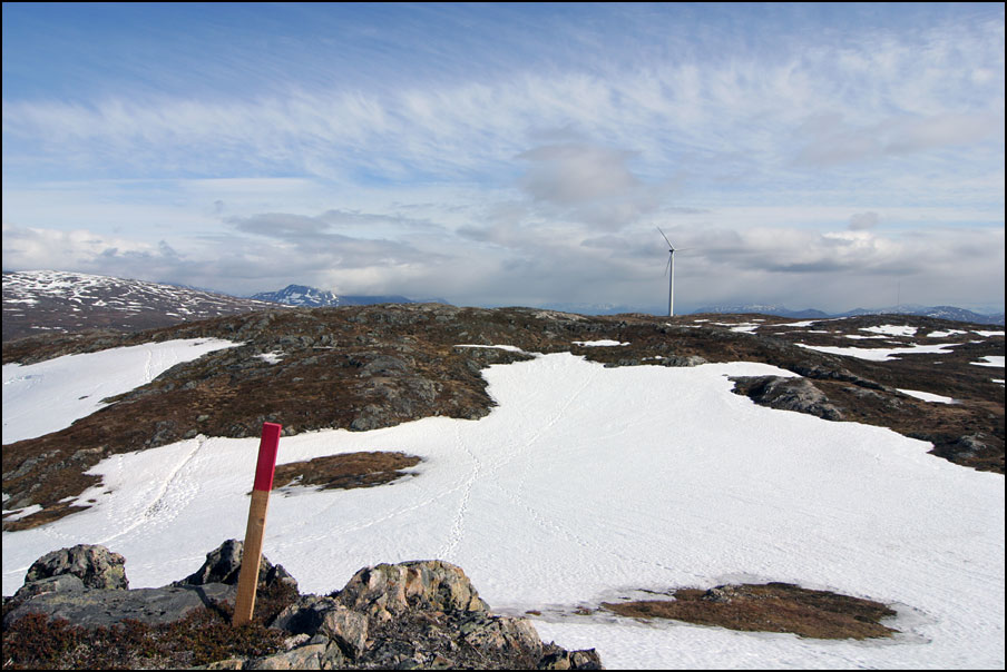
Here are some views from the way back: the red signs showing the way, and the “paths” over the large areas with snow. In some places there were melting ponds on top of the snow, with really nice blue colours.

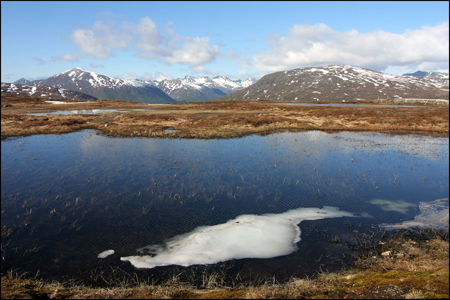
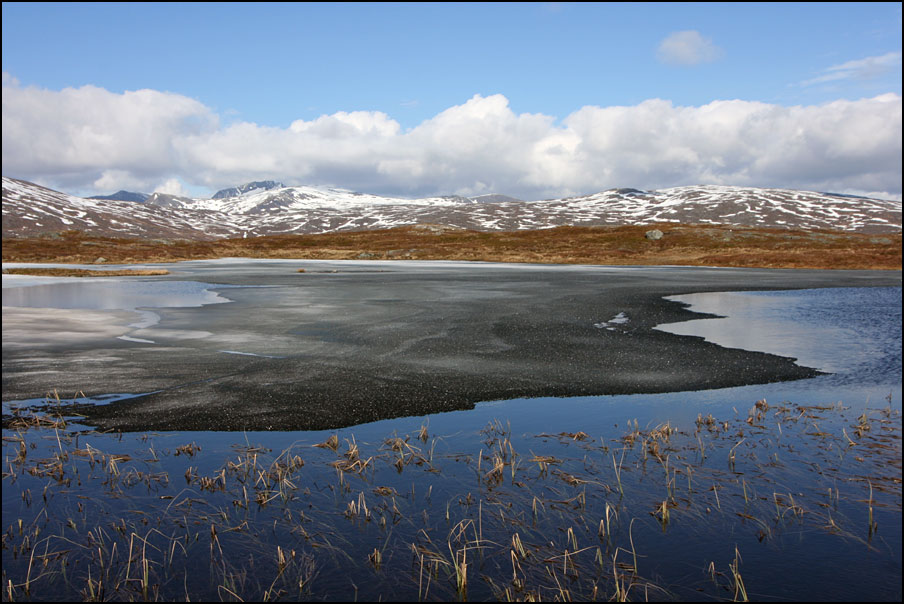
It was so sunny on the way down that I got quite sunburnt – got to remember to bring sunscreen next time! I passed some small lakes, which still had some ice cover on it. The strange thing is that some of the ice was looking very black, and sparkling in the sun. I guess it’s melting, but I don’t know where the black colour comes from…
That’s all for now, it’s almost bedtime for me. I got up at 4:30 this morning!! I went on a very exciting trip with a collegue: we flew Tromsø-Hasvik-Hammerfest-Berlevåg-Båtsfjord-Vadsø-Kirkenes, and from there back to Tromsø, on quite a small propeller plane, sitting in the cockpit! It was really fantastic 🙂 I work as an aviation meteorologist some of the time, and write forecasts for 15 airports in Northern Norway. This trip was to get more familiar with the airports and their topography, and to talk to the pilots about how they use our products and what we could improve. We also visited the control tower in Kirkenes, really fun to see “the other side” of flying!
7 thoughts on “Ti på Topp 2010: Nedre Kovhaugen & Raudfjellet”
Mooie fotos en eindelijk groen!
Ik zou ze trouwens wat meer sharpenen. Mijn site is weer online in nieuwe vorm, maar het is nog niet klaar!
groetjes Oscar
Dankje 🙂 Maar de groene foto’s zijn van vorig jaar 😛 Het is hier nu wel aardig groen, maar zodra je iets hoger gaat is er nog niet zoveel groen te bekennen.
Ik houd niet van oversharpenen, maar het komt ook doordat ze automatisch verkleind worden in de popup, afhankelijk van je scherm resolutie. Ik vind ze nu eigenlijk te klein, ben nog op bezoek naar een betere Lightbox editie zodat ze wat groter openklappen, vooral de verticale zijn wel erg mini!
Jouw website opnieuw opzetten zal vast een hele klus zijn 😐 had je nergens een backup? Succes!!
Hoi Hanneke,
Voor mijn website gebruik ik nu Slimbox v2, die opent gewoon de foto’s zo groot als ze zijn, en de title tag verschijnt als beschrijving onder de foto. Is geloof ik compatible met Lightbox.
Ik had wel een backup maar niet zo recent, en ik wilde ook wel wat anders 🙂
Ik moet nog veel beschrijvingen toevoegen maar voor de rest is mijn site weer begaanbaar!
Oscar
Ik heb vorige week een nieuwe versie van Lightbox geinstalleerd, doet die het niet dan?? Want als het goed is zijn de foto’s nu gewoon full size en ook met captions.
Je site is erg mooi geworden! Mooi ook dat de lightbox/slimbox ook bij de layout past (in het blauw). Bij mij openen ze wel wat traag de eerste keer als je op een thumbnail klikt – laadt hij ze allemaal tegelijk ofzo? Lightbox laadt de “next” foto terwijl je een foto bekijkt, niet in 1 keer allemaal. Dat scheelt wel!
Groetjes en fijne zondagavond! 🙂
4 down 11 to go. The first 5, like you said seem to be a “piece of cake”. 6 more and you get the mug!!! Can’t believe the landscape is getting so green. I guess if you stay in front of greenery you can actually see it grow. Maybe the black is part of the ash fallout from the volcano in Iceland. I can’t say the name and of course can’t spell it either. Or maybe the blac is blackness of sympathy for the environmental damage of the oil spill in SE USA…LOL..LOL… I just can’t believe the ecological disaster that was caused by greed.
The very green photos were taken last year at the end of June, but indeed it goes green extremely fast here! I’ve been thinking of taking some sort of time lapse video of it one day 🙂
I have no idea about the black colour, but those are some interesting theories 😀
Yep, 11 to go. The last one was actually a “medium” one, it wasn’t that difficult but it was a long walk and I got really tired at some point. I haven’t done any more since that one, as we’ve had constant rain here 🙁 Hoping for a change of weather soon!
ja nu zien de foto’s er beter uit inderdaad 🙂
Mijn slimbox heeft zijn eigen cascading style sheet waarin ik de kleuren en wat andere dingen veranderd heb. Ik weet niet of hij ze allemaal tegelijk laadt, ik denk tenminste een zeker aantal foto’s, want na de eerste (paar seconden) laadt alles heel snel.
groeten van Oscar
Comments are closed.