Browsed by
Month: June 2010

Drijfsijs

Drijfsijs

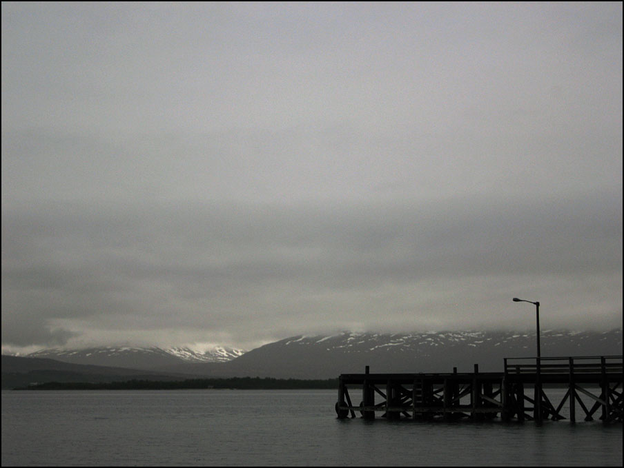
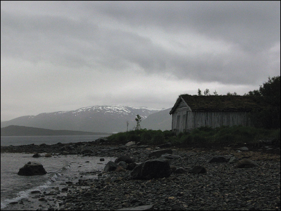
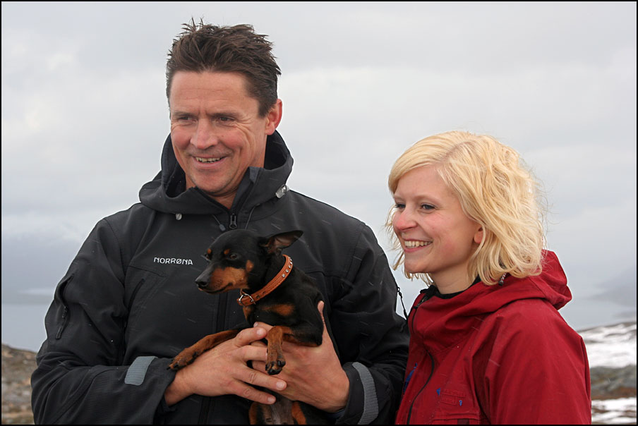
For the past week, this is what the weather looked like… (and although these photos look black & white, they aren’t – it really was that grey!). It rained a lot, and the rain was heavy – the kind of weather where I’d rather sit inside with a cup of tea than to even *think* of going outside. These photos were taken on Paul’s birthday (last Saturday). We wanted to get out for a bit after having been inside a lot. I came to regret it, as I fell on the beach bruising my legs and my arm, just after taking the second photo – the wet rocks were so slippery!

Grey and rainy... I promise this is not a black & white image! Rainy weather...

It was extra frustrating for Paul, as the boat that he bought had been delivered just before that weekend and he was keen to try it out. However, we thought it was important to have good weather conditions at the first try, so we waited for better weather to come…

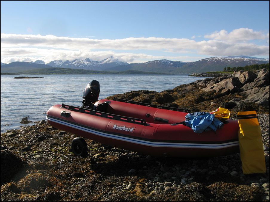
The boat is an inflatable zodiac-type boat. You can read all about it on its very own website :D. We have named it Drijfsijs, which is Amsterdam slang for any bird that floats on the water (mostly used for sea gulls and ducks, but even swans would qualify 😉 ).

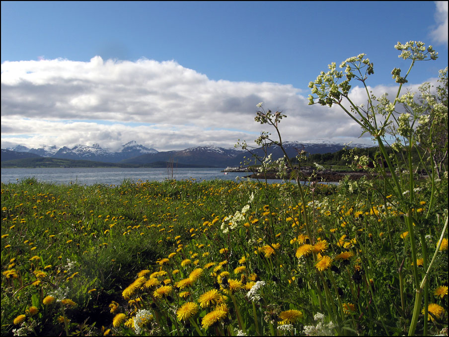
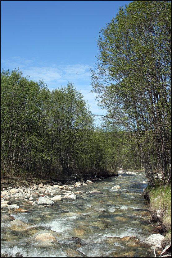
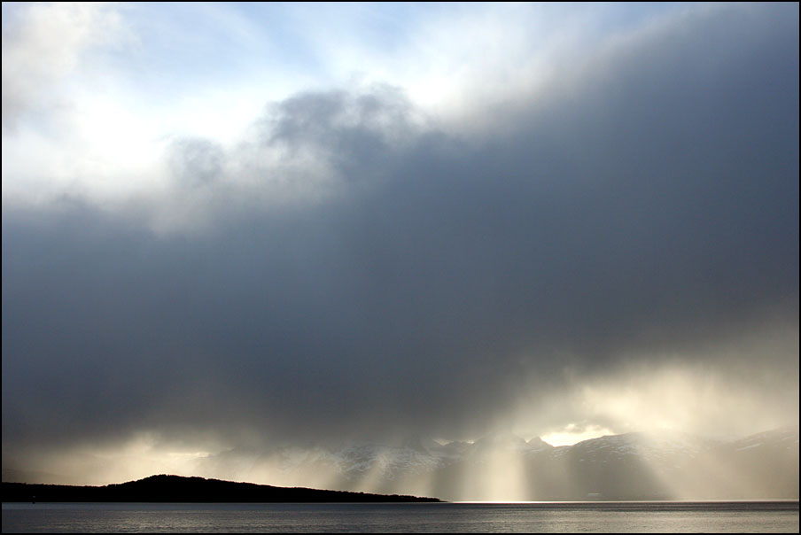
Finally, on Thursday the rain stopped and the clouds disappeared. More rain was expected the day after, so we decided we shouldn’t waste the opportunity! We drove to a nearby launching point that Paul had spotted. It’s not an official boat ramp, but it’s a nice beach with a parking lot very nearby, and out of the way of the “crowds” at Telegrafbukta – perfect. While Paul pumped up the boat (it only took him 15 minutes!), I was taking photos of the flowers (good deal 😉 ) and the green grass, quite overwhelmed by how colourful the world suddenly had become 😀

Paul pumps the boat up with a footpump - it takes only 15 minutes! I enjoyed the flowers and the colours of the landscape after all the grey weather we've had!

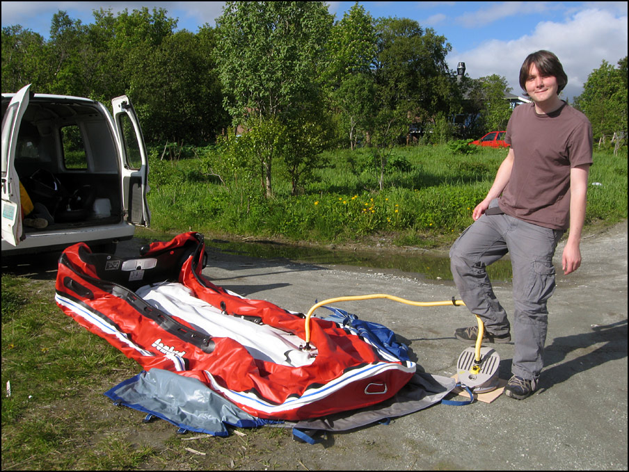
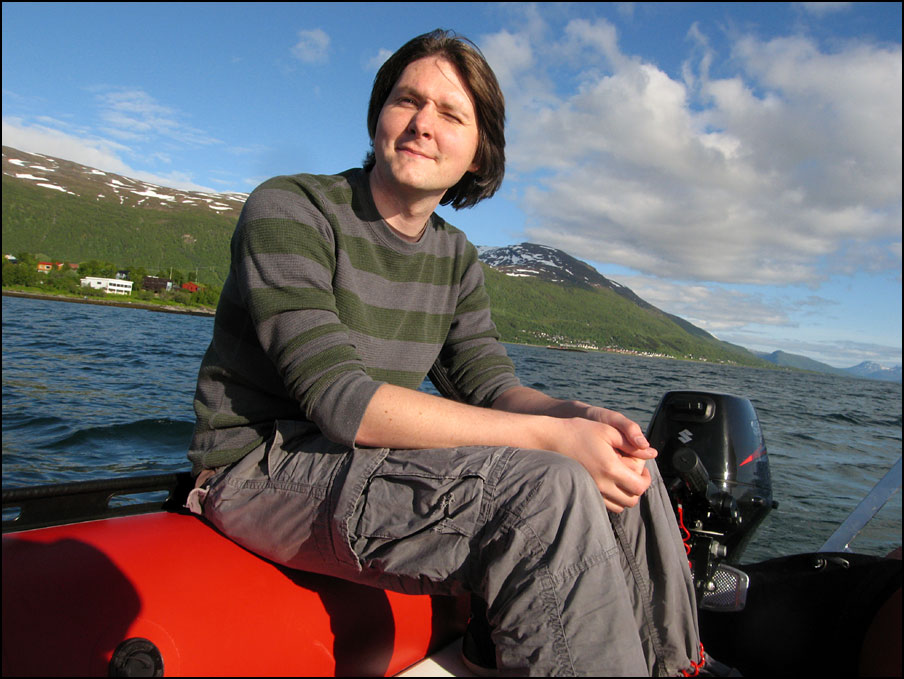
The engine is new and that means you have to start using it slowly. The first 15 minutes it had to go as slow as possible. No problem in this nice sunny weather 🙂

Ready to go! What a nice day for trying out the boat!

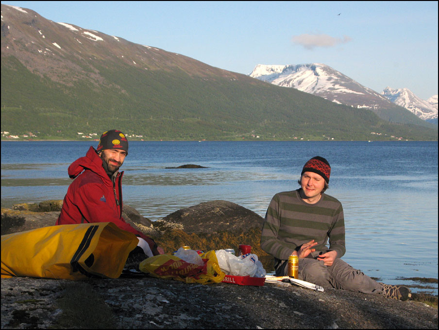
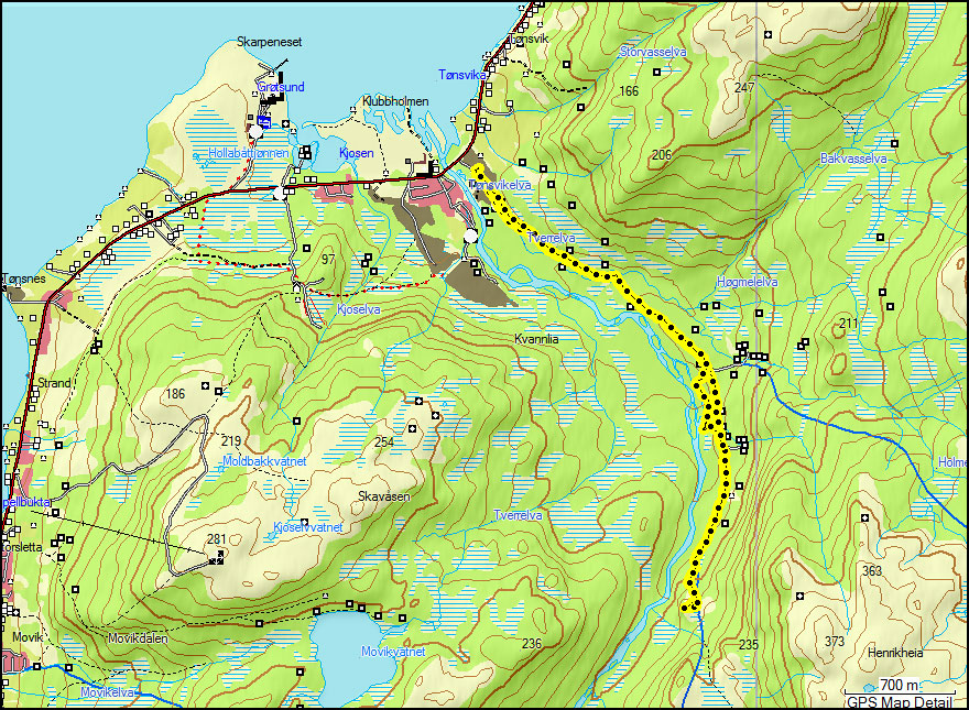
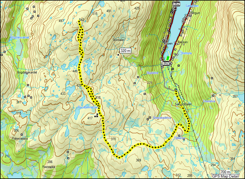
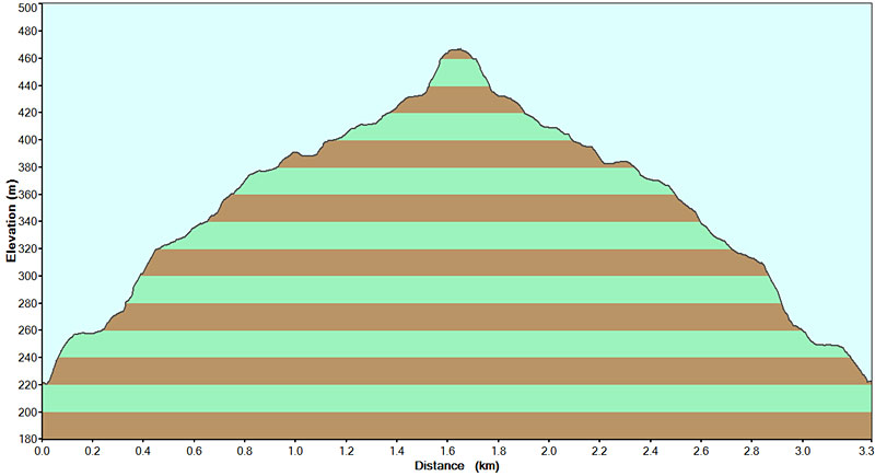
Our original plans for the evening were a dinner in town with Nicolas, so we called him to ask if he wanted to come for a boat trip instead. He was quite keen, and so we picked him up from the jetty at Telegrafbukta (the one in the very first photo). The tide was low and the ladder didn’t quite reach down to the waterlevel, so he needed to do some gymnastics before getting into the boat 😀 Below is a map showing our route, we aimed for the island of GrindĂžya, less than 2 km away.

Our route from the south tip to GrindĂžya, picking up Nicolas from the jetty at Telegrafbukta. The map also shows the little walk we did on the island.

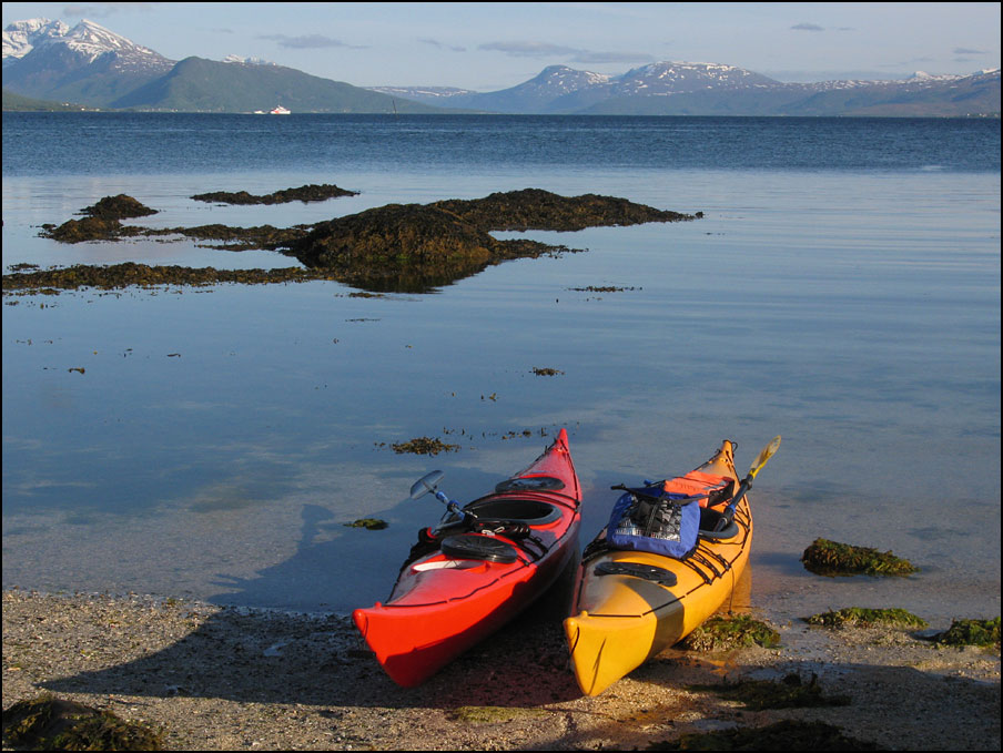
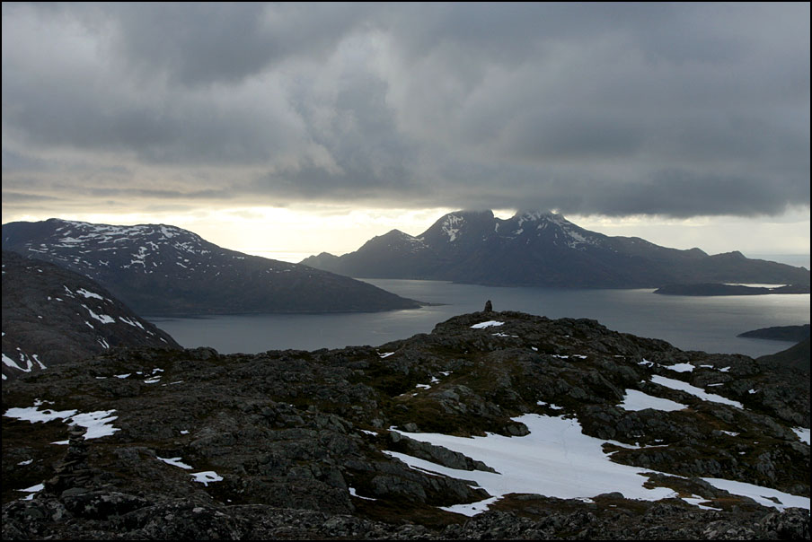
By now we could use the engine up to half throttle so we could go a bit faster. It took us about half an hour to reach the island. Of course, on such a nice evening, we weren’t the only ones there – there was another zodiac and 2 kayaks.

Arriving on a sandy beach on GrindĂžya The colourful kayaks are a bit more photogenic :)

It’s a beautiful place, we had a bbq on the rocks overlooking the sandy beach and enjoyed the views of the mountains around us. A great evening! We also explored GrindĂžya on foot a bit, although we couldn’t go very far as most of the island is closed off at this time of year, to protect the nesting birds.

Having a bbq on GrindĂžya with Nicolas - great fun! Such a beautiful place!

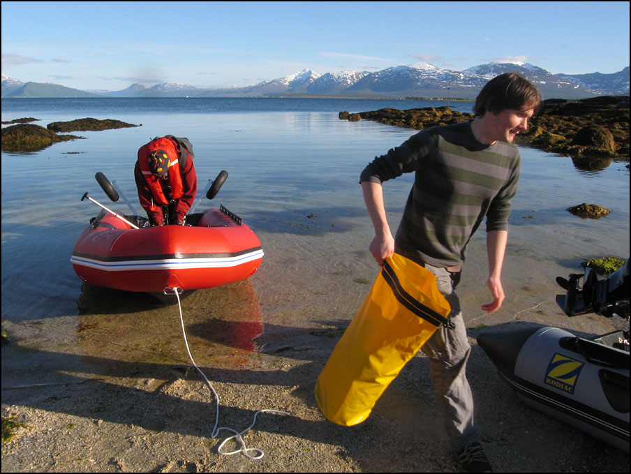
After our walk, we left the island and dropped Nicolas off at the jetty. By now, the tide had come up and the stairs were a bit easier to get to ;). When we got back to the launching place, I was a bit too keen to get out of the water and discovered I should get higher wellies – I managed to step into slightly too deep water 😐 COLD!!!

It was a fun first trip, and I’m looking forward to the many more adventures we’ll have with our boat!

Ti pÄ Topp 2010: Nedre Kovhaugen & Raudfjellet

Ti pÄ Topp 2010: Nedre Kovhaugen & Raudfjellet

Last Sunday I had to work a late shift (starting at 15:00) but we decided to go for a short hike before. We chose Nedre Kovhaugen as it’s quite nearby and a very easy hike. It was in Ti pĂ„ Topp last year as well, so we were familiar with the route. Actually it’s not even a real “top”, you follow a valley until you get to a little bump and that’s it :D. Below are the map and the profile.  This time the profile is only for the way back as the gps height was wrong on the way there. Nedre Kovhaugen is 155 m high, the total trip length was just under 8 km and it took us 3 hours and 15 minutes – but that’s including a long lunch break and a few detours 😉

Ti pÄ Topp Ti pÄ Topp

Paul at a little meandering stream, and the river down in the valley. We went down to the river, that’s the funny “bite” out of the profile!

Ti pÄ Topp Ti pÄ Topp

As we had limited time, I didn’t take many photos. Last year we did this hike at the end of June, when it was very green in the valley and it was full of ferns! Those photos never made it onto the blog as I was too busy finishing my PhD – so thought I could share some now! In the first photo you can see how the birch tree has a different colour at the bottom. Someone explained me that you can tell the snow height from this – as lichen only grow above the snow and that’s what makes the brown colour.

Ti pÄ Topp Ti pÄ Topp

I had Monday off, and decided to climb one of the moderate tops, as I had all day. I chose Raudfjellet, a mountain on KvalĂžya, about 40 km from TromsĂž. It’s 542 m high. The route follows a gravel road all the way up to 400 m, where there is a wind turbine. It’s quite a long route, about 15 km, and it took me 5 hours and 20 minutes.

Ti pÄ Topp Ti pÄ Topp

On the way up, it was quite cloudy and it would rain every now and then. On the way back it had cleared up and it was very sunny. The next two photos are taken from the same place, and show how different the landscape looks in different weather!

Ti pÄ Topp Ti pÄ Topp

From the wind turbine, the route was signposted to the top of Raudfjellet. When I got close to the wind turbine, I realised something was not quite right… and suddenly remembered seeing photos in the newspaper of it being on fire! Click here for a photo and the news article. Quite sad really, it must have cost a lot to install it so high up (and have a road built all the way). I don’t know if they plan (or can afford!) to repair it.

Ti pÄ Topp Ti pÄ Topp

After 3 hours, I finally reached the top. It has a great view over the sea and several islands, and it was a nice surprise to find a clear and sunny view that way! It was quite windy on the top though and I was FREEZING. I ate lunch in the lee of the cairn, but I couldn’t stay very long as I was getting very cold.

Ti pÄ Topp Ti pÄ Topp

Here are some views from the way back: the red signs showing the way, and the “paths” over the large areas with snow. In some places there were melting ponds on top of the snow, with really nice blue colours.

Ti pÄ Topp Ti pÄ Topp

It was so sunny on the way down that I got quite sunburnt – got to remember to bring sunscreen next time! I passed some small lakes, which still had some ice cover on it. The strange thing is that some of the ice was looking very black, and sparkling in the sun. I guess it’s melting, but I don’t know where the black colour comes from…

Ti pÄ Topp Ti pÄ Topp

That’s all for now, it’s almost bedtime for me. I got up at 4:30 this morning!! I went on a very exciting trip with a collegue: we flew TromsĂž-Hasvik-Hammerfest-BerlevĂ„g-BĂ„tsfjord-VadsĂž-Kirkenes, and from there back to TromsĂž, on quite a small propeller plane, sitting in the cockpit! It was really fantastic 🙂 I work as an aviation meteorologist some of the time, and write forecasts for 15 airports in Northern Norway. This trip was to get more familiar with the airports and their topography, and to talk to the pilots about how they use our products and what we could improve. We also visited the control tower in Kirkenes, really fun to see “the other side” of flying!

Ti pĂ„ Topp 2010: Åsfjellet & SĂžrtinden

Ti pĂ„ Topp 2010: Åsfjellet & SĂžrtinden

Ti pĂ„ Topp has started again! It’s a challenge to climb “10 tops” over the summer. If you climb more than 7, you get a mug (yay 😉 ). There’s 5 easy ones, 5 moderate ones, and 5 extra tops that are much more difficult. Last year we nearly climbed 7 tops. “Nearly”, as we gave up when we were actually very close to the top of GrĂžnnlibruna as we were getting completely soaked. Anyway, I decided to set myself a huge challenge this summer: climb ALL 15 tops. Not just 10, but also the 5 extra ones. Those are very demanding, and I’ll need the 10 other tops as training I reckon! Let’s see if I make it 🙂 I’m planning to post some photos and a map from each trip.

We started last Sunday with Åsfjellet, on the mainland, which is 336 m high. As I am a bit of a geek with my gps, here is the map and the profile of our hike:

Ti pÄ Topp Ti pÄ Topp

It was 6.6 km in total and it took us 2 hours and 40 minutes. Ok, enough of the statistics 😉 We went with 2 collegues of mine, Sevim and Silje, and their boyfriends. We didn’t have the best weather, but it stayed dry most of the time.  Here I am near the top, and we found these antlers on the way. There’s still quite a lot of snow around, as it’s been snowing a couple of times in the past week. It’s patchy – I call it “zebra mountains” :D.

Ti pÄ Topp Ti pÄ Topp

These photos are taken from the top, the view towards TromsĂž is very nice! Silje brought her little dog – it’s TINY. About as big as a cat 😀 But of course it was still the quickest to come up, and makes extra mileage by running back and forth the whole way. If we stood still for too long, he would get cold though and start to shiver!

Ti pÄ Topp Ti pÄ Topp

And a photo of us with the cairn 🙂 Notice that it was snowing while we were on the top!! We didn’t stay very long, it was not warm enough to have a break up there, so we just started our way down and had a break at the car.

Ti pÄ Topp

Yesterday afternoon, I climbed SĂžrtinden (471 m) with Sevim. Quite a lot higher than Åsfjellet, but the hike starts from a lake at 220 m, so it’s actually a much quicker hike!

Ti pÄ Topp Ti pÄ Topp

The total trip was only 3.3 km and it took us 1 hour and 40 minutes. It was very busy on the trail, there were lots of other Ti pĂ„ Topp – hikers, plus a whole school class on a trip. Everybody was in a good mood and we chatted with quite a few people on the way – nice! The first photo is taken on the way up and shows the view over TromsĂž, with Tromsdalstinden hidden in the clouds. The second photo is taken from the top. The island with its top in the clouds is VengsĂžya.

Ti pÄ Topp Ti pÄ Topp

It was cold and windy at the top, so again we decided to walk down and have a break at the car. We were hit by a shower on the way down – a mix between rain and snow which got us quite wet! I really enjoyed the trip though 🙂 On the way home, I stopped to take this photo – so many sun beams, it was beautiful!!

Sunbeams

I didn’t use to like the idea of going hiking when the weather was looking quite bad, I guess I am becoming more Norwegian 😉 As they like to say: “There is no such thing as bad weather, only bad clothing”.