Browsed by
Category: USA

USA Adventure Part 4: Fisher Towers

USA Adventure Part 4: Fisher Towers

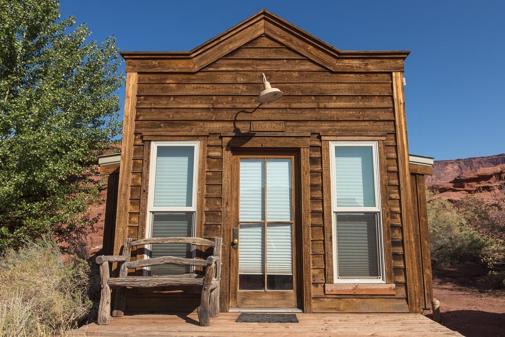
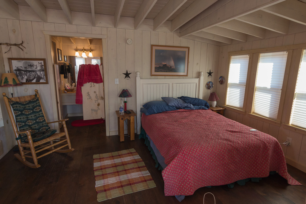
Before our trip to the USA, we spent a lot of time finding accommodation. Paul wasn’t too keen on sleeping in a tent for 3 weeks, and neither of us wanted to sleep in soulless hotels, so we put a lot of effort into finding nice places to stay, mostly cabins. The cabin we found in Moab wasn’t actually in Moab itself (a very touristy town), but a 20-30 minute drive away along the Colorado River. It was located on a horse ranch, so we weren’t completely alone there, but it certainly felt like it was in the middle of nowhere. The cabin was small, but very cosy, and we enjoyed sitting on the front step in the morning 🙂 It was true Wild West style, with swing doors to the toilet and photos of John Wayne everywhere 😉

Our fantastic cabin in the middle of nowhere! Inside our cosy cabin, with swing doors to the bathroom :)

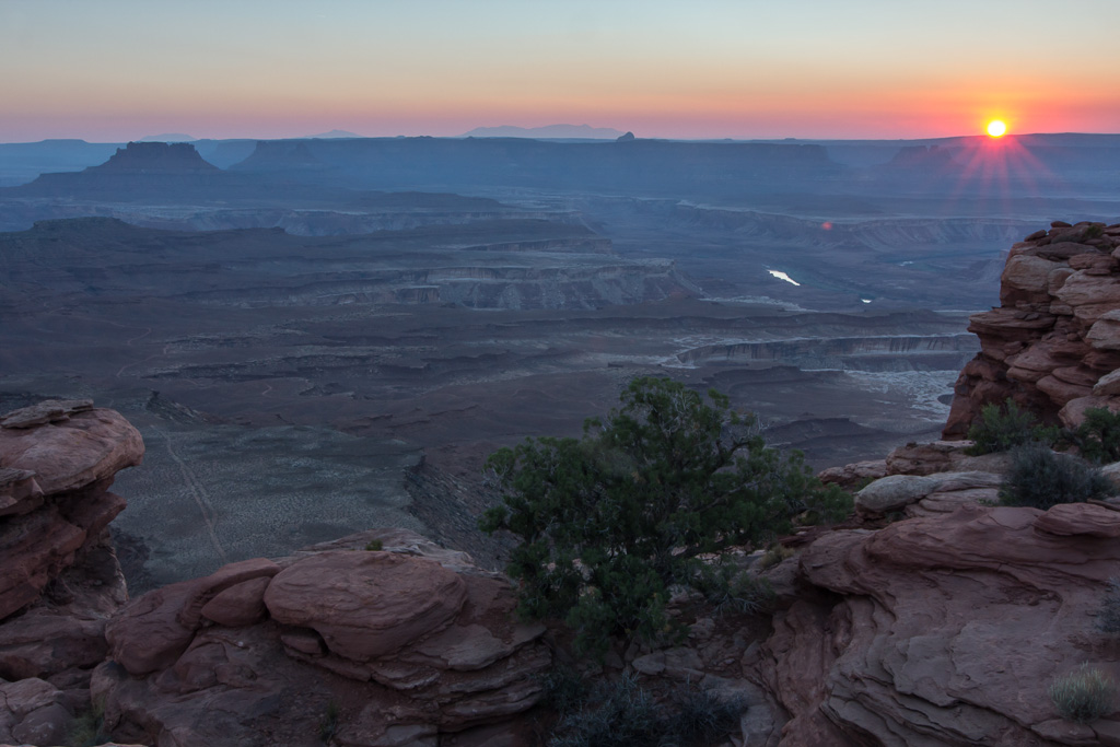
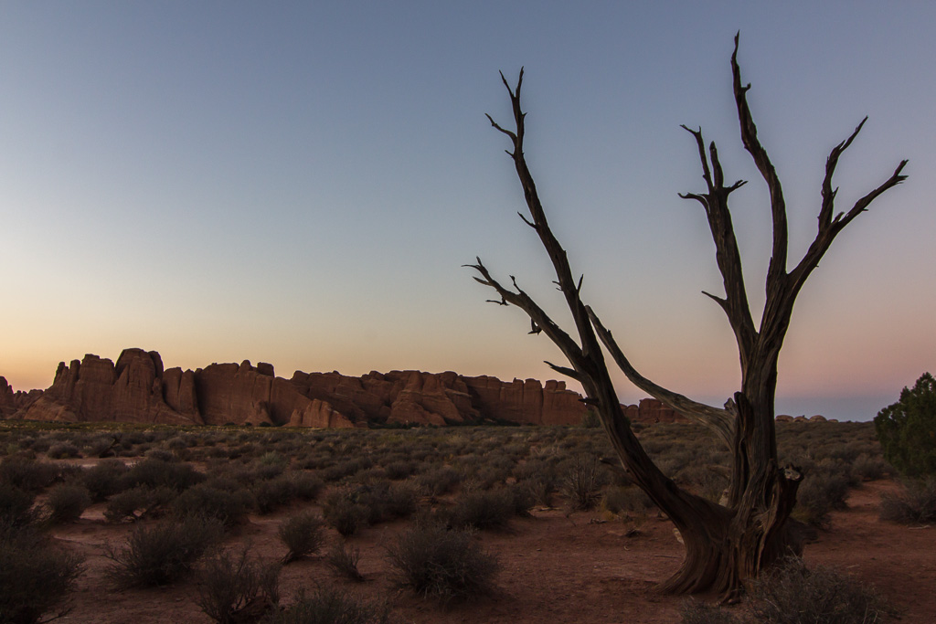
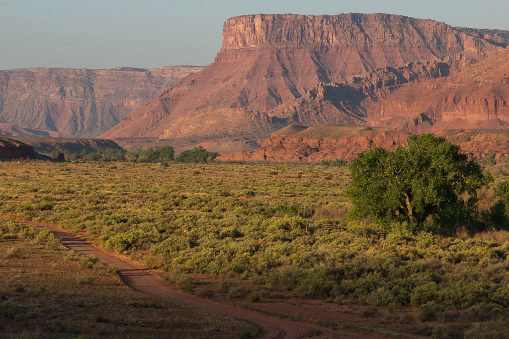
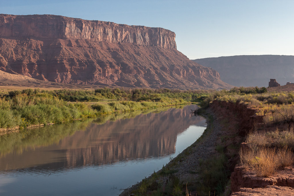
One morning I got up before sunrise (thanks to the jetlag 😉 ), and walked to the Colorado River (right behind the cabin). It was so beautiful to watch the changing light over the desert. Early in the morning, the temperature is comfortable and the light is very soft.

The dirtroad to our cabin at sunrise Reflections in the Colorado River, just behind our cabin, at sunrise

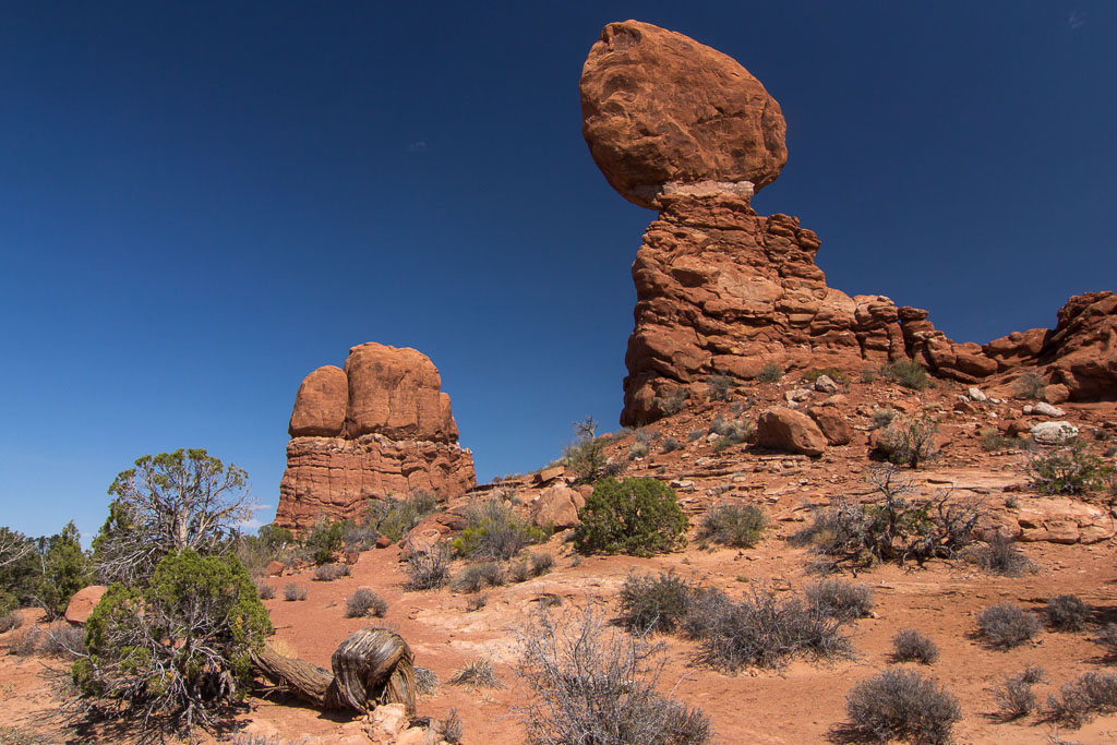
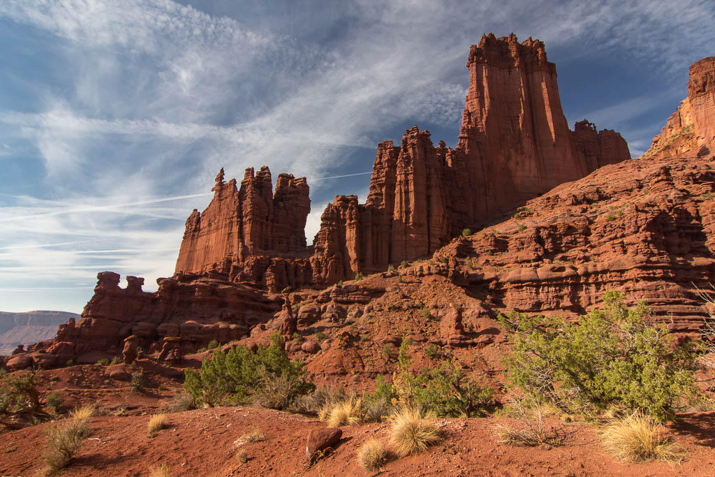
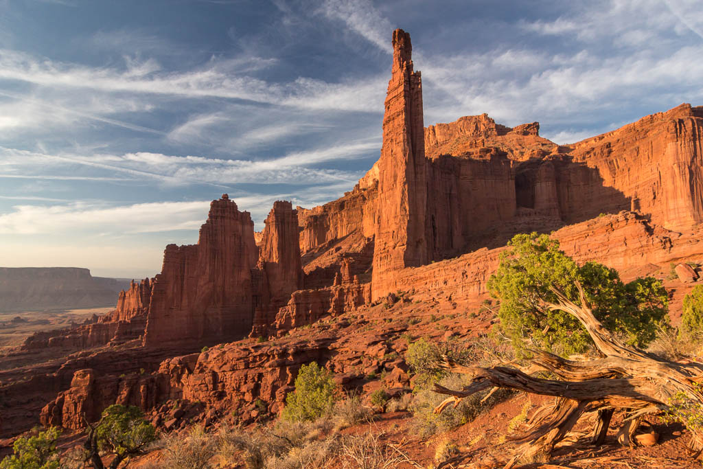
The Fisher Towers are a couple of spectacular sandstone towers that we could see from the cabin. So on the third day (our last full day in Moab) we decided to stay close to home, and hike to the Fisher Towers. It was a hot day, so we had to take it easy…

Starting our hike to Fisher Towers in the hot midday sun We took a break whenever we found a suitable place in the shade

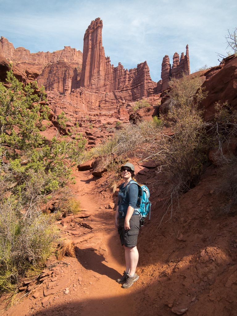
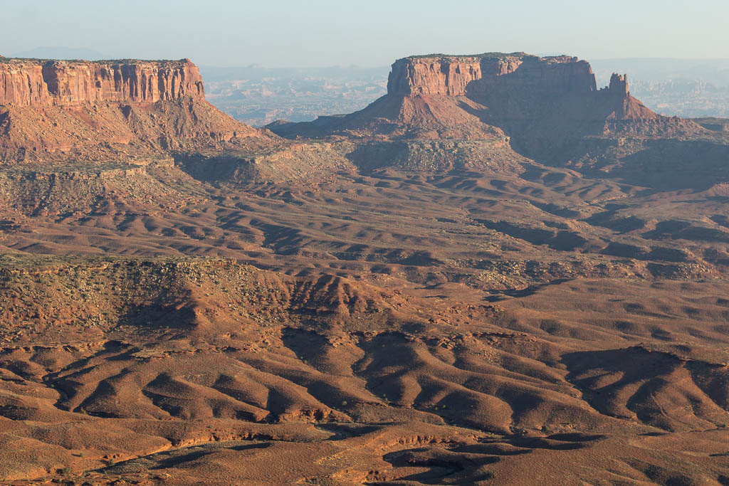
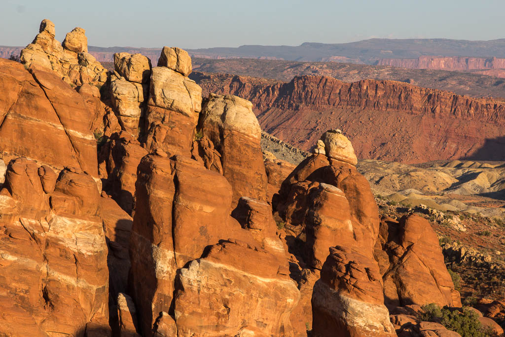
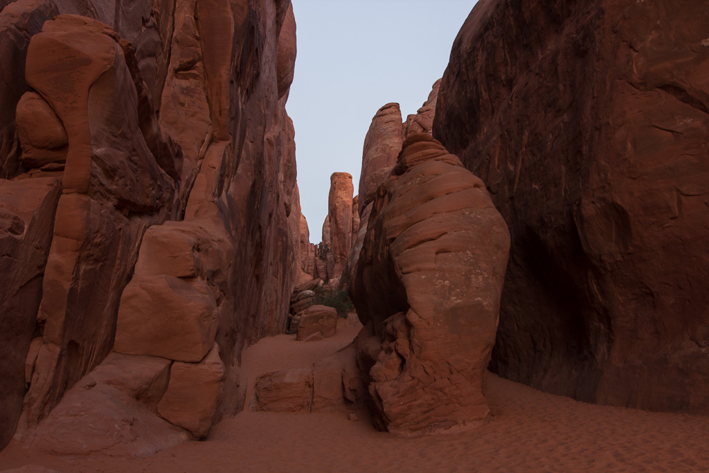
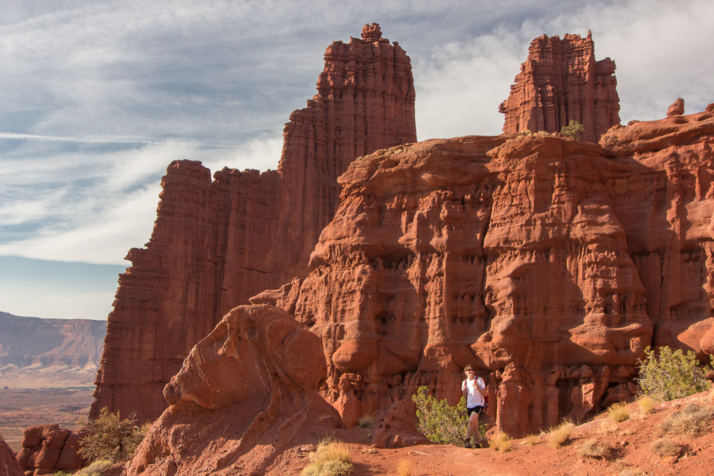
Soon we reached the foot of the towers, they are so spectacular. You get cramp in your neck from watching up at those giants!

The massive towers: you can see a tiny Paul on the path at the bottom A flowering bush

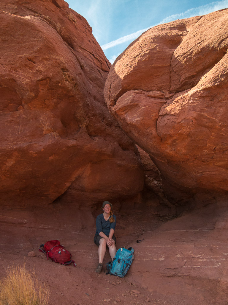
It almost felt like walking around in a dream world (or for geeks like me: in a computer game 😉 ) as the views are so different from anything we had ever seen before, and there was something new to see around every corner.

We saw two persons climbing one of the towers - scary! The Titan ;)

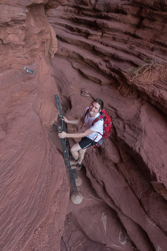
The path loops around the base of the Towers, which makes you feel very small! Once we had to climb down a metal ladder at a particularly steep bit.

This path made you feel really small... At one point, they built a metal ladder at a steep drop

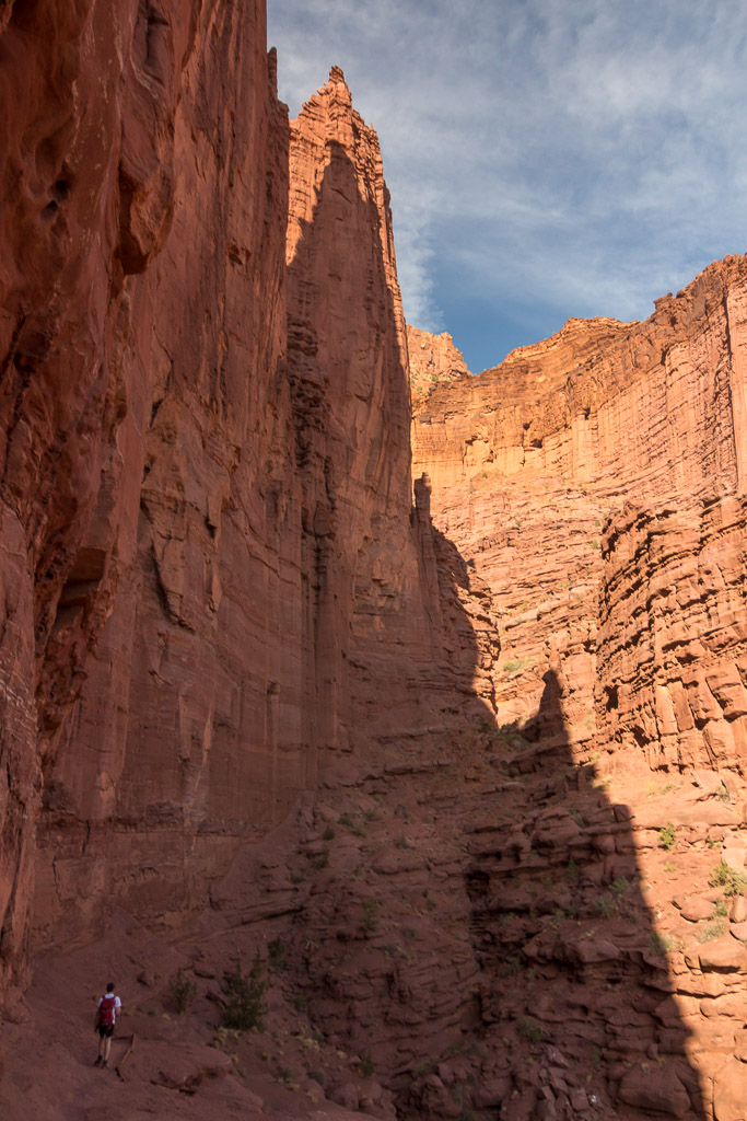
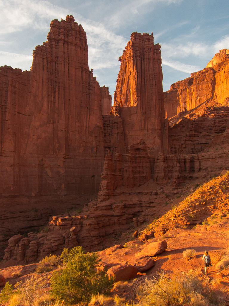
At times the path was quite exposed, but generally it was an easy hike. We did see a couple of people climbing one of the towers (with ropes of course), scary!! Looking through the visitors logbook at the start of the trail, it’s quite a popular place for climbers looking for a challenge 😉

This hike was so beautiful, every turn was worth a photo! Tiny Hanneke taking another photo...

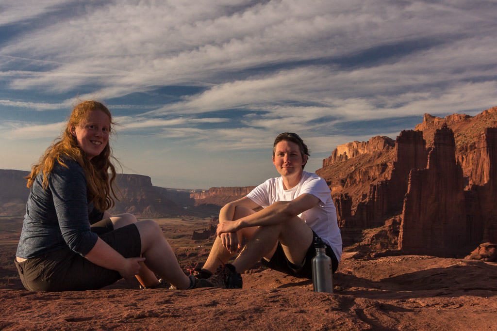
Here we’ve reached the end of the trail (there was a nice wooden sign saying END OF TRAIL), and we enjoyed a long break with spectacular views.

At the end of the trail, with a fantastic view The Colorado River in the distance

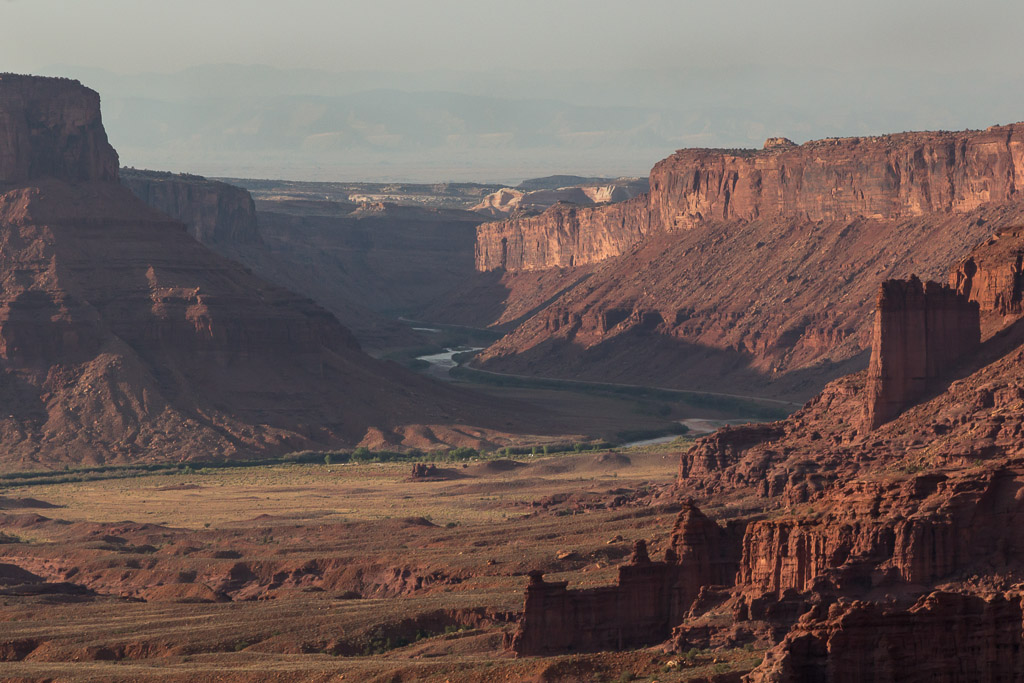
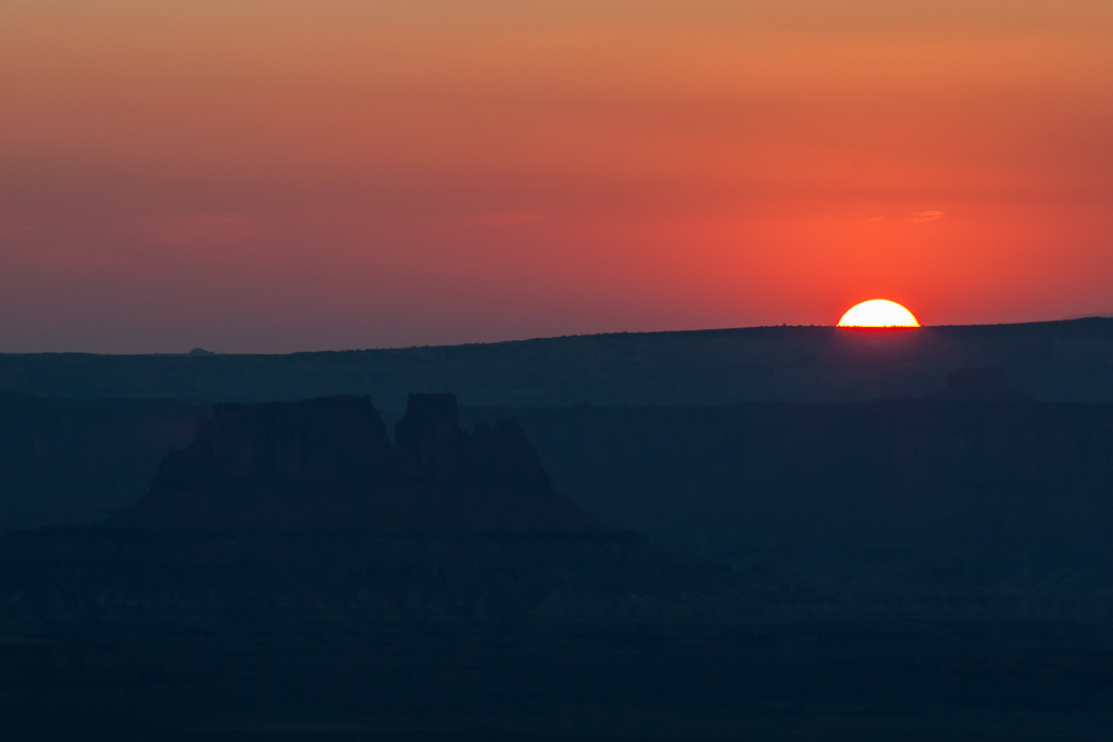
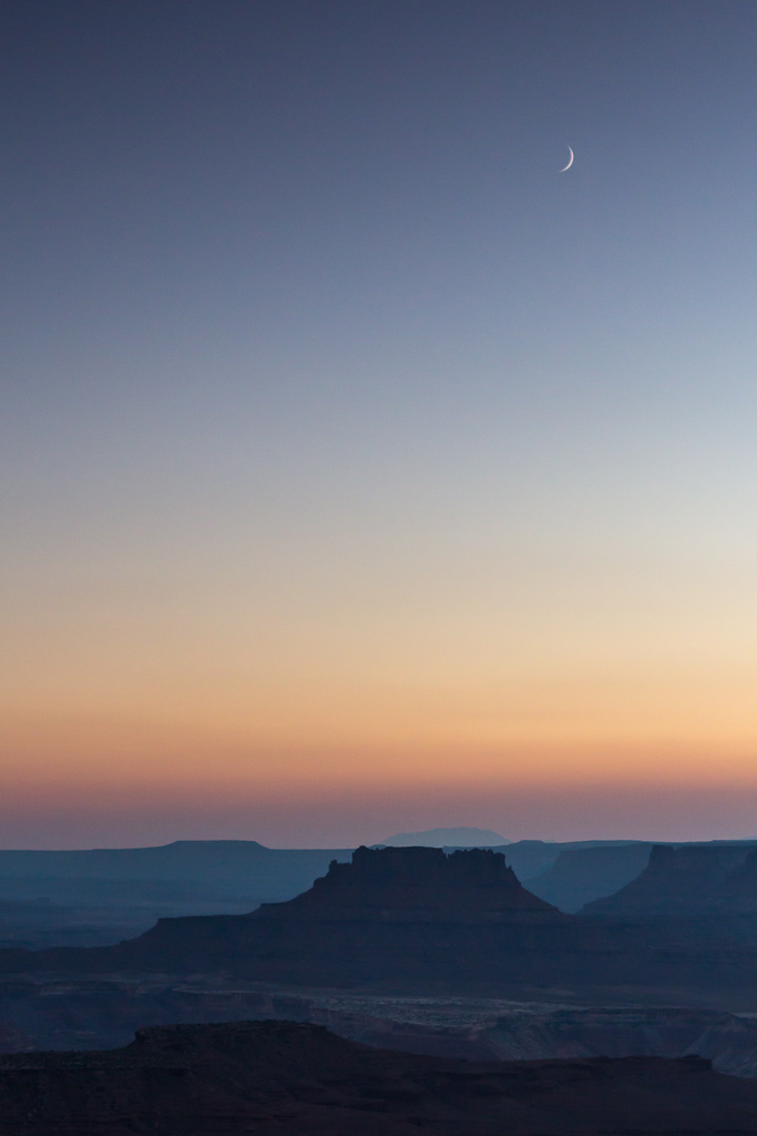
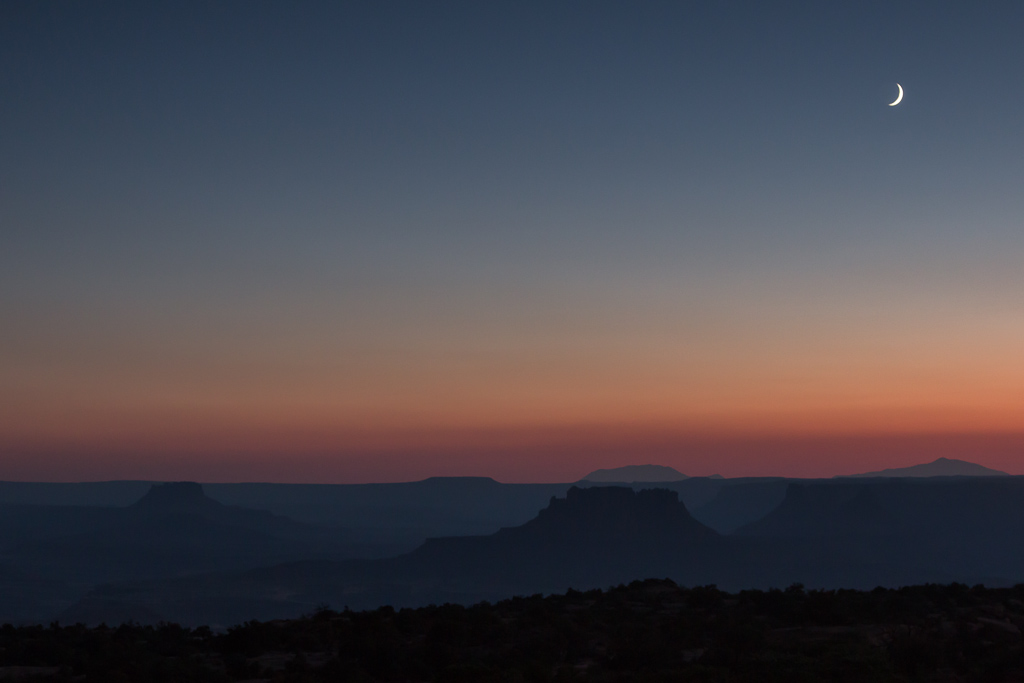
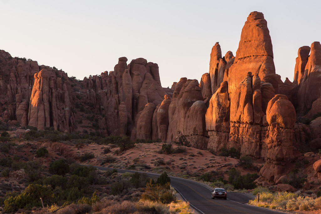
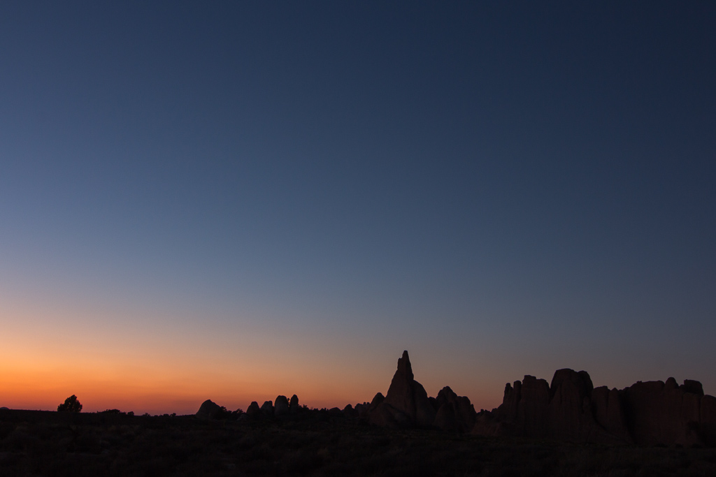
It was early evening by now, and the setting sun was painting the rocks a very deep orange – so beautiful!

A panorama of the spectacular view from the trail end As the sun was setting, the Towers turned a deep orange

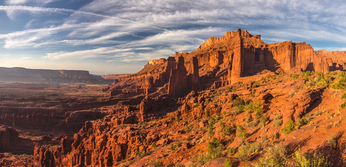
We knew we had to hurry a bit to make it back to the car before dark, but it was impossibly not to take lots of photos with this beautiful light…

On our way back This rock looked like a giant egg :)

And it just got better and better!

We knew we had to hurry a bit to make it back before dark, but it's hard to hurry up with such views! Looking back at the path

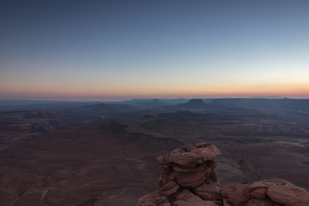
Until the sun finally set, and the crescent moon came out.

Surrounded by giants At sunset... so incredibly beautiful :)

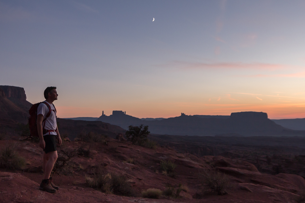
In this part of the world, it changes from sunset to pitch black quickly, so after the last photo above, we almost RAN back to the car – but we did make it without having to use head torches 🙂

USA Adventure Part 3: Canyonlands – Island in the Sky

USA Adventure Part 3: Canyonlands – Island in the Sky

Another day, another national park 🙂 Arches and Canyonlands are close together, but Canyonlands is very big and has several entrances. We chose the nearest one with the best name in the world: Island in the Sky. It’s located on a high mesa (Spanish for table, it means an elevated area with a flat top and steep sides) that looks down on another flat level (the White Rim) before dropping down all the way to the Green River, and this does make it feel like you’re on a island in the sky 🙂 Down below you can see the White Rim Road, a dirt road that follows the rim for 100 miles. It usually takes a couple of days to drive, whether you do it by 4WD or by mountain bike! Here you can find some nice photos and a video of people who drove the White Rim Road on mountain bikes with a support vehicle. I’d love to do that one day!

Anyway, as we only had one day we weren’t going to drive this road, and instead we hiked to the to the rim of the Upheaval Dome, a crater with debated origins. There’s two theories: either it’s a salt dome that pushed its way up, or an eroded meteorite crater. Either way, it’s a fascinating place and a nice walk 🙂

Parts of the 100 mile long White Rim Road in Canyonlands Upheaval Dome, the origins of this eroded crater are debated

Afterwards, we drove to Green River Overlook but the hazy conditions and harsh light were not ideal for seeing very far. Still, it was impressive to look down at the White Rim, trying to follow the White Rim Road that goes very close to the edge at times, and see the Green River in the distance.

Looking down on the White Rim and (further in the distance) the Green River Dry riverbeds, far below

The desert is full of life: there were bees flying around some bushes with flowers near the overlook, and you always find lots of (well camouflaged!) lizards.

The desert is full of live: a small bee... ... and a large lizard

We decided to hike to Murphy Point Overlook for sunset, an easy and almost flat hike to the edge of the mesa (about 4 miles return trip). We were the only ones there and found a nice spot to have some food and wait for the sun to set. This raven kept us company the whole time we were there, and he was not shy at all!

This raven kept us company while we watched the sunset I love how you can see the sunset reflected in his feathers here :)

The light is so much prettier as this time of day, and the temperatures are more comfortable as well, so we really enjoyed waiting for sunset. The views were spectacular!

Soft light at sunset Paul took photos of the sunset with his telezoom...

I had taken my new lightweight tripod with me, and a set of graduated neutral density filters (to block the bright sky so that the difference with the dark foreground is less problematic). It was a magic sunset, I felt so lucky to be in such a beautiful place, all by ourselves, watching this spectacle…

... while I used a wide angle lens with graduated ND filters.. quite a difference! Just after sunset

After the sun had set, the crescent moon became visible. So pretty!

The crescent moon became visible Sunset at this low latitude goes fast, but the colours are so intense

We walked back as quick as we could, but darkness did catch up with us before we reached the car. We had good head torches though, and the path was easy to follow, so this wasn’t a problem. It was amazing how loud all the crickets were chirping after dark! It was a long drive back to our cabin near Moab, but it was definitely worth the trip to see Island in the Sky.

USA Adventure Part 2: Arches National Park

USA Adventure Part 2: Arches National Park

It was exciting to wake up in the desert the first morning, and enjoy the views from our nice little cabin in the middle of nowhere. After a lazy morning, we drove to Arches National Park, a park with over 2000 natural sand stone arches. We bought a pass that allows entry to all national parks for a year, as we will be visiting many 🙂 Our first stop in the park was Balancing Rock. There is a short trail that goes all the way around the rock pillar, so you can admire it from all angles 😉 We were not used to the heat yet, and were taking it very easy. Until a tour bus full of pensioned people arrived and we decided it was time to leave!

Balanced Rock in Arches National Park Balanced Rock from a different angle

After looking at the park’s map, we decided to hike to the most iconic arch in the park: Delicate Arch. It’s not only the symbol of the National Park, it can also be found on all Utah’s license plates. The hike was easy and not too long, but walking uphill in the heat made it a bit more challenging. We stopped for a break in a shady place, where we got company of a little chipmunk. They are so cute! Really tiny, really fast, and not very shy. Paul had his zoomlens with him, and this is the result…

The first chipmunk we met had to be caught on camera... They are tiny, very cute, and not shy at all!

Ok, one more photo of the chipmunk because he’s so cute 😉 There are lots of them everywhere in the states, and after a while you get so used to them that you don’t take photos anymore. We continued our hike, wondering when we would get a glimpse of our final destination. In fact you don’t get to see it until the very end of the trail. You turn a corner, and suddenly it’s there! What a view… the arch is located right at the edge of a kind of platform of slickrock, so you have really nice views as well.

Ok, last photo of the chipmunk... there are so many of them that you stop taking photos at some point ;) The view we were rewarded with at the very end of our hike: Delicate Arch

It was fun playing with the fisheye lens, which can fit the whole arch in even from close by.

With the fisheye lens, the whole arch fits in one photo As real tourists, we both posed with the arch ;)

These photos show the surroundings of the arch a bit better, it’s like a big bowl! We actually walked to the bottom of the bowl, and climbed up on the other side.

The arch is located right on the edge of a big platform. You can see a lot of people on the far right, this is where you first have a view of the arch at the end of the trail. Steep slickrock with lots of holes in it

This is the unusual view from the other side, where you look right at the side of the arch so you can’t see the whole. It becomes almost hard to spot 🙂 We walked back when sunset was on its way, and we saw LOTS of people walking up with tripods. I wonder if they were all able to get a photo without 10 other photographers in it 😛 We drove a bit further into the park, and stopped at a viewpoint of Fiery Furnace. We would have liked to hike into Fiery Furnace, but you need to either join a guided walk (which needs to be booked quite a while in advance), or apply for a permit.

Delicate Arch seen from the other side of the platform, where you look right at the side of the arch so you can't see the hole. Look how steep the drop is! Fiery furnace at sunset

Sunset was really beautiful… my favourite time of the day, when it finally cools down a bit and everything is turning a deep orange.

A scenic part of the road through the park, at sunset The sunset was really pretty

We walked the short trail to Sand Dune Arch, which is located inside a slot canyon. The floor of the canyon consists of amazingly fine sand! Unfortunately, at this low latitude sunset goes realllly fast, and it’s basically dark only half an hour after the sun has set. So after enjoying sunset, it was soon time to head back to our cabin.

Inside the slot canyon near Sand Dune Arch, amazingly fine sand at the bottom of the canyon! Silhouettes at sunset... time to head home

It had been a fantastic day, but the combination of heat, jetlag and so many new experiences made us really tired. So tired that we ate at McDonalds, and that says a lot 😉