Browsed by
Category: Norway

A week in the Lofoten

A week in the Lofoten

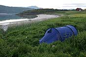
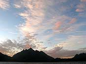
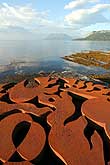
We spent the first week of August in the Lofoten. We had rented a small cottage there, but as it’s a long drive to get there from Tromsø (about 500 km, ~8 hours) we decided to leave a day early and take the tent to sleep somewhere along the way. We took a scenic smaller road following the coast. The weather was beautiful and warm, and we enjoyed a lazy dinner in the sun at this artwork (see photo below). We then continued a little bit further, and found a nice beach to pitch our tent. As a bonus, the sunset was really beautiful too!

Art at the coast The beach where we camped on the first night
Our tent Beautiful sunset!

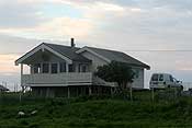
The next day we woke up to pouring rain 🙁 we continued on our way, only stopping in Svolvaer to buy some food. The house we rented was in Høynes, which was really only one street with a few houses and a farm. It was located in a very quiet part of the outer side of the Lofoten. It was almost always windy there. Sheep walked around the house, and the farm next door even had a sheep dog. A slightly crazy one, it was often chasing the ponies in the field opposite! This is the little house, which had a big view 😀

Our holiday home in the Lofoten The view from the living room!

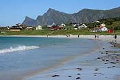
The next morning we woke up to sunshine! We decided to climb the mountain behind Reine. The distances in the Lofoten are quite large, because the roads often have to go around fjords. It was 80 km to Reine, quite a drive. We stopped a few times along the way, to walk along some beaches (we even ventured in up to our knees, but it was way too cold for swimming!).

Beautiful beach at Flakstadpollen The white beach at Ramberg

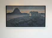
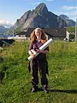
Another reason we wanted to visit Reine is the Eva Harr Gallerie. The art gallery in Tromsø has some of her work and we both really like it. It was a beautiful gallery, and it was great to see more of her work. We had only seen lithographs, but the gallery also had about 20 paintings. Really nice! The one below was my favourite. The gallery also sold her lithographs, and I finally made up my mind about buying one. I bought one called “Stjernenatt” (starry night), you can see an image of it here. I am so happy with it! I still have to get it framed, but I think it will look great in our living room 🙂

Eva Harr Gallerie - I loved this painting! Me with my purchase, so happy :)

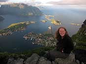
After our visit to the gallery, we drove to the starting point of the hike. It was a very short hike, but extremely steep. And very muddy, so it wasn’t an easy climb. And you don’t get to see the view until the very last moment. The view however, is worth everything – it’s so spectacular! You look over Reine and several islands behind it and the open ocean as well.

Climbing up to this ridge wasn't easy, but this view is definitely worth the effort! View over Reine, incredible!

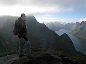
We climbed up a bit further, but at some point the path was following such a sharp ridge that we decided to turn back. Below you can see our view looking down, it was crazy! It was hard coming down on such a muddy steep path, you really had to be careful not to slip. Sometimes we had to sit down and continue on our bum 😉 We made it safely down though.

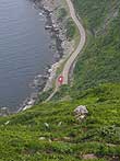
Paul and the impressive view Our car (in the red circle) way down below

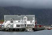
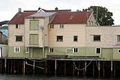
The next day the clouds were hanging low, and we decided to visit Henningsvær. A very nice place to walk around, lots of nice old wooden buildings and cosy cafes.

Henningsvær Old wooden building on sticks

We also visited Kabelvåg, the town centre is very small but also fun to walk around. On our way back, the clouds were hanging around the mountains like a hat, it looked really cool!

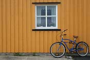
Bike & colourful house Cool cloud!

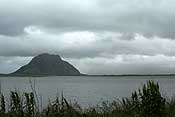
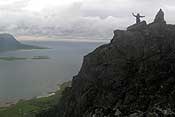
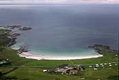
We decided to climb a peak called Hoven, the mountain in the photo below. It’s not that high – 368 m. The clouds were constantly hanging around the top, so we were a bit worried we wouldn’t have a view. It was very windy on the top, and the view kept disappearing behind the clouds, but it was quite impressive anyway. There are some nice sandy beaches in this area!

Hoven Me on top of Hoven Beautiful sandy beach seen from Hoven

The next day we decided to go for a trip with the boat. We put the boat in on a sandy beach in a calm fjord, but as soon as we reached the open ocean the waves were 1-2 m high and it was quite rough. This was my first experience of waves like that in a small inflatable, and I felt like I had to hold on very tight in order not to bounce out. I didn’t really enjoy it and even felt almost seasick, so in the end we turned back to dry land. Phew 😉 Of course the weather calmed down then. We walked around for a bit, enjoying the views, and collecting some drift wood for the stove at the cabin – it was quite cold and we fancied having a fire! (for some more photos and a map of our boat trip, see here)

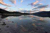
Reflections Lots of flowers and a nice view

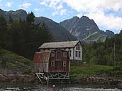
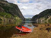
On Wednesday, it was sunny again! And there was hardly any wind, so we decided it was a perfect day for taking the boat into Trollfjord, a very narrow side fjord of Raftsund. It was such a beautiful day. The first photo shows where we put the boat in the water. The second photo shows a group of buildings we passed on the way, it looked so idyllic.

Raftsund, where we put the boat in the water Nice houses on the water

Trollfjord is narrowest at its entrance, about 100 m. The large Hurtigruten and other cruise ships often go in there, it must be very impressive with such a big ship. For our small inflatable though, it was easily wide enough :D. We were the only boat in the fjord, it was beautiful. We put the boat on land at the end of the fjord and had some lunch. We then went for a walk to a lake. There is a hydroelectricity plant at the end of the fjord, and we had to climb over the pipe 😀

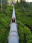
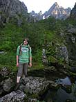
Our boat in Trollfjord Climbing over the pipeline The valley we walked through

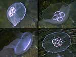
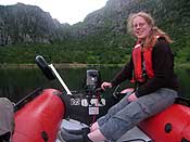
We walked up to a lake, which was a really nice walk though not very easy as it was (again ;)) very muddy. And the lake turned out to have a huge concrete dam and concrete beach so it wasn’t as scenic as we were hoping :D. It was quite late when we got back to the boat. There were lots of jellyfish in the water, and I discovered that they light up if you take a photo using the flash. They are so pretty! These ones are called moon jelly and they don’t sting so nothing to worry about 🙂 Paul taught me to drive the boat, it was fun! He also wrote an article about our trip here.

Moon jelly - there were lots of them! Captain Hanneke :) Pretty sunset

We came back from our trip to Trollfjord really late at night, so we didn’t do very much the next day. We drove to Stamsund, and enjoyed a nice dinner in the restaurant there.

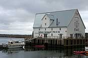
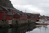
Really nice restaurant in Stamsund Rorbuer in Stamsund

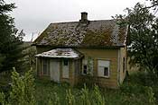
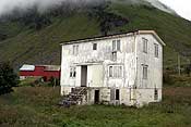
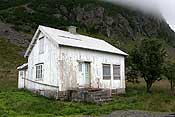
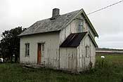
On the way back, I took some photos of abandoned houses. I find them quite fascinating, I always wonder how they became abandoned, what the story behind them is. They are great subjects for photos, with boarded up windows and completely overgrown gardens. But you do have to be careful, as I found out when I took the second photo below…. somebody was actually still living in that house and suddenly appeared in one of the windows… OOPS!

Abandoned house Abandoned house - except this one wasn't!

Another abandoned house This abandoned house was our neighbour

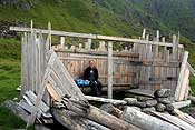
Friday was our last day in the Lofoten and we decided to walk along a nearby beach. We started the walk in Eggum, where there’s a ruin of a radar site used by the Germans in WWII. The photo below is taken through one of its “windows”. The beach here is facing the open ocean and full of driftwood and items lost from ships. There is so much wood around that someone is building a kind of hut. Very nice!

Eggum seen from the radar site Hut built out of driftwood

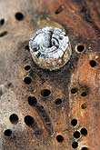
Some of the wood was full of holes from woodworms. Paul took some really nice photos of the holes and the tunnels, while I was picking some blueberries 🙂

Driftwood with holes and tunnels from woodworms Picking blueberries

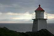
Most people walking on the beach continue all the way to Unstad, but we started quite late and didn’t go that far. We walked until the lighthouse on top of the cliff. Nice view!

The nice view from the lighthouse The lighthouse

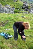
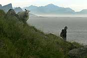
There were lots of sheep walking around (with bells on), it’s crazy how high they climb up sometimes. Some were also just enjoying the sunset 🙂

Paul and sheep :) A sheep enjoying the sunset

When we came back to the car, lots of campers had found a place for the night. The Lofoten is full of campers and caravans parked everywhere. Our car looked so tiny in between these big campers 😀

Our Caddy looks tiny between the campers!

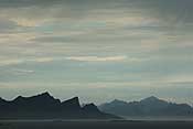
When we came back to the cabin, the sunset was really beautiful, and reflecting in the very calm sea. The first photo shows our little house on the right 🙂 What a view for our last night!

Sunset, our cabin is the white house on the right Spectacular sunset

The next day we drove all the way back to Tromsø, it took all day. We had one more day of holiday left, which we used for another boat trip, and then it was back to work for both of us. It wasn’t easy to get up at 7 again 😀 we would have liked a much longer holiday, but that’s life I guess 😉
Signaldalen to Dividalen

Signaldalen to Dividalen

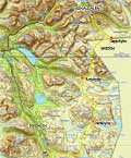
For a while, we’ve wanted to explore the skiing/hiking tracks in Indre Troms, the area near the border with Sweden. There are several huts there, linked by marked paths – ideal as we didn’t fancy hiking with a tent and cooking gear. My parents were visiting us the week before we planned to do a hiking trip, and they offered to drive us to wherever we wanted to start, so we could leave our car where we wanted to finish. This was a great offer as public transport is sparse in this area. We decided to start in Signaldalen and hike to Dividalen. The total length of the walk was 72 km! Below is a map of our route, and the height profile, with the huts that we slept in indicated.

Map showing our hike starting in Signaldalen and ending in Dividalen. Total length: 72 km Height profile for the total hike, with the huts where we slept indicated

Day 1: Rognli (Signaldalen) to Gappohytta (11 km, 4 hrs)

It took us a day to park our car in Dividalen and drive to Signaldalen with my parents (and I managed to add some more time by realising I left my waterproof jacket in the car – we had to drive back for 20 minutes to get it… oops 🙁 )

Finally, at 18:00 we were ready to go. After lots of rain, that day it had finally cleared up and it was sunny!

Ready to go! Following the dirt track up the valley

We followed a track up the valley, first through the forest and later through a more rocky landscape.

Little stream! Paul making his way through the rocky landscape
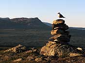
A very pointy cairn! And notice the mosquito to the left of it... (no that's not a bird!) The long-tailed skua (Fjelljo in Norwegian and Kleinste Jager in Dutch), very common in this area. They aren't very shy, you can come quite close!

After a while, we found the disadvantage of the beautiful still weather – mosquitoes! And lots of them… Fortunately our repellent seemed to work – as in we didn’t get bitten – but it’s hard to enjoy the scenery with a cloud of mosquitoes around your head!

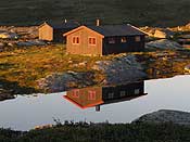
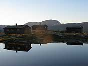
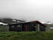
At about 22:00, we reached Gappohytta, which looked idyllic in the evening sun, reflected in the lake. There were 2 huts, one of them empty, so we had the luxury of a whole hut to ourselves. The huts from DNT (the Norwegian Trekking Association) in this part of the country are all unmanned and you need to buy a key to open them. They have no electricity or running water, but are always near a water source. They have gas for cooking (and everything else you need, like plates and pans and cutlery), wood for the stove, beds with bedding (but you need to bring a liner or a sleeping bag), and usually a separate building with a toilet of the hole-in-a-plank variety.

Gappohytta reflected in the lake! We stayed in the one closest to the lake. The one behind it is identical and had other people staying in it. The building on the right is the wood storage and toilet building
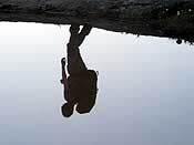
Paul reflected in the lake :) A long exposure of the waterfall where we got drinking water from

We enjoyed a good dinner that we brought from Tromsø, and then it was time for bed.

Day 2: Gappohytta to Rostahytta (20 km, 9 hrs)

The following morning it was still sunny, but with some pretty clouds and a nice breeze to blow away the mosquitoes.

The hut in the morning - beautiful sky! Another view from the hut in the morning
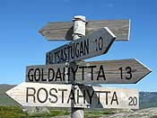
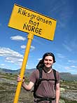
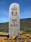
A pyramid shaped mountain :) Rostahytta was our next destination Here we were actually leaving Norway and entering Sweden for a while

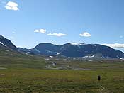
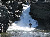
We walked through Sweden for a couple of hours. We crossed a lot of small rivers, before stopping for a break at a waterfall.

The path we followed Crossing a small river Walking through such big landscapes makes you feel small!
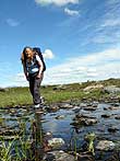
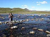
Paul had a close look at the waterfall Checking Crossing a very wide (but shallow) river

We crossed the border back into Norway, and soon reached our halfway point, which means: lunch!

The border! Finally, lunch! I was quite tired at this point

We walked through Isdalen, a pass between two valleys, strewn with huge boulders and surrounded by steep mountains.

Huge boulders everywhere Crossing Isdalen There were still some patches of snow
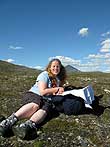
The red T was showing the way Resting my backpack for a moment

At the end of Isdalen, there is a steep descend down towards Rostadalen. The view is quite spectacular! But walking down over small rocks was rather tedious.

Enjoying the view Just before the steep ascent
The river that we later had to cross Impressive mountain!

At the bottom we had our first serious river crossing – one that required taking our boots off and wading through. I had brought flip flops for this purpose – so I wouldn’t fall over or hurt my feet – so I thought I’d be fine. What I didn’t realise is how COLD these rivers are…. It was really painful, within seconds my feet were numb with cold and I cried when I got to the other side. It took a while before my feet stopped hurting! Not quite the nicest experience… but at least now I’d know what to expect next time.

At some point we heard a funny noise nearby, something between the noise of a duck and a pig, and we looked up to see what made that noise. Not very far from us, a herd of I think around 100 reindeers was walking past. What a sight!

Not a very sharp photo, but some of the reindeer we saw Trying to spray the mosquitos away

The final stretch was tough as the mosquitoes came back in full force, this time biting me all over my face. Such a relief to finally see the hut! It was quite busy and we only just about found 2 free beds. A quick dinner, and off to sleep.

Day 3: Rostahytta to Dærtahytta (17 km, 9 hrs)

We woke up to another sunny day. We washed ourselves in a pool at the side of the river before having breakfast at the hut. The hut is very nice and modern, it’s been built in 2007!

Eating breakfast in the very new hut This was one of the older huts, there were 3 huts here Setting off

To start out hike, we crossed the river using a suspension bridge – cool!

Paul on the bridge Me getting off the bridge

After that, we climbed up rather steeply – not easy when it’s warm! We then walked along a plateau for a while.

Climbing up There were pretty flowers everywhere!

At some point the landscape became very rocky and it’s tiring to walk from rock to rock like that. We climbed up to 1045 m. At that point it started to cloudy over and with the wind that made it feel quite cold. Soon however, the hut came into view!

The rocky bit, just below the highest point First view of the hut, way down below! Climbing down a very steep and rocky bit

It wasn’t long until we reached the hut. Again, there were two buildings and we chose the one that was empty. This was the oldest of the two, and very cosy – with the added luxury of an indoors “toilet”!

We arrived very tired, sunburnt, and all muscles aching from three days of hiking (nearly 50 km). The next day was going to be a very long one (24-28 km depending on the route). It was quickly decided that a day of rest would be the best idea for tomorrow.

Day 4: Rest day in Dærtahytta

We slept for a long time and enjoyed a lazy day in the hut. Outside the clouds were low and it was raining continuously, so we chose a good day to rest! We read the guestbook, which always has some amusing entries 😀 People also leave all sorts of books and magazines, so we had plenty to read. At some point in the afternoon, we got company from a German guy who had walked from Rostahytta that day. Later on, we were joined by a Norwegian couple from Stavanger – they got lost during the previous day and had spent the whole night walking!

Reading an old book in the hut Our bedroom The hut surrounded by low clouds Getting drinking water from the river

Day 5: Dærtahytta to the car (25 km, 9 hrs)

The next day the clouds were still low and it was drizzling. We had 2 options: our original plan was to walk to Dividalshytta and spend another night there, before walking back to the car the next day, or we could walk straight back to the car. The drizzle stopped soon after we set off, and it stayed dry for the rest of the day, but there was no wind and we were bothered by mosquitos the whole time. They bit me everywhere, even through 2 layers of clothes. We got so fed up of the mosquitoes, that we decided to walk to the car and go home that evening. I later counted 30 bites just one one arm, and they were getting into our noses, mouths and ears… they literally drove us out of Dividalen!

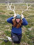
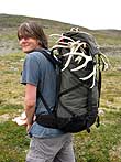
The path was quite good at first, so we made good progress. Later we had to go through a swampy area which was tough as we sank in over our boots and got wet feet. In this valley, we found a lot of antlers though! They were lying around everywhere, and we even found a matching pair. We took the best ones home, we’re planning to do something creative with them. Either a lamp, inspired by one we saw in a log cabin, or a coat hanger perhaps.

I found a big set of antlers! We found a lot of antlers, they looked quite funny on top of our backpacks

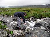
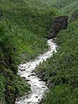
We had one major river to cross. It was too deep to walk through and very wide. Paul tried hopping from rock to rock, while I took my boots off and walked across on flip flops. We both ended with wet boots though! Paul stepped on a rock which flipped over, and I tripped and fell forwards while my boots (hanging around my neck) dipped into the water. Oh well 😉 The last part of the hike went through the forest, along a beautiful gorge created by the river we had just crossed. The river was now narrow and wild…
River going into a gorge Narrow gorge

We got back to the carpark at about 19:00 and were quite relieved to see our Caddy appearing when we came out of the forest 😀 We were wet, dirty and smelly – just longing for a warm bath at home and a good bed to sleep in 🙂 Some people who were just starting their hike asked if we had been on a long tour – wonder if we just looked that tired, or if they could smell us 😛

It was a beautiful hike through very nice landscape, but if we do it again, it won’t be in summer when there are so many mosquitoes and so much of the ground is swampy! Autumn is probably a better season. People had warned us about the mosquitoes but I thought they were exaggerating. They told me to buy a mosquito-net-hat, but I thought they look uncomfortable and silly. Next time, I’ll leave my pride at home 😉
We’re only home for one day, we’re leaving for the Lofoten tomorrow! We’ve rented a small house near the beach there for a week. I’m really looking forward to it! We’ll take the boat and are keeping our fingers crossed for some sunshine 🙂

Above the clouds on Tinden

Above the clouds on Tinden

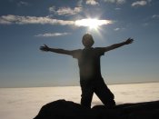
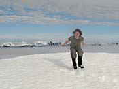
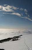
On July 1st the weather in Tromsø was grey and overcast. Hanneke and her colleague Trond were sitting in the meteorological office looking at a satellite image showing the sea of clouds when they noticed one dark pixel. That pixel was the top of Tromsdalstinden poking through the clouds. Almost since arriving in Tromsø I have dreamed about standing above the clouds on top of Tinden, but without a private meteorologist it was a difficult dream to realise. From Tromsø I could never see whether the top was above the cloud or just in the cloud. Today was my chance! So based on a single pixel I threw on some clothes, drove to the bottom of the mountain (instead of the office) and started climbing towards a layer of thick cloud and zero visibility. Hanneke and Trond thought the conditions might only last for a few hours, so I was against the clock. I left without breakfast and without charging the batteries for my GPS. A fist full of mars bars and a compass would have to do.

I headed to the top as fast as I could, but above 500 m I was  hindered by a lot by deep snow which was still on the ground. I thought I could walk around the few patches that remained in July, but they were much bigger than I thought. Trudging through snow in the cloud was not much fun. I began to worry that it would be in vain. I hoped I hadn’t taken a day off just to wander around on my own in a cloud!

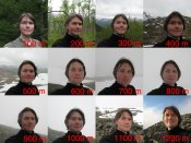
At 1000 m I was beginning to lose faith in the pixel, when I noticed a strange phenomenon. Here in the mist, rocks felt really warm to the touch. They must have seen some sun not long ago!! I stepped up the pace, and a patch of blue sky began to emerge through the mist. The cloud top was very well defined when I crossed it – within a few steps the visibility went from zero to almost infinite! It was like putting my head above the surface of a swimming pool.

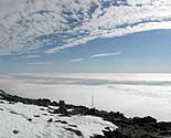
Panorama showing the clouds above Tromsdalstinden Panorama showing the clouds above Tromsdalstinden

Panorama showing the clouds above Tromsdalstinden Panorama showing the clouds above Tromsdalstinden

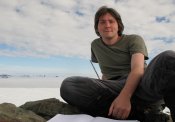
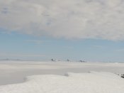
The pictures below show the view from the top, about 100 m above the clouds. The peaks in the distance are the Lyngen Alps. I spent more than two hours on the top enjoying the sunshine in a t-shirt.

Panorama showing the clouds above Tromsdalstinden Panorama showing the clouds above Tromsdalstinden

Panorama showing the clouds above Tromsdalstinden Panorama showing the clouds above Tromsdalstinden Panorama showing the clouds above Tromsdalstinden

Panorama showing the clouds above Tromsdalstinden Panorama showing the clouds above Tromsdalstinden

While on the top, I took this time-lapse video of the clouds sweeping past Tromsdalstinden. It was almost like standing on a ship and watching the waves roll past.

Just before I left another person emerged from the cloud below – he turned out to be a pilot who had seen the peak sticking out before landing in Tromsø.  He had literally run up there afterwards! Another pilot promised to try and take a photo of him on the summit. That would have been a cool picture – but just before the plane was due to take off, the cloud level rose, and we were surrounded by the whiteness again! Nevermind – we were content in the knowledge that we had stolen ourselves an extra day of sun!