Browsed by
Year: 2012

Gorzelvtinden

Gorzelvtinden

Last Thursday the weather was looking good, and I decided to climb Gorzelvtinden – my highest mountain so far this summer, at 1072 m. The route starts by climbing steeply up through a pretty forest. Above the treeline it flattens out a bit, but from 600 m it’s steep with loose rocks. You first reach Durmålsfjellet at 1020 m, and from there it’s about 2 km along an almost flat ridge to Gorzelvtinden. As soon as I reached the ridge, it was VERY windy. The kind of wind that takes your breath away and can actually get you out of balance – so I made sure to stay well away from the steep sides. I didn’t take many photos on my way up, so the first photos here are taken from the top 🙂 The first one is looking back along the ridge to Durmålsfjellet and the second shows a panorama of the view.

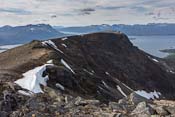
Looking back along the ridge from Gorzelvtinden towards Durmålsfjellet. You can just about make out the couple walking ahead of me, to the left. The route goes far from the steep edge - I didn't follow the path you can see just above the snow! Panorama from Gorzelvtinden

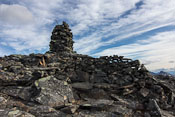
I only stayed at the top for about 5 minutes, as it was way to windy to even think about having a lunch break there. The views were spectacular though, this is a relatively new area for me and I really liked it. On both side of the mountains are some long valleys that would be worth visiting. I quickly made it back to Durmålsfjellet, where people had built an enormous sheltered bench, perfect for my lunch break! This must be the dominating wind direction on this mountain, as it was placed perfectly. It was strange to sit there comfortably while hearing the wind howling behind me. The wind was so noisy that my ears felt numb (like after a loud concert) when the sound finally fell away!

Panorama from Durmålsfjellet The sheltered bench - though it might be a bit hard to distinguish!

Going up a steep slope with loose rocks is one thing, coming down is much much worse. At least with all the mountain hiking I’ve done over the past weeks, my muscles have become a lot stronger and my knees don’t hurt anymore on slopes like this – but it’s still tiring as you have to concentrate on every single step and are constantly out of balance. I kept longing for the grassy slope at the bottom…

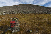
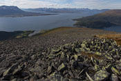
A very welcome patch of grass in the middle of the rocks Looking down from the same spots, so many rocks, so far to go... sigh

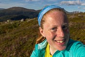
When I finally reached the grassy slopes, I met an older man who told me he did Bakaromntinden that morning and he was on his way to Gorzelvtinden now… Wow, some people! There was a group of horses in this area, and on Facebook I had read that some people had bad experiences with them. This time they were only interested in eating grass though 😉 so I took a few photos of them. I also tried to take a self portrait with Tromsdalstinden in the background, but I kept blocking the mountain with my own head 😀

The 'scary' horses on the slopes of Gorzelvtinden Self portrait without Tromsdalstinden - it's hidden behind my head :D

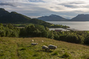
Coming down through the forest was really nice. And I met some sheep along the way 🙂

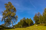
Pretty path through the forest - look at how yellow that tree to the left is already... I met some sheep near the bottom

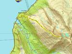
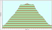
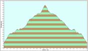
I took it really easy on my way down, and the total time was about 7 hours. It was a really nice trip, also because I met really nice people along the way 🙂 Some people I had met on Bakaromntinden before, others on Raudfjellet… so there were some friendly reunions. The couple who had been so kind to me on Bakaromntinden were worried about me being alone, and really kept an eye out for me. I was fine, but it’s nice to know that someone cares! Anyway, here is the map and height profile…

The route up Gorzelvtinden The height profile of Gorzelvtinden

This was probably my last mountain for a while, as I had to come back to work. But if the weather is nice on the odd day off, I’ll be back! 😉
Breitinden (Ringvassøya)

Breitinden (Ringvassøya)

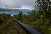
Last Tuesday I set out to climb Breitinden on Ringvassøya. This mountain is not in Ti på Topp, it was one of the mountains they lacked photos of for the new hiking book that’s coming out this autumn. Armed with a map and brief directions, I followed a pipeline up to Damnvatnet, one of the lakes that provide drinking water for Tromsø.

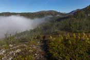
Following the pipeline up to the lake Patches of fog were passing below

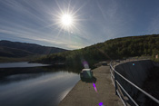
It wasn’t far to the lake, and you can actually walk over the dam, which was fun 🙂

Damvatnet, one of the lakes that provide drinking water for Tromsø. You can see my destination in the background, the triangular mountain in the middle You can walk over the dam :)

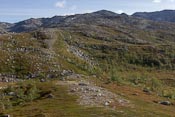
From here on, there was a faint path up the ridge towards Breitinden, but I kept losing it and in the end just made my own way up. It was quite clear which direction I had to follow, but it wasn’t always easy to find the best route. I often tried to avoid climbing every little hill on the ridge, but that didn’t always work well 😀 It made me appreciate Ti på Topp even more, though I am slightly embarrassed to admit that 😉 It’s just so much easier when there is a path and/or markers to follow!

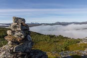
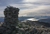
Yay, a cairn! I thought this meant the route would be marked - but no such luck ;) It's not difficult to know where you're going though - follow the ridge to the highest point

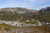
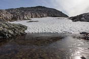
There were nice views towards the valley that leads to Ringvassbu. Higher up, I came across some large patches of snow – and there was ice on the melt ponds!

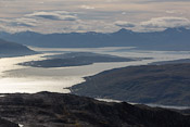
View towards Øvre and Nedre Langvatnet. The upper one is dammed and you can only just about make out the water There was ice on the surface of this pond...

There was some steep climbing on loose rocks just before the top, but I made it 😀 It took me almost 4 hours to rech the top, and the view was spectacular. Unfortunately the light was very flat though, so they photos didn’t turn out that well. There was a guestbook on top: the last entry was dated August 2009… would I really be the first visitor in 3 years? I suspect this top is more popular in winter, when the book might be inaccessible due to snow.

View towards Tromsø from the top I've been seeing Tromsø from all kind of strange angles in the past week!

Most people who signed the book were on their way to Skulgamtinden along the ridge that you can see in the second panorama below. Didn’t look very inviting to me!

Panorama from the top The view in the other direction, looking towards Skulgamtinden

After a nice break, I started my way down. I took some photos of cracked rocks, and this amazing “goretex” moss that I found several places. It seemed almost watertight, with big drops lying on the surface – if you’d push the drops with your fingers, they’d just roll away like marbles! Amazing 🙂

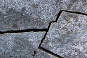
There were some impressive cracked rocks near the top Watertight moss - you could push the big drops with your fingers and they'd roll away like marbles!

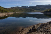
To my relief I found a much better route coming down, and even a faint path at times! I stopped to take some photos of this tiny reflecting lake, just above Damnvatnet. It really starts to look autumnal now…

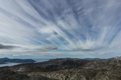
Nice sky on the way down Reflections in a small lake - it's starting to look autumnal...

Here is the map and the height profile of my hike… Total time, including breaks, was 7 hours.

Route up Breitinden - you can see my struggle to find the best route The profile of Breitinden

Sunset Panoramas

Sunset Panoramas

Yesterday was a grey and rainy day, but I knew the edge of the weather front was approaching Tromsø – and that there were clear skies on the other side! So all day I kept an eye on the radar images, but the front was moving incredibly slow. In the late afternoon it finally stopped raining, and I decided to go up Åsfjellet. When I got to the top, I could clearly see the edge of the front lying over Tromsø, with clear skies to the west (over Kvaløya). Still it took ages before the sun came out – and it came out because the sun sank below the clouds, not because the front moved away 😀

(Click to enlarge, these panoramas really deserve to be viewed full size!)

The weather front seen from Åsfjellet - on the far left you can still see the remaining low clouds after all the rain, but to the west skies are clear

Åsfjellet is a short walk (it takes just over an hour to get up, 45 minutes to get down), I still had energy left, and I suspected the frontal clouds would colour nicely in the sunset. So I quickly decided to climb another mountain: Movikhammaren, similar in height and length to Åsfjellet. The sun was setting while I ran up the steep path next to the river…

Sunset while climbing Movikhammaren

I quickly made it above the treeline and indeed, after the sun disappeared the clouds started to get a deep orange colour – so pretty!

Just after sunset, the clouds turned a deep orange

The views were truly breathtaking all the way to the top, with the colours changing constantly until they became pink…

Breathtaking view from the top!!

Then purple…

Pink turned into purple...

And finally the clouds started to lose their colours, while the horizon remained orange, and the lights on Tromsø island were slowly turned on.

Until the clouds lost colour while the lights on Tromsø island are turned on

What an incredible evening 🙂