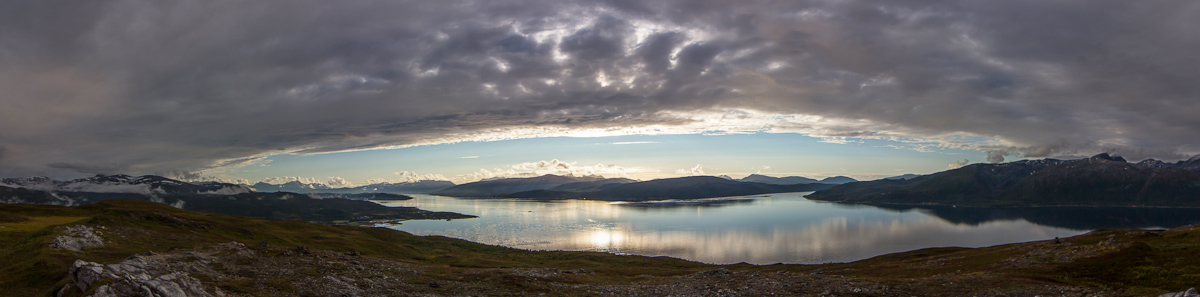
Browsed by
Month: August 2012

Sunset Panoramas

Sunset Panoramas

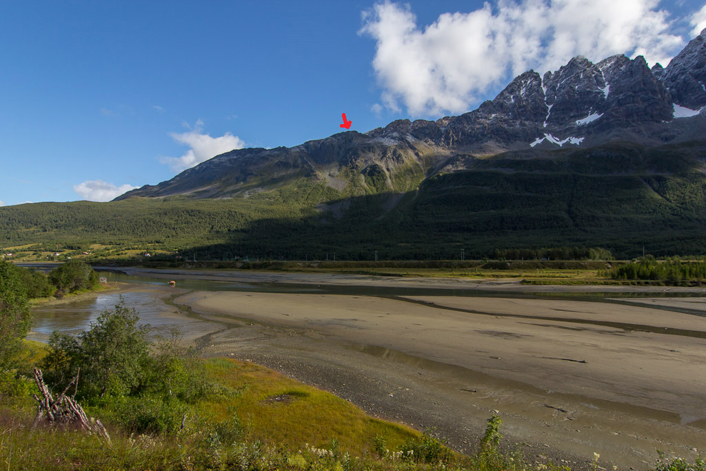
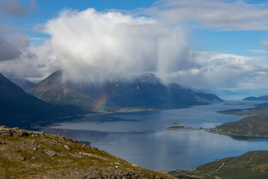
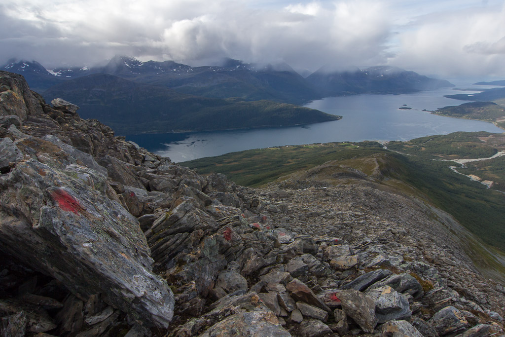
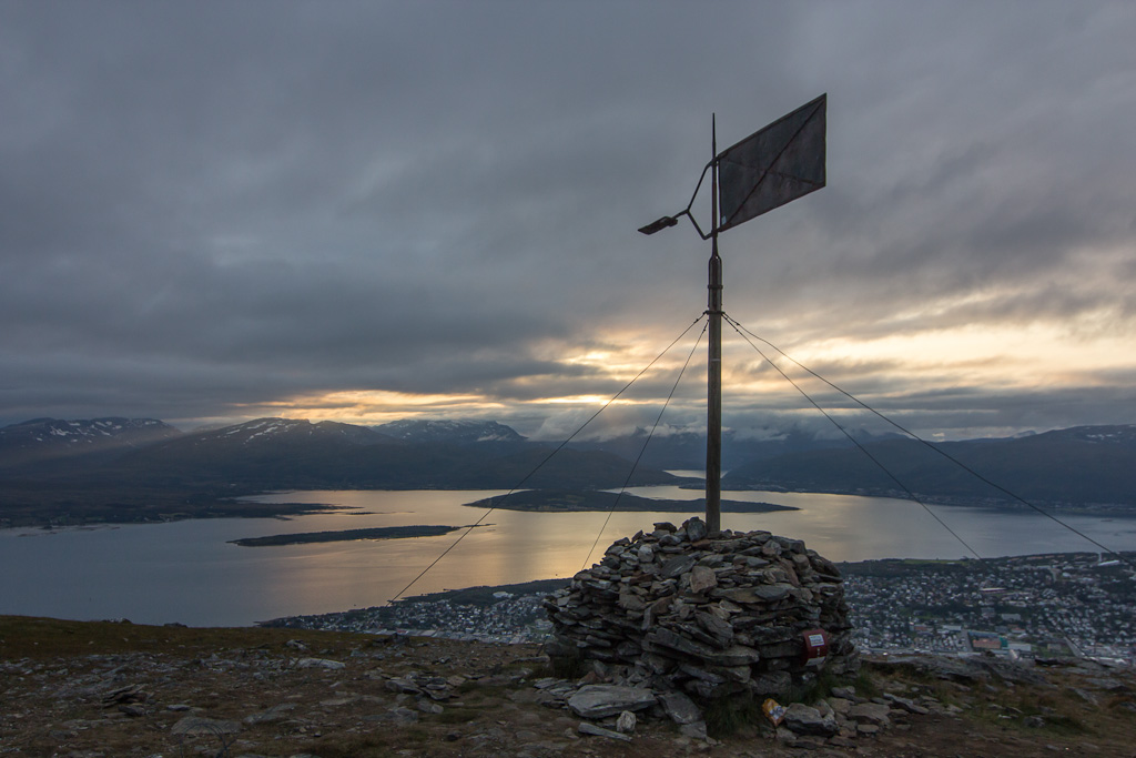
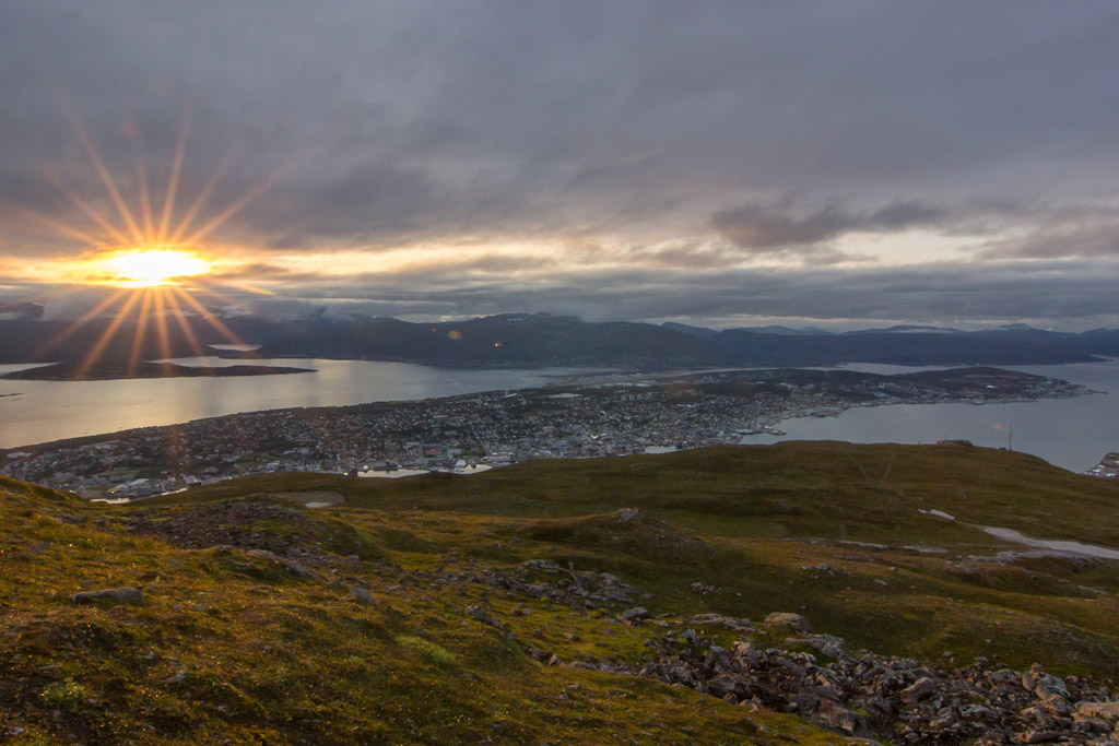
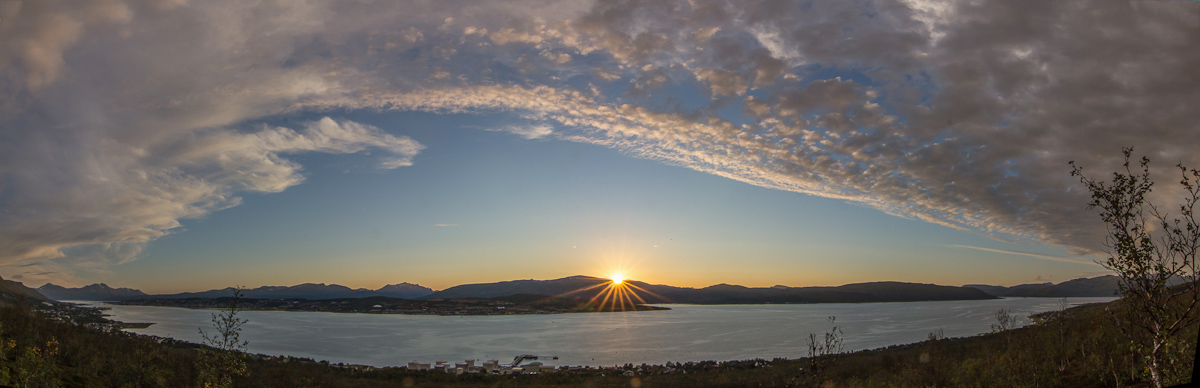
Yesterday was a grey and rainy day, but I knew the edge of the weather front was approaching Tromsø – and that there were clear skies on the other side! So all day I kept an eye on the radar images, but the front was moving incredibly slow. In the late afternoon it finally stopped raining, and I decided to go up Åsfjellet. When I got to the top, I could clearly see the edge of the front lying over Tromsø, with clear skies to the west (over Kvaløya). Still it took ages before the sun came out – and it came out because the sun sank below the clouds, not because the front moved away 😀

(Click to enlarge, these panoramas really deserve to be viewed full size!)

The weather front seen from Åsfjellet - on the far left you can still see the remaining low clouds after all the rain, but to the west skies are clear

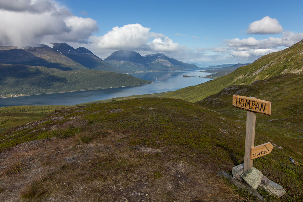
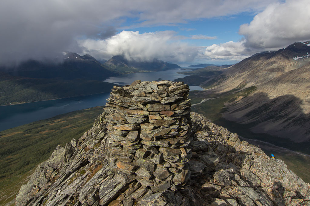
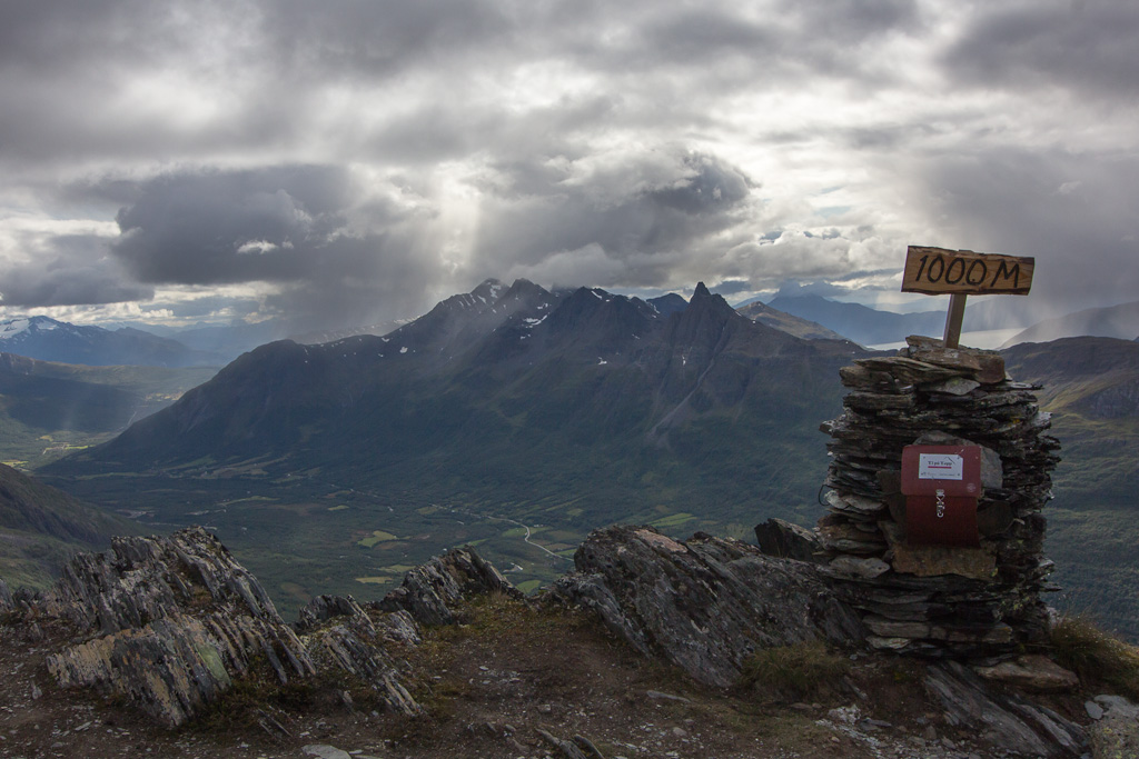
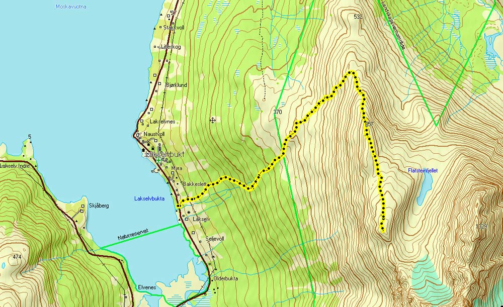
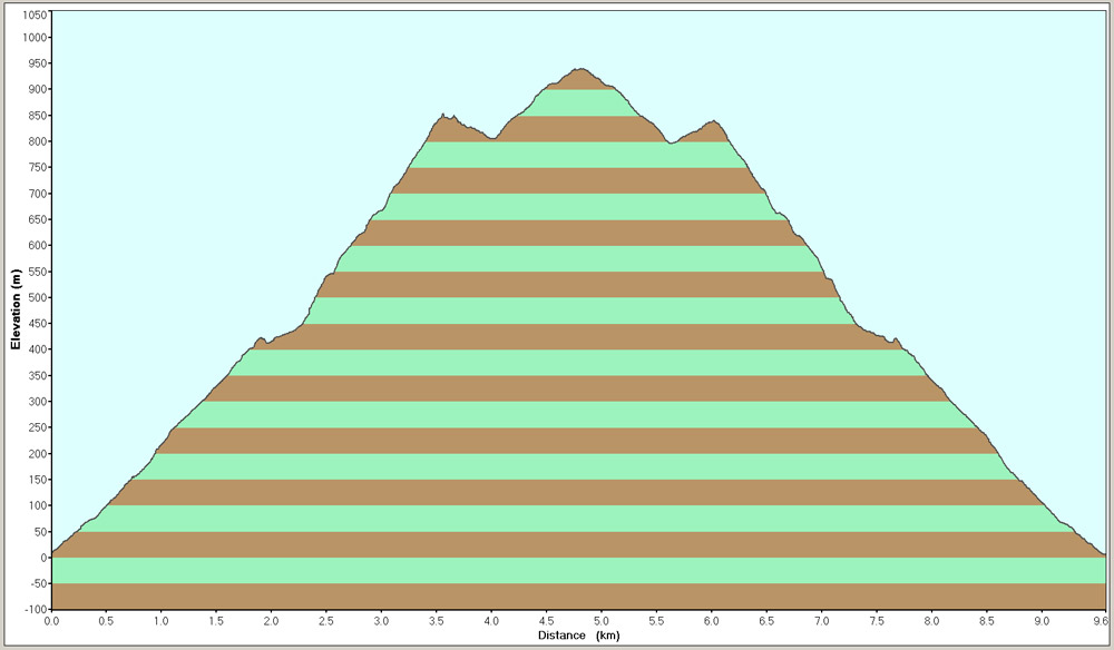
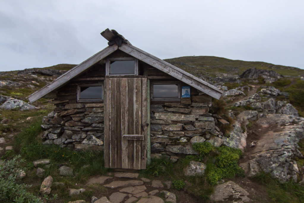
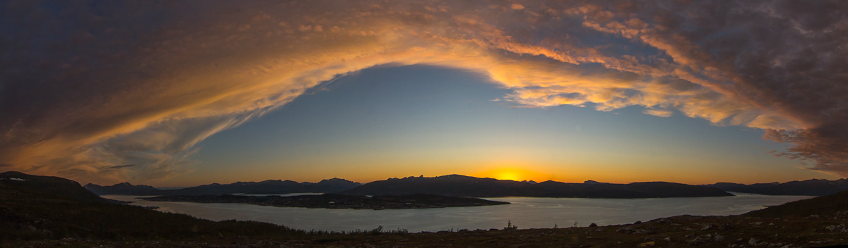
Åsfjellet is a short walk (it takes just over an hour to get up, 45 minutes to get down), I still had energy left, and I suspected the frontal clouds would colour nicely in the sunset. So I quickly decided to climb another mountain: Movikhammaren, similar in height and length to Åsfjellet. The sun was setting while I ran up the steep path next to the river…

Sunset while climbing Movikhammaren

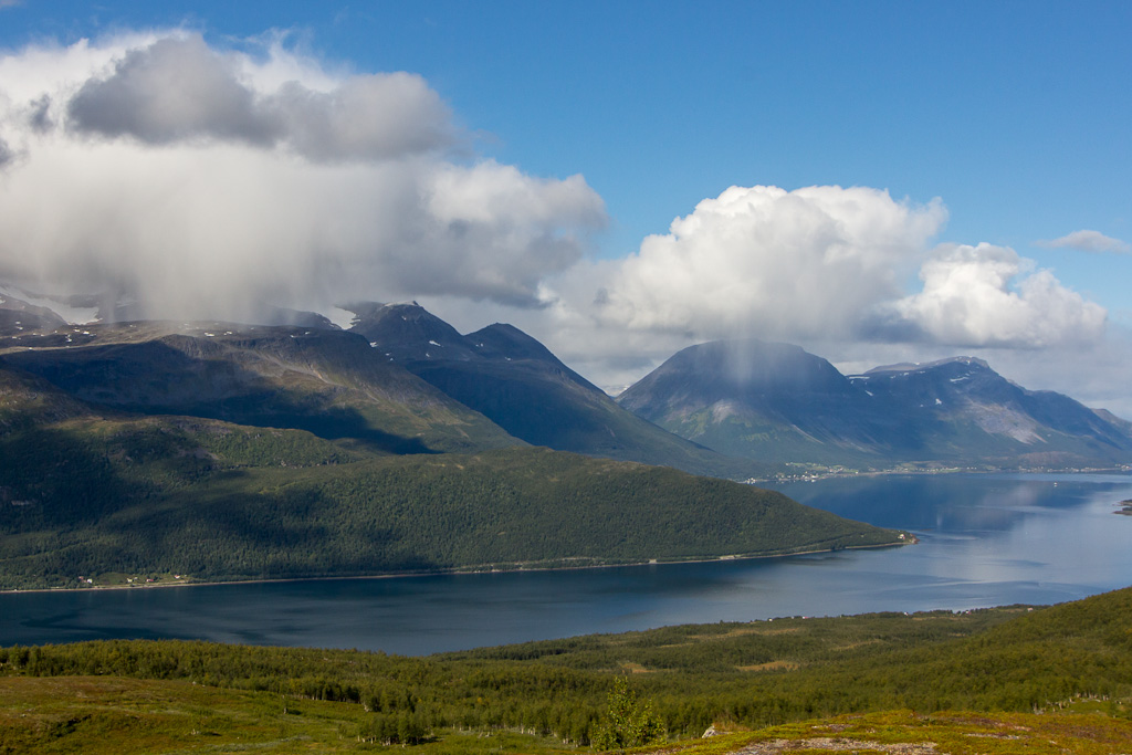
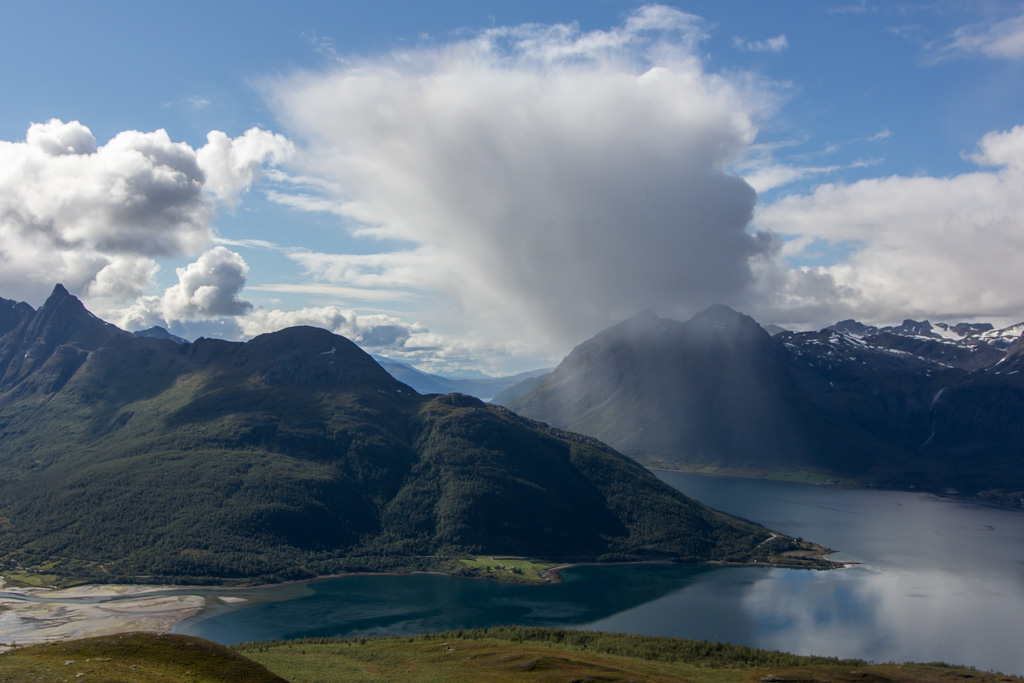
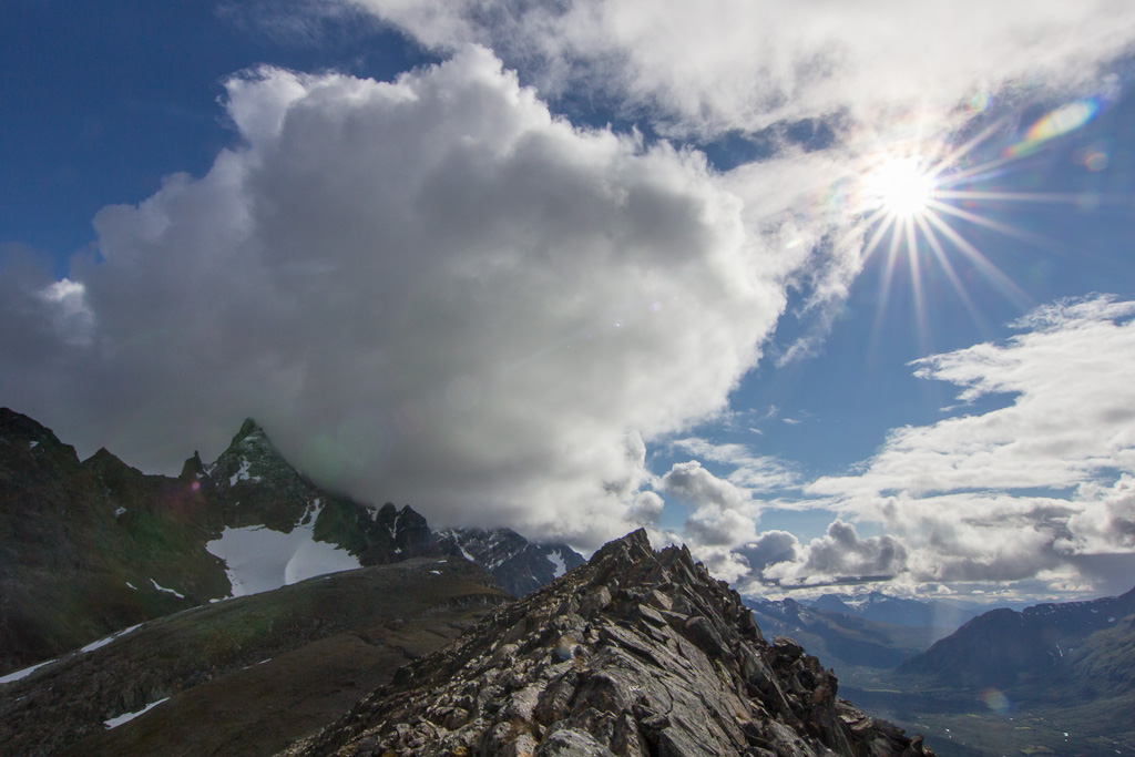
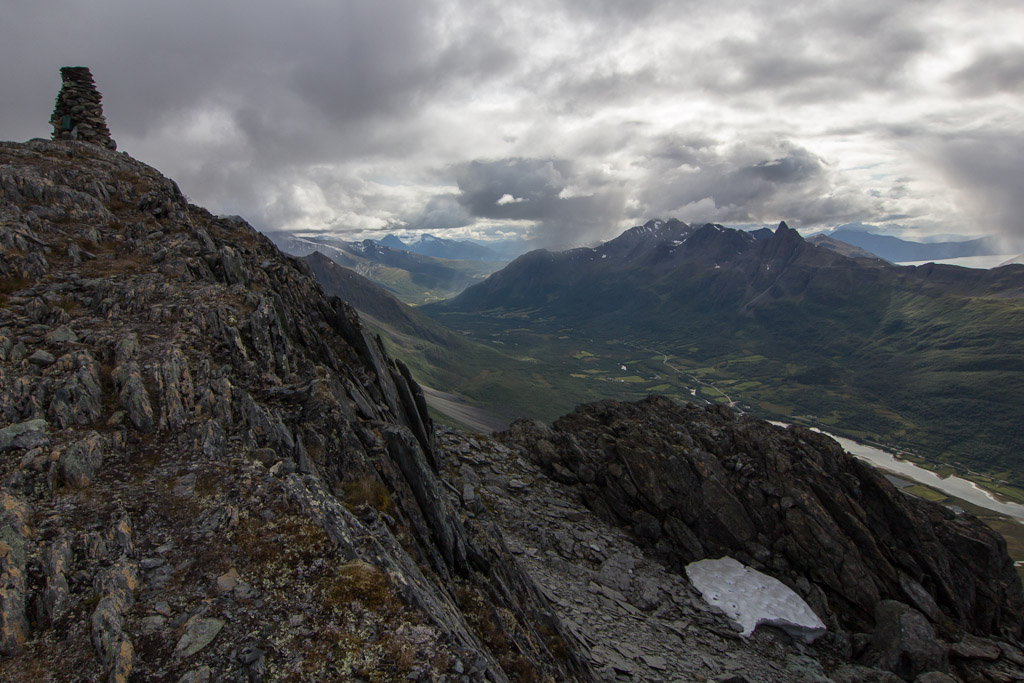
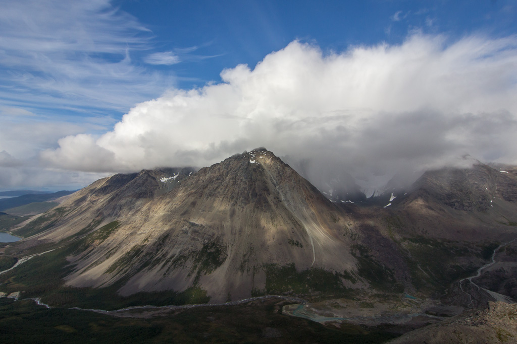
I quickly made it above the treeline and indeed, after the sun disappeared the clouds started to get a deep orange colour – so pretty!

Just after sunset, the clouds turned a deep orange

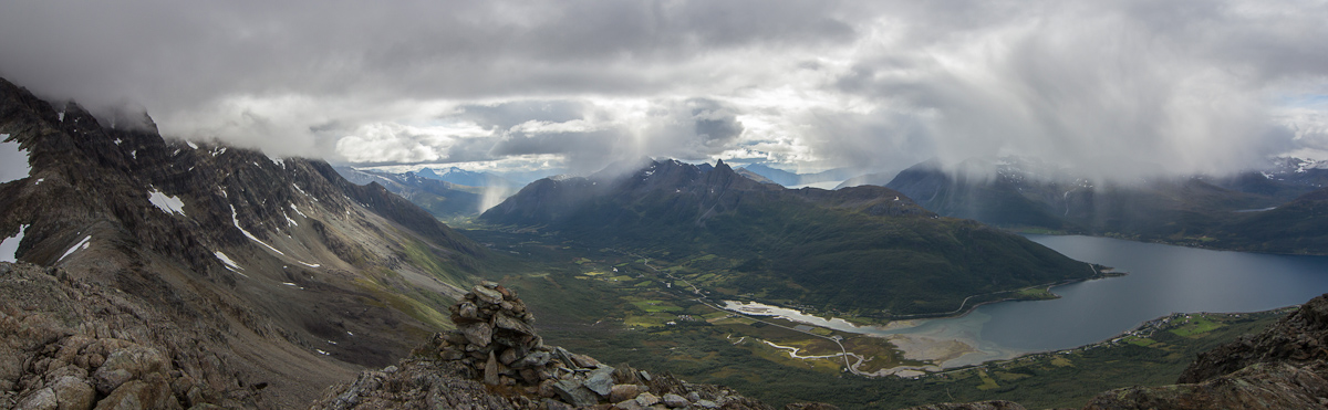
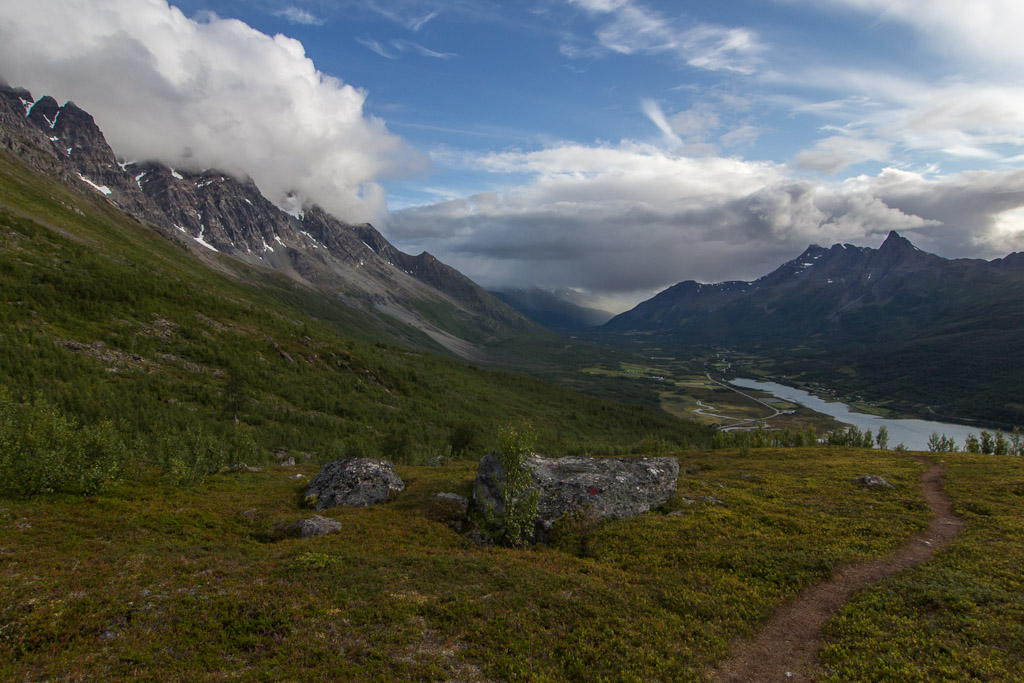
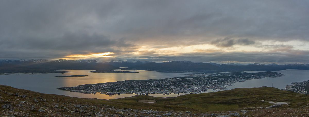
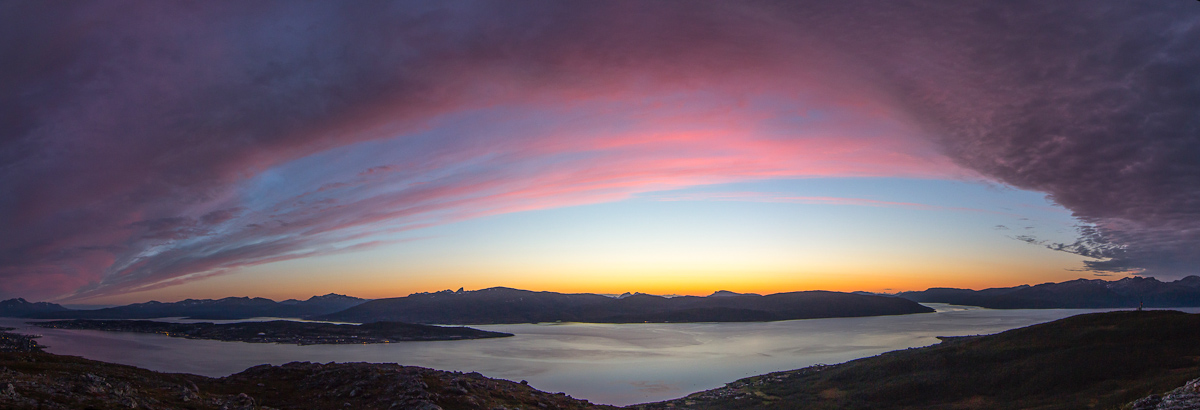
The views were truly breathtaking all the way to the top, with the colours changing constantly until they became pink…
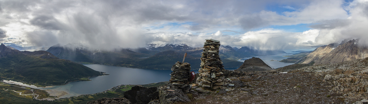
Breathtaking view from the top!!

Then purple…

Pink turned into purple...

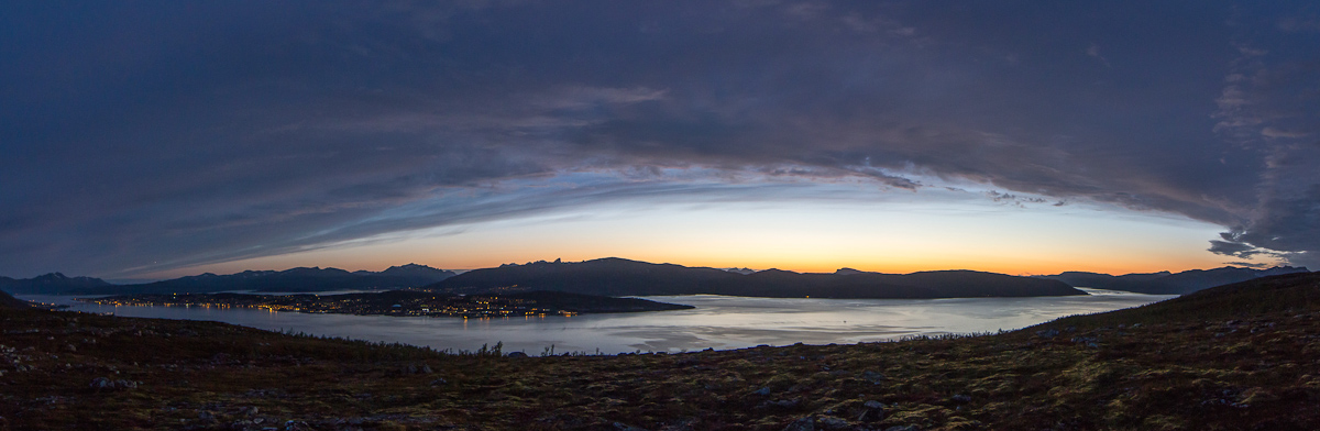
And finally the clouds started to lose their colours, while the horizon remained orange, and the lights on Tromsø island were slowly turned on.

Until the clouds lost colour while the lights on Tromsø island are turned on

What an incredible evening 🙂

1000-meteren

1000-meteren

On Thursday I drove to Lakselvbukt, around 70 km from Tromsø. Quite a long way to drive to climb a mountain, but it was worth it. The mountain is called 1000-meteren but is actually only 954 m high 😉

1000-meteren indicated by the arrow. The mountains to the right are the Lakselv mountains and are 1500-1600 meter high View from Hompan

The day started sunny and quite warm, but more and more rain showers popped up during the day. None of them hit me though 😀 It was fun to watch the showers on the other side of the fjord…

It was fun to watch all the local showers on the other side of the fjord This particular one had a funny shape!

On the way you pass the 800-meteren (which really is 857 m high, to compensate for the 1000-meteren perhaps? 😉 ), on a very narrow ridge. The path goes below this ridge, it would be madness to follow the top.

And this one even had its own rainbow The cairn at 800-meteren, which really is 857 m high

There were lots of information signs on this mountain, very nice! Most of them were about Sami language and culture, I have now learned that Jiehkevarri means Big Glacier Mountain and that there is a special word for “snow to make coffee of” in the Sami language. How cool 😀

The ridge is very narrow here! The path goes further down There were lots of information signs on the way, most of them about Sami language and history, but this one explains the views :)

The description states that the path is “relatively flat” between the 800-meteren and the top, so it was a bit frustrating to find that it actually dropped down 60 m, then climbed another 150. That is not flat for a Dutchie 😛 Anyway, I made it: the top!! It took me a bit more than 3.5 hours.

The top! They are generous with the height though, in reality this top is 954 m - I guess it averages out with the 800-meteren ;) Steep drops around the top

The views were fantastic, even though some of the surrounding mountains were covered in clouds now.

Panorama looking into Lakselvdalen Another panorama from the top

I didn’t stay on the top for very long, it was cold and windy there. Autumn is near, and I actually found areas with rime on my way up. The bit just below the 800-meteren is a bit tough, scrambling is involved here, but the route is extremely well marked.

On my way back... the ridge in the background is the one with the 800-meteren Climbing down - incredibly well marked here :)

From the ridge you have a good view of Store Holmbuktind and the glacier (partly hidden in the clouds in this photo).

Store Holmbuktind. In the clouds you can just about make out a glacier Nice view walking down

And for those interested, here is a map and a profile of the route up 1000-meteren.

Route up the 1000-meteren The profile. The description called the bit between the first and the final top 'relatively flat' - yeah right!!

After in total 6.5 hours I made it back to the car – tired but very happy after a really nice hike 🙂

Evening hike to Fløya

Evening hike to Fløya

On Tuesday the clouds were hanging low, but in the evening it cleared up a bit. I decided to walk up Fløya – I can see the big metal weather vane from my living room 🙂 The weather vane is called Værfløya in Norwegian, I had to idea that’s where the name comes from! I’d been there before, but never walked all the way from the bottom. There is a cable car taking you more than halfway, which is usually way too tempting for me 😉 But this time I walked from the bottom cable car station to the top (640 m) – and to my surprise it only took 1 hour and 40 minutes! It was a nice walk with great views, and I could see our house the entire time 😀

The only way is up... The weather vane at sunset

Just before sunset, the sun briefly came out 🙂 of course I had to take another panorama photo of Tromsø island.

The sun appeared for a brief moment Tromsø island at sunset

On the way back, I stopped at Steinbøhytte, which was completely covered in snow last time we visited. Back then, we were able to peer through the window above the door after a lot of digging – hard to imagine that now 🙂

Steinbøhytte Steinbøhytte on the inside. It's not meant to spend the night, more as a shelter and place to take a break

I have a free entry card for the cable car (thanks to Tromsø photo club), and I allowed myself the luxury of coming down by cable car. There was nobody there, and the cable car came up and down just for me – wow. I almost felt guilty having the free entry card! Here is the map and profile of this short hike.

Route of my hike up to Fløya and back to the cable car station The height profile