Browsed by
Month: August 2012

Bakaromntinden

Bakaromntinden

Last Monday I finally climbed Bakaromntinden (or Bakarovntinden, both names are in use) on Malangen, 878 m high, a mountain that had been on my “wish list” for 3 years! One of the obstacles was the ferry you needed to catch to get there – I was always worried I’d take too long and miss the last ferry home. But last year they opened a tunnel, which made things a lot easier 🙂

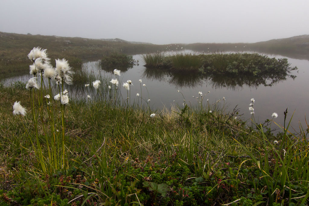
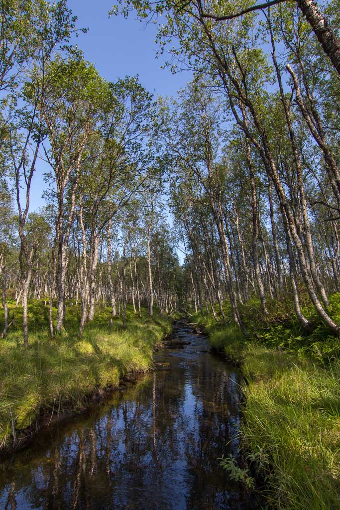
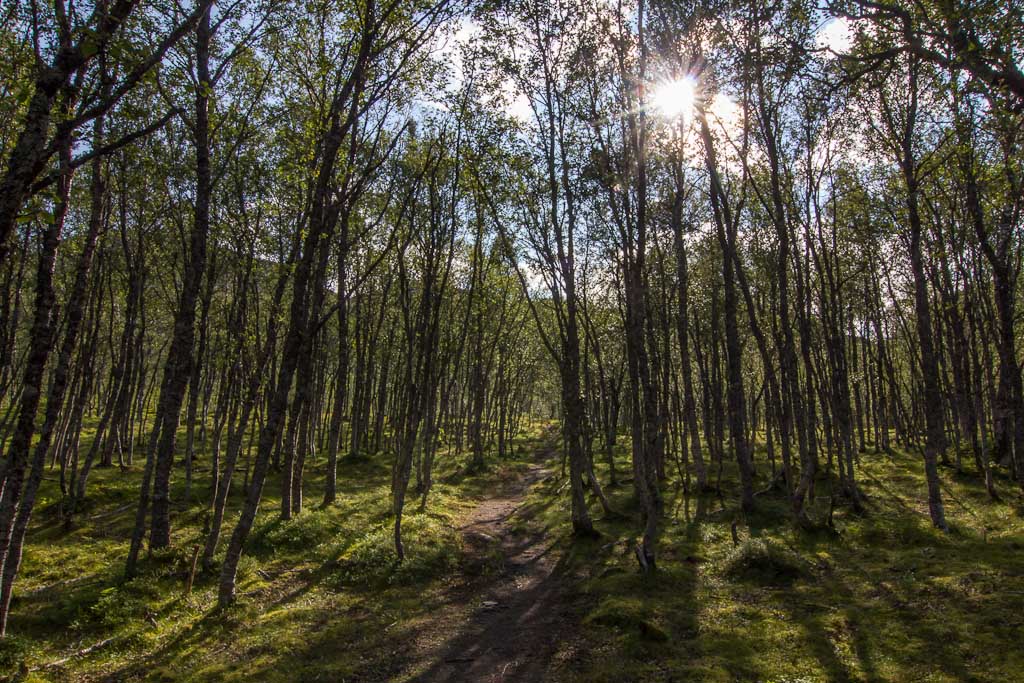
The first part of the route goes through a pretty forest, and is easy going, until it starts climbing very steeply. That part was exhausting, I was glad when I finally reached the tree line and the path flattened out a bit.

Pretty streams in the forest The path through the forest

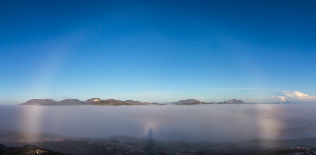
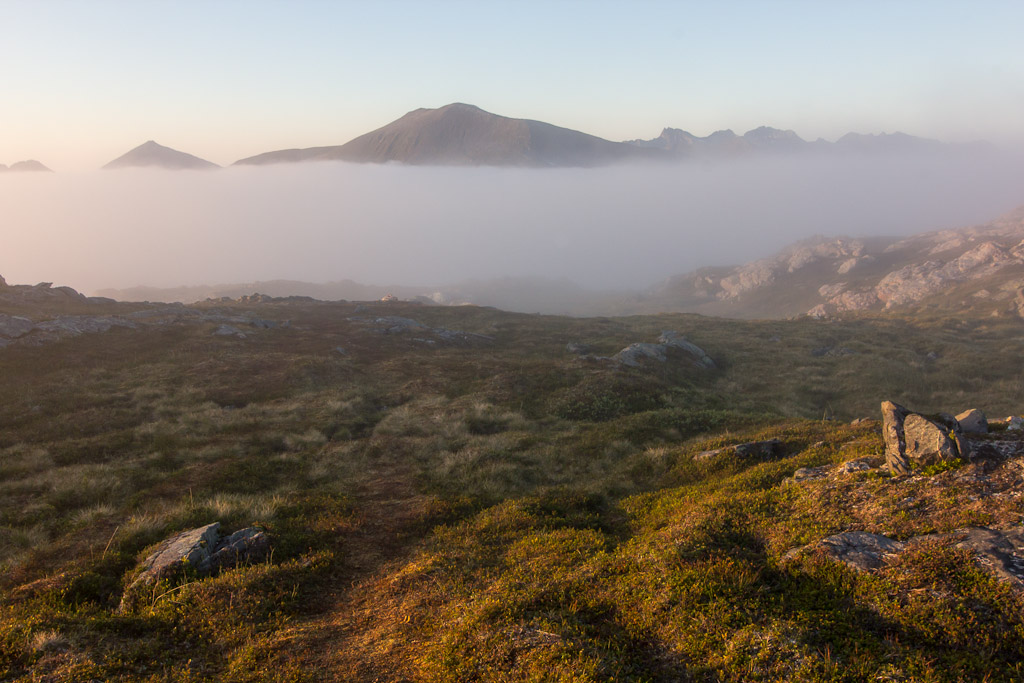
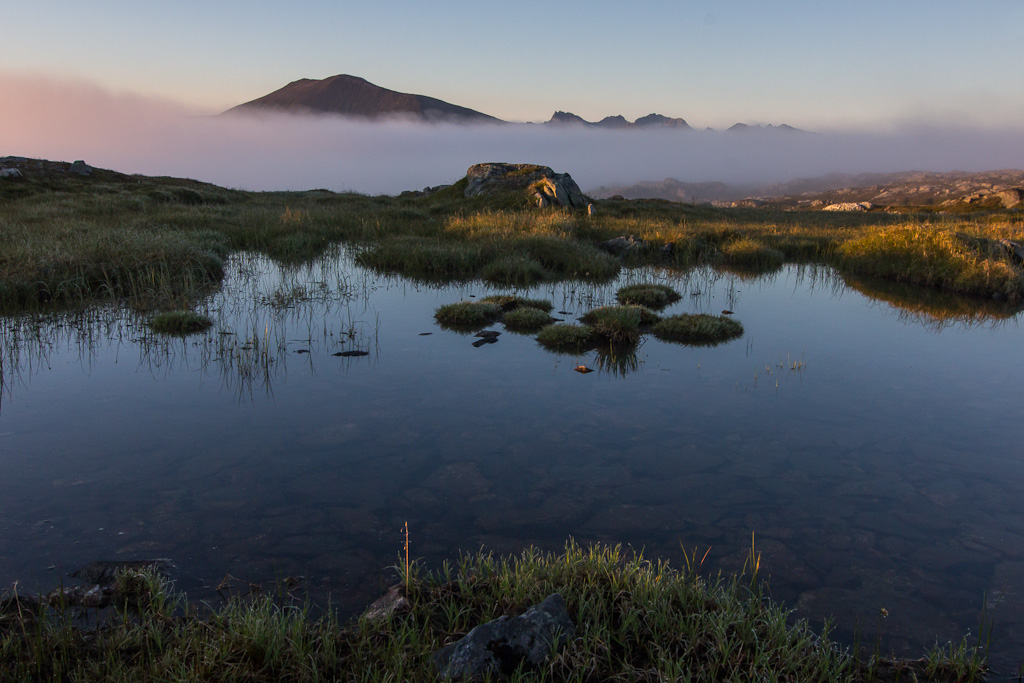
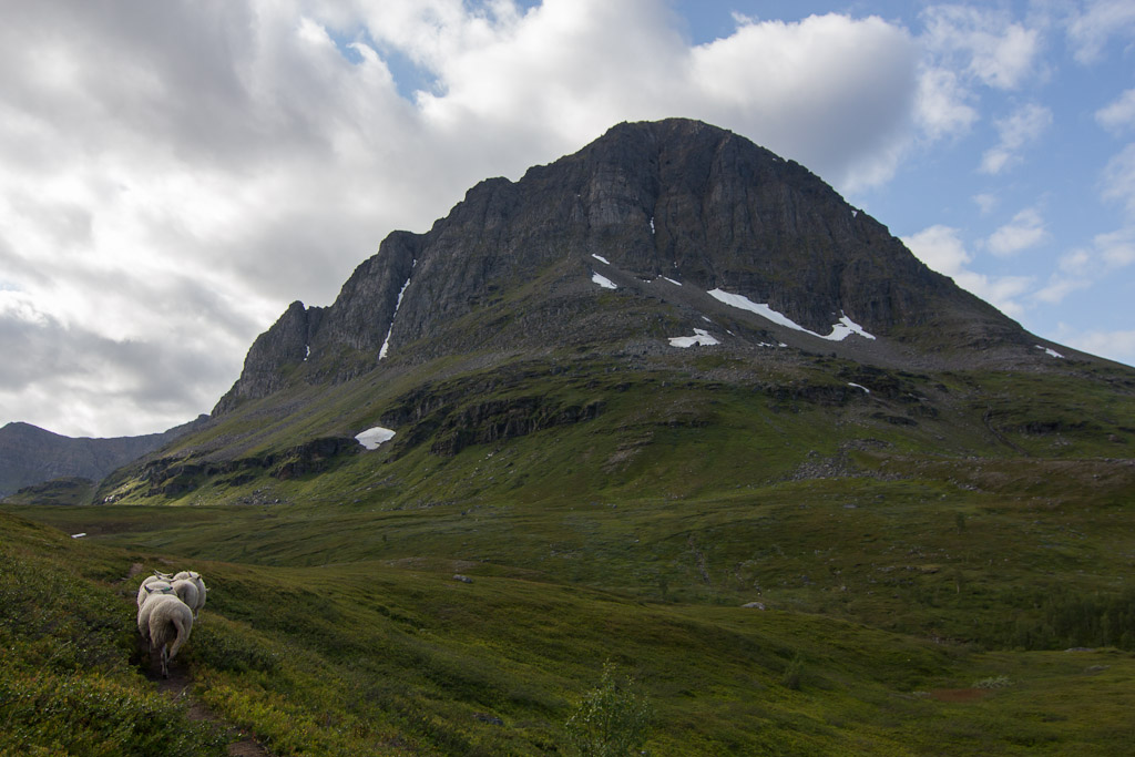
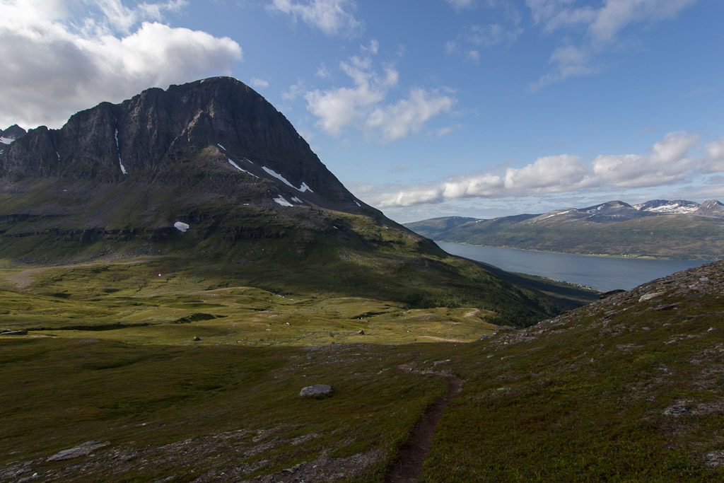
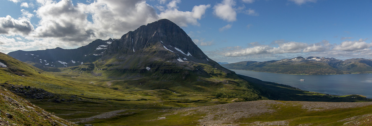
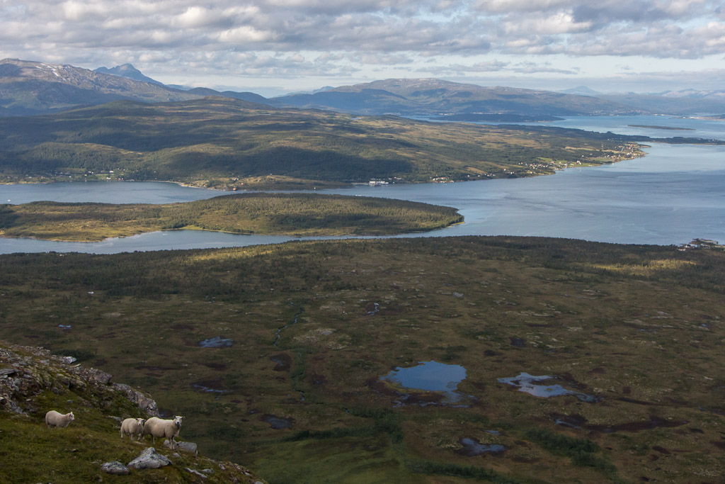
The views are very nice, with Bentsjordtinden dominating the view to the south. Paul has been up there on ski’s – hard to believe when you see the steep drops on this side, but I guess it’s less steep on the other side.

I shared the path with some sheep :) Nice view of Bentsjordtinden

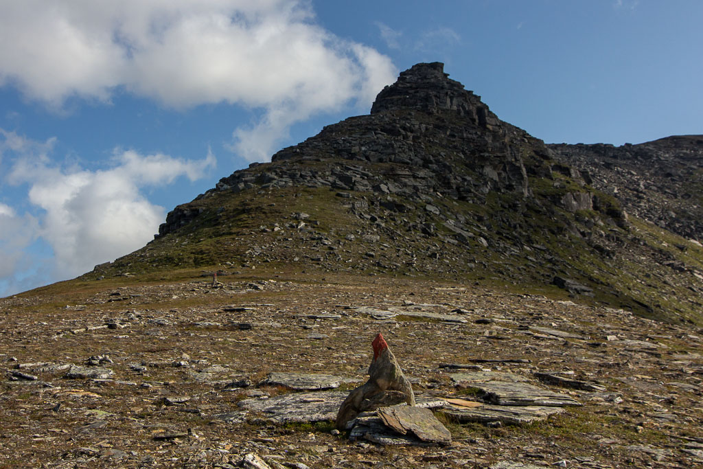
The path climbs on to the start of the Bakaromntinden ridge. Here the northbound Hurtigruten passed on its way to Tromsø…

Panorama of the view from the ridge, with the northbound Hurtigruten on its way to Tromsø

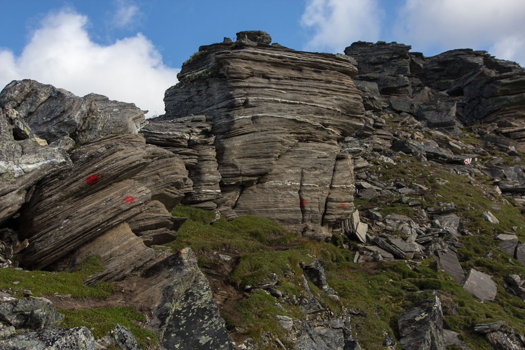
Bakaromntinden is a bit notorious for the “airy” part near the top, and I’ve heard from many people who turned around before reaching the top on their first visit. I approached this part feeling slightly nervous, it would be so disappointing to turn back when you’re almost there, but I’d never done any “airy” bits so I had no idea what to expect. The young couple who were walking in front of me did indeed turn around without reaching the top, which didn’t really surprise me as I could see from the body language of the girl that she wasn’t happy even further down the mountain. The older couple who had passed me in the forest came down just behind them, they had been to the top and assured me it was fine as long as I hold on tight and not look down 😀 So here we go!!

Starting the steep final 100 m to the top Looking back at the ridge

The route was extremely well marked, with lots of red dots and arrows, to make sure you don’t go the wrong way. The ridge has steep drops on both side, and I did have to climb with hands and feet on two occasions, but never with a drop right below me, and I never felt unsafe. I don’t have a fear of heights, that helps. I was pleased to find out that this wasn’t any problem for me. I’m enough of a chicken on slippery surfaces (snow, ice – especially on ski’s), good to know I cope better in summer. The rock formations were really impressive, and I have to say I actually really enjoyed myself 🙂

Impressive rock formations near the top! The route was VERY well marked, as you can see Enormous rock

A few more twists and turns, and I was on the top! I did it 😀

Looking back - this part was quite spectacular, with steep drops on both side of the ridge and having to climb with hands and feet Finally: the top!

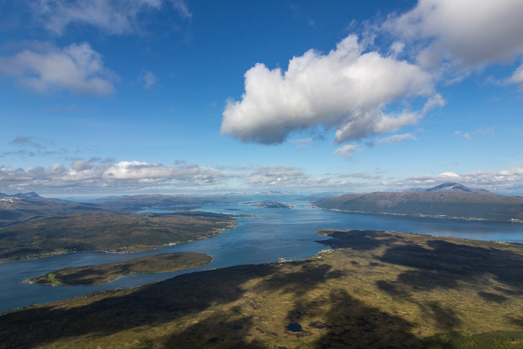
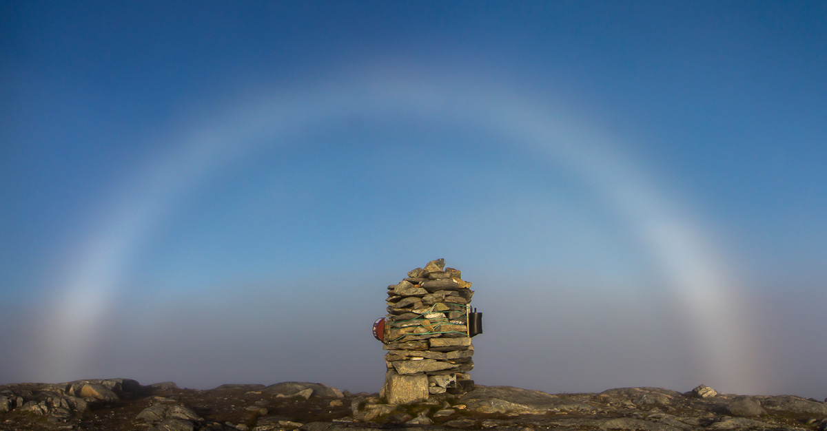
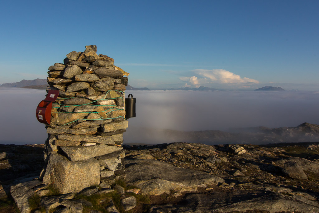
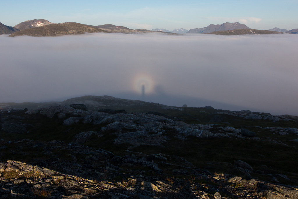
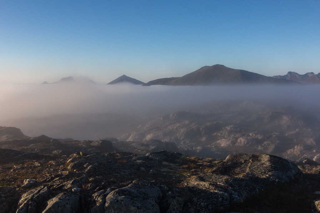
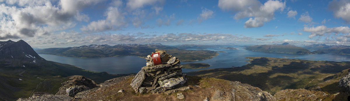
The view is spectacular, and it’s fun to see Tromsø from a new angle (you’re almost directly south of Tromsø here). There’s only just enough room for the cairn on top, I made sure I didn’t sit too close to the drop on the other side 😉

Panorama from the top: Bentsjordtinden on the left, the island Ryøya behind the cairn, Tromsø a bit further to the right and at the far right you can see all the way into Ramfjorden

Maaike had recommended the alternative route down, which was longer and less steep. I hesitated a bit, as I actually liked the rocks a lot, and according to the couple I spoke to, it was easier coming down. I was also tempted to continue up Middagstinden, further up the same ridge, but I wasn’t sure how many obstacles there were to climb along the ridge. It looked easy except for one steep bit. I haven’t actually found any information about continuing, only about climbing Middagstinden on ski’s without going to Bakaromntinden first. Anyway, I made my decision and took the alternative route back.

Huge rocks on the way back A small stream had made a deep pool at the bottom of this waterfall. Too bad it wasn't warm enough to paddle in this pool!

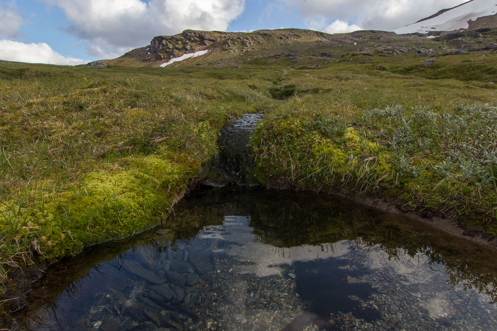
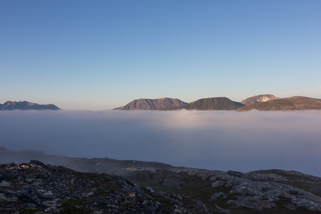
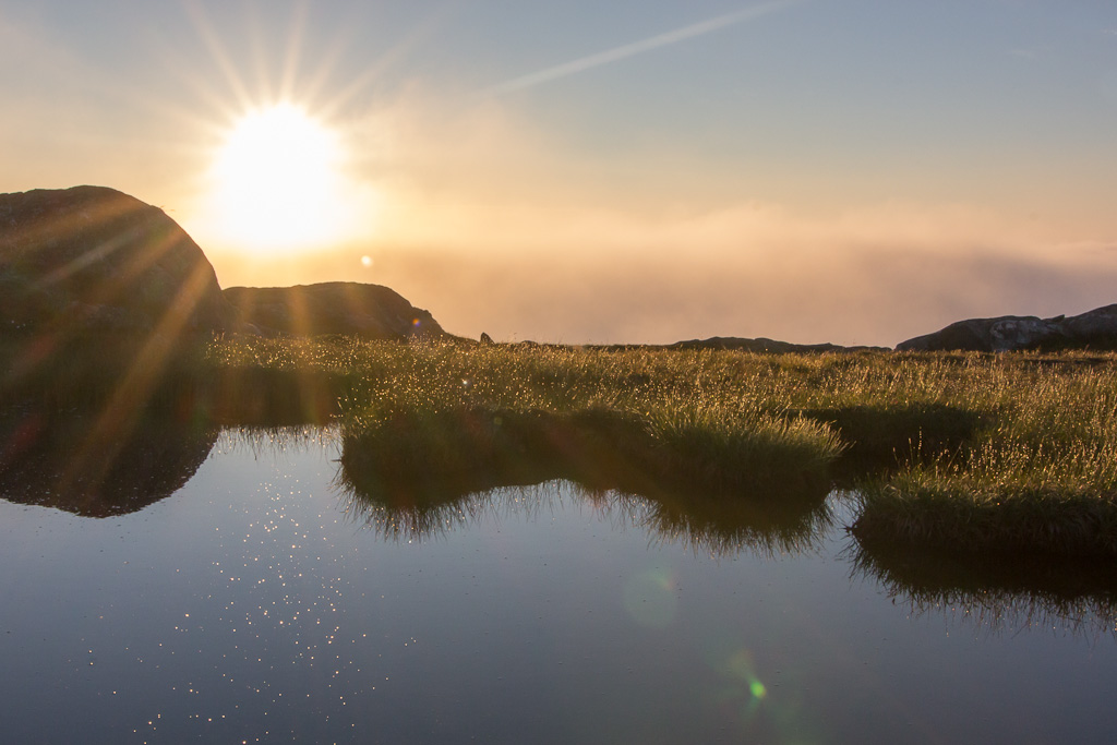
For much of the way, I couldn’t find any path, but it was quite obvious where to go in the terrain. Still, I was relieved when I finally did stumble upon the path – much easier going. The route was long and flat, and unfortunately in the (cold) shade, but it did have pretty views 🙂 and sheep! And I’m sure my knees are grateful for not having to climb down the very steep ridge 😉

The sheep are also enjoying the view :)

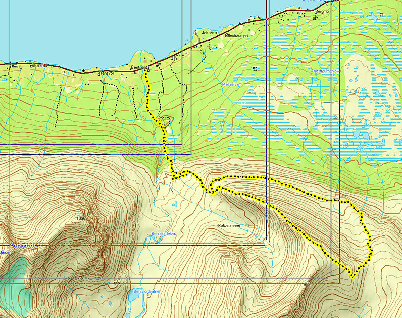
For those interested, here is a map of my route, and a height profile. I reached the top in 3 hours (which is fast for me, but slow for Norwegians :P), and with the longer distance of the alternative route, the way down took only slightly less time. Total time: 6 hours. Not bad!

The route - sorry for the grey lines! And the height profile

And now, whenever I look south from Telegrafbukta (as I so often do), I can say: I stood on top of that mountain! 🙂

Raudfjellet

Raudfjellet

Last Thursday I had planned to climb Raudfjellet (540 m), but the clouds were hanging low all day. Fog usually disappears when the sun gets strong enough – or at least it’s easy to get above the fog. Low clouds can hang around all day though, and are not as shallow as fog. I noticed the top of the cable car (at 420 m) was in the clouds all day. So i stayed at home and edited photos, until the end of the afternoon, when it suddenly cleared up here in Tromsø. I jumped in the car and drove to Raudfjellet, but this is an hours drive from Tromsø and unfortunately it was completely cloudy at the trail head. I could see some mountains in the distance with sun, so I was hoping that it would clear up. I climbed Raudfjellet two years ago via a different (much longer) route, and was surprised to find how nice the new route was, even inside the cloud 😉

Even walking through thick fog can be pretty :)

I didn’t have much of a view on my way up, and I had kind of given up hope that I would have a view from the top. And indeed, at 500 m I was still in the clouds. But wait a minute, isn’t there a slight blue tint to the clouds? And isn’t that the sun, trying to come through?! I raced up, hoping that 40 more height meters would be enough. When I reached the top, the sun finally broke through, and a very strong fog bow appeared with blue sky above! Magic…

A magical moment when the clouds disappeared just when I reached the top, and a strong fogbow appeared

I was very happy and signed my name in the book. When I looked up, the clouds had lowered even more and suddenly I had a 360 degrees view over a sea of clouds, with several other mountain tops sticking out. And some big cumulonimbus clouds inland. WOW!!

The clouds dropped even lowers, and I could see big cumulonimbus clouds inland A strong glory :)

I took lots of photos and spent an hour on the top. It was lovely having this view all to myself, but I also enjoyed sharing the experience with the two sisters who came up a little later.

And everything in one photo: the fogbow, the glory (and Brocken spectre) and the cumulonimbus View towards Vasstinden, you can see how close the fog was - lucky me!!

After a long break, I reluctantly starting walking down – knowing I’d have to walk back into the fog 😉

Tverrfjellet and Middagstinden on the left, Durmålstinden on the right On my way back through a landscape glittering in the sun. This part of the mountain was covered in clouds on the way up

The first part of the way down is quite flat though, and I was able to stay above the fog for quite a while. So many photo opportunities! I was running around taking lots and lots of photos…

Walking towards the clouds A beautiful little lake

Everything was still soaked from spending the day in the clouds, and the wet landscape was sparkling in the sun.

Perfect reflections in the lake :) Soaked cotton grass

Finally I had to descend further down, and into the fog… This route is very well marked, which was really helpful when visibility became very low (especially since it was also getting dark).

Entering the fog, last view of the sun. Very thankful for the well-marked route! And then the views turned into this...

What a great hike! I got home at 23:30, really pleased that I did go after all 🙂

Welcome Back!

Welcome Back!

The northern lights are back!! Always an exciting moment to see them dance for the first time 🙂 It’s only just about dark enough, but there they are…

The northern lights are back!! Even though it's only JUST about dark enough :) Beautiful colours to the west

Here’s to a new season, and many sleepless nights 😉 And now I better get some sleep, I’m supposed to climb one of the mountains in the photo tomorrow!